


Why visit Welshpool
Townapedia lists 5 museums and landmarks, 3 parks and trails, 34 places to eat, 1 place to stay and 6 attractions in and around town.
Highlights include Powysland Museum and Powis Castle.
Weather in Welshpool
Forecast from MET Norway (CC BY 4.0). Full forecast
About Welshpool
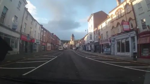
Welshpool (Welsh: Y Trallwng ) is a market town and community in Powys, Wales, historically in the county of Montgomeryshire. The town is four miles (six kilometres) from the Wales–England border and low-lying on the River Severn. The community, which also includes Cloddiau and Pool Quay, has a population of 6,664 (as of the 2011 United Kingdom census), with the town having 5,948. There are many examples of Georgian architecture within the town.
From the Wikipedia article Welshpool (this version), under CC BY-SA 4.0.
Travel tips from other travellers: Welshpool on Wikivoyage (CC BY-SA 4.0).
Things to do6

Museums and landmarks5




Parks, trails and playgrounds3


Restaurants and cafes34

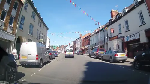
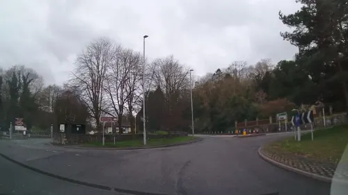
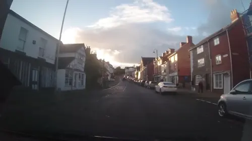
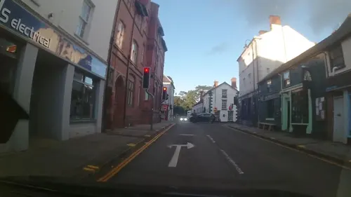
Spice Fusion
Restaurant · Bangladeshi
29 Severn Street, Welshpool


22 more on the map.
History
St Cynfelin is reputed to be the founder of two churches in the town, St Mary's and St Cynfelin's, during the Age of the Saints in the 5th and 6th centuries.
The parish of Welshpool roughly coincides with the medieval commote of Ystrad Marchell in the cantref of Ystlyg in the Kingdom of Powys.
The Long Mountain, which plays as a backdrop to most of Welshpool, once served as the ultimate grounds for defence for fortresses in the times when the town was just a swampy marsh.
Welshpool served briefly as the capital of Powys Wenwynwyn or South Powys after its prince was forced to flee the traditional Welsh royal site at Mathrafal in 1212, by the prince of Gwynedd; assistance from the English crown (enemies of the Gwynedd prince) restored the Wenwynwyn dynasty to their lands. Further disputes with Gwynedd again brought in the English; in 1284, the family strengthened their hold on Powys Wenwynwyn by converting it into a marcher lordship (via surrender and re-grant) - the Lordship of Powys. Owain, the heir to the former principality, called himself Owen de la Pole, after the town.
The town was devastated by the forces of Owain Glyndŵr (heir to Powys Fadog - North Powys) in 1400 at the start of his rebellion against the English king Henry IV. Today, the waymarked, 135-mile long-distance footpath and National Trail, Glyndŵr's Way, ends in Pont Howell Park, alongside the Montgomery Canal.
From the History section of Welshpool on Wikipedia, under CC BY-SA 4.0.
More about Welshpool
Economy
The local economy is primarily based upon agriculture and local industry. The Smithfield Livestock Market is the largest one-day sheep market in Europe. Market days are on Mondays.
The town's industrial estates are home to numerous different types of small industry, ranging from metal to food production. Due to the town's small size and population the attraction of high street stores and stores that cut keys is limited, meaning that many of the residents prefer to shop in neighbouring towns like Shrewsbury. However Welshpool remains an important hub serving its agricultural hinterland. The town is home to the headquarters of the Montgomeryshire Wildlife Trust and the Clwyd-Powys Archaeological Trust.
Education
The town is the home of two primary schools, Ysgol Gymraeg Y Trallwng and Welshpool Church in Wales Primary School. Welshpool High School is a secondary school which teaches a range of pupils from ages 11–18 and is currently in special measures. Welshpool High School teaches from Key Stage 3 to 5 including GCSE and A-Level through the Powys Sixth Scheme.
From the Wikipedia article Welshpool, under CC BY-SA 4.0.
Notable people from Welshpool
 Michael JonesBritish-French musicianPhoto: Didier.andre, CC BY-SA 3.0
 Craig WilliamsBritish Conservative politicianPhoto: David Woolfall, CC BY 3.0
 Glyn DaviesWelsh politician and MP (born 1944)Photo: Glyn Davies, CC BY 2.0
 Russell GeorgeWelsh politician (born 1974)Photo: Senedd Cymru - Welsh Parliament, CC BY 4.0
 Malcolm JohnsonBritish administratorPhoto: ITU Pictures from Geneva, Switzerland, CC BY 2.0
 Sampson LloydEnglish iron manufacturer in Birmingham (1664–1725)Photo: ( Lobsterthermidor ( talk ) 01:35, 9..., CC BY-SA 3.0
 Edwin Davieseditor and publisher (1859 -1919)Photo: Daniel Rees, Public domain
- Duster BennettBritish blues singer and musician. (1946–1976)
- James HarrisonBritish Army general (1880–1957)
- Fred DaviesEnglish footballer (1871-?)
- Sarah Winifred Parrywriter and editor of Cymru'r Plant from 1908 to 1912 (1870–1953)
- Winifred Maxwell, Countess of NithsdaleJacobite aristocrat
Born in Welshpool, according to Wikidata (CC0). Each name links to its Wikipedia article.
Where to stay1
Churches and places of worship10
Shopping17
Gas and EV charging5
Schools, colleges and libraries7
Healthcare4
Map of Welshpool
92 places. The map loads OpenStreetMap tiles when you open it.
Getting there and nearby towns
Hawarden Airport (CEG) is the nearest airport with scheduled flights listed in OpenStreetMap, 37 miles away.
- Pant 9 mi north, about 15 min by car
- Newtown 12 mi southwest, about 19 min by car
- Bishop's Castle 13 mi southeast, about 21 min by car
- Oswestry 14 mi north, about 23 min by car
- Ruyton-XI-Towns 14 mi northeast, about 22 min by car
- Great Hanwood 14 mi east, about 22 min by car
- Baschurch 15 mi northeast, about 24 min by car
- Bayston Hill 16 mi east, about 26 min by car
- Shrewsbury 17 mi east, about 27 min by car
- Church Stretton 17 mi southeast, about 27 min by car
Drive times are estimates from straight-line distance, not routes.
Towns near Welshpool


Keep exploring
Local news
Headlines from INDB.
Reviews, tips and questions
Loading what members have shared...
Sources and licences
- GeoNames (CC BY 4.0): population, coordinates, regions and time zone
- Mapillary (see each image): photos
- OpenStreetMap contributors (ODbL 1.0): places, airports, map data
- Wikidata (CC0 1.0): elevation, founding date, time zone, website, landmarks and historic places
- Wikimedia Commons (see each image): photos
- Wikipedia (CC BY-SA 4.0): overview and history text
Photo credits
- Corner Shop - Broad Street - Welshpool, Rtenny, CC BY-SA 4.0
- The Codmother, Welshpool (14934638434), grassrootsgroundswell, CC BY 2.0
- PowisCastle, Alexander Forst-Rakoczy, CC BY-SA 2.0 at
- Street-level photo, trigpoint, CC BY-SA 4.0
- Street-level photo, trigpoint, CC BY-SA 4.0
- Street-level photo, trigpoint, CC BY-SA 4.0
- Street-level photo, trigpoint, CC BY-SA 4.0
- Street-level photo, trigpoint, CC BY-SA 4.0
- Street-level photo, trigpoint, CC BY-SA 4.0
- Street-level photo, trigpoint, CC BY-SA 4.0
- Street-level photo, trigpoint, CC BY-SA 4.0
- Street-level photo, trigpoint, CC BY-SA 4.0
- Street-level photo, trigpoint, CC BY-SA 4.0
- Street-level photo, trigpoint, CC BY-SA 4.0
- Street-level photo, trigpoint, CC BY-SA 4.0
- Street-level photo, trigpoint, CC BY-SA 4.0
- Street-level photo, trigpoint, CC BY-SA 4.0
- Street-level photo, trigpoint, CC BY-SA 4.0
- Street-level photo, trigpoint, CC BY-SA 4.0
- Street-level photo, trigpoint, CC BY-SA 4.0
- Street-level photo, trigpoint, CC BY-SA 4.0
- Street-level photo, trigpoint, CC BY-SA 4.0
- Street-level photo, trigpoint, CC BY-SA 4.0
- Street-level photo, trigpoint, CC BY-SA 4.0
- Street-level photo, trigpoint, CC BY-SA 4.0
- Street-level photo, trigpoint, CC BY-SA 4.0
- Street-level photo, trigpoint, CC BY-SA 4.0
- Street-level photo, msevilla00, CC BY-SA 4.0
- Street-level photo, trigpoint, CC BY-SA 4.0
- Street-level photo, trigpoint, CC BY-SA 4.0
- Street-level photo, trigpoint, CC BY-SA 4.0
- Street-level photo, trigpoint, CC BY-SA 4.0
Page built November 10, 2026. Spotted a mistake? Tell us or suggest a place.