


Why visit Westcott
Townapedia lists 9 museums and landmarks, 11 parks and trails, 3 places to eat, 4 places to stay and 4 attractions in and around town.
Highlights include Abinger Common War Memorial, Polesden Lacey, Colekitchen Down and Norbury Park.
Weather in Westcott
Forecast from MET Norway (CC BY 4.0). Full forecast
About Westcott
Westcott is a village in central Surrey, England, about 1.5 miles (2.5 km) west of the centre of Dorking. It is in the Mole Valley district and the Surrey Hills Area of Outstanding Natural Beauty. The Pipp Brook, a tributary of the River Mole, runs to the north of the centre and the settlement is between Ranmore Common on the North Downs and Leith Hill on the Greensand Ridge.
From the Wikipedia article Westcott, Surrey (this version), under CC BY-SA 4.0.
Photos of Westcott


Things to do4



Museums and landmarks9

Abinger Common War Memorial
Monument and historic site · 2.2 mi
War memorial in Abinger, Mole Valley, Surrey, England, UK

Polesden Lacey
Museum · 2.3 mi
Country house in Great Bookham, Surrey, England, UK
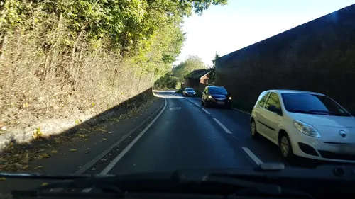

Parks, trails and playgrounds11


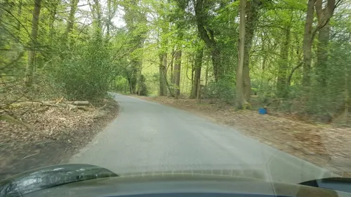

Glory Wood and Devil's Den
Park · 2.2 mi
Nature reserve in Surrey, England

Restaurants and cafes3
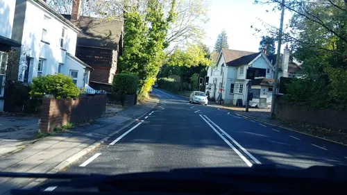
The Wotton Hatch
Bar and pub · Pizza, Pasta, Grill, Salad, Soup · 0.9 mi
Guildford Road

History
The earliest surviving record of the village is from the Domesday Book of 1086, in which it appears as Wescote. In the early 13th century, it is recorded as Westcot (1202) and Westcotes (c. 1210). The name is generally agreed to refer to a group of cottages in the western part of the parish of Dorking.
The earliest evidence of human activity in Westcott is from the Mesolithic. Flint flakes and implements from this period, the Neolithic and Bronze Age have been found to the north of the village. An excavation in the same area revealed evidence of an Iron Age enclosure, which also included some items of Roman origin. A brass Roman cavalry pendant, dated to the first century CE, was discovered in the village in 1998.
In Domesday Book, the manor was held by Ralph of Fougères as tenant-in-chief. It was in the Wotton Hundred and had a population of 14 villagers, five smallholders and three slaves. Westcott included 2.5 acres (1.0 ha) of meadow, sufficient woodland for 30 swine and a watermill. It produced an annual income of 8 pounds for the lord of the manor.
Read more of the history
Bury Hill, between Dorking and Westcott, was recorded in the 15th century. It became a manor, formed from waste (infertile land) of the manor of Milton, Dorking. James Walter bought the land in 1753, built the house there, and planted the grounds. He died 1780, after which the 3rd Viscount Grimston, his daughter's husband, succeeded him. In 1812, his son and heir, about to be created Earl of Verulam, sold the property to a wealthy Scot, Robert Barclay, and it descended to his Barclay heir in the Edwardian period, when The Nower was "a favourite place to walk for Dorking people". He was the ancestor of comedy executive/producer Humphrey Barclay.
Many pre-1800 listed buildings, including some that are thatched, are in the lanes leading off the A25, including Leslie Howard's (actor 1893–1943) Stowe Maries, built in the 1550s, in Balchins Lane. Milton Street and Westcott Street lead to several more old buildings. The Church of the Holy Trinity is Grade II listed because it was designed in 1851, by Sir George Gilbert Scott, and is made of knapped flint with ashlar quoins/dressings. Its spire has a clock, striking bell and weather vane, and there is a small western turret. Charles Barclay of Bury Hill gave equivalent to £120,702 in 2025 for it to be built, and Lady Mary Leslie the same, as an endowment. The clock was installed to commemorate the Jubilee of 1887. The parsonage was built at the expense of Barclay and the secular Westcott School was built by subscription in 1854. The infant school was also built by subscription, in 1882.
It became a chapelry of Dorking in the Victorian period. It contributed significantly to the wealth and trade of the town, principally from wool and meat from sheep farming on the North Downs within the parish bounds.
From the History section of Westcott, Surrey on Wikipedia, under CC BY-SA 4.0.
More about Westcott
Geography
Westcott lies predominantly on the Lower Greensand, with the Upper Greensand and chalk of the North Downs to the north. The village is in the catchment area of the Pipp Brook which rises in Wotton Common. The stream then flows past the village centre near its northern farmland, running through Dorking and joining the River Mole at Pixham. Mag's Well, one of the sources of Pipp Brook, is in Squire's Wood, south of Westcott. It was formerly of some repute as a medicinal spring, and is strongly impregnated with iron. A building, ruined, existed over it, and in the Victorian period children still bathed in it.
The A25 road runs through the centre of Westcott and links the village to Guildford, to the west, and Dorking, to the east. There is a thatched dovecote on the village green. The weather vane on top of the dovecote has had the "N" replaced by a "T" so that it shows the letters "WEST".
Economy
The average distance travelled to work was 17 kilometres (11 mi) in 2001.
The Prince of Wales, the only remaining public house in the village, was damaged by fire in March 2023. Westcott has an art gallery, a small shop, a bicycle shop and a hairdressers. The main village grocery store, which included the post office, closed in December 2016.
Westcott Church of England primary school celebrated its 150th anniversary in 2004. In 2010, it was merged with Abinger Common CEP school to create a two-campus school known as the Surrey Hills Church of England Primary School.
In 2009, a skate ramp and football goals were installed in the village park.
From the Wikipedia article Westcott, Surrey, under CC BY-SA 4.0.
Notable people from Westcott
 Thomas Robert MalthusBritish political economist (1766–1834)Photo: John Linnell, CC BY 4.0
- Donald RoseEnglish supercentenarian (1914–2025)
Born in Westcott, according to Wikidata (CC0). Each name links to its Wikipedia article.
Where to stay4
Churches and places of worship9
Shopping2
Schools, colleges and libraries3
Map of Westcott
45 places. The map loads OpenStreetMap tiles when you open it.
Getting there and nearby towns
London Gatwick Airport (LGW) is the nearest airport with scheduled flights listed in OpenStreetMap, 9 miles away.
- Dorking 2 mi east, about 3 min by car
- Great Bookham 4 mi north, about 6 min by car
- West Horsley 4 mi northwest, about 7 min by car
- Leatherhead 5 mi north, about 8 min by car
- Capel 6 mi south, about 9 min by car
- Ewhurst 6 mi southwest, about 9 min by car
- Ashtead 7 mi northeast, about 11 min by car
- Reigate 7 mi east, about 12 min by car
- Cobham 7 mi north, about 12 min by car
- Cranleigh 7 mi southwest, about 12 min by car
Drive times are estimates from straight-line distance, not routes.
Towns near Westcott


Keep exploring
Local news
Headlines from INDB.
Reviews, tips and questions
Loading what members have shared...
Sources and licences
- GeoNames (CC BY 4.0): population, coordinates, regions and time zone
- Mapillary (see each image): photos
- OpenStreetMap contributors (ODbL 1.0): places, airports, map data
- Wikidata (CC0 1.0): elevation, founding date, time zone, website, landmarks and historic places
- Wikimedia Commons (see each image): photos
- Wikipedia (CC BY-SA 4.0): overview and history text
Photo credits
- Westcott - Holy Trinity Church 11, Paweł 'pbm' Szubert ( talk ), CC BY-SA 3.0
- Westcott - Holy Trinity Church 15, Paweł 'pbm' Szubert ( talk ), CC BY-SA 3.0
- Westcott - Holy Trinity Church 02, Paweł 'pbm' Szubert ( talk ), CC BY-SA 3.0
- Westcott - Holy Trinity Church 12, Paweł 'pbm' Szubert ( talk ), CC BY-SA 3.0
- Westcott - Holy Trinity Church 13, Paweł 'pbm' Szubert ( talk ), CC BY-SA 3.0
- Westcott - Holy Trinity Church 04, Paweł 'pbm' Szubert ( talk ), CC BY-SA 3.0
- Westcott - Holy Trinity Church 09, Paweł 'pbm' Szubert ( talk ), CC BY-SA 3.0
- Westcott - Holy Trinity Church 01, Paweł 'pbm' Szubert ( talk ), CC BY-SA 3.0
- Westcott - Holy Trinity Church 07, Paweł 'pbm' Szubert ( talk ), CC BY-SA 3.0
- Westcott - Holy Trinity Church 06, Paweł 'pbm' Szubert ( talk ), CC BY-SA 3.0
- Westcott - Holy Trinity Church 05, Paweł 'pbm' Szubert ( talk ), CC BY-SA 3.0
- Westcott - Holy Trinity Church 08, Paweł 'pbm' Szubert ( talk ), CC BY-SA 3.0
- Westcott - Holy Trinity Church 10, Paweł 'pbm' Szubert ( talk ), CC BY-SA 3.0
- Abinger Common War Memorial, Abinger Lane, Abinger Common, Surrey 01, Mertbiol, CC0
- Polesden lacey, Martyn Davies, CC BY-SA 2.0
- Colekitchen Down (4), Dudley Miles, CC BY-SA 4.0
- NorburyPark-NewManorHouse-01, Vox Humana 8', CC BY 2.5
- St Joseph's RC Church, Falkland Grove, Dorking, The Voice of Hassocks, CC0
- St Barnabas' Church, Ranmore Common Road, Ranmore Common (NHLE Code 1189879), The Voice of Hassocks, CC0
- Holy Trinity Church, Guildford Road, Westcott (NHLE Code 1227892), The Voice of Hassocks, CC0
- (C) Hayley Bray (4), Wottonhouse, CC BY-SA 4.0
- Denbies hillside - panoramio, Benjamin Rusholme, CC BY-SA 3.0
- The Temple, The Nower, Dorking, Surrey - April 2026 - 01, Mertbiol, CC0
- Street-level photo, richardc, CC BY-SA 4.0
- Street-level photo, southglos, CC BY-SA 4.0
- Street-level photo, richardc, CC BY-SA 4.0
- Street-level photo, richardc, CC BY-SA 4.0
- Street-level photo, laye, CC BY-SA 4.0
- Street-level photo, richardc, CC BY-SA 4.0
- Street-level photo, southglos, CC BY-SA 4.0


Page built November 10, 2026. Spotted a mistake? Tell us or suggest a place.