


Willaston, United Kingdom
Willaston is a town of 2,540 people in England, United Kingdom.
Why visit Willaston
Townapedia lists 6 museums and landmarks, 8 parks and trails, 26 places to eat, 1 place to stay and 3 attractions in and around town.
Highlights include Lyceum Theatre, Nantwich Bridge, Crewe War Memorial and Dorfold Hall.
Weather in Willaston
Forecast from MET Norway (CC BY 4.0). Full forecast
About Willaston
Willaston is a civil parish and village in the unitary authority of Cheshire East, Cheshire, England. It had a population of 3,104 at the 2011 census, up from 2,973 in 2001. It lies 2 miles (3.2 km) east of Nantwich, 3 miles (4.8 km) south-west of Crewe and 7 miles (11.3 km) from junction 16 of the M6 motorway.
From the Wikipedia article Willaston, Cheshire East (this version), under CC BY-SA 4.0.
Photos of Willaston

Things to do3


Nantwich Bridge
Bridge · 1.7 mi
Grade II listed bridge in Nantwich, Cheshire East, Cheshire, England, UK

Museums and landmarks6
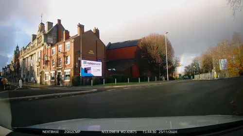
Crewe War Memorial
Monument and historic site · 2.8 mi
Grade II listed war memorial in Crewe, Cheshire, England, UK

Dorfold Hall
Museum · 2.6 mi
Country house in Acton, Cheshire, England, UK

Churche's Mansion
Monument and historic site · 1.3 mi
150 Hospital Street, Nantwich

Boer War Memorial, Crewe
Monument and historic site · 2.2 mi
Grade II listed war memorial in Crewe, Cheshire East, Cheshire, England, UK

Nantwich Museum
Museum · 1.6 mi
Museum in Nantwich, Cheshire, United Kingdom
Parks, trails and playgrounds8

Queen's Park, Crewe
Park · 2.2 mi
Park in Crewe, Cheshire, England, UK


Restaurants and cafes26

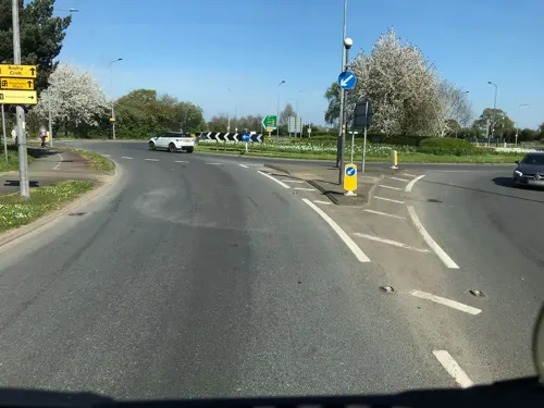

The Woodside
Bar and pub · 1.5 mi
Valley Road, Crewe
Mo-Th 12:00-23:00; Fr-Sa 12:00-24:00; Su 12:00-23:00
The Peacock
Bar and pub · 0.6 mi
221 Crewe Road
Mo 12:00-22:00; Tu-Th 12:00-23:00; Fr-Sa 09:00-23:00; Su 09:00-22:00

The Leopard
Bar and pub · 1.2 mi
33 London Road
Su-We,PH 00:00-23:00; Th-Sa 00:00-12:00

14 more on the map.
History
Willaston is believed to have taken its name from an ancient farmstead known as Wiglaf's tun. Like other English villages, the name has been changed many times over the centuries. This is due to the neighbouring parish of Wistaston having a similar sounding name. To add confusion, Willaston was once ecclesiastically divided between the neighbouring communities of Nantwich and Wybunbury.
Whilst there are at least two other villages called Willaston, the earliest documentary evidence relating to Willaston in this part of Cheshire can be found in the Domesday survey of 1086, where is it referred to as Wilavestune, owned by a 'free man' named Ulviet. A few years after the Norman conquest the title passed to Willam Malbank. The manor of Wilvastune remained in the Malbank family for several generations before ownership transferred to the Chanu family in the 13th century.
Read more of the history
At this time, Willaston was a remote, sparsely populated community with no village centre. Nevertheless, it covered a much larger area than it does today, stretching from Newcastle Road and London Road, Nantwich in the south, along Millstone Lane and as far as the ancient grazing land of Beam Heath in the north. These boundaries did not change until 1936, when local government decided to transfer some of Willaston's land to the expanding communities of Nantwich and Stapeley. In 1553, the manor of Willaston was bought by Richard Sneyd, Recorder of Chester. The Sneyd family lived at Keele Hall in Staffordshire and were the major landowners in Willaston until the middle of the 19th century.
Although Willaston had a number of farmsteads in the Middle Ages, most of the surrounding landscape was uncultivated. However, this began to change as more common land fell into private ownership during the late 18th and early 19th centuries. The process (known as 'enclosure') brought major changes to rural communities like Willaston, as individual plots of land were fenced off and used for arable farming, meadows and the grazing of livestock. The Sneyd family were absentee landlords but they owned most of the lands in Willaston from 1533 to the late 19th century.
The medieval moated site of the Chanu family was lost during the construction of the Nantwich by-pass in 1989. It was situated to the south-east of the Old Willaston Board School on land now owned by Cheerbrook Farm.
From the History section of Willaston, Cheshire East on Wikipedia, under CC BY-SA 4.0.
Where to stay1
Churches and places of worship24
Shopping7
Gas and EV charging1
Schools, colleges and libraries10
Healthcare7
Madison Spa & Renew Clinic
Clinic and pharmacy · 1.5 mi
33a Hospital Street, Nantwich
Map of Willaston
93 places. The map loads OpenStreetMap tiles when you open it.
Getting there and nearby towns
Manchester Airport (MAN) is the nearest airport with scheduled flights listed in OpenStreetMap, 21 miles away.
- Nantwich 2 mi west, about 2 min by car
- Crewe 3 mi northeast, about 4 min by car
- Audlem 5 mi south, about 9 min by car
- Betley 5 mi southeast, about 8 min by car
- Sandbach 7 mi northeast, about 12 min by car
- Alsager 8 mi east, about 12 min by car
- Bunbury 8 mi northwest, about 12 min by car
- Winsford 9 mi north, about 14 min by car
- Middlewich 9 mi north, about 14 min by car
- Rode Heath 9 mi east, about 14 min by car
Drive times are estimates from straight-line distance, not routes.
Towns near Willaston


Keep exploring
Local news
Headlines from INDB.
Reviews, tips and questions
Loading what members have shared...
Sources and licences
- GeoNames (CC BY 4.0): population, coordinates, regions and time zone
- Mapillary (see each image): photos
- OpenStreetMap contributors (ODbL 1.0): places, airports, map data
- Wikidata (CC0 1.0): elevation, founding date, time zone, website, landmarks and historic places
- Wikimedia Commons (see each image): photos
- Wikipedia (CC BY-SA 4.0): overview and history text
Photo credits
- Willaston - Worm Charming, Graham Shaw, CC BY-SA 2.0
- Lyceum Theatre, Crewe, Cheshire UK, Arwel Parry, CC BY-SA 3.0
- Nantwich Bridge Welsh Row, Espresso Addict, CC BY 2.5
- Dorfold Hall Exterior Front, DorfoldHall, CC BY-SA 4.0
- Queens park crewe towards pavilion, FREON101, CC BY-SA 3.0
- Congregational Chapel, Nantwich, Espresso Addict, CC BY-SA 3.0
- Poole Chapel, Cheshire, Espresso Addict, CC BY-SA 3.0
- St Barnabas' Church, Crewe, Margaret Sutton, CC BY-SA 2.0
- St Marys Church Acton Cheshire, Espresso Addict, CC BY-SA 4.0
- St Mary's Church, Crewe (1), Rept0n1x, CC BY-SA 3.0
- St Marys, Nantwich, Espresso Addict, CC BY-SA 3.0
- Shavington High School, Rope, Espresso Addict, CC BY-SA 3.0
- Vine Inn Hospital St Nantwich, Espresso Addict, CC BY-SA 4.0
- St Mary's church, Nantwich (13), Rept0n1x, CC BY-SA 3.0
- Churches Mansion left, Espresso Addict, CC BY-SA 3.0
- Street-level photo, rossa, CC BY-SA 4.0
- Street-level photo, rossa, CC BY-SA 4.0
- Street-level photo, ricorico, CC BY-SA 4.0
- Street-level photo, rossa, CC BY-SA 4.0
- Street-level photo, mapillarygelec, CC BY-SA 4.0
- Street-level photo, ricorico, CC BY-SA 4.0
- Street-level photo, tallguy, CC BY-SA 4.0


Page built November 10, 2026. Spotted a mistake? Tell us or suggest a place.