


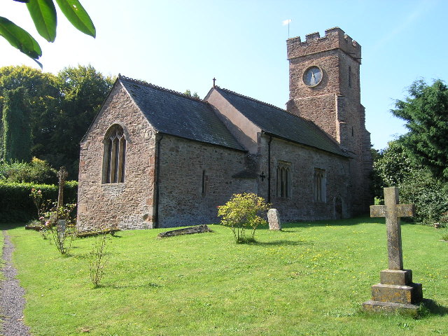


Why visit Williton
Townapedia lists 8 museums and landmarks, 7 parks and trails, 30 places to eat, 8 places to stay and 2 attractions in and around town.
Highlights include Watchet Harbour Lighthouse, Tropiquaria, Watchet Market House Museum and Watchet Museum.
Weather in Williton
Forecast from MET Norway (CC BY 4.0). Full forecast
About Williton
Williton is a village and civil parish in Somerset, England. The village lies 1.5 miles (2.4 km) south of Watchet, and 14 miles (23 km) north-west of Taunton, its post town. As well as the village itself, the parish also covers surrounding rural areas, including the hamlets of Stream to the south-west and Doniford on the coast to the north-east, where there is a Haven Holidays centre. At the 2021 census, the parish had a population of 2,833.
From the Wikipedia article Williton (this version), under CC BY-SA 4.0.
Photos of Williton

Things to do2

Watchet Harbour Lighthouse
Lighthouse · 1.5 mi
Lighthouse in Somerset, England

Tropiquaria
Zoo and aquarium · 1.2 mi
Zoo in West Somerset, United Kingdom
Washford Cross, Watchet
Mo-Su 10:30-17:00
Museums and landmarks8

Watchet Market House Museum
Museum · 1.4 mi
Local museum in Watchet, Somerset, United Kingdom


Washford Radio Museum
Museum · 1.2 mi
Museum of BBC transmitting equipment

Parks, trails and playgrounds7



Restaurants and cafes30
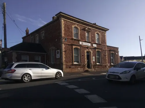
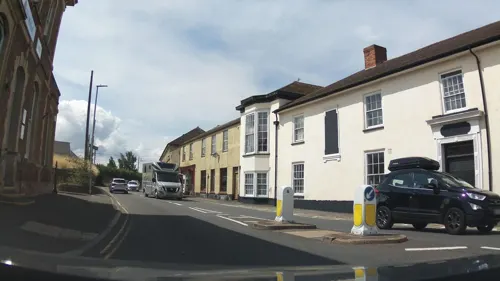
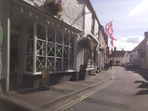
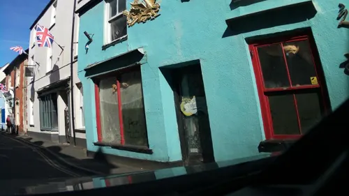



18 more on the map.
History
The name of Williton is Anglo-Saxon and means "estate on the Willet" (river); the Willet is a brook that rises at Willet, flows north through the hamlet of Stream, and close to the former manor house of Williton, then it joins the Doniford Brook north-east of Williton. Both watercourses seem to have been known as the Willet in the 12th century.
"Willet" may well be a British name. In the time of Edward the Elder the manor at Wiilitun was a royal hunting estate; its only pre-Conquest mention is in Edward's charter to the priory at Taunton, in which the prior and monks are enjoined to provide board and lodging for a single night, when the king was progressing, with dogs and falcons and their keepers, "ad Curig vel Willittun", "to Curry or else Williton". In the Domesday Survey Williton continued to form a royal estate, with Carhampton and Cannington. In the Middle Ages the village was divided into the manors of Williton Fulford and Williton Hadley. An estate known as Williton Templar belonged to the Knights Templar, and was later known as Williton Hospital and Williton Regis. Originally the centre of the village appears to have been near the church but over time it has migrated to the north-east.
Read more of the history
Williton historically formed part of the ancient parish of St Decuman's in the Williton and Freemanners hundred of Somerset. The parish was named after its parish church, to the south of Watchet. A chapel of ease dedicated to St Peter existed at Williton from medieval times; the building was largely rebuilt between 1856 and 1859. The chapelry of Williton became ecclesiastically independent from St Decuman's in 1784, when a grant from Queen Anne's Bounty allowed it to fund its own clergy. Williton remained part of the civil parish of St Decuman's until 1902, when St Decuman's was split into two civil parishes called Williton and Watchet.
Within Williton parish, to the south-west, is Orchard Wyndham House, a Grade I listed building,
which was the centre of an estate called "Orchard". Paleolithic, mesolithic and neolithic flints have been found at Doniford to the north-east of Williton while three Bronze Age barrows survive at Battlegore Burial Chamber, just north of the centre of Williton.
Much of the centre of Williton dates from the later 19th century but Long Street includes several 17th-century houses, as do Bridge, Priest, Robert and Shutgate Streets. Agriculture has been the prime activity in the parish while Williton village became a local government and communal centre. Its importance increased with the creation of new toll roads that today are the main roads to the village. It is an important local shopping area and from 1894 has been an administration centre. It had a workhouse for the district, which became the local hospital until 1990 but has now been converted into housing.
Doniford House has late medieval origins and was enlarged circa 1600. Beside the beach is an early 19th-century lime kiln which is thought to have been in operation until the 1930s.
Before World War II at a site between Watchet and Doniford a gunnery range was established for various army units to practice anti-aircraft gunnery. Unmanned target aircraft were towed by planes from RAF Weston Zoyland and later were fired from catapults over the sea. Little of the camp buildings survive and it is now the site of a holiday park.
From the History section of Williton on Wikipedia, under CC BY-SA 4.0.
More about Williton
Arts and culture
Williton is a good centre for visiting the Quantock Hills, the Brendons and Exmoor as well as the coast at Minehead, Dunster, Blue Anchor and Watchet, which are on the West Somerset Coast Path. Accommodation may be obtained in the village. There are facilities nearby for camping, sailing and wind-surfing as well as the usual beach activities. On the nearby cliffs fossils are exposed. There is easy access to the West Somerset Railway, which is the longest private railway in the country, and is run by a trust.
Places of interest are the Bakelite Museum and the Tropiquaria Zoo at the old radio station. Halsway Folk Music Centre is not far away.
The village lies on the route of the Macmillan Way West and Celtic Way Exmoor Option.
From the Wikipedia article Williton, under CC BY-SA 4.0.
Notable people from Williton
- Mary BarclayBritish actress (1916-2008)
- Jack RichardsEnglish cricketer and army officer (1918-1944)
- Hedley PennyWelsh table tennis player
Born in Williton, according to Wikidata (CC0). Each name links to its Wikipedia article.
Where to stay8
Churches and places of worship16
Shopping10
Gas and EV charging2
Schools, colleges and libraries5
Danesfield Church of England Voluntary Controlled Community Middle School
School · Anglican
North Road, Taunton
Knights Templar Community Church School & Nursery
School · Anglican, Methodist · 1.0 mi
Liddymore Road, Watchet
Healthcare2
Map of Williton
90 places. The map loads OpenStreetMap tiles when you open it.
Getting there and nearby towns
Cardiff Airport (CWL) is the nearest airport with scheduled flights listed in OpenStreetMap, 16 miles away.
- Nether Stowey 7 mi east, about 12 min by car
- Minehead 8 mi northwest, about 12 min by car
- Wiveliscombe 8 mi south, about 13 min by car
- Bishops Lydeard 9 mi southeast, about 15 min by car
- Milverton 10 mi south, about 16 min by car
- Porlock 12 mi west, about 20 min by car
- Taunton 14 mi southeast, about 22 min by car
- Bridgwater 14 mi east, about 23 min by car
- Burnham-on-Sea 15 mi east, about 24 min by car
- Barry 16 mi north, about 27 min by car
Drive times are estimates from straight-line distance, not routes.
Towns near Williton


Keep exploring
Local news
Headlines from INDB.
Reviews, tips and questions
Loading what members have shared...
Sources and licences
- GeoNames (CC BY 4.0): population, coordinates, regions and time zone
- Mapillary (see each image): photos
- OpenStreetMap contributors (ODbL 1.0): places, airports, map data
- Wikidata (CC0 1.0): elevation, founding date, time zone, website, landmarks and historic places
- Wikimedia Commons (see each image): photos
- Wikipedia (CC BY-SA 4.0): overview and history text
Photo credits
- Williton Highbridge Nursery topiary garden, Geof Sheppard, CC BY-SA 4.0
- Watchet Harbour Lighthouse (3746873659), Robert Cutts from Bristol, England, UK, CC BY-SA 2.0
- Monksilverchurch, ChurchCrawler, CC BY-SA 2.0
- St Audries church, Rodw, Public domain
- Stogumber church, Christopher Ware, CC BY-SA 2.0
- Market House Museum, Rodw, Public domain
- St Decuman church, Watchet, ChurchCrawler., CC BY-SA 2.0
- Sampford Breet church, ChurchCrawler, CC BY-SA 2.0
- Watchet Boat Museum interior, Rodw, Public domain
- St George's Church, Sampford Brett, Somerset (3766372925), Robert Cutts from Bristol, England, UK, CC BY 2.0
- Watchet harbour marina, Chris Wood ( Chris j wood ( talk ))., CC BY-SA 3.0
- Street-level photo, swinetown, CC BY-SA 4.0
- Street-level photo, southglos, CC BY-SA 4.0
- Street-level photo, southglos, CC BY-SA 4.0
- Street-level photo, southglos, CC BY-SA 4.0
- Street-level photo, southglos, CC BY-SA 4.0
- Street-level photo, southglos, CC BY-SA 4.0
- Street-level photo, southglos, CC BY-SA 4.0
- Street-level photo, southglos, CC BY-SA 4.0
- Street-level photo, southglos, CC BY-SA 4.0
- Street-level photo, southglos, CC BY-SA 4.0
- Street-level photo, southglos, CC BY-SA 4.0
- Street-level photo, southglos, CC BY-SA 4.0
- Street-level photo, swinetown, CC BY-SA 4.0
- Street-level photo, southglos, CC BY-SA 4.0
- Street-level photo, southglos, CC BY-SA 4.0
- Street-level photo, southglos, CC BY-SA 4.0
- Street-level photo, southglos, CC BY-SA 4.0
- Street-level photo, southglos, CC BY-SA 4.0
- Street-level photo, southglos, CC BY-SA 4.0


Page built November 10, 2026. Spotted a mistake? Tell us or suggest a place.