



Why visit Porlock
Townapedia lists 10 museums and landmarks, 1 park or trail, 15 places to eat, 22 places to stay and 5 attractions in and around town.
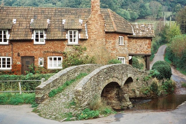
Highlights include Dovery Manor Museum and Pack Horse Bridge.
Weather in Porlock
Forecast from MET Norway (CC BY 4.0). Full forecast
About Porlock
Porlock is a coastal village in Somerset, England, 5 miles (8 km) west of Minehead. At the 2011 census, the village had a population of 1,440.
From the Wikipedia article Porlock (this version), under CC BY-SA 4.0.
Travel tips from other travellers: Porlock on Wikivoyage (CC BY-SA 4.0).
Things to do5

Museums and landmarks10


Porlock Stone Circle
Monument and historic site · 2.9 mi
Stone circle in Porlock, Somerset West and Taunton, England, UK


Parks, trails and playgrounds1

Restaurants and cafes15
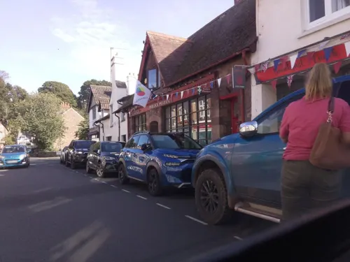
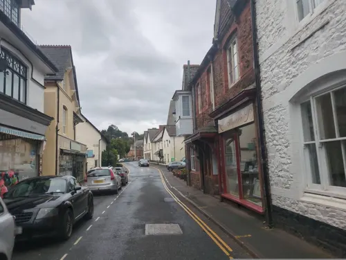
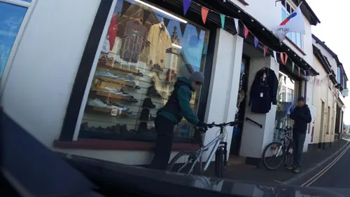
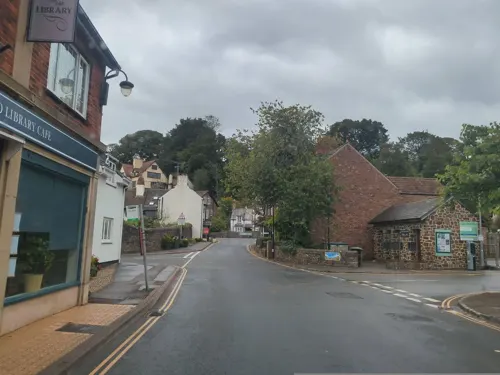
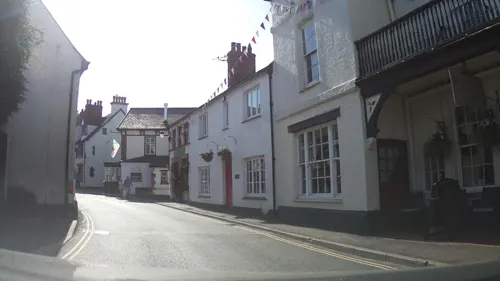


3 more on the map.
History
There is evidence for 10th or 11th century origin for the name Porlock as Portloc or Portloca meaning enclosure by the harbour, from the Old English port and loca, and in Domesday Book the village was known as "Portloc". In 914 the Vikings plundered Porlock.
The area has links with several Romantic poets and R. D. Blackmore, the author of Lorna Doone, and is popular with visitors. The visitor centre has exhibits and displays about the area. Also on display are the bones of an aurochs, discovered on Porlock beach in 1999.
From the History section of Porlock on Wikipedia, under CC BY-SA 4.0.
More about Porlock
Geography
The village adjoins the Porlock Ridge and Saltmarsh nature reserve, created from the lowland behind a high shingle embankment which was breached by the sea in 1996, which has now been designated as a Site of Special Scientific Interest. Copses of white dead trees remind the visitor of when this was freshwater pasture.
A stream flows down a wooded combe called Hawkcombe, which leads about 3 miles (4.8 km) from the village up to high open moorland. The stream, Hawkcombe Waters, runs past a Victorian hunting lodge called The Cleeve, then underground beneath the Overstream Hotel in the centre of the village.
The South West Coast Path goes through Porlock, many walkers stopping rather than continuing the long walk to Lynton. There is also a 'Coleridge Way' walk.
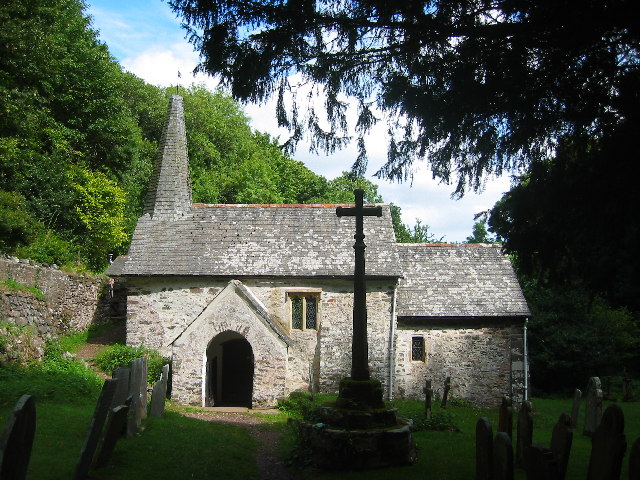
Culbone Church is said to be the smallest church in England. The main structure is 12th century. Services are still held there, despite the lack of road access – Culbone is a 2-mile (3.2 km) walk from Porlock Weir, and some 3–4 miles (5–6 km) from Porlock itself.
A toll road bypasses the 1 in 4 gradient on Porlock Hill. There is the prehistoric Porlock Stone Circle on the hill.
At low tide the remains of a submerged forest can be seen on Porlock Beach. The area was several miles inland until the sea level in the Bristol Channel rose about 7000 to 8000 years ago.
From the Wikipedia article Porlock, under CC BY-SA 4.0.
Notable people from Porlock
- Drummond MatthewsBritish geophysicist (1931–1997)
- Richard PhelpsEnglish portrait artist,1710-1785
- Michael McMasterEnglish cricketer, naval officer and businessman (1896-1965)
Born in Porlock, according to Wikidata (CC0). Each name links to its Wikipedia article.
Where to stay22
Churches and places of worship12
Shopping5
Schools, colleges and libraries2
Healthcare1
Map of Porlock
73 places. The map loads OpenStreetMap tiles when you open it.
Getting there and nearby towns
Cardiff Airport (CWL) is the nearest airport with scheduled flights listed in OpenStreetMap, 17 miles away.
- Minehead 5 mi east, about 8 min by car
- Dulverton 12 mi south, about 19 min by car
- Llantwit Major 15 mi north, about 24 min by car
- Barry 19 mi northeast, about 30 min by car
- Porthcawl 19 mi north, about 31 min by car
- Bridgend 21 mi north, about 33 min by car
- Coity 22 mi north, about 35 min by car
- Barnstaple 22 mi southwest, about 35 min by car
- Tiverton 22 mi south, about 35 min by car
- Cardiff 26 mi northeast, about 42 min by car
Drive times are estimates from straight-line distance, not routes.
Towns near Porlock


Keep exploring
Local news
Headlines from INDB.
Reviews, tips and questions
Loading what members have shared...
Sources and licences
- GeoNames (CC BY 4.0): population, coordinates, regions and time zone
- Mapillary (see each image): photos
- OpenStreetMap contributors (ODbL 1.0): places, airports, map data
- Wikidata (CC0 1.0): elevation, founding date, time zone, website, landmarks and historic places
- Wikimedia Commons (see each image): photos
- Wikipedia (CC BY-SA 4.0): overview and history text
Photo credits
- Porlockweir, Timkevan ( talk ), Public domain
- Porlock Stone Circle I, Ethan Doyle White, CC BY-SA 3.0
- Selworthy Church, Geoff Barber, CC BY-SA 2.0
- Culbonechurch, Richard Mascall, CC BY-SA 2.0
- Allerford bridge, Chris Downer, CC BY-SA 2.0
- Bossington Beach 4 - 55457622905, Tim Sheerman-Chase, CC BY 4.0
- Street-level photo, southglos, CC BY-SA 4.0
- Street-level photo, southglos, CC BY-SA 4.0
- Street-level photo, stuarth, CC BY-SA 4.0
- Street-level photo, southglos, CC BY-SA 4.0
- Street-level photo, swinetown, CC BY-SA 4.0
- Street-level photo, southglos, CC BY-SA 4.0
- Street-level photo, swinetown, CC BY-SA 4.0
- Street-level photo, southglos, CC BY-SA 4.0
- Street-level photo, southglos, CC BY-SA 4.0
- Street-level photo, southglos, CC BY-SA 4.0
- Street-level photo, southglos, CC BY-SA 4.0
- Street-level photo, swinetown, CC BY-SA 4.0
- Street-level photo, swinetown, CC BY-SA 4.0
- Street-level photo, swinetown, CC BY-SA 4.0
- Street-level photo, southglos, CC BY-SA 4.0
- Street-level photo, southglos, CC BY-SA 4.0
- Street-level photo, southglos, CC BY-SA 4.0
Page built November 10, 2026. Spotted a mistake? Tell us or suggest a place.