
Why visit Ban Mo
Townapedia lists 16 parks and trails, 2 places to eat and 1 place to stay in and around town.
Weather in Ban Mo
Forecast from MET Norway (CC BY 4.0). Full forecast
About Ban Mo
Ban Mo (Thai: บ้านหมอ, pronounced [bâːn mɔ̌ː]) is a district (amphoe) in the northwestern part of Saraburi province, central Thailand.
From the Wikipedia article Ban Mo district (this version), under CC BY-SA 4.0.
Parks, trails and playgrounds16

4 more on the map.
Restaurants and cafes2

Where to stay1

Churches and places of worship7

History
After the Buddha footprint near Saraburi was found and a temple was built, King Songtham hired Dutch engineers to build a road from Tha Ruea to Wat Phra Phutthabat to make the pilgrimage there easier. Elephants did the heavy lifting. When the elephants got sick, they were cured at Wat Khok (later called Wat Khok Ban Mo and Wat Ban Mo finally), which thus gave the district its name. Because Ban Mo literally means "home of doctor".
From the History section of Ban Mo district on Wikipedia, under CC BY-SA 4.0.
More about Ban Mo
Geography
Neighboring districts are (from the west clockwise) Don Phut, Nong Don, Phra Phutthabat, Sao Hai of Saraburi Province, and Tha Ruea of Ayutthaya province.
Economy
Ban Mo can be considered as the area that has grown the most Melientha suavis in the country, with a total area of more than 1,000 rai (160 ha; 400 acres). Taro is another important food crop.
From the Wikipedia article Ban Mo district, under CC BY-SA 4.0.
Shopping2
Gas and EV charging1
Healthcare4
Map of Ban Mo
33 places. The map loads OpenStreetMap tiles when you open it.
Getting there and nearby towns
Khok Kathiam Airforce Base (KKM) is the nearest airport with scheduled flights listed in OpenStreetMap, 30 km away.
- Lop Buri 22 km north, about 22 min by car
- Saraburi 22 km southeast, about 22 min by car
- Phra Nakhon Si Ayutthaya 33 km southwest, about 33 min by car
- Sing Buri 46 km northwest, about 46 min by car
- Suphan Buri 67 km west, about 1 h by car
- Sai Mai 78 km south, about 1 h 15 min by car
- Pak Kret 82 km south, about 1 h 15 min by car
- Khlong Sam Wa 83 km south, about 1 h 30 min by car
- Lak Si 83 km south, about 1 h 30 min by car
- Mueang Nonthaburi 87 km south, about 1 h 30 min by car
Drive times are estimates from straight-line distance, not routes.
Towns near Ban Mo


Keep exploring
Local news
Headlines from INDB.
Reviews, tips and questions
Loading what members have shared...
Sources and licences
- GeoNames (CC BY 4.0): population, coordinates, regions and time zone
- Mapillary (see each image): photos
- OpenStreetMap contributors (ODbL 1.0): places, airports, map data
- Wikidata (CC0 1.0): elevation, founding date, time zone, website
- Wikipedia (CC BY-SA 4.0): overview and history text
Photo credits
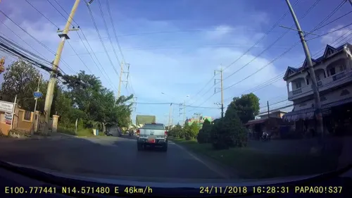
- Street-level photo, rusmanoon, CC BY-SA 4.0
- Street-level photo, rusmanoon, CC BY-SA 4.0
Page built November 10, 2026. Spotted a mistake? Tell us or suggest a place.