


Why visit Alsdorf
Townapedia lists 182 museums and landmarks, 26 parks and trails, 140 places to eat, 7 places to stay and 14 attractions in and around town.
Highlights include Koch Obst- & Gemüsehof, Tierpark Alsdorfer Weiher, ENERGETICON and Burg Alsdorf.
Weather in Alsdorf
Forecast from MET Norway (CC BY 4.0). Full forecast
About Alsdorf
Alsdorf (German pronunciation: [ˈalsdɔʁf] ) is a municipality in the district of Aachen, in North Rhine-Westphalia, Germany. Until the 21st century Alsdorf was a mining area, but now many service companies have established themselves in Alsdorf. Alsdorf has an indoor arena, a cinema, a mining museum and a zoo. One of Alsdorf's famous sights is the old Castle.
From the Wikipedia article Alsdorf (this version), under CC BY-SA 4.0.
Photos of Alsdorf


Things to do14
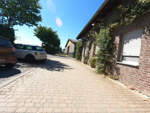
Koch Obst- & Gemüsehof
Farm and orchard · 2.0 km
20 Schwarzer Weg, Baesweiler
Mo-Th 09:00-13:00,14:30-18:00; Fr 09:00-18:00; Sa 09:00-14:00; Su,PH off



Obstbaubetrieb Roosen
Farm and orchard · 5.0 km
2 Am Beeckfließ, Baesweiler
Mo-Fr 09:00-18:00; Sa 09:00-13:00
Minis-Hof
Farm and orchard · 3.9 km
138 Geilenkirchener Straße, Herzogenrath


2 more on the map.
Museums and landmarks182


Burg Alsdorf
Monument and historic site
Ost- und Südflügel
17 Burgstraße, Alsdorf

Alsdorfer Ölmühle
Monument and historic site · 1.9 km
Ehemalige wasserbetriebene Ölmühle, erbaut vor 1420

Burg Baesweiler
Monument and historic site · 3.7 km
16 Burgstraße, Baesweiler


Fördermaschinenhaus Eduardschacht
Monument and historic site · 1.4 km
Fördermaschienenhaus Eduardschacht, Östl. Fördermaschine und Umformer




Langweiler
Monument and historic site · 6.3 km
Archaeological site in the Merzbach Valley of Western Germany
170 more on the map.
Parks, trails and playgrounds26


Gehölzbestand mit Graureiherkolonie nordwestlich Ofden
Hiking and trails · 2.1 km

Mittleres Broichbachtal zwischen Broicher Siedlung und Ofden
Hiking and trails · 2.2 km

Quellgebiet Broichbach mit Schwalbennistwand westlich Broicher Siedlung, nördlich Broich
Hiking and trails · 3.3 km

Übachtal nördlich Merkstein einschließlich Heidberg und Floesser Büschchen
Hiking and trails · 4.1 km

Freibad Merkstein
Sports field and stadium · 3.0 km
Kostenfreie Parkplätze sind reichlich vorhanden.
Buschhofer Weg, Herzogenrath
May Mo-Su 07:00-20:00
14 more on the map.
Restaurants and cafes140
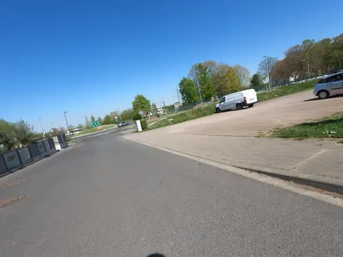
Cap 1
Restaurant · International · 3.8 km
1 Carl-Alexander-Platz, Baesweiler
Tu-Th 11:30-22:00; Fr 11:30-23:00; Sa 09:00-23:00; Su 09:00-22:00
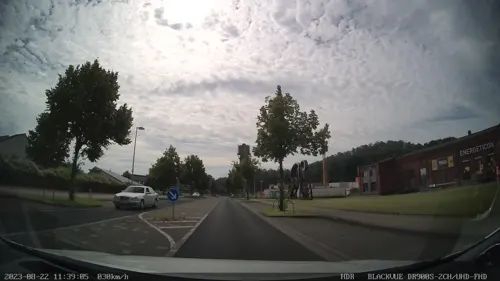
Eduard Bistro&Restaurant
Restaurant · International, Italian, Turkish · 1.3 km
7 Konrad-Adenauer-Allee, Alsdorf
Mo off; Tu-Su 11:00-22:00
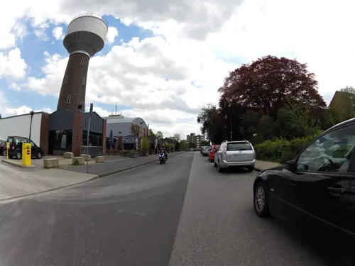
Eisfreunde Alsdorf
Restaurant · Ice Cream
13 Hubertusstraße, Alsdorf
Mo-We off; Th-Sa 14:00-20:00; Su 13:00-20:00
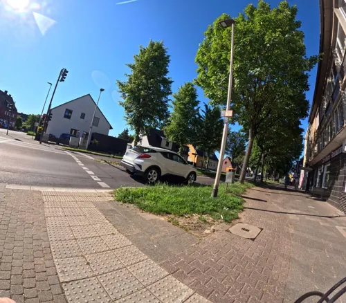
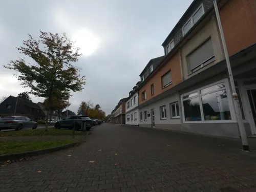
Fräulein Sahne
Cafe · Coffee Shop · 3.4 km
375 Geilenkirchener Straße, Herzogenrath
We-Fr 09:00-17:00,13:30-13:30; Sa-Su 10:00-17:30; PH closed
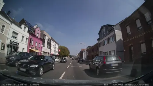
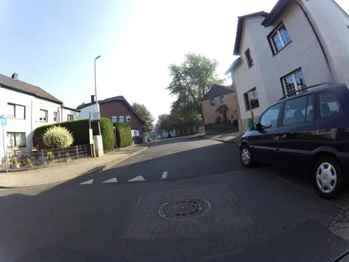
Lucky Wok Imbiss
Restaurant · Asian · 2.8 km
6 Querstraße, Alsdorf
Tu-Sa 11:30-14:30, 17:30-22:00; Su,PH 12:00-21:30

Living
Restaurant · German, Burger, Pizza · 2.2 km
46 Theodor-Seipp-Straße, Alsdorf
Mo,We,Th 09:00-21:00; Fr,Sa 09:00-21:30; Su 10:00-23:00; Tu 09:00-15:30
Sultan Kebaphaus
Restaurant · Turkish · 3.6 km
115 Aachener Straße, Alsdorf
Mo-Sa 11:30-23:00; Su 09:00-23:00
Sultan Restaurant
Restaurant · Turkish · 4.3 km
62 Roermonder Straße, Übach-Palenberg
Mo-Sa 11:30-23:00; Su 09:00-23:00
128 more on the map.
History
Today´s city of Alsdorf is a complex mixture of very different ingredients. A part of today's city was a part of the Duchy of Limburg (later united with Duchy of Brabant); and one part belonged to the territory of the Duchy of Jülich.
In addition, Alsdorf consists of ancient settlements whose history dates back to medieval times, as well as settlements that arose because of the long coal mining tradition in Alsdorf. The old settlements are: Alsdorf, Bettendorf, Hoengen, Ofden, Schaufenberg, Warden and Zopp.
The name Alsdorf was mentioned for the first time in a document of the Catholic Church in the year 1191. But it might be much older than 800 years. During its history, Alsdorf changed its affiliation a few times. Along with the duchy of Brabant and the duchy of Limburg, it also belonged to the duchy of Burgundy (1430) and fell to the Habsburgs in 1482. Then in 1555, it became part of the Spanish Netherlands under the Spanish Habsburgs. In 1714, it was returned to the Austrian Habsburgs until the French invasion of 1794. Pursuant to a judgement of the 1815 Congress of Vienna, Alsdorf was awarded to Prussia.
With the reconstruction of Germany after the Second World War, Prussia was eliminated, and its western provinces are now the state of North Rhine-Westphalia, where Alsdorf lies.
Read more of the history
Until the middle of the 19th century, farming was the main industry. Only Alsdorf (approximately 1,200) and Hoengen (about 1,400) had more than 1,000 inhabitants. Population in the greater area of today's Alsdorf totalled 4,000 people.
Today the population is more than ten times larger as a result of mining, which came to Alsdorf in the middle of the 19th century. The mining industry needed many workers. First, it was possible to cover the demand with local workers but as the mine grew, the need for workers grew. To be an attractive employer, the mine company built new houses to offer its employees good working conditions. Between 1860 and 1960, a few bigger and smaller villages were founded. These villages are: Begau, Blumenrath, Broicher Siedlung, Busch, Kellersberg, Mariadorf, Neuweiler, Ofden, Ost and Zopp. In 1932, the villages Kellerberg, Ofden, Schaufenberg, and Neuweiler were incorporated and the population grew from 11,500 to 19,711.
The great tragedy on October 21, 1930, demonstrated the danger of mine work. In the Anna II Mine, 270 men and one woman were killed. It was the second largest mining accident in Germany history.
The Maria Mine closed in September 1962, and the last mine in Alsdorf shut down in 1992. Since this time, Alsdorf has successfully changed its image away from a coal city to a modern business location. A few business parks have been founded, where a lot of companies have located.
From the History section of Alsdorf on Wikipedia, under CC BY-SA 4.0.
More about Alsdorf
Geography
Alsdorf is located near the border triangle Germany/Belgium/Netherlands in the west of Germany. Communes bordering Alsdorf are Baesweiler, Aldenhoven, Eschweiler, Würselen, Herzogenrath and Übach-Palenberg. Alsdorf belongs to the district of Aachen.
Economy
For over a century, coal mining was the heart of Alsdorf's economy. Coal production started in 1849, when the Maria Mine opened in Hoengen. In 1853, production started in the Anna coal mine of Alsdorf. This was the reason for an increase in production and workforce, this was particularly measurable in mine Anna but not in mine Maria, which was closed by September 1962. Unfortunately, the coal crisis has not spared Alsdorf, and the last mine was closed in 1992.
Alsdorf's biggest employer was the Cinram GmbH, with about 2,000 employees in district of Schaufenberg. This company produces up to 2 million DVDs, Blu-rays and CDs daily, exported throughout Europe. The company was founded in 1975 by Warner Music and sold in 2003 to the Canadian stock corporation Cinram International. Customers are well-known record labels and media companies like Warner Music, Twentieth Century Fox and Universal Pictures. In 2017 close down its european manufacturing plant at Alsdorf.
Besides acquired companies, which either used the closeness to RWTH Aachen University or which saw the favourable location near the borders to Belgium and the Netherlands as advantage.
In June 2022 it was announced that in the first quarter of 2023 Continental the German multinational automotive parts manufacturing company would produce fuel tanks at Alsdorf. A new factory is built by Continental Fuel Storage Systems GmbH.
From the Wikipedia article Alsdorf, under CC BY-SA 4.0.
Notable people from Alsdorf
 Jürgen B. HausmanncomedianPhoto: BBKurt, CC BY 3.0
- Herbert ZimmermannGerman tv presenter (1917–1966)
- Admir TerzićGerman footballer
- Hans BergerGerman politician (1938–2022)
- Auqust Berzen
Born in Alsdorf, according to Wikidata (CC0). Each name links to its Wikipedia article.
Where to stay7
Churches and places of worship43
St. Willibrord
Church · Roman Catholic · 4.0 km
36 Euchener Straße, Würselen
Martin-Luther-Kirche Merkstein
Church · Protestant · 3.3 km
397c Geilenkirchener Straße, Herzogenrath
Shopping39
Gas and EV charging19
Schools, colleges and libraries37
Healthcare22
Map of Alsdorf
250 places. The map loads OpenStreetMap tiles when you open it.
Getting there and nearby towns
Flugplatz Würselen-Aachen (AAH) is the nearest airport with scheduled flights listed in OpenStreetMap, 6 km away.
- Baesweiler 4 km northeast, about 4 min by car
- Herzogenrath 5 km west, about 5 min by car
- Übach-Palenberg 5 km northwest, about 5 min by car
- Würselen 7 km south, about 7 min by car
- Niedermerz 7 km east, about 7 min by car
- Aldenhoven 9 km east, about 9 min by car
- Eschweiler 10 km southeast, about 10 min by car
- Geilenkirchen 11 km north, about 11 min by car
- Aachen 12 km southwest, about 12 min by car
- Stolberg 12 km south, about 12 min by car
Drive times are estimates from straight-line distance, not routes.
Towns near Alsdorf


Keep exploring
Local news
Headlines from INDB.
Reviews, tips and questions
Loading what members have shared...
Sources and licences
- GeoNames (CC BY 4.0): population, coordinates, regions and time zone
- Mapillary (see each image): photos
- OpenStreetMap contributors (ODbL 1.0): places, airports, map data
- Wikidata (CC0 1.0): elevation, founding date, time zone, website, landmarks and historic places
- Wikimedia Commons (see each image): photos
- Wikipedia (CC BY-SA 4.0): overview and history text
Photo credits
- Die Burg Alsdorf in Alsdorf, sodele, CC BY-SA 2.0
- Alsdorf Stolpersteine Koernerstr 11, GregPit83, CC BY 4.0
- Alsdorf Stolperstein Koernerstr 11 Isaak Kohn, GregPit83, CC BY 4.0
- Alsdorf Stolperstein Koernerstr 11 Mendel Kohn, GregPit83, CC BY 4.0
- Alsdorf Stolpersteine Gebaeude Koernerstr 11, GregPit83, CC BY 4.0
- Alsdorf Stolperstein Koernerstr 11 Betty Kohn, GregPit83, CC BY 4.0
- Alsdorf Stolperstein Koernerstr 11 Fanny Kohn, GregPit83, CC BY 4.0
- Stolperstein Alsdorf Körnerstraße 11 Isaak Kohn, Tscheche83, CC BY-SA 4.0
- Stolperstein Alsdorf Körnerstraße 11 Mendel Kohn, Tscheche83, CC BY-SA 4.0
- Stolperstein Alsdorf Körnerstraße 11 Fanny Kohn, Tscheche83, CC BY-SA 4.0
- Stolperstein Alsdorf Körnerstraße 11 Betty Kohn, Tscheche83, CC BY-SA 4.0
- Alsdorf Stolpersteine Gebaeude Rathausstr 49, GregPit83, CC BY-SA 4.0
- Alsdorf Stolpersteine Rathausstr 49, GregPit83, CC BY-SA 4.0
- Alsdorf Stolpersteine Annastr 45, GregPit83, CC BY-SA 4.0
- Wasserturm Alsdorf Cinetower; Cultural heritage monuments in Alsdorf; Buildings in Alsdorf; Water towers in the Städteregion Aachen; Otto Intze, Qwertzu111111, CC BY-SA 4.0
- Bucherschrank Alsdorf Otto-Wels-Str 2024-06-09, W. Mathar, CC BY-SA 4.0
- Alsdorf Stolpersteine Gebaeude Annastr14, GregPit83, CC BY-SA 4.0
- Alsdorf Stolpersteine Annastr 14, GregPit83, CC BY-SA 4.0
- Rutschbahn Alsdorf Henningsdorfer Platz 2024-06-09, W. Mathar, CC BY-SA 4.0
- Stolpersteine Alsdorf Bertha Weinblum Robert-Koch-Strasse 29, GregPit83, CC BY-SA 4.0
- Stolpersteine Alsdorf Esther Weinblum Robert-Koch-Strasse 29, GregPit83, CC BY-SA 4.0
- Stolpersteine Alsdorf Anna Riefka Weinblum Robert-Koch-Strasse 29, GregPit83, CC BY-SA 4.0
- Stolpersteine Alsdorf Israel Weinblum Robert-Koch-Strasse 29, GregPit83, CC BY-SA 4.0
- Stolpersteine Alsdorf Frieda Weinblum Robert-Koch-Strasse 29, GregPit83, CC BY-SA 4.0
- Alsdorf Robert-Koch-Strasse 29 Stolperstein, GregPit83, CC BY-SA 4.0
- Alsdorf Stolpersteine Robert-Koch-Strasse29, GregPit83, CC BY-SA 4.0
- Stolpersteine Alsdorf Max Weinblum Robert-Koch-Strasse 29, GregPit83, CC BY-SA 4.0
- Burg Alsdorf - geo.hlipp.de - 8886, Sir Gawain on geo.hlipp.de, CC BY-SA 2.0
- Alsdorf Stolpersteine Rathausstr18, GregPit83, CC BY-SA 4.0
- Alsdorf Karnevalsbrunnen, GregPit83, CC BY-SA 4.0
- Alsdorf Heggeströver, GregPit83, CC BY-SA 4.0
- Burg Alsdorf Ostansicht, Sir Gawain, CC BY-SA 3.0
- Burg Baesweiler, Christian Faulhammer, CC BY-SA 2.5
- KommendeSiersdorfNordost, Sir Gawain, CC BY-SA 3.0
- 186 Alsdorfer Ölmühle, Wirtschaftsgebäude, Käthe u. Bernd Limburg, www.limburg-bernd.de, CC BY-SA 3.0 de
- Merkstein, Pfarrkirche Sankt Willibrord Dm000115 - 01 foto4 2016-09-08 15.19, Michielverbeek, CC BY-SA 4.0
- Blick auf Schulgebäude des HGG - cropped, Mapelbot, CC BY-SA 4.0
- Streichelzoo im Alsdorfer Tierpark - geo-en.hlipp.de - 12295, Andreas Hörstemeier, CC BY-SA 2.0
- Grube Anna, Schmiede (3), ArthurMcGill, CC BY-SA 4.0
- Oidtweiler Kirche, Lokilech, CC BY-SA 3.0
- NSG Gehölzbestand mit Graureiherkolonie nordwestlich Ofden (3), ArthurMcGill, CC BY-SA 4.0
- NSG Übachtal nördlich Merkstein einschließlich Heidberg und Flösser Büschchen (5), ArthurMcGill, CC BY-SA 4.0
- NSG Bergehalde Anna II (5), ArthurMcGill, CC BY-SA 4.0
- Naturschutzgebiet Bergehalde Maria-Hauptschacht (4), ArthurMcGill, CC BY-SA 4.0
- NSG Bergehalde Jaspersberg (1), ArthurMcGill, CC BY-SA 4.0
- NSG Bergehalde Anna I (1), ArthurMcGill, CC BY-SA 4.0
- Herzogenrath, katholische Pfarrkirche Sankt Gertrudis Dm000001-01 foto4 2015-08-30 12.31, Michielverbeek, CC BY-SA 4.0
- Graureiher im NSG Bergsenkungsgebiet Bettendorfer Fliess, Second-petra, CC BY-SA 4.0
- Stolpersteine Baesweiler Bahnhofstraße 13 David Randerath (Detail), Qwertzu111111, CC BY-SA 4.0
- Stolpersteine Baesweiler Breite Straße 17 Herschel Falke (Detail), Qwertzu111111, CC BY-SA 4.0
- Wasserturm Alsdorf (1), ArthurMcGill, CC BY-SA 4.0
- Burg Alsdorf Suedostansicht, Sir Gawain, CC BY-SA 3.0
- 186 Alsdorfer Ölmühle, Wohn- und Wirtschaftshaus, Käthe u. Bernd Limburg, www.limburg-bernd.de, CC BY-SA 3.0 de
- Baesweiler Burg (6), Lokilech, CC BY-SA 3.0
- Grube Anna, Fördermaschinenhaus Eduardschacht, ArthurMcGill, CC BY-SA 4.0
- Stolpersteine Baesweiler Breite Straße 17 Simon Falke (Detail), Qwertzu111111, CC BY-SA 4.0
- Carl-Alexander-Park, Baesweiler (16), ArthurMcGill, CC BY-SA 4.0
- Regenwolke über der Eifel (9335950015), Lars Steffens, CC BY-SA 2.0
- 182 Broicher Mühle, Mühlenteich, Käthe u. Bernd Limburg, www.limburg-bernd.de, CC BY-SA 3.0 de
- Broicher Bach 1, Quelle, Rückhaltebecken, Käthe u. Bernd Limburg, www.limburg-bernd.de, CC BY-SA 3.0 de
- Ev. Kirche Würselen-Vorweiden, Unknown author Unknown author, CC BY-SA 4.0
- St. Willibrord Euchen (Würselen) 01 von 01, Qwertzu111111, CC BY-SA 4.0
- Würselen Nikolauskirche, Norbert Schnitzler, CC BY-SA 3.0
- St. Barbara (Broicher Siedlung) 01, Thomas Hummel, CC BY-SA 4.0
- St. Mariä Heimsuchung (Schaufenberg), Thomas Hummel, CC BY-SA 4.0
- Markuskirche Herzogenrath Mitte von der Evangelischen Lydia-Gemeinde Herzogenrath, Qwertzu111111, CC BY-SA 4.0
- Street-level photo, madel, CC BY-SA 4.0
- Street-level photo, madel, CC BY-SA 4.0
- Street-level photo, madel, CC BY-SA 4.0
- Street-level photo, madel, CC BY-SA 4.0
- Street-level photo, hektor1989, CC BY-SA 4.0
- Street-level photo, hektor1989, CC BY-SA 4.0
- Street-level photo, hektor1989, CC BY-SA 4.0
- Street-level photo, madel, CC BY-SA 4.0
- Street-level photo, madel, CC BY-SA 4.0
- Street-level photo, madel, CC BY-SA 4.0
- Street-level photo, madel, CC BY-SA 4.0
- Street-level photo, paddy257, CC BY-SA 4.0
- Street-level photo, madel, CC BY-SA 4.0
- Street-level photo, hektor1989, CC BY-SA 4.0
- Street-level photo, hektor1989, CC BY-SA 4.0
- Street-level photo, madel, CC BY-SA 4.0
- Street-level photo, madel, CC BY-SA 4.0
- Street-level photo, hektor1989, CC BY-SA 4.0
- Street-level photo, hektor1989, CC BY-SA 4.0
- Street-level photo, thmunichways, CC BY-SA 4.0
- Street-level photo, mfa, CC BY-SA 4.0
- Street-level photo, hektor1989, CC BY-SA 4.0
- Street-level photo, hektor1989, CC BY-SA 4.0
- Street-level photo, hektor1989, CC BY-SA 4.0
- Street-level photo, hektor1989, CC BY-SA 4.0


Page built November 9, 2026. Spotted a mistake? Tell us or suggest a place.