


Why visit Altena
Townapedia lists 37 museums and landmarks, 23 parks and trails, 54 places to eat, 6 places to stay and 33 attractions in and around town.
Highlights include Dechen Cave, Hofladen-Weustermann, Haus Nachrodt and Burg Altena.
Weather in Altena
Forecast from MET Norway (CC BY 4.0). Full forecast
About Altena
Altena (German pronunciation: [ˈaltəna] ; Westphalian: Altenoa) is a town in the district of Märkischer Kreis, North Rhine-Westphalia, Germany. The town's castle is the origin for the later Dukes of Berg. Altena is situated on the Lenne river valley, in the northern stretches of the Sauerland.
From the Wikipedia article Altena (this version), under CC BY-SA 4.0.
Things to do33


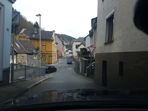
Hofladen-Weustermann
Farm and orchard · 4.5 km
9 Brenscheid, Nachrodt-Wiblingwerde
Mo-Sa 08:00-18:00; Su 00:00-24:00



21 more on the map.
Museums and landmarks37

Haus Nachrodt
Monument and historic site · 5.2 km
51 Hagener Straße, Nachrodt-Wiblingwerde
Mo, We, Fr 08:00-12:00; Tu, Th 08:00-12:00, 14:00-17:00


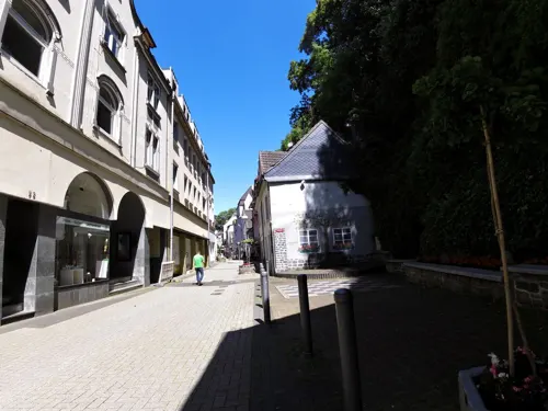


Brenscheider Ölmühle
Monument and historic site · 4.6 km
Technical_monument
5 Brenscheider Mühle, Nachrodt-Wiblingwerde

Drahtrolle „Am Hurk“
Monument and historic site · 4.4 km
18 Im Springen, Altena

Ehrendenkmal
Monument and historic site · 3.5 km
Denkmal der verstorbenen Soldaten
25 more on the map.
Parks, trails and playgrounds23

Wildgehege Mesekendahl
Park · 4.9 km
1 Mesekendahl, Schalksmühle
We-Fr 13:00-18:00; Sa,Su,PH 10:00-19:00




11 more on the map.
Restaurants and cafes54

Pilling
Restaurant · Regional
18 Nettestraße, Altena
Jun-Sep Tu-Sa 17:00-21:30, Su 16:00-21:30; Oct-May Tu-Sa...
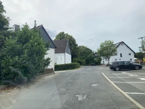
Gasthof Spelsberg
Restaurant · Regional, German · 3.1 km
17 Großendrescheid, Altena
Mo 06:30-22:00; Tu 16:30-22:00; We-Su 06:30-22:00
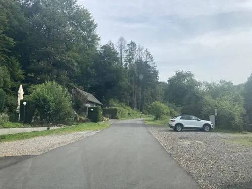
Waldrestaurant Brenscheider Mühle
Restaurant · Regional · 5.0 km
1 Brenscheider Mühle, Nachrodt-Wiblingwerde
We-Su 11:30-21:00

Burgrestaurant Altena
Restaurant · 0.6 km
80 Fritz-Thomee-Straße
Th-Sa 11:30-22:00; We 11:30-17:00; Su 11:30-18:00

Bäckerei Kayser
Bakery · 1.1 km
49 Rahmedestraße, Altena
Mo-Fr 06:15-20:00; Sa 06:15-16:00; Su 08:00-11:00
Goldbäckerei Grote
Bakery · 4.4 km
49-51 Altenaer Straße, Nachrodt-Wiblingwerde
Mo-Fr 05:30-19:00,Sa 05:30-18:00,Su 07:00-12:00


Hotel-Restaurant Zagreb
Restaurant · International · 4.4 km
318 Rahmedestraße, Altena
Mo-Th 17:00-23:00; Fr 11:30-14:30, 17:00-23:00; Sa,Su,PH 11:30-23:00
42 more on the map.
History
Altena Castle was built in the early 12th century, as a stronghold of the older Counts of Berg. A short time later a village was founded beneath the hill, with the castle alongside the river Lenne, which feeds into the river Ruhr. After the distribution of the Berg family estates in 1161, Altena became the centre of the County of Altena. The first Count of Altena became Eberhard I, Count of Berg-Altena. In 1180, after the death of the first count, the county was divided between the two oldest sons: Arnold of Altena and Friedrich of Altena.
From the History section of Altena on Wikipedia, under CC BY-SA 4.0.
Where to stay6
Churches and places of worship25
Erzengel-Michael-Kirche
Church · Coptic Orthodox
25 Kirchstraße, Altena
Evangelische Kirche Wiblingwerde
Church · Reformed · 4.3 km
3 Nachrodter Straße, Nachrodt-Wiblingwerde
Shopping16
Gas and EV charging6
Schools, colleges and libraries11
Gemeindebücherei Nachrodt
Library · 5.1 km
7 Hagener Straße, Nachrodt-Wiblingwerde
Gemeinschaftsgrundschule
School · 4.5 km
61 Ehrenmalstraße, Nachrodt-Wiblingwerde
Healthcare5
Map of Altena
216 places. The map loads OpenStreetMap tiles when you open it.
Getting there and nearby towns
Dortmund Airport (DTM) is the nearest airport with scheduled flights listed in OpenStreetMap, 25 km away.
- Werdohl 8 km southeast, about 8 min by car
- Neuenrade 8 km east, about 8 min by car
- Lüdenscheid 9 km south, about 9 min by car
- Iserlohn 9 km north, about 9 min by car
- Schalksmühle 12 km southwest, about 12 min by car
- Hemer 12 km northeast, about 12 min by car
- Balve 14 km east, about 14 min by car
- Hagen 16 km northwest, about 16 min by car
- Plettenberg 17 km southeast, about 17 min by car
- Schwerte 18 km northwest, about 18 min by car
Drive times are estimates from straight-line distance, not routes.
Local news
Headlines from INDB.
Reviews, tips and questions
Loading what members have shared...
Sources and licences
- GeoNames (CC BY 4.0): population, coordinates, regions and time zone
- Mapillary (see each image): photos
- OpenStreetMap contributors (ODbL 1.0): places, airports, map data
- Wikidata (CC0 1.0): elevation, founding date, time zone, website, landmarks and historic places
- Wikimedia Commons (see each image): photos
- Wikipedia (CC BY-SA 4.0): overview and history text
Photo credits
- Altena Burg 20051030, Dr.G.Schmitz, CC BY-SA 3.0
- Altena-101120-19041-Reformierte-Kirche, user:Mbdortmund, GFDL 1.2
- Altena-101120-19037-Burg-Holtzbrinck-cor, user:Mbdortmund, GFDL 1.2
- Altena-101120-19047-Burg-Holtzbrinck, user:Mbdortmund, GFDL 1.2
- Altena-101120-19036-Burg-Holtzbrinck, user:Mbdortmund, GFDL 1.2
- Altena-101120-19038-Burg-Holtzbrinck-cor, user:Mbdortmund, GFDL 1.2
- Altena-101120-19054-Burg-Holtzbrinck, user:Mbdortmund, GFDL 1.2
- Altena-101120-19052-Kirche, user:Mbdortmund, GFDL 1.2
- Altena-101120-19042-Burg-Holtzbrinck-cor, user:Mbdortmund, GFDL 1.2
- Altena, Germany - panoramio (5), ngocchat1014, CC BY 3.0
- Altena-101120-19085-Blechbaum, user:Mbdortmund, GFDL 1.2
- Altena-101120-19092-Burg-Jugendherberge, user:Mbdortmund, GFDL 1.2
- Altena-101120-19108-Burg-Jugendherberge, user:Mbdortmund, GFDL 1.2
- Altena-101120-19087-Drahtbaum-Detail, user:Mbdortmund, GFDL 1.2
- Altena-101120-19113-Burg-Jugendherberge, user:Mbdortmund, GFDL 1.2
- Altena-101120-19092-Burg-Jugendherberge-cor, user:Mbdortmund, GFDL 1.2
- Altena, Germany - panoramio (4), ngocchat1014, CC BY 3.0
- Altena, Germany - panoramio (3), ngocchat1014, CC BY 3.0
- Altena, Germany - panoramio (7), ngocchat1014, CC BY 3.0
- Altena, Germany - panoramio (6), ngocchat1014, CC BY 3.0
- Altena, Germany - panoramio (1), ngocchat1014, CC BY 3.0
- Altena, Germany - panoramio (2), ngocchat1014, CC BY 3.0
- Über den Dächern von Altena - panoramio, giggel, CC BY 3.0
- Altena, Fritz-Thomée-Straße 75, 2018-02 CN-01, Steffen Schmitz ( more photos ), CC BY-SA 4.0
- Burg Altena 02, Dickelbers, CC BY-SA 3.0
- Altena, Burg, 2018-02 CN-05, Steffen Schmitz ( more photos ), CC BY-SA 4.0
- Altena, Burg, 2018-02 CN-04, Steffen Schmitz ( more photos ), CC BY-SA 4.0
- Burg Altena - panoramio, Edgar El, CC BY 3.0
- Altena, Burg, 2018-02 CN-06, Steffen Schmitz ( more photos ), CC BY-SA 4.0
- Germany - Burg Altena - panoramio, giggel, CC BY 3.0
- Altena, Burg, 2018-02 CN-01, Steffen Schmitz ( more photos ), CC BY-SA 4.0
- Burg Altena, Altena (07957), Günter Seggebäing, Coesfeld, CC BY-SA 3.0
- Altena, Burg, 2018-02 CN-02, Steffen Schmitz ( more photos ), CC BY-SA 4.0
- Burg Altena im Sauerland - Flickr - 1ffischer, Frank from Deutschland, Public domain
- Burg Altena 05, Dickelbers, CC BY-SA 3.0
- Altena-LüdenscheiderStr8-1-Asio, Asio otus, CC BY-SA 3.0
- Dechenhöhle, No machine-readable author provided. Flux Garden~commonswiki assumed (based on copyright claims)., CC BY-SA 3.0
- Hemer-IhmertKirche1-Asio, Asio otus, CC BY-SA 3.0
- Aerial image of the Altena Castle (view from the east), Carsten Steger, CC BY-SA 4.0
- Altena-Burggymnasium2-Bubo, Bubo, CC BY-SA 3.0
- Altena - Deutsches Drahtmuseum 02 ies, Frank Vincentz, CC BY-SA 3.0
- Altena - Gasthaus Pilling 05 ies-Ausschnitt1b, Frank Vincentz - Ausschnittsbearbeitung: Asio 20:55, 6 November 2010 (UTC), CC BY-SA 3.0
- Wiblingwerde-Kirche1-Asio, Asio otus, CC BY-SA 3.0
- Altena - Sankt Matthäus 01 ies, Frank Vincentz, CC BY-SA 3.0
- Nachrodt-Wiblingwerde-HausNachrodt1-Bubo, Bubo, CC BY-SA 3.0
- Altena - Lutherkirche 05 ies, Frank Vincentz, CC BY-SA 3.0
- Nachrodt-Wiblingwerde - Dümplerleie 01 ies, Frank Vincentz, CC BY-SA 3.0
- Iserlohn-NSG-KesbernerKalkbuchenwald2-Bubo, Bubo, CC BY-SA 3.0
- Altena - Marktstraße - Stadtbücherei 01, Frank Vincentz, CC BY-SA 3.0
- Nachrodt evangelische Kirche Kirchstraße 1, Arnoldius, CC BY-SA 4.0
- Altena - Burg ex 17 ies, Frank Vincentz, CC BY-SA 3.0
- Iserlohn-DahlsenAuferstehungskirche1-Bubo, Bubo, CC BY-SA 3.0
- Altena - Sankt Thomas-Morus Expositur 04 ies, Frank Vincentz, CC BY-SA 3.0
- Düsternsiepen, Mina999, CC BY-SA 3.0
- Altena 06 ies, Frank Vincentz, CC BY-SA 3.0
- Burg Holtzbrinck 02, Dickelbers, CC BY-SA 3.0
- Altena Burg Bergfried Aussicht NW 3999 201509, Karlunun, CC BY-SA 4.0
- Drahtrolle „Am Hurk“, Dr.G.Schmitz, CC BY-SA 4.0
- Street-level photo, tasmaniadevil, CC BY-SA 4.0
- Street-level photo, tasmaniadevil, CC BY-SA 4.0
- Street-level photo, uwekoch, CC BY-SA 4.0
- Street-level photo, uwekoch, CC BY-SA 4.0
- Street-level photo, changchun1, CC BY-SA 4.0
- Street-level photo, tasmaniadevil, CC BY-SA 4.0
- Street-level photo, uwekoch, CC BY-SA 4.0
- Street-level photo, uwekoch, CC BY-SA 4.0
- Street-level photo, uwekoch, CC BY-SA 4.0
- Street-level photo, uwekoch, CC BY-SA 4.0
- Street-level photo, VIA_DT, CC BY-SA 4.0
- Street-level photo, zors1843, CC BY-SA 4.0
- Street-level photo, changchun1, CC BY-SA 4.0
- Street-level photo, changchun1, CC BY-SA 4.0
- Street-level photo, zors1843, CC BY-SA 4.0
- Street-level photo, uwekoch, CC BY-SA 4.0
- Street-level photo, tasmaniadevil, CC BY-SA 4.0
- Street-level photo, uwekoch, CC BY-SA 4.0
- Street-level photo, uwekoch, CC BY-SA 4.0
- Street-level photo, zors1843, CC BY-SA 4.0


Page built November 8, 2026. Spotted a mistake? Tell us or suggest a place.