


Why visit Balve
Townapedia lists 85 museums and landmarks, 42 parks and trails, 69 places to eat, 21 places to stay and 95 attractions in and around town.
Highlights include Balve Cave, Ahlenberg, Luisenhütte and Schloss Melschede.
Weather in Balve
Forecast from MET Norway (CC BY 4.0). Full forecast
About Balve
Balve (German pronunciation: [ˈbalvə] ) is a town in the Märkischer Kreis district, North Rhine-Westphalia, Germany. It is located in Hönnetal, a narrow valley created by the river Hönne, which is near the Sorpe Dam, formerly part of Balve, and at the north end of the Sauerland, near Dortmund. The town was established in 1975 with several divisions including Balve, Beckum and Eisborn and Garbeck.
From the Wikipedia article Balve (this version), under CC BY-SA 4.0.
Things to do95




83 more on the map.
Museums and landmarks85

Luisenhütte
Museum · 1.4 km
11 Wocklum, Balve
May-Oct: Tu-Fr 09:30-17:00; Sa-Su 11:00-18:00
Open in Google Maps · Wikipedia · +49 2375 3134;+49 2352 9667034


Städtisches Museum für Vor- und Frühgeschichte
Museum · 1.4 km
11a Wocklum, Balve
May-Oct Tu-Fr 09:30-17:00; May-Oct Sa-Su 11:00-18:00; May-Oct SH...

Oberrödinghauser Hammer
Monument and historic site · 7.5 km
Industrial cultural monument in Germany

Burg Klusenstein
Monument and historic site · 5.6 km
1 Klusenstein, Hemer



73 more on the map.
Parks, trails and playgrounds42



30 more on the map.
Restaurants and cafes69
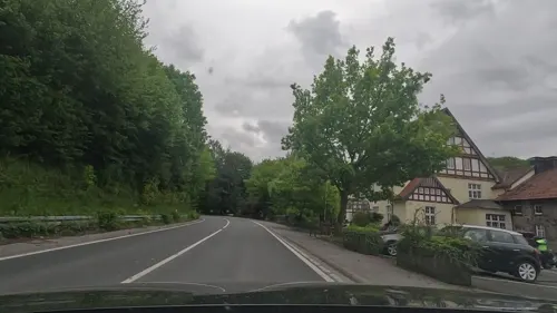
Haus Recke
Restaurant · German · 4.3 km
Hotel hat Mo-So geöffnet, eingeschränkte Öffnungszeiten beziehen sich nur auf das Restaurant
1 Binolen, Balve
Tu 17:00-22:00; We-Fr 09:00-14:00,17:00-22:00; Sa 09:00-22:00; Su...

WOOHOO Sorpesee
Restaurant · Coffee Shop, Regional, Ice Cream, German · 5.2 km
Gastronomie, Bistro, Café, Lounge-Area, Veranstaltungslocation, Fahrradverleih, Bootsverleih, Bogenschießen, Outdoor-Erlebnisse für...
191 Am Sorpesee, Sundern (Sauerland)
Mo-Su 09:00-21:00
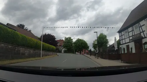
Restaurant Haus Habbel
Restaurant · German · 2.5 km
11 Sunderner Straße, Balve
Tu-Su 11:00-14:00,17:00-01:00




57 more on the map.
History
The first reference to Balve is from around 780, when it was mentioned that a Widukind owned a farm called Ballowa, another name for the town, although this reference has been disputed. The first undisputed reference was in 864, in which a blind girl from Balve was said to be healed at the grave of the Saint Ludger in the crypt of Werden Abbey.
Ballowa is also mentioned in the Thidrekssaga, a chivalric saga written in the mid-13th century in Norway. In the saga, Ballowa is the home of two dwarfs who taught Weyland much about making iron weapons. At the time of writing, Balve belonged to the county of Arnsberg.
In 1358 the town became the property of the Duchy of Westphalia, which belonged to the Archbishops of Cologne. In 1430 it was given the right to be called a city. During the Napoleonic period, it belonged for a short time (1802–1815) to Hesse, after which time it became part of the Kingdom of Prussia.
In 1975, following a substantial reorganisation of local government in Germany, the city was enlarged by the addition of the several former independent municipalities from the abolished Amt Balve, including Asbeck, Beckum, and Eisborn.
From the History section of Balve on Wikipedia, under CC BY-SA 4.0.
Where to stay21
Churches and places of worship30
Kirche Maria Frieden
Church · Catholic · 7.3 km
183 Hönnetalstraße, Menden (Sauerland)
St. Sebastian
Church · Roman Catholic · 5.9 km
5 Höveler Straße, Sundern (Sauerland)
Shopping9
Gas and EV charging7
Schools, colleges and libraries9
Healthcare4
Map of Balve
250 places. The map loads OpenStreetMap tiles when you open it.
Getting there and nearby towns
Dortmund Airport (DTM) is the nearest airport with scheduled flights listed in OpenStreetMap, 27 km away.
- Neuenrade 8 km southwest, about 8 min by car
- Hemer 9 km northwest, about 9 min by car
- Werdohl 10 km southwest, about 10 min by car
- Iserlohn 12 km northwest, about 12 min by car
- Plettenberg 14 km south, about 14 min by car
- Fröndenberg 17 km north, about 17 min by car
- Wickede 18 km north, about 18 min by car
- Lüdenscheid 21 km southwest, about 21 min by car
- Schwerte 24 km northwest, about 24 min by car
- Hagen 27 km west, about 27 min by car
Drive times are estimates from straight-line distance, not routes.
Local news
Headlines from INDB.
Reviews, tips and questions
Loading what members have shared...
Sources and licences
- GeoNames (CC BY 4.0): population, coordinates, regions and time zone
- Mapillary (see each image): photos
- OpenStreetMap contributors (ODbL 1.0): places, airports, map data
- Wikidata (CC0 1.0): elevation, founding date, time zone, website, landmarks and historic places
- Wikimedia Commons (see each image): photos
- Wikipedia (CC BY-SA 4.0): overview and history text
Photo credits
- Balve, 20070915, Dr.G.Schmitz, CC BY-SA 3.0
- Balve St Blasius west side, Arnoldius, CC BY-SA 3.0
- Balve detail of former station building, Arnoldius, CC BY-SA 3.0
- Balve former station building, Arnoldius, CC BY-SA 3.0
- Balve Stadtbrunnen 02, Arnoldius, CC BY-SA 3.0
- Balve Stadtbrunnen 01, Arnoldius, CC BY-SA 3.0
- Balve-Hauptstr25-1-Asio, Asio otus, CC BY-SA 3.0
- Balve timber framing, Arnoldius, CC BY-SA 3.0
- Balve-Hauptstr29-1-Asio, Asio otus, CC BY-SA 3.0
- Stolpersteinlage Balve Hauptstraße 37, Tomtom10, CC BY-SA 4.0
- Gedenktafel Balve Hauptstraße 37 David Bondy, Tomtom10, CC BY-SA 4.0
- Stolperstein Balve Hauptstraße 37 David Bondy, Tomtom10, CC BY-SA 4.0
- Balve Kirchplatz, Arnoldius, CC BY-SA 3.0
- Balve St Blasius altar, Arnoldius, CC BY-SA 3.0
- Balve St Blasius Epitaph, Arnoldius, CC BY-SA 3.0
- Balve St Blasius organ, Arnoldius, CC BY-SA 3.0
- Balve St Blasius south side, Arnoldius, CC BY-SA 3.0
- Balve-EhrenmalKirchplatz-2-Asio, Asio otus, CC BY-SA 3.0
- Balve-Sanssouci FFSN-4987, Petra Klawikowski, CC BY-SA 3.0
- Balve-Sanssouci FFSN-4991, Petra Klawikowski, CC BY-SA 3.0
- Oberroedinghausen-Hammer2-Bubo, Bubo, CC BY-SA 3.0
- Hemer-IhmertKirche1-Asio, Asio otus, CC BY-SA 3.0
- Balve Balver Höhle FFSN-6201, Michael Kramer, CC BY-SA 3.0
- Balver Wald, J. Braukmann Milseburg, CC BY-SA 3.0
- Hemer-BurgKlusenstein1-Asio, Asio otus, CC BY-SA 3.0
- Oberroedinghausen-Kirche1-Bubo, Bubo, CC BY-SA 3.0
- Haus Amecke (1), Venetianer, CC BY-SA 3.0
- Balve-Garbeck-Kirche1-Asio, Asio otus, CC BY-SA 3.0
- Luisenhütte Wocklum THWZ, Thomas Zimmermann ( THWZ ), CC BY-SA 3.0 de
- Schloss Wocklum FFSN-6093, Michael Kramer, CC BY-SA 3.0
- Neuenrade Berentrop - Rennofen 04 ies, Frank Vincentz, CC BY-SA 3.0
- Schloss Melschede 20080915, Dr.G.Schmitz, CC BY-SA 3.0
- Eisborn-Kirche1-Bubo, Bubo, CC BY-SA 3.0
- Langscheid St Antonius, Cancun, CC BY-SA 3.0
- Affeln-Kirche2-Bubo, Bubo, CC BY-SA 3.0
- Deilinghofen-Stephanuskirche1-Asio, Asio otus, CC BY-SA 3.0
- Balve-StJohannesBaptist1-Bubo, Bubo, CC BY-SA 3.0
- NSG Kamberg 1, Martin Lindner, CC BY-SA 4.0
- Balve-Eisborn Aussichtsturm Ebberg FFSN-6215, Michael Kramer, CC BY-SA 3.0
- Neuenrade Küntrop - Wasserburg Gevern 06 ies, Frank Vincentz, CC BY-SA 3.0
- Balve-Eisborn-Ebbergturm-1-Bubo, Bubo bubo, CC BY-SA 3.0
- K 0834 Hövel, Optimist4343, CC BY-SA 3.0
- Hemer-NSG-AmTierkoven2-Asio, Asio otus, CC BY-SA 3.0
- NSG MK-021 Bild 2, Jan.g photography, CC BY-SA 4.0
- Balve-WocklumBurgberg1-Bubo, Bubo, CC BY-SA 3.0
- Street-level photo, uwekoch, CC BY-SA 4.0
- Street-level photo, uwekoch, CC BY-SA 4.0
- Street-level photo, uwekoch, CC BY-SA 4.0
- Street-level photo, VIA_DT, CC BY-SA 4.0
- Street-level photo, uwekoch, CC BY-SA 4.0
- Street-level photo, uwekoch, CC BY-SA 4.0
- Street-level photo, uwekoch, CC BY-SA 4.0
- Street-level photo, uwekoch, CC BY-SA 4.0
- Street-level photo, uwekoch, CC BY-SA 4.0


Page built November 8, 2026. Spotted a mistake? Tell us or suggest a place.