


Iserlohn, Germany
Iserlohn is a town of 91,811 people in North Rhine-Westphalia, Germany.
Why visit Iserlohn
Townapedia lists 55 museums and landmarks, 34 parks and trails, 215 places to eat, 15 places to stay and 39 attractions in and around town.
Highlights include Dechen Cave, Bismarckturm Iserlohn, Felsenmeermuseum and Schlieperblock.
Weather in Iserlohn
Forecast from MET Norway (CC BY 4.0). Full forecast
About Iserlohn
Iserlohn (German: [iːzɐˈloːn] ; Westphalian: Iserlaun) is a city in the Märkischer Kreis district, in North Rhine-Westphalia, in west-central Germany. It is the largest city by population and area within the district and the Sauerland region.
From the Wikipedia article Iserlohn (this version), under CC BY-SA 4.0.
Travel tips from other travellers: Iserlohn on Wikivoyage (CC BY-SA 4.0).
Photos of Iserlohn


Things to do39


Bismarckturm Iserlohn
Scenic view · 2.5 km
Besteigbar, zu bestimmten Zeiten geöffnet





Sundwiger Mühle
Farm and orchard · 4.9 km
Mo-Fr 08:00-12:30,14:00-18:00; Sa 09:00-12:30
27 more on the map.
Museums and landmarks55


Historische Fabrikanlage Maste-Barendorf
Monument and historic site · 3.7 km
220-226 Baarstraße, Iserlohn

Reformierte Kirche - versöhnung
Museum
9 Wermingser Straße, Iserlohn
Mo-Fr 11:00-13:00,16:00-18:00; Sa 11:00-14:00


Oberrödinghauser Hammer
Monument and historic site · 10.1 km
Industrial cultural monument in Germany



43 more on the map.
Parks, trails and playgrounds34



22 more on the map.
Restaurants and cafes215
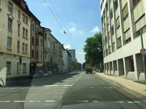
Bangkok Restaurant Iserlohn
Restaurant · Thai · 0.6 km
67 Friedrichstraße, Iserlohn
Tu-Th 12:00-15:00,18:00-22:00; Fr-Su 18:00-22:00; Mo off
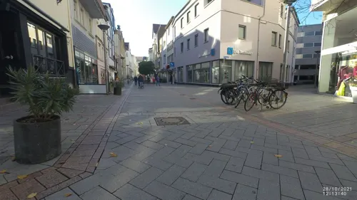
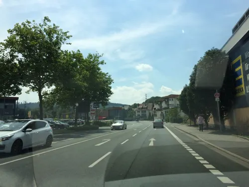
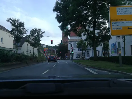
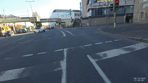
El Ambiente
Restaurant · Spanish
24 Theodor-Heuss-Ring, Iserlohn
Tu-Sa 18:00-24:00, Tu-Sa 12:00-15:00; Su,Mo off
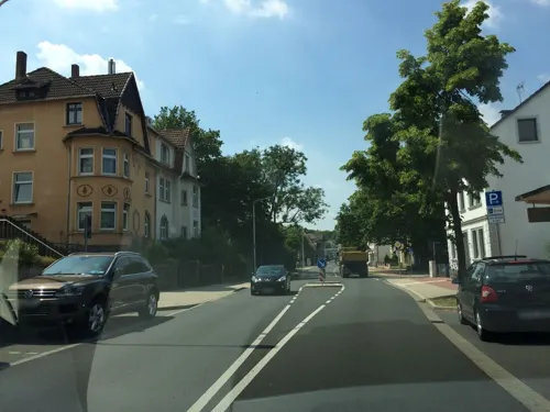
Ella Stracciatella
Cafe · Ice Cream · 1.3 km
1 Schulstraße, Iserlohn
Tu-Sa 10:00-18:30; Su 11:00-18:30
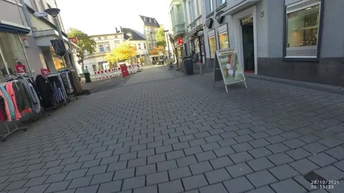
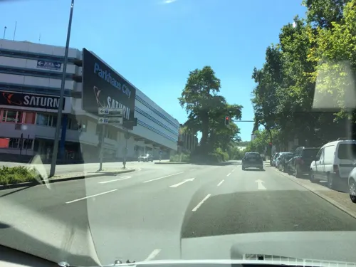
La Siesta
Restaurant · Spanish
1 Kurt-Schumacher-Ring, Iserlohn
Fr,Sa 17:45-23:00; Su 17:45-21:00; Mo 17:45-21:30; Tu-Th off
Pizzeria Bella Italia
Restaurant · Italian, Pizza, Seafood, Mediterranean, Pasta, Meat
11 Hohler Weg, Iserlohn
Tu-Su 12:00-14:00, Tu-Su 17:30-22:00, Tu-Su 18:00-21:30 open...
Pizzeria L'Italiano
Restaurant · Pizza · 2.1 km
66 Schlesische Straße, Iserlohn
Tu-Th 11:30-21:00; Sa-Su 12:00-21:00

Neumond
Restaurant · Chinese, Buffet · 4.8 km
8 Untergrüner Straße, Iserlohn
Mo-Fr 11:30-15:00,17:30-23:00; Sa 11:30-15:00,17:30-21:30; Su 12:00-23:00
203 more on the map.
History
The Pancratius church (also called Bauernkirche) is believed to have been founded in around 985, but the first written document mentioning lon dates only from 1150. In 1237 the Count of the Mark gave Iserlohn municipal rights. In 1975 the city, which had been an urban district before, incorporated the surrounding ex-municipalities of Letmathe, Hennen, Sümmern and Kesbern, and became part of the district "Märkischer Kreis". As a larger mid-sized city, Iserlohn, however, still has a special status compared to most other municipalities in the district. This means that the city takes on tasks more usually performed by the district, such as social and youth affairs, hence it is comparable to an urban district.
From the History section of Iserlohn on Wikipedia, under CC BY-SA 4.0.
More about Iserlohn
Education
Iserlohn has 15 elementary schools and 12 secondary schools (3 Gymnasien, 2Gesamtschule, 3 Realschulen, 5 Hauptschulen).
Two universities of applied sciences are also located in the city. The headquarters, together with a major branch, of the South Westphalia University of Applied Sciences (also: Fachhochschule Südwestfalen (FH SWF)) offering engineering and informatics programmes is located in the city centre on Alexanderhöhe.
From the Wikipedia article Iserlohn, under CC BY-SA 4.0.
Notable people from Iserlohn
 Ludwig NohlGerman writer and musicologist (1831–1885)Photo: Ed. Lange Heidelberg Hauptstrasse 87, CC BY-SA 4.0
 David BeckmannGerman racecar driverPhoto: Steffen Prößdorf, CC BY-SA 4.0
 Thore SchölermannGerman actorPhoto: Superbass, CC BY-SA 4.0
 Johann Stephan PütterGerman juristPhoto: Carl Arnold Friedrich Lafontaine, Public domain
 Erik WeispfennigGerman bicycle racerPhoto: Nicola, CC BY-SA 4.0
 Harm KluetingGerman historian, theologian, writer and Roman Catholic priestPhoto: J.-H. Janßen, CC BY-SA 4.0
 Wilhelm GallhofGerman painter and sculptor (1878–1918)Photo: Wilhelm Gallhof, Public domain
- Ulrich WalterGerman astronaut
- Marsha VadhanapanichThai actress, singer and model
- Volker FischerGerman fencer (b.1950)
- Matthias MellinghausWest German rower
- Hans VermeerGerman linguist (1930-2010)
Born in Iserlohn, according to Wikidata (CC0). Each name links to its Wikipedia article.
Where to stay15
Churches and places of worship48
Neuapostolische Kirche, Gemeinde Iserlohn-Nußberg
Church · New Apostolic · 2.1 km
20 Nußbergstraße, Iserlohn
Shopping55
Gas and EV charging23
Schools, colleges and libraries49
Berufsbildungszentrum der Kreishandwerkerschaft Märkischer Kreis e.V.
School · 2.6 km
2 Kalkofen, Iserlohn
Healthcare28
Map of Iserlohn
250 places. The map loads OpenStreetMap tiles when you open it.
Getting there and nearby towns
Dortmund Airport (DTM) is the nearest airport with scheduled flights listed in OpenStreetMap, 17 km away.
- Hemer 5 km east, about 5 min by car
- Altena 9 km south, about 9 min by car
- Nachrodt-Wiblingwerde 9 km southwest, about 9 min by car
- Neuenrade 12 km southeast, about 12 min by car
- Fröndenberg 12 km northeast, about 12 min by car
- Schwerte 12 km northwest, about 12 min by car
- Balve 12 km southeast, about 12 min by car
- Werdohl 14 km south, about 14 min by car
- Holzwickede 15 km north, about 15 min by car
- Hagen 16 km west, about 16 min by car
Drive times are estimates from straight-line distance, not routes.
Towns near Iserlohn


Keep exploring
Local news
Headlines from INDB.
Reviews, tips and questions
Loading what members have shared...
Sources and licences
- GeoNames (CC BY 4.0): population, coordinates, regions and time zone
- Mapillary (see each image): photos
- OpenStreetMap contributors (ODbL 1.0): places, airports, map data
- Wikidata (CC0 1.0): elevation, founding date, time zone, website, landmarks and historic places
- Wikimedia Commons (see each image): photos
- Wikipedia (CC BY-SA 4.0): overview and history text
Photo credits
- Iserlohn-Stadtbahnhof 20080831, Dr.G.Schmitz, CC BY-SA 3.0
- Iserlohn-GraffitiNolteParkhaus-2-Asio, Asio otus, CC BY-SA 3.0
- Iserlohn-GraffitiNolteParkhaus-3-Asio, Asio otus, CC BY-SA 3.0
- Iserlohn-GraffitiNolteParkhaus-1-Asio, Asio otus, CC BY-SA 3.0
- Iserlohn-IBSV-Umzug2024-45-Asio, Asio otus, CC BY-SA 3.0
- Iserlohn-IBSV-Umzug2024-46-Asio, Asio otus, CC BY-SA 3.0
- Iserlohn-IBSV-Umzug2024-11-Asio, Asio otus, CC BY-SA 3.0
- Iserlohn-IBSV-Umzug2024-16-Asio, Asio otus, CC BY-SA 3.0
- Iserlohn-IBSV-Umzug2024-26-Asio, Asio otus, CC BY-SA 3.0
- Iserlohn-IBSV-Umzug2024-39-Asio, Asio otus, CC BY-SA 3.0
- Iserlohn-IBSV-Umzug2024-18-Asio, Asio otus, CC BY-SA 3.0
- Iserlohn-IBSV-Umzug2024-17-Asio, Asio otus, CC BY-SA 3.0
- Iserlohn-IBSV-Umzug2024-6-Asio, Asio otus, CC BY-SA 3.0
- Iserlohn-IBSV-Umzug2024-43-Asio, Asio otus, CC BY-SA 3.0
- Iserlohn-IBSV-Umzug2024-29-Asio, Asio otus, CC BY-SA 3.0
- Iserlohn-IBSV-Umzug2024-9-Asio, Asio otus, CC BY-SA 3.0
- Iserlohn-IBSV-Umzug2024-33-Asio, Asio otus, CC BY-SA 3.0
- Iserlohn-IBSV-Umzug2024-5-Asio, Asio otus, CC BY-SA 3.0
- Iserlohn-IBSV-Umzug2024-20-Asio, Asio otus, CC BY-SA 3.0
- Iserlohn-IBSV-Umzug2024-35-Asio, Asio otus, CC BY-SA 3.0
- Iserlohn-IBSV-Umzug2024-40-Asio, Asio otus, CC BY-SA 3.0
- Iserlohn-IBSV-Umzug2024-37-Asio, Asio otus, CC BY-SA 3.0
- Iserlohn-IBSV-Umzug2024-1-Asio, Asio otus, CC BY-SA 3.0
- Iserlohn-IBSV-Umzug2024-15-Asio, Asio otus, CC BY-SA 3.0
- Iserlohn-IBSV-Umzug2024-21-Asio, Asio otus, CC BY-SA 3.0
- Iserlohn-IBSV-Umzug2024-24-Asio, Asio otus, CC BY-SA 3.0
- Iserlohn-IBSV-Umzug2024-47-Asio, Asio otus, CC BY-SA 3.0
- Iserlohn-IBSV-Umzug2024-38-Asio, Asio otus, CC BY-SA 3.0
- Iserlohn-IBSV-Umzug2024-42-Asio, Asio otus, CC BY-SA 3.0
- Iserlohn-IBSV-Umzug2024-25-Asio, Asio otus, CC BY-SA 3.0
- Iserlohn-IBSV-Umzug2024-48-Asio, Asio otus, CC BY-SA 3.0
- Iserlohn-IBSV-Umzug2024-7-Asio, Asio otus, CC BY-SA 3.0
- Iserlohn-IBSV-Umzug2024-23-Asio, Asio otus, CC BY-SA 3.0
- Iserlohn-IBSV-Umzug2024-10-Asio, Asio otus, CC BY-SA 3.0
- Iserlohn-IBSV-Umzug2024-19-Asio, Asio otus, CC BY-SA 3.0
- Iserlohn-IBSV-Umzug2024-50-Asio, Asio otus, CC BY-SA 3.0
- Iserlohn-IBSV-Umzug2024-13-Asio, Asio otus, CC BY-SA 3.0
- Iserlohn-IBSV-Umzug2024-2-Asio, Asio otus, CC BY-SA 3.0
- Iserlohn-IBSV-Umzug2024-22-Asio, Asio otus, CC BY-SA 3.0
- Iserlohn-IBSV-Umzug2024-27-Asio, Asio otus, CC BY-SA 3.0
- Dechenhöhle, No machine-readable author provided. Flux Garden~commonswiki assumed (based on copyright claims)., CC BY-SA 3.0
- Oberroedinghausen-Hammer2-Bubo, Bubo, CC BY-SA 3.0
- Hemer-Felsenmeer2-Asio, Asio otus, CC BY-SA 3.0
- Hemer-Bemberg1-Bubo, Bubo, CC BY-SA 3.0
- Iserlohn-Bismarckturm1-Bubo, Bubo, CC BY-SA 3.0
- Iserlohn-Danzturm4-Asio, Asio otus, CC BY-SA 3.0
- Iserlohn-Eissporthalle1-Asio, Asio otus, CC BY-SA 3.0
- Iserlohn-ReformierteKirche1-Asio, Asio otus, CC BY-SA 3.0
- Hemer-Felsenmeermuseum3-Asio, Asio otus, CC BY-SA 3.0
- Woeste2, Roosterfan, CC BY-SA 3.0
- Iserlohn-ObersteStadtkirche1-Asio, Asio otus, CC BY-SA 3.0
- Hemer-Kreuzkirche1-Bubo, Bubo, CC BY-SA 3.0
- Hemer-Juebergturm1-Asio, Asio otus, CC BY-SA 3.0
- Iserlohn-Stadtmuseum1-Asio, Asio otus, CC BY-SA 3.0
- Heinrichshöhle, 5, Rainer Lippert, CC0
- Fabrikenanlage Maste-Barendorf 2011, Stefan Didam - Schmallenberg, CC BY-SA 3.0
- Hemer-IhmertKirche1-Asio, Asio otus, CC BY-SA 3.0
- Iserlohn-MaerkischesGymnasium1-Bubo, Bubo, CC BY-SA 3.0
- Lungenklinik, Hemer, 20080523, Dr.G.Schmitz, CC BY-SA 3.0
- Hemer-SauerlandparkEingangsbereichStadt1-Asio, Asio otus, CC BY-SA 3.0
- Iserlohn-Bauernkirche2-Asio, Asio otus, CC BY-SA 3.0
- Iserlohn-AltesRathaus1-Asio, No machine-readable author provided. Asio otus assumed (based on copyright claims)., CC BY-SA 3.0
- Iserlohn-AmBilstein16-1-Bubo, Bubo, CC BY-SA 3.0
- Loessel-Brunnenkirche1-Bubo, No machine-readable author provided. Bubo bubo assumed (based on copyright claims)., CC BY-SA 3.0
- Iserlohn-NSG-KesbernerKalkbuchenwald2-Bubo, Bubo, CC BY-SA 3.0
- Iserlohn-NSG-Sonderhorst3-Asio, Asio otus, CC BY-SA 3.0
- City library - panoramio, Andreas Hörstemeier, CC BY-SA 3.0
- Iserlohn-Johanneskirche6-Asio, Asio otus, CC BY-SA 3.0
- Iserlohn-Ballotsbrunnen-2-Bubo, Bubo bubo, CC BY-SA 3.0
- Iserlohn-Erloeserkirche2-Asio, Asio otus, CC BY-SA 3.0
- Iserlohn-StHedwig1-Asio, Asio otus, CC BY-SA 3.0
- Iserlohn-DahlsenAuferstehungskirche1-Bubo, Bubo, CC BY-SA 3.0
- Roden-Christuskirche1-Bubo, Bubo, CC BY-SA 3.0
- Iserlohn-KalthofJakobuskirche1-Bubo, Bubo, CC BY-SA 3.0
- Iserlohn-NeuapostolischeKircheNussberg1-Asio, Asio otus, CC BY-SA 3.0
- Iserlohn-Schlieperblock3a-Asio, Asio otus, CC BY-SA 3.0
- 20140626-Naturschutzgebiet Steinbruch Kupferberg, PrivacyFirst, CC BY-SA 3.0
- Iserlohn-NSG-DulohLöbbecken-Kopf1-Bubo, Bubo, CC BY-SA 3.0
- Düsternsiepen, Mina999, CC BY-SA 3.0
- 20140626-Naturschutzgebiet Burgberg, PrivacyFirst, CC BY-SA 3.0
- Hemer-Frönsberg LWL-Klinik FFSW-0153, Michael Kramer, CC BY-SA 3.0
- Street-level photo, VIA_DT, CC BY-SA 4.0
- Street-level photo, VIA_DT, CC BY-SA 4.0
- Street-level photo, jenz, CC BY-SA 4.0
- Street-level photo, zors1843, CC BY-SA 4.0
- Street-level photo, VIA_DT, CC BY-SA 4.0
- Street-level photo, zors1843, CC BY-SA 4.0
- Street-level photo, VIA_DT, CC BY-SA 4.0
- Street-level photo, VIA_DT, CC BY-SA 4.0
- Street-level photo, zors1843, CC BY-SA 4.0
- Street-level photo, zors1843, CC BY-SA 4.0
- Street-level photo, VIA_DT, CC BY-SA 4.0
- Street-level photo, TillSiter, CC BY-SA 4.0
- Street-level photo, zors1843, CC BY-SA 4.0
- Street-level photo, heetENkoel, CC BY-SA 4.0
- Street-level photo, heetENkoel, CC BY-SA 4.0
- Street-level photo, VIA_DT, CC BY-SA 4.0
- Street-level photo, heetENkoel, CC BY-SA 4.0
- Street-level photo, heetENkoel, CC BY-SA 4.0
- Street-level photo, zors1843, CC BY-SA 4.0
- Street-level photo, jenz, CC BY-SA 4.0
- Street-level photo, VIA_DT, CC BY-SA 4.0
- Street-level photo, zors1843, CC BY-SA 4.0
- Street-level photo, zors1843, CC BY-SA 4.0
- Street-level photo, cuspis, CC BY-SA 4.0
- Street-level photo, zors1843, CC BY-SA 4.0
- Street-level photo, VIA_DT, CC BY-SA 4.0
- Street-level photo, heetENkoel, CC BY-SA 4.0
- Street-level photo, TillSiter, CC BY-SA 4.0


Page built November 9, 2026. Spotted a mistake? Tell us or suggest a place.