


Why visit Hemer
Townapedia lists 67 museums and landmarks, 35 parks and trails, 215 places to eat, 14 places to stay and 39 attractions in and around town.
Highlights include Balve Cave, Dechen Cave, Felsenmeermuseum and Heinrichshöhle.
Weather in Hemer
Forecast from MET Norway (CC BY 4.0). Full forecast
About Hemer
Hemer (German pronunciation: [ˈheːmɐ] ) is a town in the Märkischer Kreis district, in North Rhine-Westphalia, Germany.
From the Wikipedia article Hemer (this version), under CC BY-SA 4.0.
Photos of Hemer


Things to do39


Bismarckturm Iserlohn
Scenic view · 3.4 km
Besteigbar, zu bestimmten Zeiten geöffnet




27 more on the map.
Museums and landmarks67


Historische Fabrikanlage Maste-Barendorf
Monument and historic site · 5.8 km
220-226 Baarstraße, Iserlohn

Reformierte Kirche - versöhnung
Museum · 5.1 km
9 Wermingser Straße, Iserlohn
Mo-Fr 11:00-13:00,16:00-18:00; Sa 11:00-14:00

Stadtmuseum
Museum · 5.3 km
1 Fritz-Kühn-Platz, Iserlohn
Tu-Su 10:00-17:00; Th 10:00-19:00


Oberrödinghauser Hammer
Monument and historic site · 5.3 km
Industrial cultural monument in Germany


Burg Klusenstein
Monument and historic site · 5.7 km
1 Klusenstein, Hemer

Gut Rödinghausen
Monument and historic site · 5.0 km
15 Fischkuhle, Menden (Sauerland)


55 more on the map.
Parks, trails and playgrounds35



Freibad Schleddenhof
Sports field and stadium · 3.7 km
May-Sep Mo-Fr 06:00-20:00; May-Sep PH,Sa,Su 08:00-20:00

Hallenbad Menden
Sports field and stadium · 5.8 km
7 Am Hünenköpfchen, Menden (Sauerland)

23 more on the map.
Restaurants and cafes215
Bangkok Restaurant Iserlohn
Restaurant · Thai · 4.4 km
67 Friedrichstraße, Iserlohn
Tu-Th 12:00-15:00,18:00-22:00; Fr-Su 18:00-22:00; Mo off
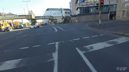
El Ambiente
Restaurant · Spanish · 5.1 km
24 Theodor-Heuss-Ring, Iserlohn
Tu-Sa 18:00-24:00, Tu-Sa 12:00-15:00; Su,Mo off
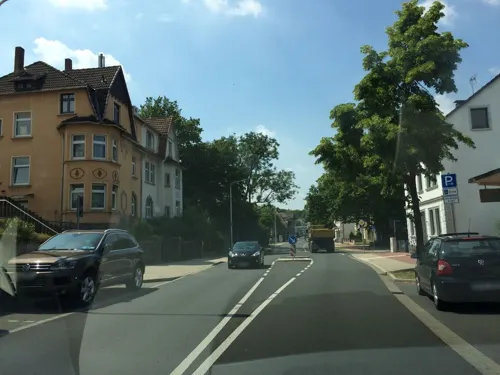
Ella Stracciatella
Cafe · Ice Cream · 3.7 km
1 Schulstraße, Iserlohn
Tu-Sa 10:00-18:30; Su 11:00-18:30
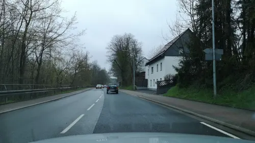
Gasthof Hünnies
Restaurant · Regional · 5.4 km
52 Mendener Straße, Menden (Sauerland)
Mo,Th-Su 17:00-24:00; Tu-We off
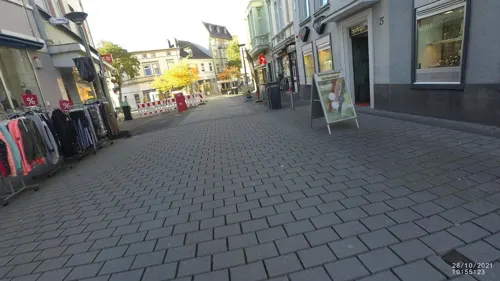
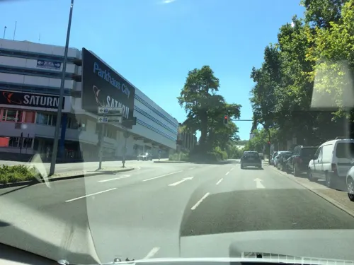
La Siesta
Restaurant · Spanish · 5.3 km
1 Kurt-Schumacher-Ring, Iserlohn
Fr,Sa 17:45-23:00; Su 17:45-21:00; Mo 17:45-21:30; Tu-Th off
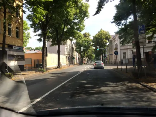
MK Pizzeria
Restaurant · Pizza, Italian · 4.5 km
63a Mendener Straße, Iserlohn
We-Mo 11:30-22:30; Tu off
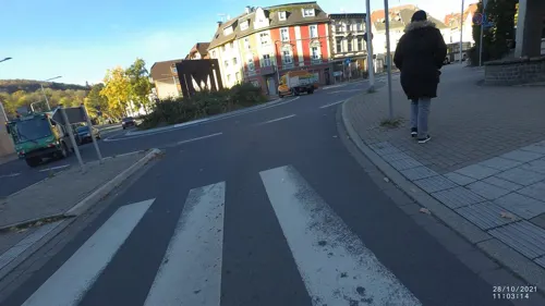
Pizzeria Bella Italia
Restaurant · Italian, Pizza, Seafood, Mediterranean, Pasta, Meat · 5.1 km
11 Hohler Weg, Iserlohn
Tu-Su 12:00-14:00, Tu-Su 17:30-22:00, Tu-Su 18:00-21:30 open...
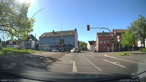
Pizzeria L'Italiano
Restaurant · Pizza · 2.9 km
66 Schlesische Straße, Iserlohn
Tu-Th 11:30-21:00; Sa-Su 12:00-21:00
203 more on the map.
History
Burial mounds show that around 1250 BC, Bronze Age shepherds and farmers lived in the area. Graves from the time of the Merovingian Franks around the year 650 were found near the present city centre.
Hemer was first mentioned in 1072 by its old name Hademare in a document of Anno II, Archbishop of Cologne, granting lands to the newly founded Benedictine Grafschaft Abbey, including St. Vitus's church and two farms, the later de:Haus Hemer and the de:Hedhof. In 1124 the parish of St. Vitus was separated from the parish of Menden.
Hemer remained an unimportant settlement without market rights, even when the Counts of the Mark gained independence from the episcopal state of Cologne in the 13th century, when Hemer found itself on the boundary of the two states. But despite the political insignificance of the Kirchspiel Hemer ("Hemer parish"), it was already quite densely settled, thanks to its location on the old road from the Rhineland to Middle Germany (now Bundesstrasse 7), and to the iron mining and smelting industries already developed here. The boundary with Cologne, formed by the valley of the Hönne river southeast of Hemer, was protected by Klusenstein Castle, built in 1353. Local government in the parish of Hemer was the responsibility of the "Amt" of Iserlohn until 1647, when it was transferred to the family of Wachtendonk, who owned Haus Hemer at that time.
Read more of the history
The Reformation reached Hemer in the second half of the 16th century, when the Church of St. Vitus (Hemer) (German: Vituskirche) became Protestant (it was demolished in 1818, and replaced by the new Ebbergkirche nearby, built in 1819/20). Between 1697 and 1700 Jobst Edmund of Brabeck, the bishop of Hildesheim and a relative of the new owners of Haus Hemer, built the church of Saints Peter and Paul in Baroque style as the new church for the Roman Catholics.
During the Napoleonic period Hemer was a "mairie" in the "arrondissement" of Hagen in the "département" of the Ruhr of the Napoleonic satellite Grand Duchy of Berg.
On October 31, 1841, the Amt Hemer was created by 14 municipalities previously administered by the Landbezirk Iserlohn. It originally consisted of the municipalities of de:Becke, de:Brockhausen, de:Calle, de:Deilinghofen, de:Evingsen, de:Frönsberg, de:Ihmert, de:Kesbern, de:Landhausen, de:Lössel, de:Niederhemer, de:Oberhemer, de:Sundwig and de:Westig, as well as the manors (Rittergut) of Edelburg, Haus Hemer and Klusenstein. The Amt was part of the Kreis Iserlohn. In 1910 Niederhemer and Oberhemer were merged into Hemer. In 1920 Lössel became part of the Amt Oestrich.
The three industrial municipalities of Hemer, Sundwig and Westig had already grown into a single urban area by World War I. The idea of merging the three municipalities had already been mooted before the war, but due to the war it was not until 1920 that it was formally proposed. However, neither Sundwig nor Westig was initially enthusiastic and both later opposed the merger, mostly because the industrialists in the two places were worried that the tax rates would rise to the higher rates of Hemer. At the same time the city of Iserlohn unsuccessfully tried to incorporate several municipalities: Letmathe and Oestrich to the west, and also the industrial municipalities of the Amt Hemer. Because of the opposition, the merger of the three municipalities was delayed until 1929, when it was carried out by order of the Prussian Ministry of the Interior. At the same time the municipality of Calle was split into four parts: the northern Griesenbrauck was added to Landhausen; Bilveringsen passed to Hemer; the central part around Wermingsen was incorporated into Iserlohn; and the southern parts passed to Westig. With effect from August 1, 1929, Hemer, Sundwig and Westig, as well as Landhausen and the remains of Calle were merged, covering an area of 26.82 km2 (10.36 sq mi) and having a population of 13,809.
Also with effect from August 1, 1929, the municipality of Brockhausen was incorporated into Deilinghofen. The rural Brockhausen had only 588 inhabitants, and because of its low income was not considered to be financially viable as an independent unit.
On January 30, 1936, the municipality of Hemer received the right to call itself a city (Stadt).
In 1934 Hemer became a garrison town. In January 1934 it was decided to build three barracks in neighboring Iserlohn, which however was unable also to provide enough free land for a training area. At a meeting in June, land around the village of Apricke was selected, of which 3 km2 was bought by the state in autumn of the same year. The hospital was also inspected and later acquired as a military hospital. This was very welcome to Hemer, as the hospital had turned out to be far too big and too expensive for the Amt, and in this way it was possible later to build a new smaller hospital.
In December 1934 temporary barracks for one battalion were also built in Hemer. On October 30, 1936, an official garrison contract between Hemer and the state was signed, which included the building of permanent barracks. Construction was still unfinished when World War II started in 1939, but was then rushed through and the buildings were reassigned as a prisoner of war camp, the Stalag VI-A.
The first Polish POWs arrived in October 1939, and had to sleep on the floor as the beds were still not finished. Inadequate equipment remained a problem throughout the whole of the war, both because the material was needed at the front, and also because the camp was permanently overpopulated. At first the inmates were mostly from Poland and France, but after the beginning of the war with the Soviet Union in 1941 Soviet POWs quickly became the majority.
From the History section of Hemer on Wikipedia, under CC BY-SA 4.0.
More about Hemer
Geography
Hemer is located at the north end of the Sauerland near the Ruhr river. The highest elevation, at 546 metres (1,791 feet), is in the Balver Wald in the south of the city. The lowest elevation, at 160 metres (520 feet), is at the Edelburg in the northeast.
From the Wikipedia article Hemer, under CC BY-SA 4.0.
Notable people from Hemer
 Wolfgang BeckerGerman film director and screenwriter (1954–2024)Photo: Martin Kraft, CC BY-SA 4.0
 Thomas SchäferGerman politician (1966-2020)Photo: Martin Kraft, CC BY-SA 4.0
 Hans PrinzhornGerman art historian (1886-1933)Photo: Unbekannt. Nachbearbeitung Asio otus ., Public domain
 Lean BergmannGerman ice hockey playerPhoto: Sandro Halank, Wikimedia Commons, CC BY-SA 4.0
 Lars Brüggemannice hockey playerPhoto: Fabien Perissinotto, CC BY-SA 4.0
- Heinz-Dieter EbbinghausGerman mathematician and logician
- Enno PoppeGerman composer and conductor
- Hamza AnhariGerman footballer
- Horst DegenGerman navy officer and world war II U-boat commander
- Michael Jeltschbiochemist
- Christian HommelGerman ice hockey player
- Bert L. ValleeAmerican medical researcher
Born in Hemer, according to Wikidata (CC0). Each name links to its Wikipedia article.
Where to stay14
Hotel Come In Haus II
Motel and hotel · 5.4 km
66 Mendener Straße, Menden (Sauerland)
Churches and places of worship41
Christ-König-Kirche
Church · Catholic · 4.2 km
51 Hüingser Ring, Menden (Sauerland)
Evangeliumschristen-Baptisten e.V.
Church · Baptist · 1.9 km
11 Schulstraße, Hemer
Shopping51
Gas and EV charging21
Shell-Tankstelle
Gas station · 5.3 km
67 Lendringser Hauptstraße, Menden (Sauerland)
Schools, colleges and libraries54
Healthcare29
Map of Hemer
250 places. The map loads OpenStreetMap tiles when you open it.
Getting there and nearby towns
Dortmund Airport (DTM) is the nearest airport with scheduled flights listed in OpenStreetMap, 18 km away.
- Iserlohn 5 km west, about 5 min by car
- Balve 9 km southeast, about 9 min by car
- Fröndenberg 10 km north, about 10 min by car
- Neuenrade 12 km south, about 12 min by car
- Altena 12 km southwest, about 12 min by car
- Nachrodt-Wiblingwerde 13 km southwest, about 13 min by car
- Werdohl 14 km south, about 14 min by car
- Wickede 14 km northeast, about 14 min by car
- Schwerte 15 km northwest, about 15 min by car
- Holzwickede 16 km northwest, about 16 min by car
Drive times are estimates from straight-line distance, not routes.
Towns near Hemer


Keep exploring
Local news
Headlines from INDB.
Reviews, tips and questions
Loading what members have shared...
Sources and licences
- GeoNames (CC BY 4.0): population, coordinates, regions and time zone
- Mapillary (see each image): photos
- OpenStreetMap contributors (ODbL 1.0): places, airports, map data
- Wikidata (CC0 1.0): elevation, founding date, time zone, website, landmarks and historic places
- Wikimedia Commons (see each image): photos
- Wikipedia (CC BY-SA 4.0): overview and history text
Photo credits
- Hemer-Ueberblick Juebergturm, Waddehadde, CC BY-SA 3.0
- The streets of Finkenweg, Hemer, SinclairUkiri, CC0
- Hemer-Zentrum7-Asio, Asio otus, CC BY-SA 3.0
- Hemer-Zentrum6-Asio, Asio otus, CC BY-SA 3.0
- Hemer-Partnerschaftsstele-1-Asio, Asio otus, CC BY-SA 3.0
- Hemer Gate - panoramio, Andreas Hörstemeier, CC BY-SA 3.0
- Hemer-Christkoenig1-Asio, Asio otus, CC BY-SA 3.0
- Christ Koenig Church Hemer, Ahoerstemeier, CC BY-SA 4.0
- Hemer-ehemaligeFeuerwehrHauptwache-1-Asio, Asio otus, CC BY-SA 3.0
- Hemer-ehemaligeFeuerwehrHauptwache-2-Asio, Asio otus, CC BY-SA 3.0
- Hemer-ehemaligeFeuerwehrHauptwache-3-Asio, Asio otus, CC BY-SA 3.0
- Hemer-Trilogie9-Asio, Asio otus, CC BY-SA 3.0
- Hemer-Trilogie7-Asio, Asio otus, CC BY-SA 3.0
- Hemer-Trilogie5-Asio, Asio otus, CC BY-SA 3.0
- Hemer-Trilogie4-Asio, Asio otus, CC BY-SA 3.0
- Hemer-Trilogie8-Asio, Asio otus, CC BY-SA 3.0
- Hemer-Trilogie6-Asio, Asio otus, CC BY-SA 3.0
- Hemer-GraffitiUmspannwerk-1-Asio, Asio otus, CC BY-SA 3.0
- Hemer-GraffitiUmspannwerk-3-Asio, Asio otus, CC BY-SA 3.0
- Hemer-Stolperschwelle-1-Asio, Asio otus, CC BY-SA 3.0
- Hemer-Stolperschwelle-2-Asio, Asio otus, CC BY-SA 3.0
- Hemer-GraffitiUmspannwerk-2-Asio, Asio otus, CC BY-SA 3.0
- Hemer-Lungenklinik-Äskulap-2-Asio, Asio otus, CC BY-SA 3.0
- Hemer-Lungenklinik-Äskulap-1-Asio, Asio otus, CC BY-SA 3.0
- Gartengestaltung in Grün auf der Landesgartenschau Hemer 2010, Andre Schaefer, CC BY-SA 2.0
- Blumen und Gartengestaltungen auf der Landesgartenschau Hemer 2010, Andre Schaefer, CC BY-SA 2.0
- Gartengestaltung Wasser auf der Landesgartenschau Hemer 2010, Andre Schaefer, CC BY-SA 2.0
- Aussichtsplattform im Felsenmeer Hemer, Andre Schaefer, CC BY-SA 2.0
- Felsenmeer Hemer Wald, Andre Schaefer, CC BY-SA 2.0
- Gartengestaltung Wasserspiel auf der Landesgartenschau Hemer 2010, Andre Schaefer, CC BY-SA 2.0
- Blumen auf der Landesgartenschau Hemer 2010, Andre Schaefer, CC BY-SA 2.0
- Felsenmeer Hemer, Andre Schaefer, CC BY-SA 2.0
- Hemer-Parkstr9-5-Asio, Asio otus, CC BY-SA 3.0
- Hemer-Parkstr9-4-Asio, Asio otus, CC BY-SA 3.0
- Balve Balver Höhle FFSN-6201, Michael Kramer, CC BY-SA 3.0
- Dechenhöhle, No machine-readable author provided. Flux Garden~commonswiki assumed (based on copyright claims)., CC BY-SA 3.0
- Oberroedinghausen-Hammer2-Bubo, Bubo, CC BY-SA 3.0
- Hemer-Felsenmeer2-Asio, Asio otus, CC BY-SA 3.0
- Balver Wald, J. Braukmann Milseburg, CC BY-SA 3.0
- Hemer-Bemberg1-Bubo, Bubo, CC BY-SA 3.0
- Iserlohn-Bismarckturm1-Bubo, Bubo, CC BY-SA 3.0
- Hemer-BurgKlusenstein1-Asio, Asio otus, CC BY-SA 3.0
- Hemer-Ebbergkirche1-Asio, No machine-readable author provided. Asio otus assumed (based on copyright claims)., CC BY-SA 3.0
- Iserlohn-Eissporthalle1-Asio, Asio otus, CC BY-SA 3.0
- Iserlohn-ReformierteKirche1-Asio, Asio otus, CC BY-SA 3.0
- Hemer-Felsenmeermuseum3-Asio, Asio otus, CC BY-SA 3.0
- Woeste2, Roosterfan, CC BY-SA 3.0
- Iserlohn-ObersteStadtkirche1-Asio, Asio otus, CC BY-SA 3.0
- Menden-HeiligGeistKirche2-Asio, Asio otus, CC BY-SA 3.0
- Hemer-Kreuzkirche1-Bubo, Bubo, CC BY-SA 3.0
- Hemer-Juebergturm1-Asio, Asio otus, CC BY-SA 3.0
- Iserlohn-Stadtmuseum1-Asio, Asio otus, CC BY-SA 3.0
- Hemer-HausHemer1-Asio, Asio otus, CC BY-SA 3.0
- Hemer-Thomaskirche2, Waddehadde, CC BY-SA 3.0
- Heinrichshöhle, 5, Rainer Lippert, CC0
- Fabrikenanlage Maste-Barendorf 2011, Stefan Didam - Schmallenberg, CC BY-SA 3.0
- Huckenohl, No machine-readable author provided. Rusti~commonswiki assumed (based on copyright claims)., Public domain
- Iserlohn-MaerkischesGymnasium1-Bubo, Bubo, CC BY-SA 3.0
- Hemer-SauerlandparkEingangsbereichStadt1-Asio, Asio otus, CC BY-SA 3.0
- Iserlohn-Aloysiuskirche3-Asio, Asio otus, CC BY-SA 3.0
- Iserlohn-Bauernkirche2-Asio, Asio otus, CC BY-SA 3.0
- Iserlohn-AltesRathaus1-Asio, No machine-readable author provided. Asio otus assumed (based on copyright claims)., CC BY-SA 3.0
- Deilinghofen-Stephanuskirche1-Asio, Asio otus, CC BY-SA 3.0
- Iserlohn-AmBilstein16-1-Bubo, Bubo, CC BY-SA 3.0
- Iserlohn-Johanneskirche6-Asio, Asio otus, CC BY-SA 3.0
- Iserlohn-Erloeserkirche2-Asio, Asio otus, CC BY-SA 3.0
- Menden-GutRödinghausen3-Asio, Asio otus, CC BY-SA 3.0
- Hemer-Brabeckschule1-Bubo, Bubo, CC BY-SA 3.0
- Menden-Hüingsen-ChristKönigKirche-1-Asio, Asio otus, CC BY-SA 3.0
- Lendringsen-Christuskirche1-Bubo, Bubo, CC BY-SA 3.0
- Hemer-NSG-AmTierkoven2-Asio, Asio otus, CC BY-SA 3.0
- Iserlohn-NSG-DulohLöbbecken-Kopf1-Bubo, Bubo, CC BY-SA 3.0
- Hemer-NSG-Riemke3-Asio, Asio otus, CC BY-SA 3.0
- Hemer-Frönsberg LWL-Klinik FFSW-0153, Michael Kramer, CC BY-SA 3.0
- City library - panoramio, Andreas Hörstemeier, CC BY-SA 3.0
- Street-level photo, heetENkoel, CC BY-SA 4.0
- Street-level photo, heetENkoel, CC BY-SA 4.0
- Street-level photo, VIA_DT, CC BY-SA 4.0
- Street-level photo, heetENkoel, CC BY-SA 4.0
- Street-level photo, heetENkoel, CC BY-SA 4.0
- Street-level photo, zors1843, CC BY-SA 4.0
- Street-level photo, VIA_DT, CC BY-SA 4.0
- Street-level photo, zors1843, CC BY-SA 4.0
- Street-level photo, zors1843, CC BY-SA 4.0
- Street-level photo, jenz, CC BY-SA 4.0
- Street-level photo, zors1843, CC BY-SA 4.0
- Street-level photo, VIA_DT, CC BY-SA 4.0
- Street-level photo, VIA_DT, CC BY-SA 4.0
- Street-level photo, VIA_DT, CC BY-SA 4.0
- Street-level photo, VIA_DT, CC BY-SA 4.0
- Street-level photo, VIA_DT, CC BY-SA 4.0
- Street-level photo, zors1843, CC BY-SA 4.0
- Street-level photo, cuspis, CC BY-SA 4.0
- Street-level photo, TillSiter, CC BY-SA 4.0
- Street-level photo, zors1843, CC BY-SA 4.0
- Street-level photo, zors1843, CC BY-SA 4.0
- Street-level photo, cuspis, CC BY-SA 4.0
- Street-level photo, zors1843, CC BY-SA 4.0
- Street-level photo, jenz, CC BY-SA 4.0
- Street-level photo, jenz, CC BY-SA 4.0
- Street-level photo, cuspis, CC BY-SA 4.0
- Street-level photo, changchun1, CC BY-SA 4.0
- Street-level photo, VIA_DT, CC BY-SA 4.0
- Street-level photo, VIA_DT, CC BY-SA 4.0
- Street-level photo, VIA_DT, CC BY-SA 4.0
- Street-level photo, zors1843, CC BY-SA 4.0
- Street-level photo, cuspis, CC BY-SA 4.0


Page built November 9, 2026. Spotted a mistake? Tell us or suggest a place.