


Bad Homburg vor der Höhe, Germany
Bad Homburg vor der Höhe is a town of 51,859 people in Hesse, Germany.
Why visit Bad Homburg vor der Höhe
Townapedia lists 65 museums and landmarks, 48 parks and trails, 241 places to eat, 34 places to stay and 9 attractions in and around town.
Highlights include Ellerhöhturm, Kinopolis Bad Homburg, Central Garage and Heimatmuseum Seulberg.
Weather in Bad Homburg vor der Höhe
Forecast from MET Norway (CC BY 4.0). Full forecast
About Bad Homburg vor der Höhe
Bad Homburg vor der Höhe (German pronunciation: [baːt ˈhɔmbʊʁk foːɐ̯ deːɐ̯ ˈhøːə] , lit. 'Bad Homburg before the Height') is the district town of the Hochtaunuskreis, Hesse, Germany, on the southern slope of the Taunus mountains. Bad Homburg is part of the Frankfurt Rhein-Main urban area. The town's official name is Bad Homburg v.d.Höhe, which distinguishes it from other places named Homburg.
From the Wikipedia article Bad Homburg (this version), under CC BY-SA 4.0.
Travel tips from other travellers: Bad Homburg vor der Höhe on Wikivoyage (CC BY-SA 4.0).
Photos of Bad Homburg vor der Höhe


Things to do9


Kinopolis Bad Homburg
Cinema and theater · 0.7 km
1 Basler Straße, Bad Homburg v.d. Höhe
Mo-Fr 15:00-21:00; Sa,Su 13:00-21:00


An'nettes Hoflädchen
Farm and orchard · 3.2 km
Gemüseverkauf mit Vertrauenskasse; Nudeln, Marmelade, Soße, Wurst/Fleisch aus dem Automaten
Museums and landmarks65

Central Garage
Museum · 1.7 km
5 Niederstedter Weg, Bad Homburg v.d. Höhe
We-Su 12:00-16:30; Mo,Tu,PH off
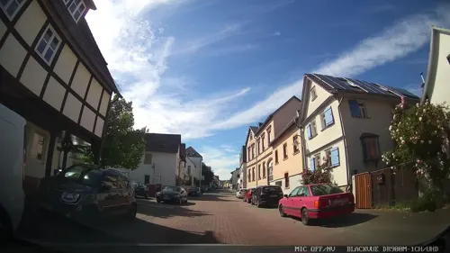
Heimatmuseum Seulberg
Museum · 3.0 km
44-46 Alt Seulberg, Friedrichsdorf
We,Th 09:00-13:00; Su 14:00-17:00; PH off

Chatelet am Römerbrunnen (ehem. Molkenanstalt)
Monument and historic site
27 Kisseleffstraße, Bad Homburg v.d. Höhe

Philipp-Reis-Haus
Museum · 3.8 km
93 Hugenottenstraße, Friedrichsdorf
Tu,Th 10:00-17:00; Su[1] 14:00-17:00

Spielbank Bad Homburg
Monument and historic site · 0.6 km
Su-Th 14:30-03:00, Fr,Sa 14:30-04:00


Heidetrank Oppidum
Monument and historic site · 6.9 km
Celtic oppidum near Oberursel in the Taunus in Germany


Nida
Monument and historic site · 8.2 km
Ancient Roman town in the northwestern suburbs of Frankfurt, Germany

Galerie Artlantis
Museum · 3.1 km
6 Tannenwaldweg, Bad Homburg v.d. Höhe
Fr 15:00-18:00; Sa,Su,PH 11:00-18:00 "nur während der Ausstellungszeiten"
53 more on the map.
Parks, trails and playgrounds48

Seedammbad
Sports field and stadium · 1.4 km
7 Seedammweg
Tu-Fr 07:00-20:30; Sa-Su 08:00-20:00

Freibad Friedrichsdorf
Sports field and stadium · 3.7 km
1 Dr.-Friedrich-Neiß-Straße, Friedrichsdorf
May-Sep PH,Tu-Su 08:00-20:00





36 more on the map.
Restaurants and cafes241
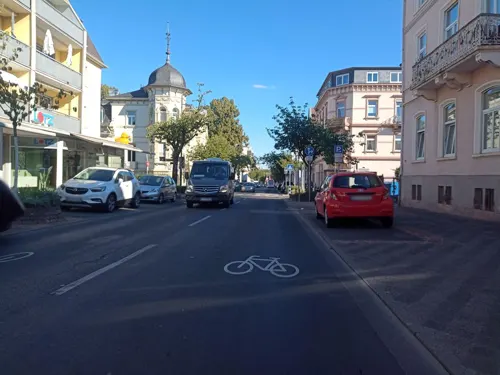
Luna y Sol
Restaurant · Spanish · 0.6 km
Tapasbar y Cerveceria
114 Louisenstraße, Bad Homburg v. d. Höhe
Mo-Fr 12:00-14:30, Mo-Fr 17:00-23:00, Sa 12:00-24:00, Su 12:00-22:00
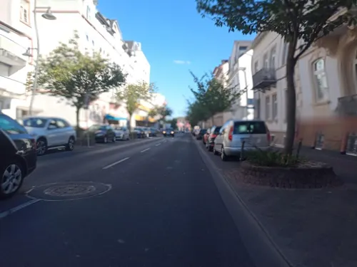
Pizza Lui
Restaurant · Italian, Indian · 0.7 km
No hot drinks, no alcoholic drinks
128 Louisenstraße, Bad Homburg v. d. Höhe
Mo-Fr 11:00-14:30,17:00-23:00; Sa,Su 12:00-23:00
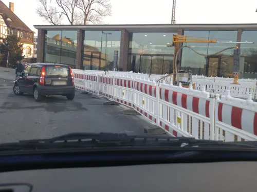
Barg
Restaurant · Persian · 0.7 km
2 Am Bahnhof, Bad Homburg v.d. Höhe
Mo-We 17:00-24:00, Th 17:00-01:00, Fr 17:00-02:00, Sa 15:00-02:00,...

Passions Restaurant & Events
Restaurant · Mediterranean, German, Regional · 3.1 km
Mediterranes Casual-Dining am Royal Homburger Golf Club mit Panoramaterrasse und Kaminzimmer für private Feiern und Firmenevents bis 100 Gäste
10 An der Karlsbrücke, Bad Homburg v.d. Höhe
Tu-Su 12:00-22:00
Villa Fantastica
Restaurant · Italian
Osteria Villa Fantastica
45 Kaiser-Friedrich-Promenade, Bad Homburg v. d. Höhe
Tu-Sa 12:00-15:00,18:00-23:30
Alt-Oberurseler Brauhaus
Restaurant · Regional · 3.9 km
13 Ackergasse, Oberursel (Taunus)
Mo-Th 11:00-24:00, Fr,Sa 11:00-01:00, Su 11:00-22:00
Bangkok Streetfood
Restaurant · Thai · 2.8 km
12 Industriestraße, Oberursel (Taunus)
Mo-Su,PH 11:00-22:00; Dec 24-25 off; Dec 31-Jan 01 off

Bäckerei Moos
Bakery · 3.6 km
71 Hugenottenstraße, Friedrichsdorf
Mo-Fr 06:30-18:30; Sa 06:30-13:30; Su 08:00-17:00

Casa Primavera
Restaurant · Italian · 3.4 km
41 Oberstedter Straße, Oberursel (Taunus)
Tu-Fr 11:30-14:30,17:30-22:00; Sa 17:30-22:00; Su 11:30-14:30,17:30-22:00
229 more on the map.
History
Local tradition holds that Bad Homburg's documented history began with the mention of the Villa Tidenheim in the Lorsch codex, associated with the year 782. This Villa Tidenheim was equated with the historic city center, which is called Dietigheim. The local historian Rüdiger Kurth has questioned this traditional story based on his study of written sources and local factors.
In 2002, Kurth initiated archaeological excavations by the University of Frankfurt, managed by Professor Joachim Henning. The excavations showed no evidence of settlement between the beginning of the Christian Era and the 13th century. The historical record in the Eberbach chronicles (Eberbacher Zeugenreihe), which mentions Wortwin (or Ortwin) von Hohenberch as Homburg's founder about 1180, is the first solid evidence of the town's existence.
As early as 1962, in an excavation under the Hirschgang wing of Bad Homburg Castle, two burnt layers were discovered, which the archaeologist Günther Binding interpreted as evidence of two former castles having occupied the site in succession and burnt down.
Read more of the history
Further digs by the University of Frankfurt at Bad Homburg Castle in April 2006, again initiated by Kurth and managed by Prof. Henning, revealed only a single burnt layer, from a half-timbered building, possibly a castle with towers, which was dated from ceramic finds to the 12th or 13th century. Most likely this building had an association with Wortwin's "castle". A further cultural layer from an even earlier time may lie beneath these remains. Investigations using carbon-14 dating and micromorphological analysis will show whether the dating can be made more precise.
Homberg acquired market rights about 1330, but the document granting these rights is said to have been lost.
The town's name, "Homburg", is derived from the Hohenberg Castle. The suffix "vor der Höhe" was probably first recorded in a document of 1399. The designation Bad was conferred in 1912.
In 1622, Homburg became the capital of the Landgraviate of Hesse-Homburg. The first landgrave of Hessen-Homburg was Friedrich I of Hessen-Homburg. Friedrich II (1680–1708) attained fame as Prince of Homburg. In 1866, as a result of the Austro-Prussian War, Homburg became Prussian territory.
With the beginning of the spa industry in the town in the mid-19th century, Homburg became an internationally famous spa town. Bad Homburg was favoured particularly by Russian nobility.
The spa industry began with the discovery of the Elisabethenbrunnen ("Princess Elizabeth's spring") in 1834. The first spa building and the first casino in Homburg were built in 1841–1842 by the brothers François (1806–1877) and Louis Blanc (1806–1852), who later owned the Monte Carlo Casino. In 1860, the town was connected with Frankfurt by a railway line.
In 1888, Homburg became known throughout the German Empire because Kaiser Wilhelm II made its castle his imperial summer residence. He later financed the building of the Church of the Redeemer (Erlöserkirche) nearby. The emperor's mother also lived there for several years. Edward VII of the United Kingdom was often a guest; it was he who introduced the Homburg hat and turned-up trousers. Edward took fasting cures at Homburg 32 times.
The Bad Homburger Golf Club in the Röderweisen in Dornholzhausen – now part of Bad Homburg – is Germany's oldest golf club. It had its beginnings in the Bad Homburg spa park, where the old clubhouse and even playable parts of the old golf course can still be found.
Not far away stands the Russian Chapel, properly called All Saints' Church, an Eastern Orthodox church whose cornerstone was laid by the Russian imperial couple on 16 October 1896, although they did not attend the church's consecration almost three years later.
King Chulalongkorn of Siam (Thailand) sent a garden pavilion in gratitude for a successful cure. It was erected in 1914.
Horex was a well known German motorcycle brand of the "Horex—Fahrzeugbau AG", founded in 1923 in Bad Homburg by Fritz Kleemann.
In 1335, permission was given by Emperor Louis IV to Gottfried von Eppstein to settle 10 Jews in each of the localities of Eppstein, Homburg, and Steinheim; it is uncertain, however, whether any Jews settled in Homburg at that time. Evidence for the existence of a permanent Jewish settlement in Homburg is found only at the beginning of the 16th century. Until 1600 it consisted of 2 or 3 families, and by 1632 these had increased to 16. The first Jewish cemetery was purchased in the 17th century. The community continued to grow so rapidly that in 1703 the landgrave Frederick II of Hesse decided on the construction of a special Judengasse (Jewish quarter). A synagogue, built in 1731, was replaced by a new one in 1867. The Jewish community of Homburg was originally part of the jurisdiction of the rabbinate of Friedberg but began to appoint its own rabbis in the 19th century.
A Hebrew printing house was located in Homburg by Seligmann ben Hirz Reis from 1710 until 1713, when he relocated to Offenbach am Main. Among other items, he published Jacob ibn Ḥabib's Ein Ya'akov (1712). Hebrew printing was resumed there in 1724 by Samson ben Salman Hanau but lack of capital limited his output. The press was acquired in 1736 by Aaron ben Ẓevi Dessau whose publications included the Shulhan Arukh (Ḥoshen Mishpat) with commentary (1742). The press was sold in 1748 and transferred in 1749 to Roedelheim. At the beginning of the 20th century, the spa of Homburg became a meeting place of Russian-Jewish intellectuals. The Jewish population numbered 604 (7.14% of the total population) in 1865, declining to 379 in 1910 (2.64%), and 300 in 1933. Of the 74 Jews who remained on 17 May 1939, 42 were deported in 1942/1943 to Concentration Camps, never to return.
From the History section of Bad Homburg on Wikipedia, under CC BY-SA 4.0.
Notable people from Bad Homburg vor der Höhe
 Reinhard GenzelGerman astronomerPhoto: MPE, CC BY-SA 3.0
 Susanne KlattenGerman businesswomanPhoto: Olaf Kosinsky, CC BY-SA 3.0 de
 Princess Maria Anna of Hesse-Homburgwife of Prince Wilhelm of Prussia; actingfirst lady of Prussia from 1810-40Photo: Friedrich Wilhelm Schadow, Public domain
 Frederick VI, Landgrave of Hesse-HomburgGerman general (1769-1829)Photo: Not mentioned, Public domain
 Frederick V, Landgrave of Hesse-Homburglandgrave of Hesse-Homburg (1751-1820)Photo: Unidentified painter, Public domain
 Frederick II, Landgrave of Hesse-HomburgGerman general, Landgraf of Hesse-Homburg (1633-1708)Photo: Workshop of Pieter Nason, Public domain
 Ferdinand, Landgrave of Hesse-Homburglandgrave of Hesse-HomburgPhoto: Friedrich Gustav Adolf Neumann., Public domain
 Landgravine Auguste of Hesse-HomburgHereditary Grand Duchess of Mecklenburg-Schwerin (1776-1871)Photo: Unidentified painter, Public domain
 Gustav, Landgrave of Hesse-Homburg(1781-1848)Photo: After Johann Heinrich Beck, Public domain
- Károly LotzGerman-Hungarian painter
- Caroline of Hesse-HomburgGerman royalty (1771-1854)
- Landgravine Amalie of Hesse-HomburgConsort of Frederick, Hereditary Prince of Anhalt-Dessau
Born in Bad Homburg vor der Höhe, according to Wikidata (CC0). Each name links to its Wikipedia article.
Where to stay34
Churches and places of worship36
Evangelisch-Freikirchliche Gemeinde Bad Homburg
Church · Baptist · 1.3 km
18 Sodener Straße, Bad Homburg v.d. Höhe
Christuskirche
Church · Protestant · 1.4 km
25 Kolberger Weg, Bad Homburg v.d. Höhe
Evangelische Kirche Gonzenheim
Church · Protestant · 1.7 km
8 Kirchgasse, Bad Homburg v.d. Höhe
Herz-Jesu-Kirche
Church · Roman Catholic · 1.9 km
92a Heuchelheimer Straße, Bad Homburg v.d. Höhe
Liebfrauenkirche
Church · Catholic · 3.5 km
32 Herzbergstraße, Oberursel (Taunus)
Evangelische Kirche St. Nikolaus
Church · Lutheran · 3.2 km
28 Kirchstraße, Oberursel (Taunus)
Shopping68
Gas and EV charging20
Aral am Europakreisel
Gas station · 0.9 km
146 Louisenstraße, Bad Homburg v.d. Höhe
Schools, colleges and libraries29
accadis International School Bad Homburg
School · 3.1 km
54 Am Weidenring
Healthcare30
Hochtaunus Apotheke Bad Homburg
Clinic and pharmacy · 1.6 km
24 Zeppelinstraße, Bad Homburg v.d. Höhe
Medicus-Apotheke im Fachartztzentrum Oberursel
Clinic and pharmacy · 3.8 km
10 Nassauer Straße, Oberursel (Taunus)
Map of Bad Homburg vor der Höhe
250 places. The map loads OpenStreetMap tiles when you open it.
Getting there and nearby towns
Frankfurt Airport (FRA) is the nearest airport with scheduled flights listed in OpenStreetMap, 23 km away.
- Friedrichsdorf 3 km northeast, about 3 min by car
- Oberursel 4 km southwest, about 4 min by car
- Steinbach am Taunus 7 km southwest, about 7 min by car
- Wehrheim 9 km northwest, about 9 min by car
- Bad Vilbel 10 km southeast, about 10 min by car
- Eschborn 10 km south, about 10 min by car
- Rosbach vor der Höhe 10 km northeast, about 10 min by car
- Schwalbach am Taunus 10 km southwest, about 10 min by car
- Karben 11 km east, about 11 min by car
- Frankfurt am Main 13 km south, about 13 min by car
Drive times are estimates from straight-line distance, not routes.
Towns near Bad Homburg vor der Höhe


Keep exploring
Local news
Headlines from INDB.
Reviews, tips and questions
Loading what members have shared...
Sources and licences
- GeoNames (CC BY 4.0): population, coordinates, regions and time zone
- Mapillary (see each image): photos
- OpenStreetMap contributors (ODbL 1.0): places, airports, map data
- Wikidata (CC0 1.0): elevation, founding date, time zone, website, landmarks and historic places
- Wikimedia Commons (see each image): photos
- Wikipedia (CC BY-SA 4.0): overview and history text
Photo credits
- Bad-homburg-dorotheenstrasse-002, Dontworry, CC BY-SA 3.0
- Lancia Fulvia HF 1.3 (no 30), Rallye Monte-Carlo Historique 2025, Bad Homburg vor der Höhe (P1033094), Matti Blume, CC BY-SA 4.0
- Bleibeskopf 76, Leipold, Marc, Public domain
- Heidetränk Oppidum old Celtic oppidum, Leonhard Lenz, CC BY-SA 4.0
- Hessenpark-weinberg+rhein-main-001, Dontworry, CC BY-SA 3.0
- Nida Heddernheim Toepferoefen1, Haselburg-müller, CC BY-SA 3.0
- Wehrheim Obernhain, MdE, CC BY-SA 3.0
- Frankfurt Tempel mit Turm 2005 08 26, Donny Wöllauer, CC BY-SA 3.0
- Bad Homburg, Englische Kirche 01, 4spring, CC0
- Bad-homburg-erloeserkirche-038, Dontworry, CC BY-SA 3.0
- Campus accadis Bad Homburg, Hochschulmarketing accadis, CC BY-SA 3.0
- Kaiserin-Friedrich-Gymnasium Haupteingang, Fabian Angeloni, CC BY-SA 2.0 de
- Gonzenheim, Evangelische Kirche, Karsten11, Public domain
- Kurpark-hg-spielbank-005, Dontworry, CC BY-SA 3.0
- BHvdH Sinclair-Haus 20110320 Pano, Eva K., GFDL 1.2
- Aerial image of Schlosspark Bad Homburg (view from the southwest), Carsten Steger, CC BY-SA 4.0
- Seedammbad Bad Homburg, Karsten Ratzke, Public domain
- Bad Homburg, St. Marienkirche, Karsten Ratzke, CC0
- Kirdorf, Evangelische Gedächtniskirche, Karsten11, Public domain
- NSG Kirdorfer Feld bei Bad Homburg 2021-08-12 37, Leonhard Lenz, CC0
- Oberursel, Liebfrauenkirche, Karsten11, CC0
- Ellerhöhturm-01, Muck, CC BY-SA 4.0
- Christuskirche, Bad Homburg 02, 4spring, CC0
- Bad Homburg Gartenfeld, Herz Jesu Kirche, Karsten11, CC0
- Evangelisch-Freikirchliche Gemeinde Bad Homburg, 02, 4spring, CC0
- Bad Homburg, Kurpark. Restaurant am Römerbrunnen, Karsten Ratzke, CC0
- Friedrichsdorf TS Philipp-Reis-Haus 3, MdE, CC BY-SA 3.0 de
- Friedrichsdorf TS Schwimmbad, MdE, CC BY-SA 3.0
- Friedrichsdorf, Hugenottenstraße 86, Karsten Ratzke, CC0
- Bad Homburg Spielbank Front, Karsten11, Public domain
- Gymnasium Oberursel, Karsten11, Public domain
- Schlosspark-Bad-Homburg-JR-G6-1773-2007-08-06, Johannes Robalotoff, CC BY-SA 3.0 de
- BHvdH Erloeserkircher Frontansicht EVA 8493, Eva K., GFDL 1.2
- Gluckenstein 1, Karsten11, Public domain
- Bad Homburg Seedambad Sportbecken Innen, Karsten11, Public domain
- Friedrichsdorf TS Philipp-Reis-Haus 2, MdE, CC BY-SA 3.0
- Bad Homburg, St. Marien Seitenansicht, Karsten11, CC0
- Kirdorfer Feld mit Ausblick, YEycan, CC BY-SA 3.0
- Opelit Mopetta Bad Homburg, Buch-t, CC BY-SA 3.0 de
- Bad Homburg, das Kurhaus, Dguendel, CC BY 3.0
- Bad Homburg – Kurpark - panoramio (8), giggel, CC BY 3.0
- Street-level photo, sungedoul, CC BY-SA 4.0
- Street-level photo, sungedoul, CC BY-SA 4.0
- Street-level photo, chuck, CC BY-SA 4.0
- Street-level photo, jurgenweighardt, CC BY-SA 4.0
- Street-level photo, jose1711, CC BY-SA 4.0
- Street-level photo, tmka, CC BY-SA 4.0
- Street-level photo, jose1711, CC BY-SA 4.0
- Street-level photo, tmka, CC BY-SA 4.0
- Street-level photo, miguel_andrade, CC BY-SA 4.0
- Street-level photo, miguel_andrade, CC BY-SA 4.0
- Street-level photo, tmka, CC BY-SA 4.0
- Street-level photo, scg1176, CC BY-SA 4.0
- Street-level photo, miguel_andrade, CC BY-SA 4.0
- Street-level photo, tmka, CC BY-SA 4.0
- Street-level photo, tmka, CC BY-SA 4.0
- Street-level photo, troher15, CC BY-SA 4.0
- Street-level photo, tmka, CC BY-SA 4.0
- Street-level photo, schmitzjochen, CC BY-SA 4.0
- Street-level photo, schmitzjochen, CC BY-SA 4.0


Page built November 9, 2026. Spotted a mistake? Tell us or suggest a place.