


Why visit Bad Vilbel
Townapedia lists 67 museums and landmarks, 48 parks and trails, 193 places to eat, 16 places to stay and 13 attractions in and around town.
Highlights include Theater Lempenfieber, Äppelhaus, Heimatmuseum and Burg Vilbel.
Weather in Bad Vilbel
Forecast from MET Norway (CC BY 4.0). Full forecast
About Bad Vilbel
Bad Vilbel (German pronunciation: [baːt ˈfɪlbl̩] ) is a spa town in Hesse (Hessen), Germany, famous for its many mineral water springs. Bad Vilbel is the largest town in the Wetteraukreis district and part of the Frankfurt Rhein-Main urban area with its city center located 8 km northeast of downtown Frankfurt am Main at the banks of the river Nidda.
From the Wikipedia article Bad Vilbel (this version), under CC BY-SA 4.0.
Photos of Bad Vilbel


Things to do13


Äppelhaus
Farm and orchard · 3.0 km
90 Klingenweg, Frankfurt am Main
Apr-Oct: Tu-Su 11:00-18:00; Nov-Mar: Tu,We,Fr-Su 11:00-16:00;...
Dottenfelderhof Laden
Farm and orchard · 2.0 km
Dottenfelder Hof, Bad Vilbel
Mo-Sa 08:00-19:00; PH off
Laupus-Hofladen
Farm and orchard · 2.1 km
100 Harheimer Weg, Bad Vilbel
Mo-Fr 09:00-18:30; Sa 08:00-18:00; Su,PH off
Obsthof Schneider
Farm and orchard · 3.0 km
24 Am Steinberg, Frankfurt am Main
Apr-Oct: Mo-Su 09:00-19:00; Nov-Apr: Mo-Fr 11:00-18:00; Nov-Apr:...
Schelmenhäuser Hofgut
Farm and orchard · 3.3 km
1, Frankfurt am Main
Apr-Jul Mo-Sa 09:00-19:00; Apr-Jul Su,PH 09:00-18:00
Altstadt Markt
Farm and orchard · 0.7 km
6 Marktplatz, Bad Vilbel
Mo-Fr 07:30-18:30; Sa 07:30-14:30


1 more on the map.
Museums and landmarks67


Burg Vilbel
Monument and historic site · 0.9 km
2 Klaus-Havenstein-Weg, Bad Vilbel

Heimatmuseum Seckbach
Museum · 4.0 km
126 Wilhelmshöher Straße, Frankfurt am Main
Mo-Sa Off; Jan-Dec: Su[1] 15:00-17:00

Lersnersches Schloss
Monument and historic site · 3.1 km
3 Zur Charlottenburg, Frankfurt am Main


Ehrenmal für die Gefallenen der Weltkriege Frankfurt-Seckbach
Monument and historic site · 3.2 km

Nida
Monument and historic site · 7.6 km
Ancient Roman town in the northwestern suburbs of Frankfurt, Germany

alte Sendestation "Heiligenstock"
Monument and historic site · 3.3 km
Ehemaliges Abstimmhaus an der Haupt-Sendeantenne (horizontal gespannter Dipol)?

Schelmenburg
Monument and historic site · 2.7 km
1 Schelmenburgplatz, Frankfurt am Main


Barockes Herrenhaus der Familie von Glauburg
Monument and historic site · 3.3 km
1 Untere Burggasse, Frankfurt am Main
55 more on the map.
Parks, trails and playgrounds48




36 more on the map.
Restaurants and cafes193
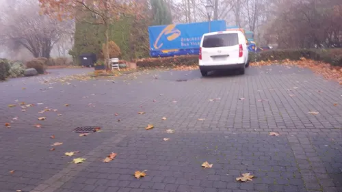
Alte Mühle
Restaurant · German, International · 0.9 km
13 Lohstraße, Bad Vilbel
Mo off; Tu-Fr 11:00-24:00; Sa-Su,PH 10:00-24:00
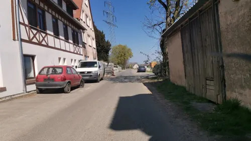
Hofcafe
Cafe · Bistro · 2.0 km
Geschlossen vom 24. bis 26.12. und 31.12.2025 und am 1.1.2026. Betriebsferien vom 12.-19.1.2026.
1 Dottenfelder Hof, Bad Vilbel
Mo-Sa 09:00-18:00; PH off
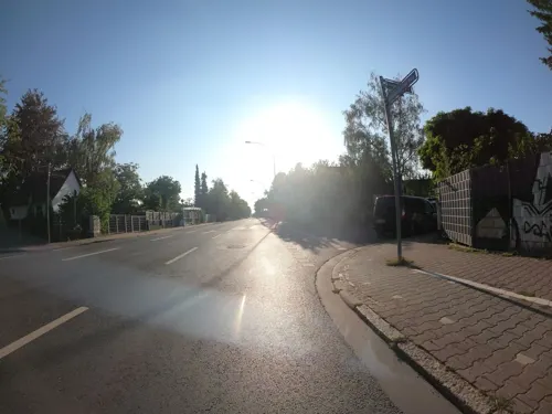
Pizzeria Sun
Restaurant · Italian · 4.5 km
Heimservice
7 Hagebuttenweg, Frankfurt am Main
Mo-Fr 11:00-23:00; Sa, Su, PH 12:00-23:00
Open in Google Maps · +49 69 95209928;+49 69 41074160;+49 176 34947252
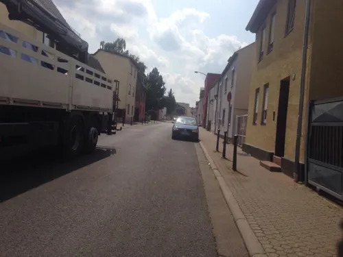
Cô Kim
Restaurant · Vietnamese
135 Frankfurter Straße, Bad Vilbel
Mo-Sa 11:30-14:30,17:00-22:00, Su 11:30-14:30, 17:00-21:00
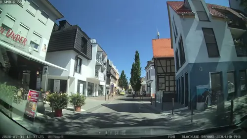
Down Under
Restaurant · Australian, American
34 Frankfurter Straße, Bad Vilbel
Mo-Sa 12:00-01:00, Su 12:00-00:00
Eismanufaktur San Marco
Ice cream · Ice Cream · 3.7 km
6 Gravensteiner-Platz, Frankfurt am Main
Mo-Su 10:00-21:00
Il Sorriso
Restaurant · Italian · 3.5 km
2 Vilbeler Straße, Bad Vilbel
Tu-Fr,Su 11:30-14:30,17:30-23:00; Sa 17:30-23:00; Mo off

Ristorante Pizzeria Bella Italia
Restaurant · Italian, Pizza · 1.9 km
Außenbereich: 3 Tische, bequem am Parkplatz
4 Mühlstraße, Bad Vilbel
Mo-Fr 11:00-14:00,17:00-23:00; Sa,Su 17:00-23:00

Der Bäcker Eifler
Bakery · 1.2 km
15 Rodheimer Straße, Bad Vilbel
Mo-Fr 07:00-22:00; Sa 07:00-22:00; Su 07:00-18:00

Il Sorriso Cocktail Lounge Bar
Bar and pub · Italian, Pizza
145 Frankfurter Straße, Bad Vilbel
Mo off; Su-Th 17:30-01:30, Fr,Sa 17:30-02:30
181 more on the map.
History
Bad Vilbel was founded in 774 (first written document) but much older artefacts were found in the area. In 1848 during railway works, a Roman villa was unearthed with a
thermae and a mosaic. A replica of this mosaic is presented in a modern exhibition in the spa gardens.
The town Vilbel got the label "Bad" (spa) in 1948 for its numerous mineral springs. The health spa operations stopped in the 1960s but the mineral water industry connected more springs of the Wetterau by pipelines to the bottling plant of Hassia in Bad Vilbel. The Hessian government reform formed 1971/72 Bad Vilbel (with Heilsberg), Dortelweil, Gronau and Massenheim to the new city Bad Vilbel. Since 1997 new areas have been developed for living and business, like the residential area of Dortelweil-West or the commercial park Quellenpark between Bad Vilbel, Massenheim and Dortelweil.
From the History section of Bad Vilbel on Wikipedia, under CC BY-SA 4.0.
Notable people from Bad Vilbel
- Friedel LutzGerman footballer (1939–2023)
- Wilhelm von FinckGerman entrepreneur and banker (1848–1924)
- Wolfgang KaimGerman chemist
Born in Bad Vilbel, according to Wikidata (CC0). Each name links to its Wikipedia article.
Where to stay16
Churches and places of worship45
Ev. Kirche Massenheim (Friedenskirche)
Church · Protestant · 1.7 km
7 An der Kirche, Bad Vilbel
Evangelische Kirche
Church · Protestant · 3.5 km
5 Hauptstraße, Bad Vilbel
Festeburggemeinde
Church · Protestant · 4.5 km
58 An der Wolfsweide, Frankfurt am Main
Ev. Kirche Niedererlenbach
Church · Protestant · 3.2 km
1 Zur Charlottenburg, Frankfurt am Main
Shopping63
Gas and EV charging15
Schools, colleges and libraries35
Healthcare20
Praxis für Allgemeinmedizin Sportmedizin und Naturheilverfahren
Clinic and pharmacy · 3.6 km
2 Karbener Weg, Bad Vilbel
Map of Bad Vilbel
250 places. The map loads OpenStreetMap tiles when you open it.
Getting there and nearby towns
Frankfurt Airport (FRA) is the nearest airport with scheduled flights listed in OpenStreetMap, 22 km away.
- Karben 6 km northeast, about 6 min by car
- Frankfurt am Main 8 km southwest, about 8 min by car
- Maintal 8 km southeast, about 8 min by car
- Offenbach 9 km south, about 9 min by car
- Mühlheim am Main 10 km southeast, about 10 min by car
- Bad Homburg vor der Höhe 10 km northwest, about 10 min by car
- Friedrichsdorf 10 km northwest, about 10 min by car
- Oberursel 12 km west, about 12 min by car
- Nidderau 11 km northeast, about 11 min by car
- Steinbach am Taunus 12 km west, about 12 min by car
Drive times are estimates from straight-line distance, not routes.
Towns near Bad Vilbel


Keep exploring
Local news
Headlines from INDB.
Reviews, tips and questions
Loading what members have shared...
Sources and licences
- GeoNames (CC BY 4.0): population, coordinates, regions and time zone
- Mapillary (see each image): photos
- OpenStreetMap contributors (ODbL 1.0): places, airports, map data
- Wikidata (CC0 1.0): elevation, founding date, time zone, website, landmarks and historic places
- Wikimedia Commons (see each image): photos
- Wikipedia (CC BY-SA 4.0): overview and history text
Photo credits
- Badvilbel-altesrathaus, No machine-readable author provided. Cmdr~commonswiki assumed (based on copyright claims)., CC BY 2.5
- Bad Vilbel, Stolperstein Emma Strauss 2, Guido_Arnold, CC BY-SA 3.0
- Bad Vilbel, Stolperstein Emma Strauss, Guido_Arnold, CC BY-SA 3.0
- Bad Vilbel, Stolperstein Johanna Strauss, Guido_Arnold, CC BY-SA 3.0
- Bad Vilbel, Stolpersteine Strauss, Guido_Arnold, CC BY-SA 3.0
- Bad Vilbel, Stolperstein Hugo Strauss, Guido_Arnold, CC BY-SA 3.0
- Bad Vilbel 2023-08-01 05, NikolaSkuridin, CC BY-SA 4.0
- Bad Vilbel, Stolpersteine Schönfeld, Guido_Arnold, CC BY-SA 3.0
- Bad Vilbel, Karolina Schönfeld, Guido_Arnold, CC BY-SA 3.0
- Bad Vilbel, Julius Schönfeld, Guido_Arnold, CC BY-SA 3.0
- Bad Vilbel 2023-08-01 06, NikolaSkuridin, CC BY-SA 4.0
- Bad Vilbel 2023-08-01 07, NikolaSkuridin, CC BY-SA 4.0
- Enamel signs, Bad Vilbel (LRM 20210103 124910), Matti Blume, CC BY-SA 4.0
- Bad Vilbel Friedrich-Karl-Sprudel-2, Indiana68, CC BY-SA 4.0
- Bad Vilbel Friedrich-Karl-Sprudel 1, Indiana68, CC BY-SA 4.0
- Bad Vilbel, Stolperstein Fanny Goldberg, Guido_Arnold, CC BY-SA 3.0
- Bad Vilbel, Stolperstein Adolf Goldberg, Guido_Arnold, CC BY-SA 3.0
- Bad Vilbel, Stolperstein Elise Strauss, Guido_Arnold, CC BY-SA 3.0
- Bad Vilbel, Stolperstein Isidor Franz Strauss, Guido_Arnold, CC BY-SA 3.0
- Bad Vilbel, Stolperstein Isidor Franz Strauss 2, Guido_Arnold, CC BY-SA 3.0
- Bad Vilbel, Stolperstein Rudolf Martin Homberger, Guido_Arnold, CC BY-SA 3.0
- Bad Vilbel, Stolperstein Chambre und Homberger, Guido_Arnold, CC BY-SA 3.0
- Bad Vilbel, Stolperstein Dr. Albert Chambre, Guido_Arnold, CC BY-SA 3.0
- Bad Vilbel, Stolperstein Karoline Schiff, Guido_Arnold, CC BY-SA 3.0
- Stolperstein Bad Vilbel Grünebaum Heinrich, Jt wob ( Diskussion ) 17:37, 26. Apr. 2020 (CEST), CC BY-SA 4.0
- Stolperstein Bad Vilbel Grünebaum Edith, Jt wob ( Diskussion ) 17:30, 26. Apr. 2020 (CEST), CC BY-SA 4.0
- Stolperstein Bad Vilbel Grünebaum Klara, Jt wob ( Diskussion ) 17:34, 26. Apr. 2020 (CEST), CC BY-SA 4.0
- Bad Vilbel, Stolperstein Betty Wechsler, Guido_Arnold, CC BY-SA 3.0
- Bad Vilbel, Stolperstein Simon Wechsler, Guido_Arnold, CC BY-SA 3.0
- Bad Vilbel, Stolperstein Siegried Wechsler, Guido_Arnold, CC BY-SA 3.0
- Bad Vilbel, Stolperstein Henny Wechsler, Guido_Arnold, CC BY-SA 3.0
- Nida Heddernheim Toepferoefen1, Haselburg-müller, CC BY-SA 3.0
- Exotarium, Zoo Frankfurt, Unknown author, CC BY-SA 3.0
- Heilig-Geist-Kirche, Frankfurt-Riederwald, Sebastian Kasten, CC BY-SA 3.0
- FH FrankfurtMain Nibelungenplatz, Jan Uthoff, CC BY 2.5
- Frankfurt Bockenheim Jügelhaus 22, 25asd, CC0
- Zentgrafenschule newbldg frankfurt hesse germany, ArcCan, CC BY-SA 3.0
- Wasserburg Bad Vilbel 869-vd, Pedelecs, CC BY-SA 3.0
- Anna schmidt schule niedererlenbach p 016, Peng ( talk ) 12:08, 4 May 2011 (UTC), CC BY 3.0
- FFM-Seckbach Berger Warte Totale, Frank Behnsen, CC BY-SA 3.0
- Bg-klinik-ffm001, dontworry, CC BY-SA 3.0
- FFM-Bergen-Enkheim Rathaus-Ostfassade, Frank Behnsen, CC BY-SA 3.0
- Seckbacher Ried, Karsten Ratzke, CC0
- Huthpark, Fnordson, CC BY-SA 4.0
- Festeburgkirche, Gaki64, CC BY-SA 3.0
- Lersnersches Schloss Hofseite, Haselburg-müller, CC BY-SA 3.0
- Haupteingang-Georg-Büchner-Gymnasium-Bad-Vilbel-03042007, Thomas Maetz, CC BY-SA 3.0
- Hessen-Center Frankfurt Fassade, Hessen-Center Frankfurt, CC BY-SA 4.0
- Großsender Heiligenstock, S. Kasten, CC BY-SA 3.0
- Bergen Schelmenburg 2014 01, Lumpeseggl, CC BY-SA 3.0
- Bethanienkirche von Osten, Gaki64, CC BY-SA 3.0
- Harheim, ev Kirche, Karsten Ratzke, CC0
- Frankfurt-Enkheim, Mühlbachtal, Karsten Ratzke, CC0
- Lohrberg-Blick-Frankfurt-2013-Ffm-467-468, Simsalabimbam, CC BY-SA 3.0
- Enkheimer Ried, S. Kasten, CC BY-SA 3.0
- Eschbach Nidda Muendung, MdE, CC BY-SA 3.0
- Am Berger Hang 04, Leonhard Lenz, CC BY-SA 4.0
- Naturschutzgebiet "Im alten See bei Gronau" 01, Klaus Stahlke, CC BY-SA 4.0
- Bad Vilbel, Katholische Pfarrkirche Verklärung Christi (2), Karsten Ratzke (changes by Rabanus Flavus ), CC0
- Dortelweil, evangelische Kirche, Karsten11, Public domain
- Gronau, Kirche, Karsten Ratzke, CC0
- Msh An der Kirche 7 ev Kirche Ost, Massemer, CC BY-SA 4.0
- Ehrenmal-Seckbach, Benutzer:Martin-vogel, CC BY-SA 3.0
- Pedellhaus, w:de:User:Martin-vogel, CC BY-SA 3.0
- Theater Lempenfieber Frankfurt Berkersheim, Sveneric, CC BY-SA 4.0
- Street-level photo, jurgenweighardt, CC BY-SA 4.0
- Street-level photo, vilby, CC BY-SA 4.0
- Street-level photo, ashokaking, CC BY-SA 4.0
- Street-level photo, jurgenweighardt, CC BY-SA 4.0
- Street-level photo, robffm, CC BY-SA 4.0
- Street-level photo, mapcreator, CC BY-SA 4.0
- Street-level photo, mapcreator, CC BY-SA 4.0
- Street-level photo, mapcreator, CC BY-SA 4.0
- Street-level photo, robffm, CC BY-SA 4.0
- Street-level photo, jurgenweighardt, CC BY-SA 4.0
- Street-level photo, 7eter, CC BY-SA 4.0
- Street-level photo, robffm, CC BY-SA 4.0
- Street-level photo, robffm, CC BY-SA 4.0
- Street-level photo, robffm, CC BY-SA 4.0
- Street-level photo, flidolin, CC BY-SA 4.0
- Street-level photo, wegavision, CC BY-SA 4.0
- Street-level photo, jeddmason, CC BY-SA 4.0
- Street-level photo, jeluf, CC BY-SA 4.0
- Street-level photo, robffm, CC BY-SA 4.0
- Street-level photo, ashokaking, CC BY-SA 4.0
- Street-level photo, robffm, CC BY-SA 4.0
- Street-level photo, ashokaking, CC BY-SA 4.0
- Street-level photo, robffm, CC BY-SA 4.0
- Street-level photo, flidolin, CC BY-SA 4.0
- Street-level photo, robffm, CC BY-SA 4.0


Page built November 9, 2026. Spotted a mistake? Tell us or suggest a place.