


Why visit Borken
Townapedia lists 115 museums and landmarks, 47 parks and trails, 156 places to eat, 23 places to stay and 13 attractions in and around town.
Highlights include Hof Börger, Bee Happy, Schloss Raesfeld and Kloster Mariengarden.
Weather in Borken
Forecast from MET Norway (CC BY 4.0). Full forecast
About Borken
Borken (German pronunciation: [ˈbɔʁkn̩] ; Westphalian: Buorken) is a town and the capital of the district of the same name, in North Rhine-Westphalia, Germany.
From the Wikipedia article Borken, North Rhine-Westphalia (this version), under CC BY-SA 4.0.
Photos of Borken


Things to do13

Hof Börger
Farm and orchard · 6.4 km
4 Börgersweg, Borken
Mo-Fr 08:30-18:00; Sa 08:30-14:00; Tu,Su,PH off
Hof Hasselhoff
Farm and orchard · 6.3 km
Eggs, seasonal vegetables, meat
Mo-Su 06:00-23:00



1 more on the map.
Museums and landmarks115

Schloss Raesfeld
Monument and historic site · 9.1 km
Vorburg Schloss Raesfeld; Sterndeuterturm
25 Freiheit, Raesfeld


Habers Mühle
Monument and historic site · 9.6 km
Holländer Turmwindmühle

Haus Döring
Monument and historic site · 2.4 km
5 Haus Döringweg, Borken

Wellenhäuschen
Monument and historic site · 6.5 km
Wellhäuschen über der Holtbachquelle, um 1900
Hauptstraße, Borken



Museum Burg Ramsdorf
Museum · 6.4 km
4 Burgplatz, Velen
Apr-Oct: Tu-Sa 15:00-17:00, Apr-Oct: Su 14:00-17:00
103 more on the map.
Parks, trails and playgrounds47


Burlo-Vardingholter Venn und Entenschlatt
Hiking and trails · 10.0 km




35 more on the map.
Restaurants and cafes156
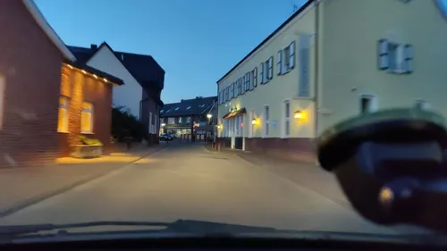
Gasthof Enning
Restaurant · German · 7.2 km
26 Hauptstraße, Borken
We-Fr 17:00+; Sa,Su 15:00+; Mo,Tu off
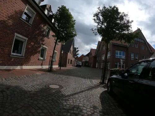
La Piccola Italia
Restaurant · Italian · 6.5 km
29 Hüpohl, Velen
Mo-Th 17:00-22:00; Fr-Sa 17:00-00:00; Su 12:00-22:00
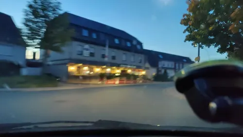
La Villa
Restaurant · Pizza, Italian · 7.3 km
4 Südlohner Straße, Borken
Tu-Sa 17:30-23:00; Su,PH 12:00-15:00,17:30-23:00; Mo off
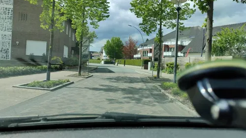
Landhotel Beckmann
Restaurant · 5.4 km
7a Borkener Straße, Heiden
Oct-Apr: Mo,Tu,Fr 16:30+; Oct-Apr: We,Th off; May-Sep: Mo,Tu...


Drönings Landcafé
Cafe · Cake · 5.6 km
20 Krückling, Velen
Th,Fr 14:00-18:00; Sa 09:30-18:00; PH,Su 12:00-18:00; Mo-We off

144 more on the map.
History
The name comes from the German word "Burg" or "Burk" and gradually changed to "Burke", then "Burken" and finally to "Borken". Around the year 800 the village was being used by Charles The Great (Charlemagne) as a stopover place on his travels. In 1226 City rights were granted by Bishop Dietrich II of Isenberg-Limburg. Fortification of the city with walls and towers was first noted in 1391.
From 1810 to 1814 it was part of the French Empire. In 1815 Borken came under the jurisdiction of the Prussian Province of Westphalia. At the same time it became the seat of government for the newly formed district or county of Borken (Kreis Borken). Between 1880 and 1905 the area experienced the building of railroad connections: (1880 Wanne-Borken-Winterswijk line, 1901 Empel-Bocholt-Borken and Borken-Burgsteinfurt, 1905 Borken-Coesfeld-Münster).
Toward the end of World War II, 90 percent of the old town, with its many shops and apartments, was destroyed by air raids.
After the war, community rearrangements followed in 1969, including annexation of Gemen and other towns in the vicinity. Between 1975 and 1978 came the cleaning up and rebuilding of the southern part of the old city. There, buildings which had outlasted the destruction of the Second World War were finally demolished. In 2001 Borken celebrated its 775th anniversary.
From the History section of Borken, North Rhine-Westphalia on Wikipedia, under CC BY-SA 4.0.
More about Borken
Geography
Borken is situated 10 km east of the Dutch border. Borken station is the northern terminus on the remaining section of the Gelsenkirchen-Bismarck–Winterswijk railway.
The 10 largest groups of foreign residents by 31 December 2018:
From the Wikipedia article Borken, North Rhine-Westphalia, under CC BY-SA 4.0.
Notable people from Borken
 Otto Leopold of Limburg Stirum(1684-1754)Photo: Anton Wetterer, Public domain
 Linda BockGerman volleyball playerPhoto: Sandro Halank , Wikimedia Commons, CC BY-SA 4.0
- Jacques PalmingerGerman actor and musician
- Günther StorckGerman bishop
- Barbara SchäferGerman politician (1934–2024)
- Mareike WegenerGerman film director, screenwriter and film producer
- Peter SpodenGerman air force pilot
Born in Borken, according to Wikidata (CC0). Each name links to its Wikipedia article.
Where to stay23
Churches and places of worship32
St. Maria Immaculata
Church · Roman Catholic · 8.1 km
61 Rhedebrügger Straße, Borken
St. Michael
Church · Roman Catholic · 5.1 km
87 Marbecker Straße, Borken
Shopping52
Gas and EV charging24
Schools, colleges and libraries30
Healthcare17
Map of Borken
250 places. The map loads OpenStreetMap tiles when you open it.
Getting there and nearby towns
Flughafen Essen-Mülheim (ESS) is the nearest airport with scheduled flights listed in OpenStreetMap, 49 km away.
- Heiden 5 km east, about 5 min by car
- Raesfeld 9 km south, about 9 min by car
- Velen 11 km northeast, about 11 min by car
- Rhede 11 km west, about 11 min by car
- Südlohn 11 km north, about 11 min by car
- Rhade 12 km southeast, about 12 min by car
- Reken 13 km east, about 13 min by car
- Bahnhof Reken 14 km east, about 14 min by car
- Bocholt 17 km west, about 17 min by car
- Gescher 16 km northeast, about 16 min by car
Drive times are estimates from straight-line distance, not routes.
Towns near Borken


Keep exploring
Local news
Headlines from INDB.
Reviews, tips and questions
Loading what members have shared...
Sources and licences
- GeoNames (CC BY 4.0): population, coordinates, regions and time zone
- Mapillary (see each image): photos
- OpenStreetMap contributors (ODbL 1.0): places, airports, map data
- Wikidata (CC0 1.0): elevation, founding date, time zone, website
- Wikimedia Commons (see each image): photos
- Wikipedia (CC BY-SA 4.0): overview and history text
Photo credits
- Barockbildstock, Burloer Str Borken, Schottland77, CC BY-SA 4.0
- Borken, sculptuur op den Markt foto7 2016-07-20 14.55, Michielverbeek, CC BY-SA 4.0
- Borken Heiliggeistkirche vormals S 201809, Karlunun, CC BY-SA 4.0
- Heilig-Geist-Kirche Borken, H.Helmlechner, CC BY-SA 4.0
- Borken (Westfalen) - Escultura en Markt - Sculpture in Markt - 01, Xosema, CC BY-SA 4.0
- FFF Borken (Westfalen) 2019-03-15 Bühne, Tetzemann, CC0
- Weihnachtsmarkt Borken 2018 02, Tetzemann, CC0
- Altes Rathaus Borken, H.Helmlechner, CC BY-SA 4.0
- FFF Borken (Westfalen) 2019-03-15 Frontransparent, Tetzemann, CC0
- Weihnachtsmarkt Borken 2018 04, Tetzemann, CC0
- St. Remigius Borken 01, H.Helmlechner, CC BY-SA 4.0
- Weihnachtsmarkt Borken 2018 03, Tetzemann, CC0
- 20190217 Holkensturm, Borken (09917), Günter Seggebäing, Coesfeld, CC BY-SA 3.0
- Borken Remigiuskirche SW Portalbereich 201809, Matthias Nonnenmacher, CC BY-SA 4.0
- 20190811 St. Remigius, Borken (06953), Günter Seggebäing, Coesfeld, CC BY-SA 3.0
- Borken, St. Remigius (08), Subbass1, CC BY-SA 4.0
- Borken, St. Remigius (06), Subbass1, CC BY-SA 4.0
- Borken, St. Remigius (07), Subbass1, CC BY-SA 4.0
- FFF Borken (Westfalen) 2019-03-15 Frontranspi, Tetzemann, CC0
- FFF Borken (Westfalen) 2019-03-15 Plakate, Tetzemann, CC0
- Borken (Westfalen) - Igrexa de San Remixio - Iglesia de San Remigio - St. Remigius Church - 01, Xosema, CC BY-SA 4.0
- Borken (Westfalen) - Igrexa de San Remixio - Iglesia de San Remigio - St. Remigius Church - 03, Xosema, CC BY-SA 4.0
- Borken (Westfalen) - Igrexa de San Remixio - Iglesia de San Remigio - St. Remigius Church - 02, Xosema, CC BY-SA 4.0
- 20190324 Schatten des Gekreuzigten, St. Remigius, Borken (00733), Günter Seggebäing, Coesfeld, CC BY-SA 3.0
- 20190324 Außen-Kruzifix bei St. Remigius, Borken (00734), Günter Seggebäing, Coesfeld, CC BY-SA 3.0
- Borken, St. Johannes (36), Subbass1, CC BY 3.0
- Borken, St. Johannes (22), Subbass1, CC BY 3.0
- Borken, St. Johannes (23), Subbass1, CC BY 3.0
- Borken, St. Johannes (38), Subbass1, CC BY 3.0
- Borken, St. Johannes (24), Subbass1, CC BY 3.0
- Borken, St. Johannes (16), Subbass1, CC BY 3.0
- Borken, St. Johannes (08), Subbass1, CC BY-SA 4.0
- Borken, St. Johannes (17), Subbass1, CC BY 3.0
- Borken, St. Johannes (03), Subbass1, CC BY-SA 4.0
- Borken, St. Johannes (39), Subbass1, CC BY 3.0
- Borken, St. Johannes (30), Subbass1, CC BY 3.0
- Borken, St. Johannes (25), Subbass1, CC BY-SA 4.0
- Borken, St. Johannes (31), Subbass1, CC BY 3.0
- Borken, St. Johannes (18), Subbass1, CC BY 3.0
- Borken, Propsteipfarre Sankt Remigius foto8 2012-03-28 16.05, Michielverbeek, CC BY-SA 3.0
- Aerial image of Burg Gemen (view from the southwest), Carsten Steger, CC BY-SA 4.0
- Velen Burg Ramsdorf 1, Unknown author, CC BY-SA 3.0
- 20190331 Burlo-Vardingholter Venn, Borken (00894), Günter Seggebäing, Coesfeld, CC BY-SA 3.0
- 20140720 115538 Kloster Mariengarden, Burlo, Borken (DSC04618), Günter Seggebäing, Coesfeld, CC BY-SA 3.0
- 20140720 115349 Kloster Mariengarden, Burlo, Borken (DSC04595), Günter Seggebäing, Coesfeld, CC BY-SA 3.0
- Gemener Franziskanerkonvent und Kirche St. Marien, Borken (00520), Günter Seggebäing, Coesfeld, CC BY-SA 3.0
- 20140720 110649 Schloss Raesfeld, Raesfeld (DSC04100), Günter Seggebäing, Coesfeld, CC BY-SA 3.0
- Raesfeld, St.-Martin-Kirche -- 2014 -- 2031 -- Ausschnitt, Dietmar Rabich, CC BY-SA 4.0
- St. Marien Burlo - Altarraum, Günter Seggebäing, CC BY-SA 3.0
- St. Maria Immaculata 02, Helfmann, CC BY-SA 3.0
- Naturschutzgebiet Bietenschlatt in Südlohn, Tetzemann, CC0
- Kranenmeer in Heiden, Cedrichoyer, CC BY-SA 3.0
- Martin-Luther-Kirche in Borken (Westfalen), Tetzemann, CC BY-SA 4.0
- Borken-Marbeck Haus Döring, Döringsweg 5 2018, Uwe Barghaan, CC BY-SA 3.0
- Holzbrücke im Tiergarten Schloss Raesfeld, Reinhard G. Nießing, CC BY-SA 4.0
- Weseke St. Ludgerus, Michielverbeek (changes by Rabanus Flavus ), CC BY-SA 4.0
- Windmühle Habers in Rhede 01, Muehlenbernd, CC BY-SA 4.0
- Akvokastela kapelo Raesfeld St. Sebastian, Thomas Pusch, CC BY-SA 3.0
- Ev. Kirche Raesfeld 2020-06-30 6415, Dr. W. Strickling, CC BY-SA 4.0
- Wellenhäuschen Borken-Weseke A3, Tetzemann, CC0
- Heimathaus Borken-Weseke A3, Tetzemann, CC0
- Kirche Borkenwirthe, Hans Börsting, CC BY-SA 4.0
- ©RGN Foto Museum am Schloss Raesfeld IMG 5616, Reinhard G. Nießing, CC BY-SA 4.0
- Street-level photo, schalke_05, CC BY-SA 4.0
- Street-level photo, Lowiekse, CC BY-SA 4.0
- Street-level photo, poxonline, CC BY-SA 4.0
- Street-level photo, poxonline, CC BY-SA 4.0
- Street-level photo, geogladbecker, CC BY-SA 4.0
- Street-level photo, poxonline, CC BY-SA 4.0
- Street-level photo, jockel76, CC BY-SA 4.0
- Street-level photo, poxonline, CC BY-SA 4.0
- Street-level photo, poxonline, CC BY-SA 4.0
- Street-level photo, poxonline, CC BY-SA 4.0
- Street-level photo, poxonline, CC BY-SA 4.0
- Street-level photo, poxonline, CC BY-SA 4.0
- Street-level photo, poxonline, CC BY-SA 4.0
- Street-level photo, geogladbecker, CC BY-SA 4.0
- Street-level photo, schalke_05, CC BY-SA 4.0
- Street-level photo, poxonline, CC BY-SA 4.0
- Street-level photo, poxonline, CC BY-SA 4.0
- Street-level photo, schalke_05, CC BY-SA 4.0
- Street-level photo, cAble_Guy, CC BY-SA 4.0
- Street-level photo, poxonline, CC BY-SA 4.0
- Street-level photo, gdm, CC BY-SA 4.0
- Street-level photo, huna, CC BY-SA 4.0


Page built November 9, 2026. Spotted a mistake? Tell us or suggest a place.