


Gütersloh, Germany
Gütersloh is a town of 96,180 people in North Rhine-Westphalia, Germany.
Why visit Gütersloh
Townapedia lists 76 museums and landmarks, 44 parks and trails, 250 places to eat, 16 places to stay and 7 attractions in and around town.
Highlights include Theater Gütersloh, Freilichtbühne Mohns Park, Stadtmuseum and Miele-Museum.
Weather in Gütersloh
Forecast from MET Norway (CC BY 4.0). Full forecast
About Gütersloh
Gütersloh (German pronunciation: [ˈɡyːtɐsloː] ; Low German: Gütsel) is a city in North Rhine-Westphalia, Germany, in the region of Ostwestfalen-Lippe and the administrative region of Detmold. Gütersloh is the administrative centre for a district of the same name and has a population of 102,464 people.
From the Wikipedia article Gütersloh (this version), under CC BY-SA 4.0.
Travel tips from other travellers: Gütersloh on Wikivoyage (CC BY-SA 4.0).
Photos of Gütersloh


Things to do7



Hofladen Schröder
Farm and orchard · 3.2 km
15 Kiebitzstraße, Gütersloh
Mo-Fr 09:00-18:00; Sa 09:00-14:00

Museums and landmarks76




Horstfriedhof
Cemetery · Roman Catholic · 2.6 km
Ehemaliger katholischer „Drei-Höfe-Friedhof“ der Höfe Bettenworth, Schlickmann und Westerbarkey.
64 more on the map.
Parks, trails and playgrounds44


Stadtpark und Botanischer Garten Gütersloh
Park · 1.3 km
Park and botanical garden in Gütersloh, Germany




32 more on the map.
Restaurants and cafes250
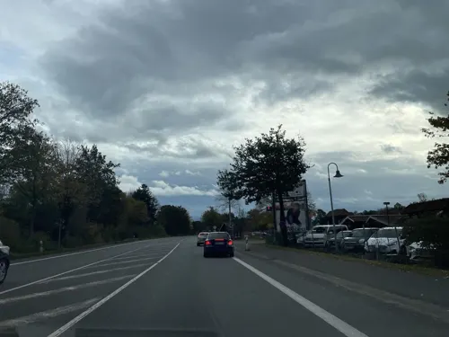
Auszeit bei Sascha
Cafe · Regional · 6.7 km
47 Südfeld, Marienfeld
Mo-Fr 09:00-18:30, Sa 09:00-16:30; Su 09:30-14:00
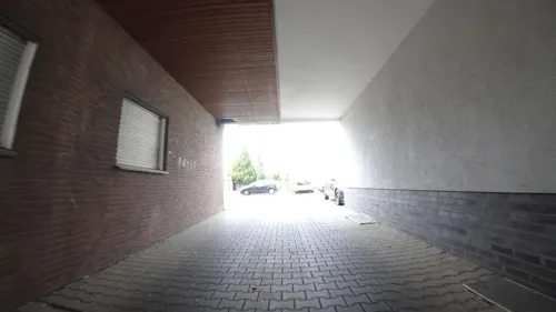
La Trattoria
Restaurant · Italian
126 Berliner Straße, Gütersloh
Mo off, Tu-Th 12:00-14:30,17:30-22:00; Fr 12:00-14:30,17:30-23:00;...
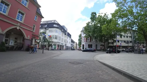
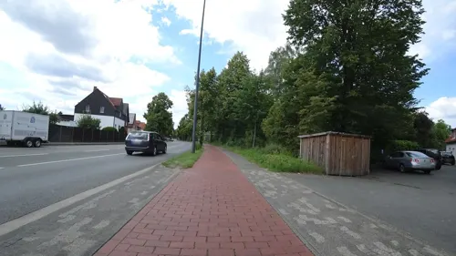
PUPU Fine Sushi & Asian Cuisine
Restaurant · Asian, Sushi · 1.5 km
54 Brockhäger Straße, Gütersloh
Mo-Th 11:00-15:00, 16:30-22:00; Fr-Su 11:00-22:30
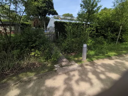
Palmenhaus-Café
Cafe · Ice Cream, Cake · 1.4 km
57 Parkstraße, Gütersloh
Mo-Su 12:00-17:30; Oct 31-Mar 31 off
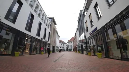

Cafe & Bar Celona
Restaurant · Pizza, Burger, Tapas, Cake, Breakfast, Coffee Shop, Ice Cream
11 Kolbeplatz, Gütersloh
Su-Th 09:00-01:00, Fr,Sa 09:00-02:00
Fachwerk
Restaurant · German · 2.2 km
35 Postdamm, Gütersloh
Mo-Th 18:00-01:00, Fr,Sa 18:00-03:00, Su 17:00-24:00
BULLIT - Kebab & Bowl
Restaurant · Kebab, Beef Bowl, Turkish
15 Königstraße, Gütersloh
Mo-Sa 11:30-21:00; Su 16:00-21:00
238 more on the map.
History
The then-official district of Gütersloh included the town of the same name. It also included seven other municipalities: Avenwedde, Ebbesloh, Friedrichsdorf, Hollen, Isselhorst, Niehorst and Spexard; which existed until 1969 and were incorporated as part of the 1969 North Rhine-Westphalian municipal reform. Currently, all of them are now municipal sub-division units within Gütersloh's borders.
From the History section of Gütersloh on Wikipedia, under CC BY-SA 4.0.
More about Gütersloh
Geography
Gütersloh lies in the Emssandebene, south-west of the Teutoburg Forest and on the north-eastern edge of the Westphalian Basin and has no significant points of elevation. The town's lowest point is 64 metres (210 ft) above sea level on the river Ems near the Princess Royal Barracks and the highest point is 105 metres (344 ft) above sea level in the eastern township of Friedrichsdorf.
The border to Rheda-Wiedenbrück extends as part of the Rhedaer Forest, a large wooded area with predominantly conifers. The river Dalke flows through the town from east to west, crossing close to the Stadt Park as well as the town centre and river Ems.
Economy
Gütersloh is an industrial town; inside the ring road is the town centre, which contains a variety of shops and department stores. Gütersloh is best known for Bertelsmann (a media company with 11,300 workers in the district) and Miele (an appliance manufacturer with 5,000 workers). There are 5,000 other small and medium enterprises in Gütersloh. Those companies have 46,000 workers. The most important areas are:
food: Mestemacher (baked goods, Pumpernickel), Campina GmbH (Dairy), Marten, Vogt & Wolf (meat, sausages), Gehring-Bunte (drinks)
Arts and culture
Gütersloh has four parks: The Stadtpark und Botanischer Garten Gütersloh contains a duck pond, a botanical garden, and many paths bordered by mature trees. It was built 1908–09 next to the river Dalke. The Mohns Park contains a paddling pool, an adventure playground area, a minigolf area, some sports fields and a hockey field can be used for ice hockey too. Since 1949 there is an amphitheater with 1,100 seats. The name comes from the owner, Frederike Mohn, from whom the town bought the park in 1937. There is also the small Riegerpark (named after the Rieger nursery) and the park of the LWL-clinic (built 1911–14, with many listed buildings and a small deer park).
Swimmers are accommodated amply in Gütersloh with no fewer than four pools, both indoor and outdoor, the large outdoor pool has an Olympic-size pool, diving boards and sunbathing space, while the original indoor pool has the usual sauna and steam rooms.
The Stadtmuseum Gütersloh (Gütersloh Town Museum) features exhibits on Gütersloh's local history as well as the history of medicine and industry.
From the Wikipedia article Gütersloh, under CC BY-SA 4.0.
Notable people from Gütersloh
 Alice WeidelGerman politician (born 1979), AfDPhoto: Elekes Andor, CC BY 4.0
 Hans Werner HenzeGerman composer (1926–2012)Photo: Unknown author Unknown author, Public domain
 Friedrich Daniel von RecklinghausenGerman pathologist (1833-1910)Photo: Unknown author Unknown author, Public domain
 Reinhard MohnGerman businessman and philanthropist (1921–2009)Photo: Bertelsmann Unternehmenskommunikation, CC BY-SA 3.0 de
 Meltem KaptanGerman-Turkish comedian and authorPhoto: Elena Ternovaja, CC BY-SA 3.0
 Ernst HillerGerman motorcycle racer (1928–2008)Photo: Unknown author, CC BY-SA 3.0
 Monika HeinoldGerman politicianPhoto: Gerd Seidel ( Rob Irgendwer ), CC BY-SA 3.0
 Christina KampmannGerman politicianPhoto: Foto-AG Gymnasium Melle, CC BY 3.0
 Simon GosejohannGerman comedian and television presenterPhoto: 9EkieraM1, CC BY-SA 3.0
- Ludwig MüllerLeading member of the German Christians and Reichsbischof (1883–1945)
- Diana AmftGerman actress and children's writer
- Horst TappeGerman photographer (1938-2005)
Born in Gütersloh, according to Wikidata (CC0). Each name links to its Wikipedia article.
Where to stay16
Churches and places of worship32
Kirchengemeinde Hl. Therapon Gütersloh
Church · Greek Orthodox · 1.2 km
47 Oststraße, Gütersloh
Shopping65
Gas and EV charging31
Schools, colleges and libraries37
Healthcare24
Map of Gütersloh
250 places. The map loads OpenStreetMap tiles when you open it.
Getting there and nearby towns
Flugplatz Bielefeld (BFE) is the nearest airport with scheduled flights listed in OpenStreetMap, 13 km away.
- Rheda-Wiedenbrück 8 km southwest, about 8 min by car
- Friedrichsdorf 8 km northeast, about 8 min by car
- Verl 10 km east, about 10 min by car
- Steinhagen 10 km north, about 10 min by car
- Rietberg 11 km south, about 11 min by car
- Harsewinkel 12 km northwest, about 12 min by car
- Bielefeld 18 km northeast, about 18 min by car
- Halle 17 km north, about 17 min by car
- Oelde 18 km southwest, about 18 min by car
- Delbrück 20 km southeast, about 20 min by car
Drive times are estimates from straight-line distance, not routes.
Towns near Gütersloh


Keep exploring
Local news
Headlines from INDB.
Reviews, tips and questions
Loading what members have shared...
Sources and licences
- GeoNames (CC BY 4.0): population, coordinates, regions and time zone
- Mapillary (see each image): photos
- OpenStreetMap contributors (ODbL 1.0): places, airports, map data
- Wikidata (CC0 1.0): elevation, founding date, time zone, website, landmarks and historic places
- Wikimedia Commons (see each image): photos
- Wikipedia (CC BY-SA 4.0): overview and history text
Photo credits
- Veerhoffhaus Gütersloh, Gütsel Print und Online, CC BY-SA 4.0
- Gütersloh, das Alte Amtsgericht, Dguendel, CC BY 4.0
- Wohn- und Geschäftshaus Gütersloh Berliner Straße 25, TrotzRegen, CC BY-SA 4.0
- Gütersloh, auf dem Berliner Platz, Dguendel, CC BY 4.0
- Gütersloh, das Alte Amtsgericht, Portal, Dguendel, CC BY 4.0
- Gütersloh ehem.Amtsgericht, ludger1961 00:02, 8 June 2006 (UTC), CC BY-SA 3.0
- Gütersloh, die Lutherkirche, Dguendel, CC BY 4.0
- Gütersloher Notgeld ca. 1923. 100 Milliarden-Mark-Schein mit Abbildung des Alten Gütersloher Rathauses, Axel und Christa Murken, CC BY-SA 4.0
- Gütersloh, auf der Königstraße, Dguendel, CC BY 4.0
- Gütersloh, die Berliner Straße, Dguendel, CC BY 4.0
- Gütersloh, das Alte Amtsgericht, Bild 2, Dguendel, CC BY 4.0
- Martin-Luther-Kirche, 2, Gütersloh, Kreis Gütersloh, GeorgDerReisende, CC BY-SA 4.0
- Moltkestraße 10, 2, Gütersloh, Kreis Gütersloh, GeorgDerReisende, CC BY-SA 4.0
- Gütersloh, Haus Königstraße 7, Dguendel, CC BY 4.0
- Kökerstraße 5, 2, Gütersloh, Kreis Gütersloh, GeorgDerReisende, CC BY-SA 4.0
- Moltkestraße 10a, 1, Gütersloh, Kreis Gütersloh, GeorgDerReisende, CC BY-SA 4.0
- Moltkestraße 10a, 2, Gütersloh, Kreis Gütersloh, GeorgDerReisende, CC BY-SA 4.0
- Gütersloh, Haus Königstraße 7, Bild 2, Dguendel, CC BY 4.0
- Moltkestraße 10, 1, Gütersloh, Kreis Gütersloh, GeorgDerReisende, CC BY-SA 4.0
- Martin-Luther-Kirche, 1, Gütersloh, Landkreis Gütersloh, GeorgDerReisende, CC BY-SA 4.0
- Kökerstraße 5, 1, Gütersloh, Kreis Gütersloh, GeorgDerReisende, CC BY-SA 4.0
- Moltkestraße 12, 1, Gütersloh, Kreis Gütersloh, GeorgDerReisende, CC BY-SA 4.0
- Brunnen an der Martin-Luther-Kirche Gütersloh, Gerd Fahrenhorst, CC BY 4.0
- Theater GT Südost, Steffan Sturm, CC BY-SA 3.0 de
- Apostelkirche (Gütersloh) (01), Chris06, CC BY-SA 4.0
- Brockhagen Evangelische Pfarrkirche, Daniel Brockpähler, CC BY-SA 3.0
- Botanischer-guetersloh, Hewa, CC0
- DKBM 2010 07e, F. Rauh at de.wikipedia, CC BY-SA 3.0 de
- ESG-Guetersloh-RS, Hewa, CC BY-SA 3.0
- Mohns-Park-Freilichtbuehne, Hewa, CC BY 3.0
- Isselhorst Kirchturm, Daniel Brockpähler, CC BY-SA 3.0
- Evangeliumskirche gt rs, Hewa, CC BY 3.0
- Gütersloh - Spexard (Naturschutzgebiet), Hagar66, CC BY-SA 3.0
- Heidewald-fsv-guetersloh, Hewa, CC BY 3.0
- Gütersloh - Mitte West-Heilig Geist Kirche 1, Hagar66, CC BY-SA 3.0
- Schmiede Heimatmuseum Marienfeld, Daniel Brockpähler, CC BY-SA 3.0
- Liebfrauen-Guetersloh, Hewa, CC BY 3.0
- Martin Luther Kirche Guetersloh Proedous, Uwe Steinkolk, CC BY-SA 2.5
- Matthaeuskirche-GT, Hewa, CC BY 3.0
- St-stephanus-guetersloh, Hewa, CC BY 3.0
- Tönnies-Arena Rheda-Wiedenbrück, Bielibob, CC BY-SA 3.0
- Avenwedde-Bahnhof Christuskirche 2, Daniel Brockpähler, CC BY-SA 3.0
- Lukaskirche-Guetersloh, Hewa, CC BY 3.0
- Denkmalbereich „Zumhagen Hof“ Haus 3 + 4, Worldfootage, CC BY-SA 4.0
- Gütersloh - NSG Am Lichtebach 1, Hagar66, CC BY-SA 3.0
- Huehnermoor, Daniel Brockpähler, CC BY-SA 3.0
- Spexard - NSG Spexard - 2, Ath, CC0
- Guetersloh-Riegerpark-Skulp, Hewa, CC0
- Miele car, Buch-t, Public domain
- 15-12-31 Am Kamphof 05, Achim Raschka, CC BY-SA 4.0
- SG-GT-001, Hewa, CC BY-SA 3.0
- Anne-Frank-Gesamtschule, CfB Gütersloh / Originally uploaded by Wolf1974, GFDL
- Stadtmuseum-schild3, Hewa, CC BY 3.0
- Street-level photo, flohoff, CC BY-SA 4.0
- Street-level photo, flohoff, CC BY-SA 4.0
- Street-level photo, dsmm, CC BY-SA 4.0
- Street-level photo, baldur80, CC BY-SA 4.0
- Street-level photo, flohoff, CC BY-SA 4.0
- Street-level photo, flohoff, CC BY-SA 4.0
- Street-level photo, flohoff, CC BY-SA 4.0
- Street-level photo, flohoff, CC BY-SA 4.0
- Street-level photo, flohoff, CC BY-SA 4.0
- Street-level photo, flohoff, CC BY-SA 4.0
- Street-level photo, flohoff, CC BY-SA 4.0
- Street-level photo, flohoff, CC BY-SA 4.0
- Street-level photo, flohoff, CC BY-SA 4.0
- Street-level photo, flohoff, CC BY-SA 4.0
- Street-level photo, derlipper, CC BY-SA 4.0
- Street-level photo, stefanro74, CC BY-SA 4.0
- Street-level photo, flohoff, CC BY-SA 4.0
- Street-level photo, flohoff, CC BY-SA 4.0
- Street-level photo, zuse, CC BY-SA 4.0
- Street-level photo, flohoff, CC BY-SA 4.0


Page built November 9, 2026. Spotted a mistake? Tell us or suggest a place.