


Heiligenstadt, Germany
Heiligenstadt in Oberfranken
Heiligenstadt is a town of 3,690 people in Bavaria, Germany.
Why visit Heiligenstadt
Townapedia lists 70 museums and landmarks, 6 parks and trails, 32 places to eat, 10 places to stay and 40 attractions in and around town.
Highlights include Bing Cave, Altenberg, Altes Schloss and Burgruine Streitburg.
Weather in Heiligenstadt
Forecast from MET Norway (CC BY 4.0). Full forecast
About Heiligenstadt
Heiligenstadt in Oberfranken (German pronunciation: [ˈhaɪlɪɡn̩ˌʃtat ʔɪn ˈʔoːbɐˌfʁaŋkn̩], lit. 'Heiligenstadt in Upper Franconia'; officially: Heiligenstadt i. OFr.) is a community with market rights in the Upper Franconian district of Bamberg. The town clusters round the base of Schloss Greifenstein.
From the Wikipedia article Heiligenstadt in Oberfranken (this version), under CC BY-SA 4.0.
Things to do40



28 more on the map.
Museums and landmarks70

Altes Schloss
Monument and historic site · 7.9 km
Building in Eggolsheim, Upper Franconia, Germany


Burgstall Ebermannstadt
Monument and historic site · 9.3 km
Building in Ebermannstadt, Upper Franconia, Germany



Burgstall Wartleiten
Monument and historic site · 7.4 km
Building in Wiesenttal, Upper Franconia, Germany


Schloss
Monument and historic site · 4.5 km
Cultural heritage monument D-4-74-168-1 (0) in Unterleinleiter, Bavaria
Streitburg Castle
Monument and historic site · 6.6 km
Castle in Wiesenttal, Bavaria
Bahnstrecke Ebermannstadt–Heiligenstadt
Monument and historic site · 5.0 km

58 more on the map.
Parks, trails and playgrounds6



Restaurants and cafes32

Brauereigasthof Reichold
Restaurant · Regional · 7.2 km
24, Aufseß
Nov-Mar: PH,We-Su 08:00+, Apr-Oct: Mo,Tu 17:00+, Apr-Oct: PH,We-Su 08:00+
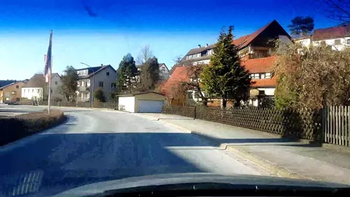
Brauereigasthof Rothenbach
Restaurant · 4.7 km
70 Im Tal, Aufseß
Apr-Oct: PH,Mo-Su 09:00+, Nov: PH,We-Mo 09:00+, Dec-Feb: PH,Fr-Su...
Brauereigasthof Stadter
Restaurant · Regional · 7.3 km
26 Hauptstraße, Aufseß
Apr-Oct: Tu-Su,PH 10:00+, Nov-Mar: Th-Su,PH 10:00+
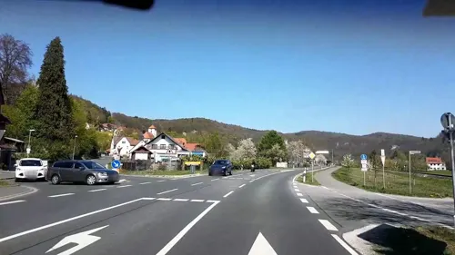
Restaurant Saloniki
Restaurant · Greek · 6.9 km
14 Bahnhofstraße, Wiesenttal
Mo 17:00-22:30, Tu off, We-Sa 17:00-22:30, Su 11:00-14:00,17:00-22:30

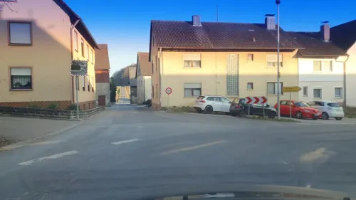
Gasthaus Drei Kronen Brauerei Aichinger
Restaurant
5 Marktplatz, Heiligenstadt i. OFr.
Mo,We-Sa 10:30-22:00; Su,PH 10:00-22:00; Tu off
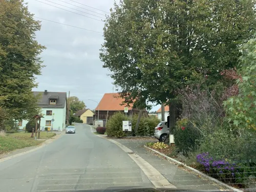


Landgasthof Steinbrecher
Restaurant · 7.4 km
16 Voigendorf, Wiesenttal
Mo-We 11:00-14:00, 17:30-21:00, Fr 11:00-14:00, Sa, Su 11:00-21:00
Kathi-Bräu
Restaurant · Regional · 5.5 km
1, Aufseß
Tu-Fr 11:00-21:00; Sa, Su, PH 09:00-19:00

20 more on the map.
History
Prehistoric finds establish that the market community's municipal area was already populated thousands of years ago, at least at times. However, permanent small communities only arose about the year 500 at the time of the Migration Period (or Völkerwanderung). Documentary mention, though, came only much later.
The community's villages arose about a thousand years ago. Heiligenstadt itself already existed before the Bishopric of Bamberg was founded in 1007.
In the Leinleiter Valley were lordly seats of the Knights of Streitberg. In 1525, the peasants revolted and inflicted heavy damage upon the castles. In 1541, the Emperor granted Heiligenstadt market privilege.
In 1580, the Reformation was introduced into Heiligenstadt and Unterleinleiter. In 1690, the Prince-Bishop of Bamberg, Marquard Sebastian Schenk von Stauffenberg inherited the knightly estates of Greifenstein and Burggrub together with patronage over Heiligenstadt. The Counts Schenk von Stauffenberg still live at Greifenstein Castle and the palatial estate of Burggrub today. The villages in the community's northern area grew out of the former Bamberg Ämter. Here there was no change in the prevailing religion.
Through the Reichsdeputationshauptschluss in 1803, the community passed to Bavaria.
From the History section of Heiligenstadt in Oberfranken on Wikipedia, under CC BY-SA 4.0.
Where to stay10
Churches and places of worship31
St. Veit und St. Michael
Church · Protestant
6 Pfarrberg, Heiligenstadt i. OFr.
St. Martin
Church · Roman Catholic · 5.3 km
36, Heiligenstadt i. OFr.
Shopping4
Gas and EV charging1
Schools, colleges and libraries4
Map of Heiligenstadt
198 places. The map loads OpenStreetMap tiles when you open it.
Getting there and nearby towns
Verkehrslandeplatz Burg Feuerstein (URD) is the nearest airport with scheduled flights listed in OpenStreetMap, 8 km away.
- Hollfeld 12 km northeast, about 12 min by car
- Litzendorf 13 km northwest, about 13 min by car
- Hirschaid 14 km west, about 14 min by car
- Stadelhofen 16 km north, about 16 min by car
- Forchheim 18 km southwest, about 18 min by car
- Pettstadt 18 km west, about 18 min by car
- Bamberg 20 km west, about 20 min by car
- Pottenstein 20 km southeast, about 20 min by car
- Heroldsbach 23 km southwest, about 23 min by car
- Zapfendorf 24 km northwest, about 24 min by car
Drive times are estimates from straight-line distance, not routes.
Local news
Headlines from INDB.
Reviews, tips and questions
Loading what members have shared...
Sources and licences
- GeoNames (CC BY 4.0): population, coordinates, regions and time zone
- Mapillary (see each image): photos
- OpenStreetMap contributors (ODbL 1.0): places, airports, map data
- Wikidata (CC0 1.0): elevation, founding date, time zone, website, landmarks and historic places
- Wikimedia Commons (see each image): photos
- Wikipedia (CC BY-SA 4.0): overview and history text
Photo credits
- Heiligenstadt vom Pavillon, Fraenk91332, CC BY-SA 4.0
- Heiligenstadt Evangelisch-lutherische Pfarrkirche Luftbild -20240406-RM-160204, Reinhold Möller Ermell, CC BY-SA 4.0
- Heiligenstadt in Oberfranken. Rathaus und Marktplatz. - geo-en.hlipp.de - 13926, Udo und Joan Fugel, CC BY-SA 2.0
- Rathaus Heiligenstadt - panoramio, Hatti1, CC BY-SA 3.0
- Heiligenstadt Gemeindebücherei 1103464, Ermell, CC BY-SA 4.0
- Heiligenstadt Marktplatz-20240406-RM-160315, Reinhold Möller Ermell, CC BY-SA 4.0
- Heiligenstadt in Oberfranken Osterbrunnen-20070411-RM-092801, Ermell, CC BY-SA 4.0
- Heiligenstadt in Oberfranken Osterbrunnen-20070411-RM-092848, Ermell, CC BY-SA 4.0
- Heiligenstadt-easter-fountainP4164116, ermell, CC BY-SA 4.0
- RROF Marktplatz Heiligenstadt, Cyklonista, CC BY-SA 4.0
- Heiligenstadt Evangelisch-lutherische Pfarrkirche Luftbild -20240406-RM-160605, Reinhold Möller Ermell, CC BY-SA 4.0
- Heiligenstadt (Oberfranken) Kirche St. Vitus and St. Michael 1103413, Ermell, CC BY-SA 4.0
- Heiligenstadt Heiligenstadter Hof 1103419, Ermell, CC BY-SA 4.0
- Hotel Heiligenstadter Hof - panoramio - Hatti1, Hatti1, CC BY-SA 3.0
- Heiligenstadt-tourist-information-1103416, ermell, CC BY-SA 4.0
- Hotel Heiligenstadter Hof - panoramio - Hatti1 (1), Hatti1, CC BY-SA 3.0
- Hotel Heiligenstadter Hof - panoramio, Hatti1, CC BY-SA 3.0
- Heiligenstadt Luftbild-20240406-RM-160706, Reinhold Möller Ermell, CC BY-SA 4.0
- Heiligenstadt Evangelisch-lutherische Pfarrkirche Luftbild -20240406-RM-160759, Reinhold Möller, CC BY-SA 4.0
- Heiligenstadt Friedhof Orthophoto-20240406-RM-160638, Reinhold Möller Ermell, CC BY-SA 4.0
- Heiligenstadt-Innenraum-1103360-hdr4, ermell, CC BY-SA 4.0
- Heiligenstadt-Innenraum-1103370-hdr4, ermell, CC BY-SA 4.0
- Heiligenstadt-Kirche-Orgel-1103345-hdr-PS-PS, ermell, CC BY-SA 4.0
- Mühlrad-Heiligenstadt-1020520, ermell, CC BY-SA 3.0
- Veitskirche in Heiligenstadt - panoramio, Immanuel Giel, CC BY 3.0
- Mühlrad-Heiligenstadt-1020517, ermell, CC BY-SA 3.0
- Heiligenstadt Evangelisch-lutherische Pfarrkirche Luftbild -20240406-RM-160817, Reinhold Möller, CC BY-SA 4.0
- Heiligenstadt Evangelisch-lutherische Pfarrkirche Luftbild -20240406-RM-160837, Reinhold Möller, CC BY-SA 4.0
- Ford GT (Mustang) Heiligenstadt-20180819-RM-160637, Reinhold Möller Ermell, CC BY-SA 4.0
- Heiligenstadt Luftbild-20240406-RM-160913, Reinhold Möller Ermell, CC BY-SA 4.0
- Binghöhle Streitberg Stalagmiten vorn und Stalagtiten-oben, Rainerhaufe, CC BY-SA 4.0
- Burgruine Neideck 05112008, pegasus2, Public domain
- Burgstall Ebermannstadt01, Sven-121, CC0
- Burgstall-Schlüsselstein02, Sven-121, Public domain
- UnterleinleiterSchloss, No machine-readable author provided. Immanuel Giel assumed (based on copyright claims)., CC BY-SA 3.0
- Burgruine Streitberg01, Sven-121, CC0
- Burgstall Vestenberg03, Sven-121, CC0
- GreifensteinSchloss, Immanuel Giel, CC BY-SA 3.0
- Christuskirche Heiligenstadt Außenansicht, GregorHelms, CC BY 3.0
- Voitmannsdorf Kapelle 2, Immanuel Giel, Public domain
- KircheBrunn, Immanuel Giel, CC BY-SA 3.0
- Kapelle Teuchatz 01, Immanuel Giel, Public domain
- Tiefenpölz Kirche Luftbild-20240512-RM-162946, Reinhold Möller, CC BY-SA 4.0
- Pfarrkirche Wüstenstein Portalansicht, Aufseßtaler, CC BY-SA 4.0
- 2017 Pfadfinderhaus Lindersberg 01, Derzno, CC BY-SA 4.0
- 2018 Leidingshofer Tal 01, Derzno, CC BY-SA 4.0
- Schulmühle P4194501 2 3N-2, Ermell, CC BY-SA 4.0
- UnterleinleiterEvangelischeKirche, No machine-readable author provided. Immanuel Giel assumed (based on copyright claims)., CC BY-SA 3.0
- 2019PeterUndPaulUnterleinleiter, Stefan Oemisch, CC BY-SA 4.0
- Hochstahl St. Johannes der Täufer, Benreis, CC BY 3.0
- Pfarrkirche St. Matthäus (Neuhaus) 01, Derzno, CC BY-SA 3.0
- Kirche Tiefenhoechstadt 01, Immanuel Giel, Public domain
- Binghöhle-350, Michael Diefenbach, CC BY-SA 3.0
- Bei der Berglastubn - panoramio, G. Zapf, CC BY 3.0
- Street-level photo, r66, CC BY-SA 4.0
- Street-level photo, r66, CC BY-SA 4.0
- Street-level photo, rnissl, CC BY-SA 4.0
- Street-level photo, r66, CC BY-SA 4.0
- Street-level photo, r66, CC BY-SA 4.0
- Street-level photo, r66, CC BY-SA 4.0
- Street-level photo, mike409, CC BY-SA 4.0
- Street-level photo, r66, CC BY-SA 4.0
- Street-level photo, r66, CC BY-SA 4.0
- Street-level photo, chhe, CC BY-SA 4.0
- Street-level photo, r66, CC BY-SA 4.0
- Street-level photo, r66, CC BY-SA 4.0
- Street-level photo, r66, CC BY-SA 4.0
- Street-level photo, r66, CC BY-SA 4.0


Page built November 9, 2026. Spotted a mistake? Tell us or suggest a place.