


Herscheid, Germany
Herscheid is a town of 7,658 people in North Rhine-Westphalia, Germany.
Why visit Herscheid
Townapedia lists 54 museums and landmarks, 37 parks and trails, 26 places to eat, 7 places to stay and 62 attractions in and around town.
Highlights include Beimborn's Hofladen, Kulturhaus Lüdenscheid, Bahnhof Hüinghausen and Heimatmuseum Spieker.
Weather in Herscheid
Forecast from MET Norway (CC BY 4.0). Full forecast
About Herscheid
Herscheid (German pronunciation: [ˈheːɐ̯ʃaɪt]; Westphalian: Hiärschge) is a municipality in the southern Märkischer Kreis, in North Rhine-Westphalia, Germany.
From the Wikipedia article Herscheid (this version), under CC BY-SA 4.0.
Things to do62

Beimborn's Hofladen
Farm and orchard
Unbemannter automatischer Laden für regionale Hofprodukte
1 Oberdorfstraße, Herscheid
Mo-Su 06:00-22:00


Bruchbachbeef
Farm and orchard · 2.0 km
Rindfleisch aus eigener Zucht
Sa 09:00-12:00
Hofladen Bühner
Farm and orchard · 2.8 km
Regionale Lebensmittel, Wein, Käse, Deko-Artikel
We-Sa 09:00-17:00, Su 11:00-16:00

50 more on the map.
Museums and landmarks54



Schmiedemuseum Bremecker Hammer (At moment closed)
Monument and historic site · 4.7 km
95 Brüninghauser Straße, Lüdenscheid
ehem. Grube Glückshoffnung
Monument and historic site · 2.5 km
Direkt an der Herscheider Mühle im Grubenbezirk Silberg; der Beginn des Bergbau-Wanderweges von 1979; Schächte (Hauptschacht 11 m...
ehem. Grube Recontre
Monument and historic site · 2.6 km
Etwa 500 Meter von der Schule in der Schönebecke nach Richtung Herscheid; 16. September 1864 neu gemuthet; Neuverleihung am 19. September 1865
ehem. Grube Silberblick
Monument and historic site · 2.8 km
30. Januar 1859 neu gemutet; 9. September 1861 neu verliehen im Grubenbezirk Silberg
ehem. Grube Amandus
Monument and historic site · 1.9 km
25 m langer, zugemauerter Stollen (in einem Schuppen; unzugänglich); verliehen 1876-08-04
ehem. Grube Auf der Silberkoulen
Monument and historic site · 2.5 km
Im Grubenbezirk Silberg
42 more on the map.
Parks, trails and playgrounds37



25 more on the map.
Restaurants and cafes26
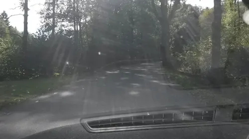
Herscheider Mühle
Restaurant · German · 2.4 km
1 Herscheider Mühle, Herscheid
Mo-Su 08:00-22:00; Th off; Fr off
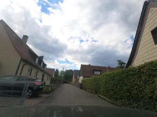
Steakhaus am Piepersloh
Restaurant · Steak House · 5.8 km
8 In den Buchen, Lüdenscheid
Mo-Su 11:00-23:00
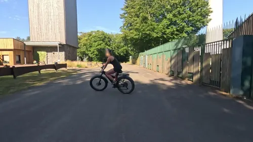



Zur Oestertalsperre
Restaurant · 5.5 km
1 An der Oestertalsperre, Plettenberg
Tu-Fr 11:30-17:30; Sa 11:00-17:30
Restaurant Sonneborn
Restaurant · 5.4 km
199 Herscheider Landstraße, Lüdenscheid
Mo-Sa 09:30-18:30; Su off
Dorfkrug - Thuns
Restaurant · Fine Dining · 6.6 km
7 Brauck, Werdohl
Tu-Sa 18:00-23:00


Ital. Eisdiele Fattorel
Cafe
16 Lüdenscheider Straße, Herscheid
Mo-Su,PH 11:00-20:30
Restaurant Lazarus im Hotel Haus Hollweg
Restaurant · 6.3 km
4a Brüninghauser Straße, Lüdenscheid
Mo off; Tu-Sa 17:00-23:00; Su 13:30-18:00
14 more on the map.
History
The first written document mentioning Hertsceido dates from 1072 in a charter from Grafschaft Abbey of Anno II, Archbishop of Cologne. However, the settlements in what is now the municipal area probably date back to the 4th century. From the 12th century till 1753 the parish of Herscheid formed a court district. During the French occupation (1806 till 1814), the Mairie Ebbe covered Herscheid and neighbouring Valbert.
From the History section of Herscheid on Wikipedia, under CC BY-SA 4.0.
Where to stay7
Churches and places of worship9
Freie evangelische Gemeinde Baberg
Church · Protestant · 6.1 km
1 Baberg, Meinerzhagen
Shopping3
Gas and EV charging4
Schools, colleges and libraries7
Michael-Ende-Schule, Städtische Schule für Kranke
School · 6.4 km
14 Paulmannshöher Straße, Lüdenscheid
Healthcare5
Map of Herscheid
214 places. The map loads OpenStreetMap tiles when you open it.
Getting there and nearby towns
Dortmund Airport (DTM) is the nearest airport with scheduled flights listed in OpenStreetMap, 39 km away.
- Lüdenscheid 9 km northwest, about 9 min by car
- Werdohl 9 km north, about 9 min by car
- Plettenberg 10 km east, about 10 min by car
- Meinerzhagen 10 km southwest, about 10 min by car
- Kierspe 12 km southwest, about 12 min by car
- Neuenrade 12 km north, about 12 min by car
- Attendorn 13 km southeast, about 13 min by car
- Altena 14 km north, about 14 min by car
- Schalksmühle 17 km northwest, about 17 min by car
- Halver 17 km west, about 17 min by car
Drive times are estimates from straight-line distance, not routes.
Local news
Headlines from INDB.
Reviews, tips and questions
Loading what members have shared...
Sources and licences
- GeoNames (CC BY 4.0): population, coordinates, regions and time zone
- Mapillary (see each image): photos
- OpenStreetMap contributors (ODbL 1.0): places, airports, map data
- Wikidata (CC0 1.0): elevation, founding date, time zone, website, landmarks and historic places
- Wikimedia Commons (see each image): photos
- Wikipedia (CC BY-SA 4.0): overview and history text
Photo credits
- Herscheid-Rathaus1-Bubo, Bubo, CC BY-SA 3.0
- Apostelkirche Herscheid, Dirk Lohmann, CC BY-SA 4.0
- Der Spieker in Herscheid aus dem 15.-16. Jahrhundert. Früher Sammelhaus für Kirchennaturalien, heute Bücherei, Standesamt und Heimatstube. - panoramio, giggel, CC BY 3.0
- Herscheider Panorama, Dirk Lohmann, CC BY-SA 4.0
- Herscheid-West FFSW-0335, Michael Kramer, CC BY-SA 3.0
- Herscheid Friedhof FFSW-0331, Michael Kramer, CC BY-SA 3.0
- Herscheid FFSW-0327, Michael Kramer, CC BY-SA 3.0
- Flugplatz Plettenberg-Hüinghausen südwestlich des Herscheider Ortsteils Hüinghausen FFSW-0339, Michael Kramer, CC BY-SA 3.0
- Herscheid Ebbebachtal ober Kiesbert e 20190330 1144, Karlunun, CC BY-SA 4.0
- Lüdenscheid-Kulturhaus-01 new, derivative work: Pro2 ( talk ) Lüdenscheid-Kulturhaus-01.jpg : Silvercork The original uploader was Silvercork at German Wikipedia ., CC BY-SA 3.0
- Herscheid-Apostelkirche1-Asio, Asio otus, CC BY-SA 3.0
- Grimminghausen, Benutzer: Stammbaum03, Lars Womelsdorf, CC BY-SA 3.0
- MME-Museumszug, User:Stefan Kunzmann, CC BY-SA 3.0
- Nordhelle, Milseburg, CC BY-SA 3.0
- Herscheid-SchwarzeAheHammer1-Bubo, Bubo, CC BY-SA 3.0
- Lister-Quellgebiet, AndreasFahrrad, CC BY-SA 4.0
- Werdohl-Deitenbecke1-Asio, Asio otus, CC BY-SA 3.0
- 2024-03-03 NSG Herveler Bruch MK-069 (NRW) 01, YvoBentele, CC BY-SA 4.0
- Herscheider Spieker, Nils Springob, Public domain
- Panorama Blick vom Rahlenberg, DW. Lohmann, CC BY-SA 4.0
- 20230702-IMG 4747 kl-Gasthof Vedder, (nob), CC BY-SA 4.0
- Street-level photo, uwekoch, CC BY-SA 4.0
- Street-level photo, uwekoch, CC BY-SA 4.0
- Street-level photo, uwekoch, CC BY-SA 4.0
- Street-level photo, uwekoch, CC BY-SA 4.0
- Street-level photo, uwekoch, CC BY-SA 4.0
- Street-level photo, uwekoch, CC BY-SA 4.0
- Street-level photo, uwekoch, CC BY-SA 4.0
- Street-level photo, uwekoch, CC BY-SA 4.0
- Street-level photo, simonikes, CC BY-SA 4.0


Page built November 9, 2026. Spotted a mistake? Tell us or suggest a place.