


Why visit Hoyerswerda
Townapedia lists 45 museums and landmarks, 25 parks and trails, 110 places to eat, 13 places to stay and 8 attractions in and around town.
Highlights include Zoo Hoyerswerda, Cinemotion Hoyerswerda, Stadtmuseum Hoyerswerda and Steinkreuz.
Weather in Hoyerswerda
Forecast from MET Norway (CC BY 4.0). Full forecast
About Hoyerswerda
Hoyerswerda (German: [hɔʏɐsˈvɛʁda] ) or Wojerecy (Upper Sorbian: [ˈwɔjɛʁɛtsɨ] ) is a major district town in the district of Bautzen in the German state of Saxony. It is located in the Sorbian settlement area of Upper Lusatia, in which the Upper Sorbian language is spoken in addition to German.
From the Wikipedia article Hoyerswerda (this version), under CC BY-SA 4.0.
Travel tips from other travellers: Hoyerswerda on Wikivoyage (CC BY-SA 4.0).
Photos of Hoyerswerda


Things to do8

Zoo Hoyerswerda
Zoo and aquarium · 0.9 km
13c Am Haag, Hoyerswerda
Nov-Feb: 10:00-16:00; Mar-Oct: 09:00-18:00
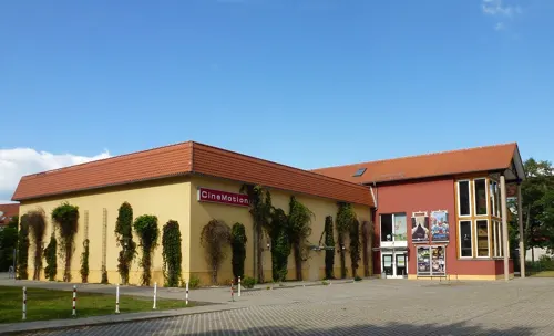
Cinemotion Hoyerswerda
Cinema and theater · 0.7 km
2 An der Mühle, Hoyerswerda
Mo-Su 11:30-23:00



Museums and landmarks45

Stadtmuseum Hoyerswerda
Museum · 0.8 km
1 Schloßplatz, Hoyerswerda
Mar Su[-1] - Oct Su[-1] - 1 day Mo-Su,PH 10:00-18:00, Oct Su[-1] -...


Energiefabrik Knappenrode
Museum · 7.9 km
Von Glückauf zu Ahoi Wie der Bergbau die Lausitz prägte, welche Anstrengungen technisch und menschlich notwendig waren, um das Gold der...
8 Ernst-Thälmann-Straße, Hoyerswerda
Tu-Su 10:00-18:00


Kursächsische Postmeilensäule
Monument and historic site · 0.6 km
Kursächsische Postmeilensäule-Distanzsäule


Gefallenendenkmal
Monument and historic site · 3.1 km
Gedenkstätte für die Opfer der Weltkriege

33 more on the map.
Parks, trails and playgrounds25



Wald- und Strandbad Wittichenau
Sports field and stadium · 6.3 km
Mo-Fr 13:00-20:00, Sa-Su 11:00-20:00; SH 11:00-20:00


13 more on the map.
Restaurants and cafes110
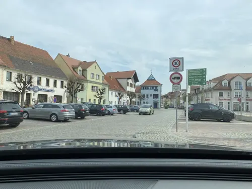
Bäckerei Bresan
Bakery · Coffee Shop, Breakfast, German · 5.9 km
13 Markt - Torhošćo, Wittichenau - Kulow
Mo-We 06:00-12:00; Fr 06:00-13:00; Sa 06:00-11:00; Su 06:00-10:00
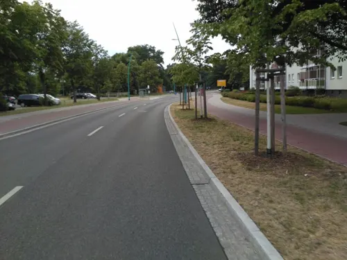

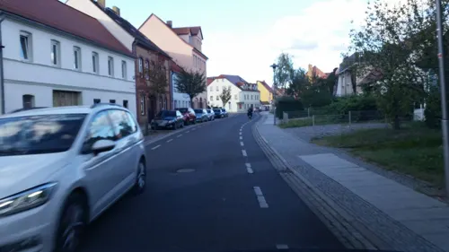
Taumii
Restaurant · Asian
31 Lange Straße - Dołha dróha, Hoyerswerda - Wojerecy
Tu-Su 11:00-15:00, 17:00-22:00
die Bleibe
Cafe · Breakfast, Coffee Shop, German, Pancake · 5.8 km
8 Markt - Torhošćo, Wittichenau - Kulow
Tu-Fr 08:00-13:30
Bäckerei Roland Ermer
Bakery · 0.9 km
7a Alte Berliner Straße, Hoyerswerda
Mo-Fr 06:15-18:00; Sa 06:15-12:00; Su,PH off

Restaurant Westphalenhof
Restaurant · Fine Dining · 3.2 km
Restaurant Westphalenhof
43 Dorfaue
We-Fr 18:00-22:00; Sa-Su 11:00-14:00, 18:00-22:00
Broilerbar
Restaurant · Chicken · 1.6 km
25 Frederic-Joliot-Curie-Straße, Hoyerswerda
We-Fr 17:00-23:00; Sa 11:00-14:00,17:00-23:00; Su 11:00-15:00;...
Fischgaststätte Dr. Zelder
Restaurant · Fish · 3.9 km
46 Neudorf-Teichhaus, Wittichenau - Kulow
easter-Oct 03: Su 10:00-20:00
Gasthaus zum Mühlengrund
Restaurant · Regional · 3.6 km
4 Am Anger, Hoyerswerda
We-Fr 16:00-22:00;Sa 11:00-24:00;Su 09:30-20:00

Stadtcafé
Cafe · Breakfast, Bistro, Ice Cream
1 Kirchstraße - Cyrkwinska dróha, Hoyerswerda - Wojerecy
Mo-Su 07:00-18:00
98 more on the map.
History
The first settlers arrived in this area in 700 AD. They were Milceni Slavs. Many artifacts from this old culture have been found in the Hoyerswerda area.
1000 AD saw the construction of the first church in the town; the Heilige Familie ('Holy Family') which is still standing today in the historic centre of Hoyerswerda.
The city was first mentioned in 1268. At the time the mayor was Hoyer von Vredeberg.
In 1371 it was designated an official market town. Before this Hoyerswerda was a very little town with few structures, but the city then grew under the leadership of the new mayor Karl IV.
It received municipal rights from Freiherr von Duba on 19 December 1423, as well as the right to elect its own council.
In the 17th century, the city experienced many problems due to the 30 Years War. The Number of inhabitants dropped drastically, but recovered by the end of the century.
In 1624, Hoyerswerda became the capital of the Spremberg district. A few years later the district took the name Hoyerswerda because of the growing importance of the city.
In the middle of this century Hoyerswerda had become the largest town in the Lusatian region.
Read more of the history
In the 18th century the Polish King and Elector of Saxony, Augustus II the Strong, gave the Duchy of Hoyerswerda to Ursula Katharina Lubomirska, who helped the town develop trade and manufacturing. In 1737, King Augustus III of Poland bought the town from Lubomirska. The King used to stop in the Hoyerswerda Castle during his travels from Dresden to Warsaw. The Battle of Hoyerswerda occurred nearby in 1759 during the Seven Years' War.
In 1815 Hoyerswerda became part of the Kingdom of Prussia. Initially it was administered as part of the Spremberg-Hoyerswerdaer Kreis of the Province of Brandenburg, but in 1825 the southern part was split off to form Landkreis Hoyerswerda and attached to the Province of Silesia. In 1871, with Prussia, it became part of the German Empire. In 1873 a new railway between Hoyerswerda and Ruhland opened. It had a positive effect on the economic development of the city. In 1912, the Domowina, the organisation of the Sorbs, was founded in the city. In 1918, the Sorbs protested here against the policy of Germanisation. The town became part of the Prussian Province of Lower Silesia in 1919.
During the Second World War, in 1944, the Dulag 124 prisoner-of-war camp was relocated from Slavuta to Hoyerswerda. At the end of the war the town was declared a core centre of German defence and was therefore heavily damaged. The invading Soviet Red Army set the town on fire. It became part of Saxony again after the war, but from 1952, it was administered by the Bezirk (Region) of Cottbus, until 1990, when the states of East Germany were abolished.
During the GDR period, Hoyerswerda became an important industrial town. The lignite processing enterprise "Schwarze Pumpe" was established in 1955 (it is today in the federal state of Brandenburg). From 1957, the demand for new living space rose dramatically. In the following years, 10 new living areas were established with tens of thousands of apartments being built. In 1981, the city reached its maximum number of inhabitants, with 71,054 residents. At that time, more children per inhabitant were born in Hoyerswerda than anywhere else in the GDR. Upon reunification in 1990, the people of the city decided to become part of the reconstituted state of Saxony. With the end of the GDR and the reorganisation of the East German economy, many enterprises in the industrial region of Hoyerswerda were scaled down or closed.
In 1991 multiple xenophobic attacks targeted immigrant workers from the Far East as well as asylum seekers from Asia, Africa and Eastern Europe. A hostel accommodating asylum seekers was attacked and petrol bombs were thrown. Media coverage of the unrest shocked many in Germany and abroad, provoking much public debate.
Between 1993 and 1998, several smaller villages became part of the city, but the number of overall inhabitants declined rapidly, from about 70,000 people in the 1980s to about 35,000 people by the end of 2012. There have been attempts to renovate the city. Many of the apartment blocks built during the time of the GDR have been demolished or renovated. This project, like others, was financed with money from the EU and the Federal Republic of Germany.
Its role as an independently ruled town ("Kreisfreie Stadt") in Saxony disappeared in 2008 with the reshaping of the regional administration of Saxony.
From the History section of Hoyerswerda on Wikipedia, under CC BY-SA 4.0.
More about Hoyerswerda
Geography
The town is situated in the north of the District of Bautzen, close to the borders of Saxony with Brandenburg. Major cities and towns in proximity are Cottbus 35 kilometres (22 miles) in the north-west, Dresden 55 kilometres (34 miles) in the south-west and Berlin 150 kilometres (93 miles) in the north. Hoyerswerda is part of Upper Lusatia and lies on a rural plain characterised by the presence of several lakes and some marshes.
Hoyerswerda is divided beside the Old Town and New Town into the following districts (names given in German/Upper Sorbian):
The old town of Hoyerswerda is divided into eleven districts:
Neida, Dresdner Vorstadt, Am Bahnhof ('At the Railway Station'), Am Stadtrand ('On the Outskirts'), an der Neupetershainer Bahn, An der Thrune, Innere Altstadt ('Inner Historic Centre'), Senftenberger Vorstadt, Spremberger Vorstadt, Nördliche Elsteraue, Südliche Elsteraue.
Neustadt Zentrum ('New Town Centre'), Kühnicht, Grünewaldring, Gondelteich ('Gondola Lake'), Wohnkomplex I, Wohnkomplex II, Wohnkomplex III, Wohnkomplex IV, Wohnkomplex V/VE, Wohnkomplex VI, Wohnkomplex VII, Wohnkomplex VIII, Wohnkomplex IX, Wohnkomplex X.
From the Wikipedia article Hoyerswerda, under CC BY-SA 4.0.
Notable people from Hoyerswerda
 Eric OelschlägelGerman association football playerPhoto: Lanthan2003, CC BY-SA 4.0
 André ThiemeGerman show jumperPhoto: Michael Kramer, CC BY-SA 3.0
 Karsten HilseGerman politicianPhoto: Olaf Kosinsky, CC BY-SA 3.0 de
 Vera MeyerGerman biotechnologist and university professorPhoto: Anton Mauersegler, CC BY-SA 4.0
- Rudolf von SebottendorfGerman antisemite, freemason and founder of the Thule Society (1875-1945)
- Tony JantschkeGerman footballer
- Roland HennigEast German cyclist
- Dietmar HötgerEast German judoka
- Gabriele FähnrichEast German gymnast
- Petra PfaffGerman hurdler
- Otto Franz von MöllendorffGerman zoologist and diplomat (1848–1903)
- Heinz Walter KozurGerman paleontologist and stratigrapher
Born in Hoyerswerda, according to Wikidata (CC0). Each name links to its Wikipedia article.
Where to stay13
Churches and places of worship16
Kreuzkirche
Church · Roman Catholic · 6.1 km
32 Bautzener Straße - Budyska dróha, Wittichenau - Kulow
Kreuzkirche (Kirche des Apostelamtes Jesu Christi)
Church · Apostolic
41 Friedrichsstraße - Friedrichowa dróha, Hoyerswerda - Wojerecy
Shopping29
Gas and EV charging9
SB - Freie Tankstelle
Gas station · 6.2 km
95 Kamenzer Straße - Kamjenska dróha, Wittichenau - Kulow
Schools, colleges and libraries16
Brigitte-Reimann Stadtbibliothek Hoyerswerda
Library · 1.5 km
6/7 Dietrich-Bonhoeffer-Straße, Hoyerswerda
Grundschule „An der Elster“
School · 1.4 km
54 Frederic-Joliot-Curie-Straße, Hoyerswerda
Oberschule Hoyerswerda
School · 2.2 km
40 Claus-von-Stauffenberg-Straße, Hoyerswerda
Healthcare12
Altstadt-Apotheke
Clinic and pharmacy
1 Heinrich-Heine-Straße - Heinricha Heineowa dróha, Hoyerswerda - Wojerecy
Apotheke am Jahnstadion
Clinic and pharmacy · 2.2 km
13 Liselotte-Herrmann-Straße, Hoyerswerda
Apotheke am Klinikum
Clinic and pharmacy · 2.6 km
10 Maria-Grollmuß-Straße, Hoyerswerda
Map of Hoyerswerda
250 places. The map loads OpenStreetMap tiles when you open it.
Getting there and nearby towns
Dresden Airport (DRS) is the nearest airport with scheduled flights listed in OpenStreetMap, 47 km away.
- Wittichenau 6 km south, about 6 min by car
- Wiednitz 16 km west, about 16 min by car
- Senftenberg 19 km northwest, about 19 min by car
- Kamenz 21 km southwest, about 21 min by car
- Großräschen 23 km northwest, about 23 min by car
- Drebkau 24 km north, about 24 min by car
- Schipkau 25 km west, about 25 min by car
- Schwarzheide 27 km west, about 27 min by car
- Weißwasser 29 km east, about 29 min by car
- Bautzen 32 km southeast, about 32 min by car
Drive times are estimates from straight-line distance, not routes.
Towns near Hoyerswerda


Keep exploring
Local news
Headlines from INDB.
Reviews, tips and questions
Loading what members have shared...
Sources and licences
- GeoNames (CC BY 4.0): population, coordinates, regions and time zone
- Mapillary (see each image): photos
- OpenStreetMap contributors (ODbL 1.0): places, airports, map data
- Openverse (see each image): photos
- Wikidata (CC0 1.0): elevation, founding date, time zone, website, landmarks and historic places
- Wikimedia Commons (see each image): photos
- Wikipedia (CC BY-SA 4.0): overview and history text
Photo credits
- Marktplatz-Hoyerswerda, Frank Weiner, Public domain
- AfD Wahlplakat Hoyerswerda, svolks, CC BY-SA 3.0
- Handwerkergasse Lange Straße Hoyerswerda - panoramio, nokam, CC BY-SA 3.0
- Hoyerswerda Gaststaette Post, Doris Antony , Berlin, CC BY-SA 4.0
- Johanneskirche Hoyerswerda - panoramio, nokam, CC BY-SA 3.0
- Wasserturm Hoyerswerda, GZagatta, CC BY-SA 4.0
- Flickr - IngolfBLN - Bahnhof Hoyerswerda - Bahnhofsvorplatz (3), IngolfBLN, CC BY-SA 2.0
- Flickr - IngolfBLN - Bahnhof Hoyerswerda - Bahnhofsvorplatz (2), IngolfBLN, CC BY-SA 2.0
- Flickr - IngolfBLN - Bahnhof Hoyerswerda (8), IngolfBLN, CC BY-SA 2.0
- Flickr - IngolfBLN - Bahnhof Hoyerswerda - Bahnhofsvorplatz (1), IngolfBLN, CC BY-SA 2.0
- Flickr - IngolfBLN - Bahnhof Hoyerswerda - Bahnhofsvorplatz, IngolfBLN, CC BY-SA 2.0
- Hoyerswerda Wasserturm 2, Oberlausitzerin64, CC BY-SA 4.0
- Mittelstraße 1, Hoyerswerda, ubahnverleih, CC0
- Markt 5, Hoyerswerda, ubahnverleih, CC0
- Mittelstraße 19, Hoyerswerda, ubahnverleih, CC0
- Mittelstraße 2, Hoyerswerda, ubahnverleih, CC0
- Mittelstraße, Hoyerswerda, ubahnverleih, CC0
- Aufwändig gestaltete Rad-Zufahrt zum Bahnhof Hoyerswerda, Konrad Krause / adfc.sachsen, CC BY-SA 2.0
- Hoyerswerda, Kursächsische Distanzsäule (1), Manfred Schröter, Berga, CC BY-SA 4.0
- VT 4.12.01 (01) im BW Hoyerswerda, René Mettke, CC BY-SA 4.0
- Markt 6, Hoyerswerda, ubahnverleih, CC0
- Markt 8, Hoyerswerda, ubahnverleih, CC0
- Markt 9, Hoyerswerda (2), ubahnverleih, CC0
- Markt Hoyerswerda - panoramio, nokam, CC BY-SA 3.0
- Markt 9, Hoyerswerda, ubahnverleih, CC0
- Hoyerswerda Wasserturm, Doris Antony , Berlin, CC BY-SA 4.0
- 28.05.92 Hoyerswerda 201856 (54341663283), Phil Richards from London, UK, CC BY-SA 2.0
- Flickr - IngolfBLN - Bahnhof Hoyerswerda (18), IngolfBLN, CC BY-SA 2.0
- Flickr - IngolfBLN - Bahnhof Hoyerswerda (12), IngolfBLN, CC BY-SA 2.0
- Flickr - IngolfBLN - Bahnhof Hoyerswerda (22), IngolfBLN, CC BY-SA 2.0
- Flickr - IngolfBLN - Bahnhof Hoyerswerda (1), IngolfBLN, CC BY-SA 2.0
- Flickr - IngolfBLN - Bahnhof Hoyerswerda (23), IngolfBLN, CC BY-SA 2.0
- Hoyerswerda Knappenrode Aerial, Gunther Tschuch, CC BY-SA 4.0
- Dubringer Moor 2, SeptemberWoman, CC BY-SA 3.0
- Zoo Pinguinanlage HY, SeptemberWoman, CC BY-SA 3.0
- Jahn-Stadion Hoyerswerda, SeptemberWoman, CC BY-SA 3.0
- Lausitzhalle HY 2, SeptemberWoman, CC BY-SA 3.0
- Hoyerswerda Schwarzkollm Krabatmuehle, Oberlausitzerin64, CC BY-SA 4.0
- Kreuzkirche 1 HY, SeptemberWoman, CC BY-SA 3.0
- Kapelle Am Elstergrund Dörgenhausen HY 1, SeptemberWoman, CC BY-SA 3.0
- Dorfstraße 82 Schwarzkollm HY, SeptemberWoman, CC BY-SA 3.0
- Elsterheide Nardt war graves, Doris Antony , Berlin, CC BY-SA 4.0
- Kirche Laubusch, SeptemberWoman, CC BY-SA 3.0
- Kreuzkirche Wittichenau 2, SeptemberWoman, CC BY-SA 3.0
- Wittichenau, Germany. Memorial to the fallen Soviet soldiers during the Second World War. - panoramio, Maarten Sepp, CC BY-SA 3.0
- Fotothek df rp-d 0860006 Wittichenau. Kobermühle, Ansicht, Unknown author, CC BY-SA 3.0 de
- Dubring Kirche, SeptemberWoman, CC BY-SA 3.0
- Schloss Hoyerswerda 7, SeptemberWoman, CC BY-SA 3.0
- KatholischesGemeindezentrumSanktThomasMorusHoyerswerda, iclandicviking, Public domain
- Suehnekreuz Wittichenau, lutzto, CC BY-SA 3.0
- Markt Postdistanzsäule HY 2, SeptemberWoman, CC BY-SA 3.0
- Markt Wittichenau 2, SeptemberWoman, CC BY-SA 3.0
- Sühnestein Schäferweg Bröthen HY, SeptemberWoman, CC BY-SA 3.0
- Dorfaue Zeißig HY Gedenkstätte, SeptemberWoman, CC BY-SA 3.0
- Spannteich 02, Staubi59, CC BY-SA 4.0
- Katholische Pfarrkirche Hoyerswerda, SeptemberWoman (shifted & brightened by Rabanus Flavus ), CC BY-SA 3.0
- Johanniskirche Hoyerswerda, Iclandicviking at de.wikipedia, Public domain
- Schwarzkollm - Kirche, René Mettke, CC BY-SA 3.0
- Hoyerswerdaer Straße Kapelle Keula, SeptemberWoman, CC BY-SA 3.0
- Schulstraße 2 Grundschule am Park HY 1, SeptemberWoman, CC BY-SA 3.0
- Knappenrode - Energiefabrik - Brikettfabrik 07 ies, Frank Vincentz, CC BY-SA 3.0
- Pestalozzistraße Lessing-Gymnasium HY 2, SeptemberWoman, CC BY-SA 3.0
- Cinemotion Hoyerswerda, herr.g, CC BY-SA 2.0
- Street-level photo, sp8962de, CC BY-SA 4.0
- Street-level photo, vorwaertsimmer, CC BY-SA 4.0
- Street-level photo, autobahn42, CC BY-SA 4.0
- Street-level photo, autobahn42, CC BY-SA 4.0
- Street-level photo, yiro, CC BY-SA 4.0
- Street-level photo, sp8962de, CC BY-SA 4.0
- Street-level photo, ubahnverleih, CC BY-SA 4.0
- Street-level photo, ubahnverleih, CC BY-SA 4.0
- Street-level photo, sp8962de, CC BY-SA 4.0
- Street-level photo, yiro, CC BY-SA 4.0
- Street-level photo, autobahn42, CC BY-SA 4.0
- Street-level photo, yiro, CC BY-SA 4.0
- Street-level photo, autobahn42, CC BY-SA 4.0
- Street-level photo, bejotel, CC BY-SA 4.0
- Street-level photo, yiro, CC BY-SA 4.0
- Street-level photo, autobahn42, CC BY-SA 4.0
- Street-level photo, sp8962de, CC BY-SA 4.0
- Street-level photo, yiro, CC BY-SA 4.0
- Street-level photo, sp8962de, CC BY-SA 4.0


Page built November 9, 2026. Spotted a mistake? Tell us or suggest a place.