


Why visit Schipkau
Townapedia lists 45 museums and landmarks, 14 parks and trails, 65 places to eat, 25 places to stay and 6 attractions in and around town.
Highlights include Gutshaus, Kursächsische Postmeilensäule, DEKRA Lausitzring and Snowtropolis.
Weather in Schipkau
Forecast from MET Norway (CC BY 4.0). Full forecast
About Schipkau
Schipkau (Lower Sorbian: Šejkow, pronounced [ˈʃɛjkɔw]) is a municipality in the Oberspreewald-Lausitz district, in Lower Lusatia, Brandenburg, Germany.
From the Wikipedia article Schipkau (this version), under CC BY-SA 4.0.
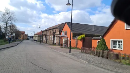
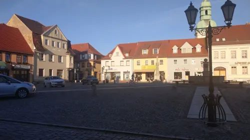
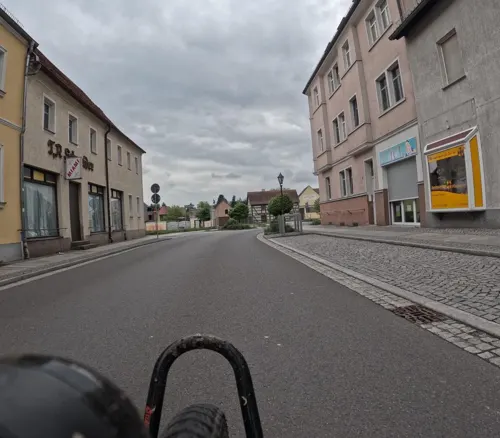
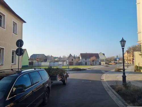
Photos of Schipkau


Things to do6


Museums and landmarks45


Kursächsische Postmeilensäule
Monument and historic site · 6.9 km
Postmeilensäule, auf dem Markt in Ruhland

Wasserturm
Monument and historic site · 5.3 km
Wasserturm Wasserturmstraße in Schwarzheide


Sühnekreuz
Monument and historic site · 6.2 km
Granitsäule mit eingemeisseltem Kreuz und der Jahreszahl 1766

Sühnekreuz
Monument and historic site · 7.0 km
In der Südostecke der Friedhofsmauer, Einmündung der August-Bebel-Straße - Ernst-Thälmann-Straße

Grenzstein Schlesien - Brandenburg
Monument and historic site · 6.4 km
Grenzstein in Ruhland an der Brücke über die Schwarze Elster mit Inschrift: Provinzgrenze anno 1825 Brandenburg | Schlesien

Lutherdenkmal
Monument and historic site · 5.8 km
Lutherdenkmal an der Lutherkirche, am Dorfanger, Mückenberger Straße in Schwarzheide

Provinzgrenze Sachsen / Mark-Brandenburg
Monument and historic site · 6.6 km
Provinzgrenze Sachsen / Mark-Brandenburg Kostebrauer Straße in Lauchhammer.

Wasserturm
Monument and historic site · 4.5 km
Wasserturm, L2 Lackstraße im Werksgelände der BASF Schwarzheide GmbH in Schwarzheide

Wegweiserstein
Monument and historic site · 1.4 km
Wegestein, an der Poststraße / Ruhlander Straße zwischen Schwarzheide und Schipkau in Schipkau.

33 more on the map.
Parks, trails and playgrounds14


Erlebnisbad Senftenberg
Sports field and stadium · 5.4 km
32 Hörlitzer Straße, Senftenberg





2 more on the map.
Restaurants and cafes65
LukAs
Restaurant · Regional · 5.3 km
49 Ruhlander Straße, Schwarzheide
Mo-Fr 16:30-22:00; Sa 14:00-23:00; Su 11:30-21:00
Gia Mas
Restaurant · Greek · 6.7 km
12b Dorfstraße
11:30-14:30,17:30-22:00
Restaurant Hänig
Restaurant · German · 6.7 km
17 Briesker Straße, Senftenberg
Th 14:00-20:00; Fr-Sa 11:00-20:00; Su 11:00-15:00
Zur Windparkschänke
Restaurant · 5.0 km
36 Karl-Marx-Siedlung, Schipkau
We-Fr 17:00-21:00; Sa-Su 11:00-21:00
Ristorante Sorrento
Restaurant · Italian · 6.9 km
47 Dresdener Straße, Ruhland
Mo,We-Fr 11:30-14:00,17:00-23:00; Sa 17:00-24:00; PH closed
Eiscafé Alice
Cafe · Ice Cream · 7.0 km
5 Dresdener Straße, Ruhland
Mo-Su 14:00-18:00

53 more on the map.
History
From 1815 to 1947, Schipkau was part of the Prussian Province of Brandenburg. From 1952 to 1990, it was part of the Bezirk Cottbus of East Germany. In 2021, the Energiepark Lausitz project of the municipality of Schipkau was realized on the Klettwitz Hochkippe by GP JOULE with the partners Terravent and Steinbock EE. There, the open spaces between the existing wind turbines are used for the construction and operation of photovoltaic systems.
On September 19, 2024 construction work on GICON High-Altitude Wind Turbine in Klettwitz wind park, which belongs to Schipkau, started. It will have a nacelle height of 300 metres and a rotor diametre of 126 metres. When completed, it will not only be the tallest wind turbine in the world, but also the second-tallest man-made object in Germany and one of the tallest structures in the European Union.
From the History section of Schipkau on Wikipedia, under CC BY-SA 4.0.
More about Schipkau
Geography
The municipality is located in the north of the historical region of Lusatia, close to the motorway A13, connecting Berlin with Dresden.
Schipkau counts 5 civil parishes (Ortsteile): Annahütte, Drochow, Hörlitz, Klettwitz and Meuro.
From the Wikipedia article Schipkau, under CC BY-SA 4.0.
Where to stay25
Churches and places of worship17
Shopping20
Gas and EV charging14
Supercharger Schwarzheide
EV charging · 5.7 km
44 Naundorfer Straße, Schwarzheide
Schools, colleges and libraries18
Brandenburgische Technische Universität Cottbus-Senftenberg
School · 6.2 km
1 Universitätsplatz, Senftenberg
Brandenburg University of Technology Cottbus-Senftenberg
School · 6.1 km
Healthcare7
Hospita Sozialdienste GmbH - Haus am Wiesengrund
Clinic and pharmacy · 4.9 km
5 Goetheplatz, Lauchhammer
Map of Schipkau
231 places. The map loads OpenStreetMap tiles when you open it.
Getting there and nearby towns
Dresden Airport (DRS) is the nearest airport with scheduled flights listed in OpenStreetMap, 44 km away.
- Schwarzheide 5 km southwest, about 5 min by car
- Senftenberg 7 km east, about 7 min by car
- Lauchhammer 10 km west, about 10 min by car
- Großräschen 11 km northeast, about 11 min by car
- Finsterwalde 18 km northwest, about 18 min by car
- Hoyerswerda 25 km east, about 25 min by car
- Doberlug-Kirchhain 26 km northwest, about 26 min by car
- Kamenz 31 km southeast, about 31 min by car
- Großenhain 36 km southwest, about 36 min by car
- Bad Liebenwerda 35 km west, about 35 min by car
Drive times are estimates from straight-line distance, not routes.
Towns near Schipkau


Keep exploring
Local news
Headlines from INDB.
Reviews, tips and questions
Loading what members have shared...
Sources and licences
- GeoNames (CC BY 4.0): population, coordinates, regions and time zone
- Mapillary (see each image): photos
- OpenStreetMap contributors (ODbL 1.0): places, airports, map data
- Wikidata (CC0 1.0): elevation, founding date, time zone, website, landmarks and historic places
- Wikimedia Commons (see each image): photos
- Wikipedia (CC BY-SA 4.0): overview and history text
Photo credits
- Lausitz Luftsport- & Techniktage 2013-Rueckflug by-RaBoe 001, © Ra Boe / Wikipedia, CC BY-SA 3.0 de
- Evangelische Kirche Schipkau 2025 SE, Hans G. Oberlack, CC BY 4.0
- Evangelische Kirche Schipkau 2025 Fenster, Hans G. Oberlack, CC BY 4.0
- Evangelische Kirche Schipkau 2025 SW, Hans G. Oberlack, CC BY 4.0
- Evangelische Kirche Schipkau 2025 Portal W, Hans G. Oberlack, CC BY 4.0
- Evangelische Kirche Schipkau 2025 NW, Hans G. Oberlack, CC BY 4.0
- 2017 Audi DTM Team photo (33936369274), Mattias Ekström, CC BY 2.0
- Dorfkirche Kostebrau Nordostansicht, Assenmacher, CC BY-SA 4.0
- Gartenstadt Marga XII, SPBer, CC BY-SA 3.0
- Klettwitz seite1, Z thomas, CC BY 3.0
- Annahütte kirche, Z thomas, CC BY 3.0
- Evangelische Lutherkirche, No machine-readable author provided. Haig~commonswiki assumed (based on copyright claims)., Public domain
- Ruhland, Gutshof 2, Gutshaus, Z thomas, CC BY 3.0
- Bibliothek senftenberg 2018-09-29 (1), Z thomas, CC BY-SA 4.0
- Ruhland kriegerdenkmal, Z thomas, CC BY 3.0
- Ruhland, Marktplatz, Postmeilensäule mit Informationstafel mit QR-Code, dahinter Elektro-Postauto, Wilhelm Zimmerling PAR, CC BY-SA 4.0
- Marga Kirche 2016 W, Hans G. Oberlack, CC BY-SA 4.0
- Grundschule steigerstraße Senftenberg 2020-02-15 9, Z thomas, CC BY-SA 4.0
- Schwarzheide Wasserturm, Oberlausitzerin64, CC BY-SA 4.0
- Schwarzheide kathkirche2, Z thomas, CC BY 3.0
- Senftenberg schwimmhalle, Z thomas, CC BY 3.0
- Hoerlitz barbarakirche, Z thomas, CC BY 3.0
- Hoerlitz heilandskirche, Z thomas, CC BY 3.0
- Ruhland Postmeilensaeule-03, Radler59 ( talk ), CC BY-SA 4.0
- Senftenberg Steinkreuz II, Radler59, CC BY-SA 3.0
- Senftenberg Steinkreuz I, Radler59, CC BY-SA 3.0
- Grenzstein anno 1825 Schlesien - Brandenburg, Pirolina, CC BY-SA 3.0
- Schwarzheide Lutherdenkmal, Radler59 ( talk ), CC BY-SA 4.0
- Lauchhammer-Ost Grenzstein, Radler59 ( talk ), CC BY-SA 4.0
- Schwarzheide BASF Wasserturm, Radler59 ( talk ), CC BY-SA 4.0
- Schipkau Wegestein, Radler59 ( talk ), CC BY-SA 4.0
- Senftenberg selk, Z thomas, CC BY 3.0
- Schwarzheide Lutherkirche, Radler59 ( talk ), CC BY-SA 4.0
- Marga Kirche 2016 N, Hans G. Oberlack, CC BY-SA 4.0
- Ruhland, Querstr. 3, katholische Kirche Nordostansicht, Winter, Wilhelm Zimmerling PAR, CC BY-SA 4.0
- Regenbogenschule Senftenberg 2020-03-24 (95), Z thomas, CC BY-SA 4.0
- Senftenberg altlutherischekirche, Z thomas, CC BY 3.0
- Ruhland, Brauhausplatz etwa 1900, mit Germania-Denkmal, Unknown author Unknown author, Public domain
- Ruhland, Kirchplatz, Stadkirche Nordostansicht, Winter, 01, Wilhelm Zimmerling PAR, CC BY-SA 4.0
- Schwarzheide kathkirche4, Z thomas, CC BY 3.0
- Snowtropolis senftenberg, LeonRascal, CC BY-SA 3.0
- Senftenberg Alter Friedhof lub 2023-08-21 img03, Lukas Beck, CC BY-SA 4.0
- Street-level photo, jenki, CC BY-SA 4.0
- Street-level photo, sp8962de, CC BY-SA 4.0
- Street-level photo, dsmm, CC BY-SA 4.0
- Street-level photo, dsmm, CC BY-SA 4.0
- Street-level photo, dsmm, CC BY-SA 4.0
- Street-level photo, dsmm, CC BY-SA 4.0
- Street-level photo, britiger, CC BY-SA 4.0
- Street-level photo, bejotel, CC BY-SA 4.0
- Street-level photo, dsmm, CC BY-SA 4.0
- Street-level photo, dsmm, CC BY-SA 4.0
- Street-level photo, dsmm, CC BY-SA 4.0
- Street-level photo, dsmm, CC BY-SA 4.0
- Street-level photo, dsmm, CC BY-SA 4.0
- Street-level photo, dsmm, CC BY-SA 4.0
- Street-level photo, 5rmft, CC BY-SA 4.0
- Street-level photo, 5rmft, CC BY-SA 4.0
- Street-level photo, britiger, CC BY-SA 4.0
- Street-level photo, dsmm, CC BY-SA 4.0
- Street-level photo, dsmm, CC BY-SA 4.0
- Street-level photo, dsmm, CC BY-SA 4.0
- Street-level photo, dsmm, CC BY-SA 4.0
- Street-level photo, dsmm, CC BY-SA 4.0
- Street-level photo, dsmm, CC BY-SA 4.0
- Street-level photo, dsmm, CC BY-SA 4.0
- Street-level photo, dsmm, CC BY-SA 4.0
- Street-level photo, dsmm, CC BY-SA 4.0
- Street-level photo, dsmm, CC BY-SA 4.0
- Street-level photo, signout, CC BY-SA 4.0


Page built November 9, 2026. Spotted a mistake? Tell us or suggest a place.