


Why visit Schwarzheide
Townapedia lists 31 museums and landmarks, 4 parks and trails, 25 places to eat, 7 places to stay and 2 attractions in and around town.
Highlights include Gutshaus and Kursächsische Postmeilensäule.
Weather in Schwarzheide
Forecast from MET Norway (CC BY 4.0). Full forecast
About Schwarzheide
Schwarzheide (German pronunciation: [ˈʃvaʁtsˌhaɪdə] ; Lower Sorbian: Carny Gózd) is a town in the Oberspreewald-Lausitz district, in Lower Lusatia, Brandenburg, Germany. It is situated on the river Schwarze Elster, 11 km southwest of Senftenberg, 110 km south of Berlin and 40 km north of Dresden. The little river Pössnitz runs through the eastern part of Schwarzheide.
From the Wikipedia article Schwarzheide (this version), under CC BY-SA 4.0.
Photos of Schwarzheide


Things to do2


Museums and landmarks31


Kursächsische Postmeilensäule
Monument and historic site · 2.1 km
Postmeilensäule, auf dem Markt in Ruhland

Wasserturm
Monument and historic site
Wasserturm Wasserturmstraße in Schwarzheide


Sühnekreuz
Monument and historic site · 2.4 km
Steinkreuz in Ruhland nahe des Kirchehof auch Tatzenkreuz genannt.

Kunstgussmuseum Lauchhammer
Museum · 5.1 km
3 Freifrau-von-Löwendahl-Straße, Lauchhammer

Grenzstein Schlesien - Brandenburg
Monument and historic site · 1.8 km
Grenzstein in Ruhland an der Brücke über die Schwarze Elster mit Inschrift: Provinzgrenze anno 1825 Brandenburg | Schlesien

Lutherdenkmal
Monument and historic site · 2.0 km
Lutherdenkmal an der Lutherkirche, am Dorfanger, Mückenberger Straße in Schwarzheide

Wasserturm
Monument and historic site · 1.7 km
Wasserturm, L2 Lackstraße im Werksgelände der BASF Schwarzheide GmbH in Schwarzheide

Wegweiserstein
Monument and historic site · 4.5 km
Wegestein, an der Poststraße / Ruhlander Straße zwischen Schwarzheide und Schipkau in Schipkau.

19 more on the map.
Parks, trails and playgrounds4


Restaurants and cafes25
LukAs
Restaurant · Regional
49 Ruhlander Straße, Schwarzheide
Mo-Fr 16:30-22:00; Sa 14:00-23:00; Su 11:30-21:00
Sportgaststätte Arnsdorf
Restaurant · 4.9 km
25 Ludwig-Jahn-Straße, Ruhland
Tu-Fr 17:00-22:00; Sa,Su "nach Vereinbarung"
Ristorante Sorrento
Restaurant · Italian · 2.2 km
47 Dresdener Straße, Ruhland
Mo,We-Fr 11:30-14:00,17:00-23:00; Sa 17:00-24:00; PH closed

Eiscafé Alice
Cafe · Ice Cream · 2.2 km
5 Dresdener Straße, Ruhland
Mo-Su 14:00-18:00
Bäckerei Jacobi
Bakery · 2.2 km
1 Mittelstraße, Ruhland
Tu-Fr 05:30-12:00, 13:30-18:00; Sa 05:30-10:00
Chinatown
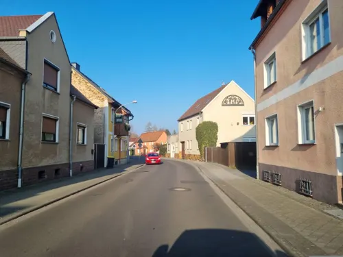
Restaurant · Chinese · 0.7 km
37 Ruhlander Straße, Schwarzheide
Mileta's Gaststätte "Am Schwarzwasser"
Restaurant · German · 2.2 km
18 Goethestraße, Ruhland
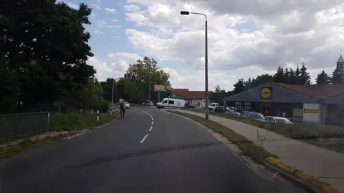


Asia Bistro Reis-Haus
Restaurant · Asian
100a Ruhlander Straße, Schwarzheide
13 more on the map.
History
The town's landmark is the watertower. Today´s industrial town, Schwarzheide, was created on October 1, 1936, from the independent communities, Zschornegosda (today Schwarzheide-West) and Naundorf (now part of Schwarzheide-Ost). The name was translated from the Sorbian name, "Zschornegosda", (čorny = black, gozd = heath, wood).
The date of foundation of this community is unknown. Zschornegosda and Naundorf were founded in the 12th or the 13th century after the Christianization of the Sorbs.
The first written evidence of Naundorf (as Nuwendorff) came from a pledge deed from 1421. Zschornegosda was first written in 1449 (as Cschörnegast) in the feudal deed of Duke Frederick II, Elector of Saxony. Naundorf is a typical street village. Zschornegosda is a rotunde called okolnica. The chapel was on the highest point of a sandy knoll.
The development of both villages was retarded by wars, fires, and epidemics. Until the 18th century, the villages had no more than 100 inhabitants.
In 1780, the discovery of lignite coal west of Zschornegosda in Bockwitz led to mining and the foundation of briquette factories (Ferdinand, Victoria, Victoria II). The river, Schwarze Elster, was drained and converted to a canal, so it was no longer possible to live from fishing. Highway A13 was built in 1936.
Read more of the history
In 1937, Brabag (German: Braunkohlen Benzin AG) completed the Brabag II facility in Ruhland-Schwarlheide (the 4th Nazi Germany Fischer-Tropsch plant) to produce gasoline and diesel fuel from lignite coal. The plant was a target of the Oil Campaign of World War II, used Sachsenhausen concentration camp forced labor, and became a post-war Soviet Joint Stock Company. The factory became VEB Synthesewerk Schwarzheide on January 1, 1954.
When the village's population reached eight-thousand inhabitants, the village became a town on January 11, 1967.
After 1990, Synthesewerk Schwarzheide became a part of BASF AG, which manufactures polyurethane.
The river, Schwarze Elster, forms the border between Lower and Upper Lusatia.
From 1635, both Zschornegosda and Naundorf were part of the Electorate of Saxony. In 1815 both villages became a part of Prussia because of the Congress of Vienna. From 1815 to 1947, they were part of the Prussian Province of Brandenburg.
Between 1818 and 1952, Zschornegosda and Naundorf were part of Kreis Calau.
From 1952 to 1990, Schwarzheide was a part of Kreis Senftenberg in the Bezirk Cottbus of East Germany.
In 1990, town was annexed to Brandenburg, and, on December 6, 1993, to Oberspreewald-Lausitz.
The town parliament of Schwarzheide is composed of the mayor and 18 members.
From the History section of Schwarzheide on Wikipedia, under CC BY-SA 4.0.
More about Schwarzheide
Arts and culture
Symbol is the 36 m high water tower built in 1943/44 by French prisoners of war. Lutherkirche from 1754 is also located in the center. The oldest nightclub in eastern Germany is Freizeitpark Wandelhof and there is also a cinema with four separate screens and 650 seats.
Monument from 1965 on cemetery Schwarzheide-West for more than 23 unfree workers Brabag victims
Evangelical church (1953 first new church in the GDR, Otto-Nuschke-Straße)
Pine forests, lakes, meadows, and pastures surround Schwarzheide. The Lusatian Lake District and Spreewald are also near Schwarzheide.
From the Wikipedia article Schwarzheide, under CC BY-SA 4.0.
Where to stay7
Pension Am Pössnitzbogen
Motel and hotel · 2.6 km
6 Senftenberger Straße, Schwarzheide
Churches and places of worship7
Shopping15
Gas and EV charging5
Supercharger Schwarzheide
EV charging · 1.2 km
44 Naundorfer Straße, Schwarzheide
Schools, colleges and libraries5
Grundschulteil Geschwister-Scholl-Oberschule
School · 2.1 km
1 Wallstraße, Ruhland
Healthcare4
Map of Schwarzheide
105 places. The map loads OpenStreetMap tiles when you open it.
Getting there and nearby towns
Dresden Airport (DRS) is the nearest airport with scheduled flights listed in OpenStreetMap, 39 km away.
- Lauchhammer 6 km west, about 6 min by car
- Senftenberg 11 km northeast, about 11 min by car
- Großräschen 16 km northeast, about 16 min by car
- Finsterwalde 20 km northwest, about 20 min by car
- Doberlug-Kirchhain 26 km northwest, about 26 min by car
- Hoyerswerda 27 km east, about 27 min by car
- Kamenz 28 km southeast, about 28 min by car
- Großenhain 31 km southwest, about 31 min by car
- Bad Liebenwerda 32 km west, about 32 min by car
- Ottendorf-Okrilla 33 km south, about 33 min by car
Drive times are estimates from straight-line distance, not routes.
Towns near Schwarzheide


Keep exploring
Local news
Headlines from INDB.
Reviews, tips and questions
Loading what members have shared...
Sources and licences
- GeoNames (CC BY 4.0): population, coordinates, regions and time zone
- Mapillary (see each image): photos
- OpenStreetMap contributors (ODbL 1.0): places, airports, map data
- Wikidata (CC0 1.0): elevation, founding date, time zone, website
- Wikimedia Commons (see each image): photos
- Wikipedia (CC BY-SA 4.0): overview and history text
Photo credits
- Schwarzheide Wasserturm, Z thomas, CC BY 3.0
- Schwarzheide Wasserturm-02, Radler59 ( talk ), CC BY-SA 4.0
- Schwarzheide Wasserturm-01, Radler59 ( talk ), CC BY-SA 4.0
- Schwarzheide Welle lub 2024-04-27, Lukas Beck, CC BY 4.0
- Schwarzheide Fischotter lub 2024-04-27, Lukas Beck, CC BY 4.0
- Schwarzheide, Anne-Frank-Straße, Begegnungszentrum Nordansicht, Winter, Wilhelm Zimmerling PAR, CC BY-SA 4.0
- Schwarzheide, Anne-Frank-Straße, Begegnungszentrum Nordnordostansicht, Winter, 01, Wilhelm Zimmerling PAR, CC BY-SA 4.0
- Schwarzheide, Anne-Frank-Straße, Begegnungszentrum Nordnordostansicht, Winter, 02, Wilhelm Zimmerling PAR, CC BY-SA 4.0
- Schwarzheide, Anne-Frank-Straße, Begegnungszentrum Nordnordostansicht, Winter, Wilhelm Zimmerling PAR, CC BY-SA 4.0
- Schwarzheide, Statue „Der Liegende“ von Erst Sauer am Begegnungszentrum, Nordostansicht, Wilhelm Zimmerling PAR, CC BY-SA 4.0
- Schwarzheide, Informationsschild zu „Der Liegende“ von Erst Sauer, Begegnungszentrum, Wilhelm Zimmerling PAR, CC BY-SA 4.0
- Schwarzheide, Statue „Der Liegende“ von Erst Sauer am Begegnungszentrum, Ostsüdostansicht, Wilhelm Zimmerling PAR, CC BY-SA 4.0
- Schwarzheide, Statue „Der Liegende“ von Erst Sauer am Begegnungszentrum, Südostansicht, Wilhelm Zimmerling PAR, CC BY-SA 4.0
- Schwarzheide, Anne-Frank-Straße, Begegnungszentrum, an der Skate-Anlage vorbei zum Ruheplatz, Westnordwestansicht, Winter, Wilhelm Zimmerling PAR, CC BY-SA 4.0
- Schwarzheide, Anne-Frank-Straße, Begegnungszentrum, Skate-Anlage Nordansicht, Winter, Wilhelm Zimmerling PAR, CC BY-SA 4.0
- Schwarzheide, Informationstafel Sicherheitsregeln Skate-Park vor dem Begegnungszentrum, Wilhelm Zimmerling PAR, CC BY-SA 4.0
- Schwarzheide, Anne-Frank-Straße, Begegnungszentrum, Skate-Anlage Nordostansicht, Winter, Wilhelm Zimmerling PAR, CC BY-SA 4.0
- Schwarzheide, Anne-Frank-Straße, Begegnungszentrum 0stansicht, Winter, Wilhelm Zimmerling PAR, CC BY-SA 4.0
- Schwarzheide, Informationstafel zum Haus der Begegnung, Wilhelm Zimmerling PAR, CC BY-SA 4.0
- Schwarzheide, Anne-Frank-Straße, Begegnungszentrum 0stsüdostansicht, Winter, Wilhelm Zimmerling PAR, CC BY-SA 4.0
- Schwarzheide, Anne-Frank-Straße, Begegnungszentrum, Skate-Anlage Südansicht vom Sichtschutz-Erdwall, Winter, Wilhelm Zimmerling PAR, CC BY-SA 4.0
- Schwarzheide siedlung, Z thomas, CC BY 3.0
- Schwarzheide, Goetheplatz nordwärts von Ecke Lange Straße, Vorwinter, 01, Wilhelm Zimmerling PAR, CC BY-SA 4.0
- Schwarzheide, Lange Straße westwärts von Ecke Goetheplatz, Vorwinter, 01, Wilhelm Zimmerling PAR, CC BY-SA 4.0
- Schwarzheide, Lange Straße ostwärts von Ecke Goetheplatz, Vorwinter, 01, Wilhelm Zimmerling PAR, CC BY-SA 4.0
- Schwarzheide, Goetheplatz 1, Informationstafel Wandelhofsiedlung, 01, Hans Jank; photo by Wilhelm Zimmerling PAR, CC BY-SA 4.0
- Schwarzheide, Goetheplatz 1, Karte auf Informationstafel Wandelhofsiedlung, 01, Hans Jank; photo by Wilhelm Zimmerling PAR, CC BY-SA 4.0
- Schwarzheide, Goetheplatz 1, Informationstafel Wandelhofsiedlung, 02, Wilhelm Zimmerling PAR, CC BY-SA 4.0
- Kunstgussmuseum Lauchhammer, LutzBruno, CC BY 3.0
- Evangelische Lutherkirche, No machine-readable author provided. Haig~commonswiki assumed (based on copyright claims)., Public domain
- Ruhland, Gutshof 2, Gutshaus, Z thomas, CC BY 3.0
- Ruhland kriegerdenkmal, Z thomas, CC BY 3.0
- Ruhland, Marktplatz, Postmeilensäule mit Informationstafel mit QR-Code, dahinter Elektro-Postauto, Wilhelm Zimmerling PAR, CC BY-SA 4.0
- Schwarzheide kathkirche2, Z thomas, CC BY 3.0
- Ruhland Postmeilensaeule-03, Radler59 ( talk ), CC BY-SA 4.0
- Ruhland Steinkreuz I, Radler59, CC BY-SA 3.0
- Grenzstein anno 1825 Schlesien - Brandenburg, Pirolina, CC BY-SA 3.0
- Schwarzheide Lutherdenkmal, Radler59 ( talk ), CC BY-SA 4.0
- Schwarzheide BASF Wasserturm, Radler59 ( talk ), CC BY-SA 4.0
- Schipkau Wegestein, Radler59 ( talk ), CC BY-SA 4.0
- Schwarzheide Lutherkirche, Radler59 ( talk ), CC BY-SA 4.0
- Ruhland, Querstr. 3, katholische Kirche Nordostansicht, Winter, Wilhelm Zimmerling PAR, CC BY-SA 4.0
- Schwarzheide kirche 02, Z thomas, CC BY-SA 4.0
- Trauerhalle Friedhof Schwarzheide-Ost, Redoubleyou, CC BY-SA 4.0
- Ruhland, Kirchplatz, Stadkirche Nordostansicht, Winter, 01, Wilhelm Zimmerling PAR, CC BY-SA 4.0
- Ruhland, Ortrander Str. 5, Blutpflaume vor dem „Schützenhaus“ blühend, Frühling, 02, Wilhelm Zimmerling PAR, CC BY-SA 4.0
- Street-level photo, sp8962de, CC BY-SA 4.0
- Street-level photo, britiger, CC BY-SA 4.0
- Street-level photo, bejotel, CC BY-SA 4.0
- Street-level photo, dsmm, CC BY-SA 4.0
- Street-level photo, dsmm, CC BY-SA 4.0
- Street-level photo, 5rmft, CC BY-SA 4.0
- Street-level photo, 5rmft, CC BY-SA 4.0
- Street-level photo, britiger, CC BY-SA 4.0
- Street-level photo, baldur80, CC BY-SA 4.0
- Street-level photo, dsmm, CC BY-SA 4.0
- Street-level photo, dsmm, CC BY-SA 4.0
- Street-level photo, dsmm, CC BY-SA 4.0
- Street-level photo, sp8962de, CC BY-SA 4.0
- Street-level photo, sp8962de, CC BY-SA 4.0
- Street-level photo, dsmm, CC BY-SA 4.0
- Street-level photo, britiger, CC BY-SA 4.0
- Street-level photo, dsmm, CC BY-SA 4.0
- Street-level photo, sp8962de, CC BY-SA 4.0
- Street-level photo, Suricata, CC BY-SA 4.0
- Street-level photo, dsmm, CC BY-SA 4.0
- Street-level photo, Suricata, CC BY-SA 4.0
- Street-level photo, dsmm, CC BY-SA 4.0
- Street-level photo, dsmm, CC BY-SA 4.0
- Street-level photo, dsmm, CC BY-SA 4.0
- Street-level photo, sp8962de, CC BY-SA 4.0
- Street-level photo, Suricata, CC BY-SA 4.0
- Street-level photo, moenk, CC BY-SA 4.0
- Street-level photo, dsmm, CC BY-SA 4.0
- Street-level photo, dsmm, CC BY-SA 4.0


Page built November 9, 2026. Spotted a mistake? Tell us or suggest a place.