


Abbots Bromley, United Kingdom
Abbots Bromley is a town of 1,351 people in England, United Kingdom.
Why visit Abbots Bromley
Townapedia lists 1 museum or landmark, 2 parks and trails and 5 places to eat in and around town.
Weather in Abbots Bromley
Forecast from MET Norway (CC BY 4.0). Full forecast
About Abbots Bromley
Abbots Bromley is a village and civil parish in the East Staffordshire district of Staffordshire and lies approximately 9.8 miles (15.8 km) east of Stafford, England. According to the University of Nottingham English Place-names project, the settlement name Abbots Bromley could mean 'clearing/wood frequented by broom'. The prefix 'abbots' was added because the village was held by Burton Abbey. The population of the civil parish at the 2011 census was 1,779.
From the Wikipedia article Abbots Bromley (this version), under CC BY-SA 4.0.
Museums and landmarks1

Parks, trails and playgrounds2


Restaurants and cafes5


Churches and places of worship4

Church of St Michael and All Angels, Hamstall Ridware
Church · 3.4 mi
Church in Hamstall Ridware, Staffordshire, England, UK

Church of the Holy Angels, Hoar Cross
Church · 2.7 mi
Grade I listed church in Hoar Cross, East Staffordshire, England, UK

History
The first historical record of the village dates from 942, when the manor of "Bromleage" was given to Wulfsige the Black. The will, dated 1002, of Wulfric Spot, Earl of Mercia, gave the village to the Abbey of Burton upon Trent. There is some evidence that the current settlement was a planned town – there is evidence of burgage plots, a grid pattern of streets and a wide market place.
Abbas Bromley is recorded in the Domesday Book of 1086–7 as Brunlege, when it was part of the land of St Mary of Burton.
In 1227, a weekly market was confirmed by Royal Charter at the site of the Buttercross (recorded in 1339, the present structure said by Pevsner to date from the 17th century), which survives to the present. The current, triangular market place is now grassed over and serves as a village green and the focus for events on Horn Dance Day.
The village remained affiliated to the Abbey until the Dissolution of the Monasteries in 1545. Henry VIII gave Bromley Abbatis to Sir William Paget, Clerk of the Signet and Privy Councillor. The village was known as Paget's Bromley for several centuries, (distinguishing it from the part of the parish in the hands of the Bagot family, still known as Bagot's Bromley) but eventually the influence of the Paget family declined, and the name reverted to Abbots Bromley.
Read more of the history
Despite being an agricultural centre on account of its market and fairs, Abbots Bromley enjoyed some industrial success. In the 16th century it was a major centre for glass manufacture. In 1606 it gained a grammar school, now Richard Clarke First School.
Despite nineteenth century efforts to connect the village to the expanding railway network the North Staffordshire Railway received an act of parliament to build a branch line from Stowe-by-Chartley which was never taken advantage of. Abbots Bromley remained comparatively isolated and in decline, losing its market, fairs and economic status.
By the 1950s the village faced economic decay and an ageing population. It was also comparatively late in receiving mains electricity and gas services. More recently it has become a dormitory settlement for surrounding urban areas such as the West Midlands conurbation and Derby. There has been some new development as well as the restoration of historic buildings, with a Millennium Hall perhaps the most noted recent example.
From the History section of Abbots Bromley on Wikipedia, under CC BY-SA 4.0.
Notable people from Abbots Bromley
 Stephen SmithEnglish footballer, born 1874 (1874–1935)Photo: The photographer was H.J. Whitlock..., Public domain
- Philip Lawleychemist (1927-2011)
Born in Abbots Bromley, according to Wikidata (CC0). Each name links to its Wikipedia article.
Shopping2
Schools, colleges and libraries2
Map of Abbots Bromley
16 places. The map loads OpenStreetMap tiles when you open it.
Getting there and nearby towns
East Midlands Airport (EMA) is the nearest airport with scheduled flights listed in OpenStreetMap, 23 miles away.
- Rugeley 5 mi southwest, about 8 min by car
- Uttoxeter 6 mi north, about 9 min by car
- Doveridge 6 mi north, about 10 min by car
- Burton upon Trent 10 mi east, about 16 min by car
- Lichfield 10 mi south, about 15 min by car
- Stafford 10 mi west, about 16 min by car
- Burntwood 10 mi south, about 16 min by car
- Cannock 11 mi southwest, about 17 min by car
- Great Wyrley 12 mi southwest, about 19 min by car
- Cheadle 12 mi north, about 20 min by car
Drive times are estimates from straight-line distance, not routes.
Towns near Abbots Bromley


Keep exploring
Local news
Headlines from INDB.
Reviews, tips and questions
Loading what members have shared...
Sources and licences
- GeoNames (CC BY 4.0): population, coordinates, regions and time zone
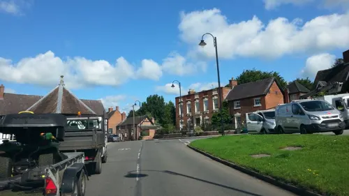
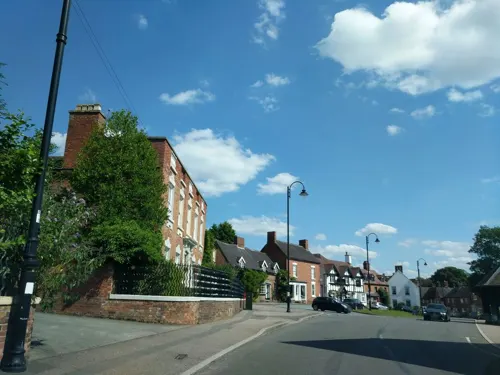
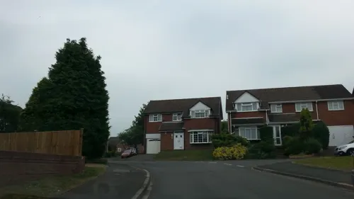
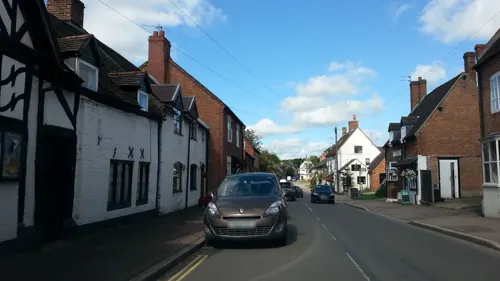
- Mapillary (see each image): photos
- OpenStreetMap contributors (ODbL 1.0): places, airports, map data
- Wikidata (CC0 1.0): elevation, founding date, time zone, website, landmarks and historic places
- Wikimedia Commons (see each image): photos
- Wikipedia (CC BY-SA 4.0): overview and history text
Photo credits
- Abbots Bromley Horn Dance Outside the Bagots Arms, Mariegriffiths, CC BY-SA 4.0
- St Michael's Church, Hamstall Ridware, Bs0u10e01, CC BY-SA 3.0
- HolyAngelsHoarCross1, Andrewrabbott ( talk ), Public domain
- Coach and Horses, Abbots Bromley, JThomas, CC BY-SA 2.0
- Street-level photo, adam2, CC BY-SA 4.0
- Street-level photo, adam2, CC BY-SA 4.0
- Street-level photo, adam2, CC BY-SA 4.0
- Street-level photo, adam2, CC BY-SA 4.0
- Street-level photo, adam2, CC BY-SA 4.0
Page built November 10, 2026. Spotted a mistake? Tell us or suggest a place.