


Lichfield, United Kingdom
Lichfield is a town of 34,738 people in England, United Kingdom.
Why visit Lichfield
Townapedia lists 25 museums and landmarks, 23 parks and trails, 91 places to eat, 5 places to stay and 2 attractions in and around town.
Highlights include Lichfield Garrick, Lichfield Garrick Theatre, Erasmus Darwin House and Letocetum Roman Baths and Museum.
Weather in Lichfield
Forecast from MET Norway (CC BY 4.0). Full forecast
About Lichfield
Lichfield () is a cathedral city and civil parish in Staffordshire, England. It is situated 18 miles (29 km) south-east of Stafford, 9 miles (14 km) north-east of Walsall, 8 miles (13 km) north-west of Tamworth, 13 miles (21 km) south-west of Burton upon Trent and Derby, and 14 miles (22.5 km) north of Birmingham. At the time of the 2021 census, the population was 34,738 and that of the wider Lichfield District was 106,400.
From the Wikipedia article Lichfield (this version), under CC BY-SA 4.0.
Travel tips from other travellers: Lichfield on Wikivoyage (CC BY-SA 4.0).
Photos of Lichfield


Things to do2

Lichfield Garrick Theatre
Cinema and theater
Theatre in Lichfield, England
Museums and landmarks25

Erasmus Darwin House
Museum · 0.4 mi
Grade I listed historic house museum in Lichfield, United Kingdom


The Samuel Johnson Birthplace Museum
Museum
Breadmarket Street, Lichfield
Mo-Su 10:30-16:30

Lichfield War Memorial
Monument and historic site
War memorial in Lichfield, Staffordshire, England
Samuel Johnson Birthplace Museum
Museum
Grade I listed biographical museum in Lichfield, United Kingdom

Staffordshire Regiment Museum
Museum · 2.5 mi
Military museum in Lichfield, Staffordshire, United Kingdom



13 more on the map.
Parks, trails and playgrounds23





11 more on the map.
Restaurants and cafes91
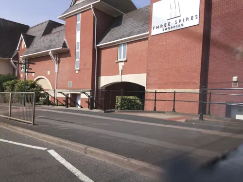
Coffee#1
Cafe · Coffee Shop
3-5 Gresley Row, Lichfield
Mo-Fr 07:30-17:30; Sa 08:00-18:00; Su 09:00-17:00

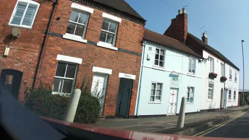

Brewhouse & Kitchen
Bar and pub
1 Bird Street, Lichfield
Mo-We 11:00-23:00; Th 11:00-24:00; Fr-Sa 11:00-01:00; Su 11:00-23:00


The Quill and Scholar
Restaurant · Grill
12-14 Tamworth Street, Lichfield
Mo-Sa 12:00-23:00, Su 12:00-22:00
79 more on the map.
History
The earliest evidence of settlement is Mesolithic flints discovered on the high ground of the cemetery at St Michael on Greenhill, which may indicate an early flint industry. Traces of Neolithic settlement have been discovered on the south side of the sandstone ridge occupied by Lichfield Cathedral.
The site of Letocetum{{efn|The Brittonic *Lētocaiton, "Greywood") lies 2.2 mi (3.5 km) south-west of Lichfield, near the point where Icknield Street crosses Watling Street. Established in AD 50 as a Roman military fortress, it had become a civilian settlement (vicus) with a bath house and a mansio by the 2nd century. Letocetum fell into decline by the 4th century and the Romans had left by the fifth century. There have been scattered Romano-British finds in Lichfield and it is possible that a burial discovered beneath the cathedral in 1751 was Romano-British. There is no evidence of what happened to Letocetum after the Romans left; however, Lichfield may have emerged as the inhabitants of Letocetum relocated during its decline. A Cair Luit Coyd ("Fort Greywood") was listed by Nennius among the 28 cities of Britain in his Historia Brittonum, although these were largely historic remembrances of early Sub-Roman Britain.
Read more of the history
The early history of Lichfield is obscure. The first authentic record occurs in Bede's history, where it is called Licidfelth and mentioned as the place where St Chad fixed the episcopal see of the Mercians in 669. The first Christian king of Mercia, Wulfhere, donated land at Lichfield for Chad to build a monastery. It was because of this that the ecclesiastical centre of Mercia became settled as the Diocese of Lichfield, which was approximately 7 miles (11 km) north-west of the seat of the Mercian kings at Tamworth.
In July 2009, the Staffordshire Hoard, the largest collection of Anglo-Saxon gold ever found, was discovered in a field in the parish of Hammerwich, 4 mi (6.4 km) south-west of Lichfield; it was probably deposited in the 7th century.
The first cathedral was built on the present site in 700 when Bishop Hædde built a new church to house the bones of St Chad, which had become the centre of a sacred shrine to many pilgrims when he died in 672. The burial in the cathedral of the kings of Mercia, Wulfhere in 674 and Ceolred in 716, further increased the city's prestige. In 786 King Offa made the city an archbishopric with authority over all the bishops from the Humber to the River Thames; his appointee was Archbishop Hygeberht. This may have been motivated by Offa's desire to have an archbishop consecrate his son Ecgfrith as king, since it is possible Jænberht refused to perform the ceremony, which took place in 787. After King Offa's death in 796, Lichfield's power waned; in 803 the primacy was restored to Canterbury by Pope Leo III after only 16 years.
The Historia Brittonum lists the city as one of the 28 cities of Britain around AD 833.
During the ninth century, Mercia was devastated by Danish Vikings. Lichfield itself was unwalled and the cathedral was despoiled, so Bishop Peter moved the see to the fortified and wealthier Chester in 1075. At the time of the Domesday Book survey (1086), Lichfield was held by the Bishop of Chester; it was listed as a small village. The lord of the manor was the Bishop of Chester until the reign of Edward VI.
In 1102, Bishop Peter's successor, Robert de Limesey, transferred the see from Chester to Coventry. The Bishop of Coventry and Lichfield had seats in both locations; work on the present Gothic cathedral at Lichfield began in 1195.
In 1153, a markets charter was granted by King Stephen and, ever since, weekly markets have been held in the Market Square.
Bishop Roger de Clinton was responsible for transforming the scattered settlements to the south of Minster Pool into the ladder-plan streets existing today. Market Street, Wade Street, Bore Street and Frog Lane linked Dam Street, Conduit Street and Bakers Lane on one side with Bird Street and St John Street on the other. Bishop de Clinton also fortified the cathedral close and enclosed the town with a bank and ditch, and gates were set up where roads into the town crossed the ditch. In 1291, Lichfield was severely damaged by a fire which destroyed most of the town; however the Cathedral and Close survived unscathed.
In 1387, Richard II gave a charter for the foundation of the guild of St Mary and St John the Baptist; this guild functioned as the local government, until its dissolution by Edward VI, who incorporated the town in 1548.
The policies of Henry VIII had a dramatic effect on Lichfield. The Reformation brought the disappearance of pilgrim traffic following the destruction of St Chad's shrine in 1538, which was a major loss to the city's economic prosperity. That year too the Franciscan Friary was dissolved, the site becoming a private estate. Further economic decline followed the outbreak of plague in 1593, which resulted in the death of over a third of the entire population.
Three people were burned at the stake for heresy under Mary I. The last public burning at the stake for heresy in England took place in Lichfield, when Edward Wightman from Burton upon Trent was executed by burning in the Market Place on 11 April 1612 for promoting himself as the divine Paraclete and Saviour of the world.
From the History section of Lichfield on Wikipedia, under CC BY-SA 4.0.
More about Lichfield
Geography
Lichfield covers an area of approximately 5.41 sq mi (14.0 km2) in the south-east of the county of Staffordshire, in the West Midlands region of England. It lies approximately 17 mi (27 km) north of Birmingham and 120 mi (200 km) north-west of London. The city is located between the high ground of Cannock Chase to the west and the valleys of the rivers Trent and Tame to the east.
It is underlain by red sandstone, deposited during the arid desert conditions of the Triassic period. Mercia Mudstone underlies the north and north-eastern edges of the city towards Elmhurst and Curborough. The red sandstone underlying the majority of Lichfield is present in many of its ancient buildings, including Lichfield Cathedral and the Church of St Chad.
The ground within the city slopes down from 116m in the north-west to 86m on the sandstone shelf where Lichfield Cathedral stands. To the south and east of the city centre is a ridge which reaches 103 m at St Michael on Greenhill. Boley Park lies on top of a ridge with its highest point on Borrowcop Hill at 113m. To the south-east the level drops to 69 m where Tamworth Road crosses the city boundary into Freeford. There is another high ridge south-west of the city where there are two high points, one at Berry Hill Farm at 123 m and the other on Harehurst Hill near the city boundary at Aldershawe where the level reaches 134 m.
Economy
Lichfield's wealth grew along with its importance as an ecclesiastical centre. The original settlement prospered as the place where pilgrims gathered to worship at the shrine of St Chad: this practice continued until the Reformation, when the shrine was destroyed.
In the Middle Ages, the main industry was making woollen cloth; there was also a leather industry. Much of the surrounding area was open pasture, and there were many surrounding farms.
In the 18th century, Lichfield became a busy coaching centre. Inns and hostelries grew up to provide accommodation, and industries dependent on the coaching trade such as coach builders, corn and hay merchants, saddlers, and tanneries began to thrive. The Corn Exchange was designed by T. Johnson and Son and completed in 1850.
The invention of the railways saw a decline in coach travel, and with it came the decline in Lichfield's prosperity. By the end of the 19th century, brewing was the principal industry, and in the neighbourhood were large market gardens which provided food for the growing populations of nearby Birmingham and the Black Country.
Arts and culture
The Lichfield Greenhill Bower takes place annually on Spring Bank Holiday. Originating from a celebration that was held after the Court of Arraye in the 12th century, the festival has evolved into its modern form, but has kept many of its ancient traditions. After a recreation of the Court of Arraye at the Guildhall, a procession of marching bands, morris men and carnival floats makes its way through the city and the Bower Queen is crowned outside the Guildhall. There is a funfair in the city centre, and another fair and jamboree in Beacon Park.
The Lichfield Festival, an international arts festival, has taken place every July for 30 years. The festival is a celebration of classical music, dance, drama, film, jazz, literature, poetry, visual arts and world music. Events take place at many venues around the city but centre on Lichfield Cathedral and the Garrick Theatre. Popular events include the medieval market in the Cathedral Close and the fireworks display which closes the festival.
Triennially the Lichfield Mysteries, the biggest community theatre event in the country, takes place at the cathedral and in the Market Place. It consists of a cycle of 24 medieval-style plays involving over 600 amateur actors. Other weekend summer festivals include the Lichfield Folk Festival and The Lichfield Real Ale, Jazz and Blues Festival.
Education
In addition to nine primary schools and one infant school, Lichfield has three secondary schools:
Nether Stowe School, a comprehensive school with specialist Maths and Computing college status.
Lichfield Cathedral School: A co-educational school for ages 3 to 18, based in the Cathedral Close and Longdon
Maple Hayes School: A DfES Approved Special School for dyslexic children.
The Lichfield campus of the University of Staffordshire and South Staffordshire College is located on the Friary. This campus facility was opened in 1998, offering further and higher education courses up to and including master's degrees. A £3 million school of art, design and media, housed in purpose-built accommodation, opened in 2006. This facility received the highest possible grade of 'outstanding provision' in the latest Ofsted inspection report.
Lichfield Library and Record Office was located on the corner of St John Street and The Friary. The building also included an adult education centre and a small art gallery. The library occupied this building in 1989, when it moved from the Lichfield Free Library and Museum on Bird Street. The library moved into the newly renovated St Mary's Church on Market Square in 2018
From the Wikipedia article Lichfield, under CC BY-SA 4.0.
Notable people from Lichfield
 Samuel JohnsonEnglish writer and lexicographer (1709–1784)Photo: Joshua Reynolds, Public domain
 Elias AshmoleEnglish antiquarian, politician, officer of arms, astrologer and alchemist (1617-1692)Photo: After John Riley, Public domain
 Sophie CapewellBritish sporting cyclistPhoto: Nicola, CC BY-SA 4.0
 Siân BrookeBritish actressPhoto: JaceMerlyn, CC BY-SA 4.0
 John ColsonmathematicianPhoto: John Wollaston the Younger, Public domain
 Richard GarnettBritish scholar, librarian, biographer and poet (1835-1906)Photo: Internet Archive Book Images, No restrictions
 Sue WilliamsonSouth African artist (born 1941)Photo: Suewilliamson, CC BY-SA 4.0
 Jeremy MooreEnglish senior Royal Marine officer (1928–2007)Photo: Dickbrettbohrer, CC0
 Freya GregoryEnglish footballerPhoto: Steffen Prößdorf, CC BY-SA 4.0
- Henry SaltEnglish artist, traveller, diplomat, and egyptologist (1780-1827)
- Robert DarwinEnglish medical doctor; father of naturalist Charles Darwin
- John HinchBritish musician (1947-2021)
Born in Lichfield, according to Wikidata (CC0). Each name links to its Wikipedia article.
Where to stay5
Churches and places of worship16
Shopping17
Gas and EV charging4
Schools, colleges and libraries23
Healthcare3
Map of Lichfield
209 places. The map loads OpenStreetMap tiles when you open it.
Getting there and nearby towns
Birmingham Airport (BHX) is the nearest airport with scheduled flights listed in OpenStreetMap, 16 miles away.
- Burntwood 4 mi west, about 7 min by car
- Brownhills 6 mi southwest, about 9 min by car
- Tamworth 6 mi southeast, about 10 min by car
- Aldridge 7 mi southwest, about 10 min by car
- Rugeley 7 mi northwest, about 11 min by car
- Pelsall 7 mi southwest, about 11 min by car
- Streetly 7 mi south, about 12 min by car
- Sutton Coldfield 8 mi south, about 13 min by car
- Great Wyrley 8 mi west, about 13 min by car
- Walsall 9 mi southwest, about 15 min by car
Drive times are estimates from straight-line distance, not routes.
Towns near Lichfield


Keep exploring
Local news
Headlines from INDB.
Reviews, tips and questions
Loading what members have shared...
Sources and licences
- GeoNames (CC BY 4.0): population, coordinates, regions and time zone
- Mapillary (see each image): photos
- OpenStreetMap contributors (ODbL 1.0): places, airports, map data
- Wikidata (CC0 1.0): elevation, founding date, time zone, website, landmarks and historic places
- Wikimedia Commons (see each image): photos
- Wikipedia (CC BY-SA 4.0): overview and history text
Photo credits
- Lichfield Cathedral East1, Leon Hawley, CC BY 3.0
- Birmingham Road, Lichfield - bus 820 - Midland Classic (26193057820), Elliott Brown from Birmingham, United Kingdom, CC BY-SA 2.0
- Lichfield Bus Station - Birmingham Road, Lichfield (6669171125), Elliott Brown from Birmingham, United Kingdom, CC BY 2.0
- Lichfield City Station (6668742069), Elliott Brown from Birmingham, United Kingdom, CC BY 2.0
- Lichfield City Station (6668765411), Elliott Brown from Birmingham, United Kingdom, CC BY 2.0
- Lichfield City Station (6668719811), Elliott Brown from Birmingham, United Kingdom, CC BY 2.0
- Lichfield City Station (6668711685), Elliott Brown from Birmingham, United Kingdom, CC BY 2.0
- Lichfield City Station (6668724487), Elliott Brown from Birmingham, United Kingdom, CC BY 2.0
- Lichfield Cathedral (32817515955), Dr Bob Hall from Birmingham, England, CC BY-SA 2.0
- Erasmus Darwin House, Bs0u10e01, CC BY-SA 3.0
- Garden of Remembrance - Lichfield - war memorial (6681152815), Elliott Brown from Birmingham, United Kingdom, CC BY 2.0
- The Staffordshire Regiment Museum - Exterior, WarMagician at English Wikipedia, CC BY 3.0
- Beacon Park, Bs0u10e01, CC BY-SA 3.0
- St Marys Lichfield 1, Bs0u10e01, CC BY-SA 3.0
- Lichfield Garrick Theatre, Bs0u10e01, CC BY 3.0
- Letocetum Title, Bs0u10e01, CC BY 3.0
- Johnsons Birthplace, Bs0u10e01, CC BY 3.0
- Christ Church Lichfield, Bs0u10e01, CC BY 3.0
- Church of St Chad, Lichfield, User:Bs0u10e01, CC BY 3.0
- Lich Cath Face, Bs0u10e01, CC BY-SA 3.0
- Lich Clock Tower, Bs0u10e01, CC BY 3.0
- The Kings Head 21 Bird Street Lichfield WS13 6PW, Spudgun67, CC BY-SA 4.0
- LichCathedral5, Roger Robinson, CC BY-SA 3.0
- The Home Front in Britain, 1944 TR2323, Ministry of Information official photographer, Public domain
- Letocetum view from St.John the Baptist Church, Harold9595959, CC BY-SA 4.0
- St Michael on Greenhill Front, Bs0u10e01, CC BY 3.0
- Diamond East Midlands - Linkup (15017 - WN74 YFO) - 28 May 2025, Aethonatic, CC0
- Chaserider(541), Midlandsbuses, CC0
- Chaserider Volvo B8RLE Evora 639, Midlandsbuses, CC0
- Heartlands Bus bus 133 (82 HCB), 31 December 2010, Sherpa_536, CC BY 2.0
- Bus Link (34 - YJ67 FZT) - 28 May 2025, Aethonatic, CC0
- Bennetts Coaches (BK14 LDZ) - 28 May 2025, Aethonatic, CC0
- Guildhall, Lichfield (3675814071), Elliott Brown from Birmingham, United Kingdom, CC BY 2.0
- Prince's Park – Plaque 01, BrownhillsBoy, CC BY-SA 4.0
- Street-level photo, southglos, CC BY-SA 4.0
- Street-level photo, adam2, CC BY-SA 4.0
- Street-level photo, southglos, CC BY-SA 4.0
- Street-level photo, southglos, CC BY-SA 4.0
- Street-level photo, editid, CC BY-SA 4.0
- Street-level photo, southglos, CC BY-SA 4.0
- Street-level photo, jamestait, CC BY-SA 4.0
- Street-level photo, southglos, CC BY-SA 4.0
- Street-level photo, jamestait, CC BY-SA 4.0


Page built November 10, 2026. Spotted a mistake? Tell us or suggest a place.