

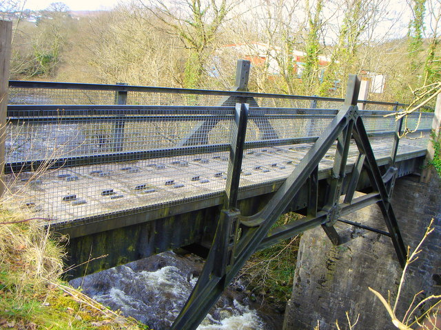


Abercanaid, United Kingdom
Abercanaid is a town of 5,061 people in Wales, United Kingdom.
Why visit Abercanaid
Townapedia lists 4 museums and landmarks, 2 parks and trails, 29 places to eat, 4 places to stay and 5 attractions in and around town.
Highlights include Pont-y-Cafnau and Vue Merthyr Tydfil.
Weather in Abercanaid
Forecast from MET Norway (CC BY 4.0). Full forecast
About Abercanaid
Abercanaid (Welsh: Abercannaid) is a small village in the county borough of Merthyr Tydfil, Glamorgan, Wales, United Kingdom with a population of about 5,060. It is situated 2.5 miles (4.0 km) south of Merthyr town centre and west of Pentrebach, across the River Taff and north of Troedyrhiw. The Taff Trail runs through the village, adjacent to the path of the disused Glamorganshire Canal, which was an important means of transporting iron and coal during the industrial boom in which the South Wales Valleys prospered.
From the Wikipedia article Abercanaid (this version), under CC BY-SA 4.0.
Things to do5



Museums and landmarks4

Technology
Monument and historic site · 1.3 mi
Public Art Installation by Charles Sainsbury
The Robert and Lucy Thomas Memorial Fountain
Monument and historic site · 1.4 mi
Parks, trails and playgrounds2


Restaurants and cafes29

Frankie & Benny's
Diner · American · 1.2 mi
8, Merthyr Tydfil
Mo-Th 11:30-21:00; Fr-Sa 11:30-22:00; Su 11:30-21:00

New Crown Inn
Restaurant · 1.5 mi
28 High Street, Merthyr Tydfil
Mo off; Tu-We 12:00-23:00; Th-Sa 12:00-24:00; Su 12:00-23:00


17 more on the map.
History
Most of the Housing Estate was built in 1860 to sustain the collieries. The Waun Wyllt colliery was opened as a level mine in 1824 and was later renamed the Abercanaid Colliery. Gethin Colliery was located close to the canal and was sunk in 1849. There were two serious accidents at the colliery where 47 men and boys died on 19 February 1862
The village has three public houses: The Colliers Arms, The Richards Arms and Llywnyreos Inn. The Richards Arms boasts the football side for the village, whereas The Colliers Arms and Llywnyreos are more notable for their involvement in local league darts. At one time, Abercanaid had a total of seven pubs: the aforementioned three, The Duffryn Arms, The White Hart, The Glamorgan Arms and The Gethin Inn.
The Glamorganshire Canal passed along the edge of the Village. It was constructed around 1800 and fell into decline following the construction of the railways, eventually becoming disused. Abercanaid was one of the stations on the Quakers Yard and Merthyr Railway. The line and the Station became disused in the 1960s, and now the nearby Pentrebach Train Station serves the village.
Chapel Street was so named because of the three chapels that once stood in it. The only existing one left is the Zion Chapel on the corner of Cardiff Street. Graig Chapel was demolished in the late 1990s and replaced by houses. The local church is St. Peter and Paul.
Read more of the history
Work began on constructing a new, modern school, Abercanaid Community School, in October 2001. The school is situated on the site of Abercanaid Park and is run by long-time headteacher Mike Sullivan. It officially opened on 22 January 2003. The school acts as a feeder to Afon Taf High School, Cyfarthfa High School, and Bishop Hedley High School.
A famous ex-pupil of the school is Petula Clark, who spent some time as a child in the village living with her family. She returned to Abercanaid on 24 January 2007 as part of the BBC series, 'Coming Home' and was greeted by the pupils, including Robyn Williams, who performed a selection of songs for her, including her own hit song, Downtown.
Another former Abercanaid pupil and resident is synth, FX and sampler Lyndon Jones of the now-disbanded band Midasuno.
From the History section of Abercanaid on Wikipedia, under CC BY-SA 4.0.
Notable people from Abercanaid
- Leighton Durham ReynoldsBritish classical scholar (1930–1999)
- Dai EvansWelsh footballer (1902-1951)
- Dai RichardsWelsh footballer (1906-1969)
Born in Abercanaid, according to Wikidata (CC0). Each name links to its Wikipedia article.
Where to stay4
Churches and places of worship16
Shopping3
Gas and EV charging1
Schools, colleges and libraries7
Map of Abercanaid
71 places. The map loads OpenStreetMap tiles when you open it.
Getting there and nearby towns
Cardiff Airport (CWL) is the nearest airport with scheduled flights listed in OpenStreetMap, 22 miles away.
- Merthyr Tydfil 2 mi north, about 3 min by car
- Aberfan 3 mi southeast, about 4 min by car
- Mountain Ash 3 mi south, about 5 min by car
- Fochriw 3 mi east, about 5 min by car
- Aberdare 4 mi west, about 6 min by car
- Rhymney 4 mi northeast, about 7 min by car
- Treharris 5 mi southeast, about 8 min by car
- Rhondda 6 mi southwest, about 9 min by car
- Ferndale 6 mi southwest, about 9 min by car
- Abercynon 6 mi south, about 9 min by car
Drive times are estimates from straight-line distance, not routes.
Towns near Abercanaid


Keep exploring
Local news
Headlines from INDB.
Reviews, tips and questions
Loading what members have shared...
Sources and licences
- GeoNames (CC BY 4.0): population, coordinates, regions and time zone
- Mapillary (see each image): photos
- OpenStreetMap contributors (ODbL 1.0): places, airports, map data
- Wikidata (CC0 1.0): elevation, founding date, time zone, website, landmarks and historic places
- Wikimedia Commons (see each image): photos
- Wikipedia (CC BY-SA 4.0): overview and history text
Photo credits
- Egg-ended boiler shed, Abercanaid, Andy Dingley, CC BY-SA 3.0
- Pont y Cafnau iron rail bridge and aqueduct, John Wilson, CC BY-SA 2.0
- Y tu mewn i gapel Bethania, Aberpennar, GeraintTudur2, CC BY-SA 3.0
- Abernant St Matthews Church, Nick Earl, CC BY-SA 2.0
- Ynysgau Chapel, Unknown author, Public domain
- Vue Cinema Merthyr Tydfil, Sionk, CC BY-SA 4.0
- Street-level photo, southglos, CC BY-SA 4.0
- Street-level photo, trigpoint, CC BY-SA 4.0
- Street-level photo, trigpoint, CC BY-SA 4.0
- Street-level photo, southglos, CC BY-SA 4.0
- Street-level photo, southglos, CC BY-SA 4.0
- Street-level photo, editid, CC BY-SA 4.0
- Street-level photo, editid, CC BY-SA 4.0
- Street-level photo, editid, CC BY-SA 4.0
- Street-level photo, editid, CC BY-SA 4.0
Page built November 10, 2026. Spotted a mistake? Tell us or suggest a place.