

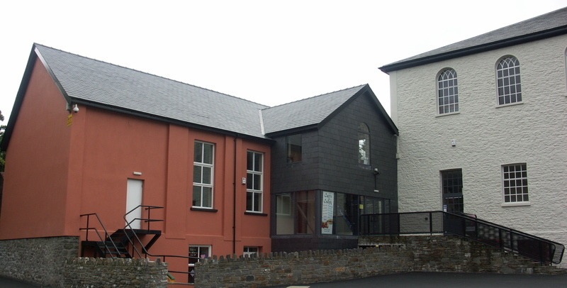
Why visit Fochriw
Townapedia lists 4 museums and landmarks, 4 parks and trails, 16 places to eat, 1 place to stay and 3 attractions in and around town.
Highlights include Pen Garn-Bugail, Rhymney War Memorial, Parc Bryn Bach and Parc Cwm Darran.
Weather in Fochriw
Forecast from MET Norway (CC BY 4.0). Full forecast
About Fochriw
Fochriw (Welsh pronunciation: [vɔxˈrɪu̯]) is a village in Caerphilly County Borough, Wales. It was well known for its neighbouring collieries, which employed nearly the entire local population in the early 20th century. It lies within the historic county boundaries of Glamorgan. The village appears as the backdrop on the BBC Wales sitcom High Hopes credits.
From the Wikipedia article Fochriw (this version), under CC BY-SA 4.0.
Things to do3


Museums and landmarks4

Parks, trails and playgrounds4



Restaurants and cafes16


Mount Pleasant Inn
Bar and pub · 0.6 mi
Mount Pleasant Row, Bargoed
The Blast Furnace Inn
Bar and pub · 1.0 mi
Board Street, Bargoed
Pontlottyn Empire Club
Bar and pub · 0.9 mi
7 Stuart Street, Bargoed
The Brewery Club
Bar and pub · 1.5 mi
Old Brewery Lane, Tredegar

The Golden Fry
Fast food · Fish And Chips, Burger · 1.5 mi
49 High Street, Tredegar
Mo-Sa 11:30-22:00; Su 17:00-22:00
Hot Wok
Fast food · 1.6 mi
77 High Street, Tredegar
Mo Off; Tu-Su 17:00-23:30
Bertie's Place
Fast food · Fish And Chips · 1.3 mi
5 Jerusalem Street, Tredegar
4 more on the map.
History
Fochriw's growth was germinated to a lesser extent by the Rhymney Iron Company’s demand for ironstone, and to a greater extent by the Dowlais Ironworks’ need for high-quality coal. The coal was of such good quality that it could be directly used in the iron-making process without the need for conversion to coke.
Over a period of about 130 years, the landscape changed from rural to industrial and then back to rural, as it is today. However, the latter changes did not take place until relatively recently when nearly all the remnants of the coal mining industry were removed from around the village.
From the History section of Fochriw on Wikipedia, under CC BY-SA 4.0.
More about Fochriw
Education
The first school in the area was a National School at Pentwyn. It was opened in 1856 by the Gellygaer Charities which were left to the parish by Edward Lewis of Gilfach Bargoed in 1715.
The new infant school was opened in July 1910 and was attended for instruction by the scholars for the first time on the first Monday of September 1910. In April 1911 a half acre of land adjacent to the existing school was bought for £20. It was not until September 1912 that a letter was written to the building committee of the County Council recommending that a new school be built.
On 1 April 1971 both Infants and Junior schools combined under one Head Teacher to become Fochriw Primary School. A Nursery was opened at Plantation Terrace in 1973.
From the Wikipedia article Fochriw, under CC BY-SA 4.0.
Where to stay1
Churches and places of worship8
St Mary and St Andrew Church
Church · Church In Wales · 0.6 mi
Gelligaer Common, Bargoed
Shopping1
Gas and EV charging1
Schools, colleges and libraries5
Healthcare5
Map of Fochriw
48 places. The map loads OpenStreetMap tiles when you open it.
Getting there and nearby towns
Cardiff Airport (CWL) is the nearest airport with scheduled flights listed in OpenStreetMap, 24 miles away.
- Rhymney 1 mi north, about 2 min by car
- Tredegar 3 mi northeast, about 5 min by car
- Merthyr Tydfil 3 mi west, about 6 min by car
- Ebbw Vale 5 mi northeast, about 7 min by car
- Bargoed 5 mi southeast, about 8 min by car
- Treharris 5 mi south, about 8 min by car
- Mountain Ash 5 mi southwest, about 8 min by car
- Gelligaer 6 mi south, about 9 min by car
- Nelson 6 mi south, about 10 min by car
- Blackwood 6 mi southeast, about 10 min by car
Drive times are estimates from straight-line distance, not routes.
Towns near Fochriw


Keep exploring
Local news
Headlines from INDB.
Reviews, tips and questions
Loading what members have shared...
Sources and licences
- GeoNames (CC BY 4.0): population, coordinates, regions and time zone
- Mapillary (see each image): photos
- OpenStreetMap contributors (ODbL 1.0): places, airports, map data
- Wikidata (CC0 1.0): elevation, founding date, time zone, website, landmarks and historic places
- Wikimedia Commons (see each image): photos
- Wikipedia (CC BY-SA 4.0): overview and history text
Photo credits
- Fochriw Pentecostal Mission, Jaggery, CC BY-SA 2.0
- Canolfan Soar, Merthyr Tudful, Daicaregos, CC BY-SA 4.0
- Street-level photo, trigpoint, CC BY-SA 4.0
- Street-level photo, trigpoint, CC BY-SA 4.0
- Street-level photo, southglos, CC BY-SA 4.0
- Street-level photo, southglos, CC BY-SA 4.0
- Street-level photo, southglos, CC BY-SA 4.0
- Street-level photo, southglos, CC BY-SA 4.0
Page built November 10, 2026. Spotted a mistake? Tell us or suggest a place.