


Why visit Aberfan
Townapedia lists 3 museums and landmarks, 5 places to eat and 4 attractions in and around town.
Highlights include Pont-y-gwaith.
Weather in Aberfan
Forecast from MET Norway (CC BY 4.0). Full forecast
About Aberfan
Aberfan (Welsh pronunciation: [ˌabɛrˈvan]) is a former coal mining village in the Taff Valley 4 mi (6 km) south of the town of Merthyr Tydfil, Wales, in the community of Merthyr Vale, in the principal area of Merthyr Tydfil.
From the Wikipedia article Aberfan (this version), under CC BY-SA 4.0.
Things to do4

Pont-y-gwaith
Bridge · 1.4 mi
Historical bridge over the River Taff near Edwardsville, Merthyr Tydfil, Wales

Museums and landmarks3
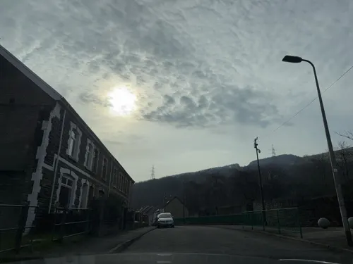

Restaurants and cafes5
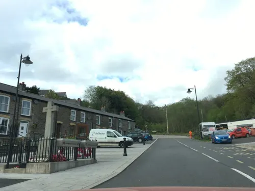
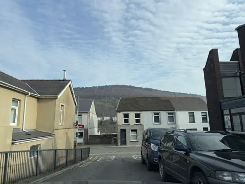
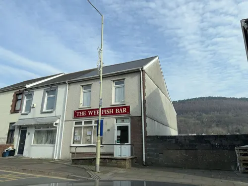


Churches and places of worship11

Bethania
Church · 1.6 mi
Chapel in Mountain Ash, Rhondda Cynon Taf, Wales
Rhos Welsh Baptist Chapel
Church · 1.6 mi
Church in Mountain Ash, Wales, UK

Bethel Calvinistic Methodist Chapel
Church · 3.4 mi
Chapel in Ynysybwl, Rhondda Cynon Taf, Wales
Bethesda Baptist Chapel
Church · 2.9 mi
Chapel in Abercwmboi, Rhondda Cynon Taf, Wales
Capel Bethania
Church · 2.9 mi
Former chapel in Abercynon, Rhondda Cynon Taf, Wales
History
Aberfan consisted of two cottages and an inn frequented by local farmers and bargemen until 23 August 1869, when John Nixon and his partners started the Merthyr Vale Colliery.
Between 1952 and 1965, with mountains denuded there was severe flooding in the Pantglas area of Aberfan on at least 11 occasions.
By 1966 the population had grown to approximately 5,000, most of whom were employed in the coal industry.
For many years, millions of cubic metres of excavated mining debris from the colliery were deposited on the side of Mynydd Merthyr, directly above the village of Aberfan on the opposite side of the valley. Huge piles, or "tips", of loose rock and mining spoil had been built up over a layer of highly porous sandstone that contained numerous underground springs, and several tips had been built up directly over these springs. Although local authorities had raised specific concerns in 1963 about spoil being tipped on the mountain above the village primary school, these were largely ignored by the National Coal Board's area management.
Read more of the history
Early on the morning of Friday, 21 October 1966, after several days of heavy rain, a subsidence of about 3–6 metres occurred on the upper flank of colliery waste tip No. 7. At 9:15 a.m. more than 150,000 cubic metres of water-saturated debris broke away and flowed downhill at high speed. A mass of over 40,000 cubic metres of debris slid into the village in a slurry 12 m (39 ft) deep.
The slide destroyed a farm and 20 terraced houses along Moy Road, and struck the northern side of the Pantglas Junior School and part of the separate senior school, demolishing most of the structures and filling the classrooms with thick mud and rubble up to 10 m (33 ft) deep. Mud and water from the slide flooded many other houses in the vicinity, forcing many villagers to evacuate their homes.
From the History section of Aberfan on Wikipedia, under CC BY-SA 4.0.
More about Aberfan
Geography
Aberfan is situated toward the bottom of the western valley slope of the River Taff, on the eastern slope of Mynydd Merthyr hill, about four miles (6 km) south of the town Merthyr Tydfil. The Taff runs north-to-south through the village; at the upper side of the settlement, on the western outskirts, a disused Glamorganshire Canal bed and a railway embankment run parallel to the river.
Education
Aberfan has two primary schools: Ynysowen Primary School adjacent to the Grove Field; and Ysgol Gynradd Gymraeg Rhyd y Grug, which has moved to the previously occupied Ynysowen Primary School building.
From the Wikipedia article Aberfan, under CC BY-SA 4.0.
Notable people from Aberfan
 Derek VaughanBritish politician (born 1961)Photo: Lukasz Kobus / European Union, 2023..., CC BY 4.0
- Peter StimpsonWelsh cricketer
- Frank ViningBritish potter
- Peter VaughanWelsh chief constable
- Con MurphyWelsh rugby union and rugby league footballer
- Nansi WilliamsBritish lunchlady
Born in Aberfan, according to Wikidata (CC0). Each name links to its Wikipedia article.
Gas and EV charging1
Schools, colleges and libraries6
Healthcare2
Map of Aberfan
32 places. The map loads OpenStreetMap tiles when you open it.
Getting there and nearby towns
Cardiff Airport (CWL) is the nearest airport with scheduled flights listed in OpenStreetMap, 20 miles away.
- Mountain Ash 2 mi west, about 3 min by car
- Treharris 2 mi southeast, about 4 min by car
- Nelson 3 mi southeast, about 6 min by car
- Gelligaer 4 mi southeast, about 7 min by car
- Merthyr Tydfil 4 mi north, about 7 min by car
- Fochriw 4 mi northeast, about 6 min by car
- Rhondda 5 mi southwest, about 8 min by car
- Bargoed 5 mi east, about 8 min by car
- Aberdare 5 mi west, about 8 min by car
- Ferndale 5 mi southwest, about 8 min by car
Drive times are estimates from straight-line distance, not routes.
Towns near Aberfan


Keep exploring
Local news
Headlines from INDB.
Reviews, tips and questions
Loading what members have shared...
Sources and licences
- GeoNames (CC BY 4.0): population, coordinates, regions and time zone
- Mapillary (see each image): photos
- OpenStreetMap contributors (ODbL 1.0): places, airports, map data
- Wikidata (CC0 1.0): elevation, founding date, time zone, website, landmarks and historic places
- Wikimedia Commons (see each image): photos
- Wikipedia (CC BY-SA 4.0): overview and history text
Photo credits
- Mynwent Aberfan Cemetery, Wales on a rainy day - Sept 2024 20, Llywelyn2000, CC BY-SA 4.0
- Pontygwaith, The original uploader was Varitek at English Wikipedia ., CC BY-SA 3.0
- Y tu mewn i gapel Bethania, Aberpennar, GeraintTudur2, CC BY-SA 3.0
- Street-level photo, southglos, CC BY-SA 4.0
- Street-level photo, southglos, CC BY-SA 4.0
- Street-level photo, editid, CC BY-SA 4.0
- Street-level photo, editid, CC BY-SA 4.0
- Street-level photo, southglos, CC BY-SA 4.0
- Street-level photo, editid, CC BY-SA 4.0
- Street-level photo, editid, CC BY-SA 4.0
Page built November 10, 2026. Spotted a mistake? Tell us or suggest a place.