

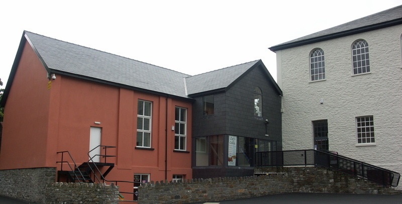
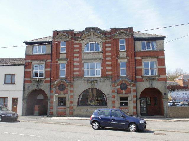
Why visit Rhymney
Townapedia lists 14 museums and landmarks, 10 parks and trails, 65 places to eat, 4 places to stay and 11 attractions in and around town.
Highlights include Beaufort Theatre, Mynydd Bedwellte, Tredegar Medical Aid Society Heritage Centre and Tredegar Museum.
Weather in Rhymney
Forecast from MET Norway (CC BY 4.0). Full forecast
About Rhymney
Rhymney (; Welsh: Rhymni [ˈr̥əmnɪ]) is a town and a community in the county borough of Caerphilly, South Wales. Until 1972 it existed in the historic county of Monmouthshire. With the villages of Pontlottyn, Fochriw, Abertysswg, Deri and New Tredegar, Rhymney is designated as the 'Upper Rhymney Valley' by the local Unitary Authority, Caerphilly County Borough Council. The community of Rhymney includes the town of Rhymney, Pontlottyn, Abertysswg, Butetown and Twyncarno.
From the Wikipedia article Rhymney (this version), under CC BY-SA 4.0.
Things to do11
Beaufort Theatre
Cinema and theater · 4.4 mi
Theatre in Blaenau Gwent, Wales


Museums and landmarks14

Tredegar Medical Aid Society Heritage Centre
Museum · 1.9 mi
10 The Circle, Tredegar
Mo Off; Tu-Sa 10:00-15:00; Su Off
Tredegar Museum
Museum · 1.9 mi
The Circle, Tredegar
We 10:00-13:00; Fr 10:00-13:00,14:00-16:30; Sa 10:00-12:00

Soar-Y-Graig Welsh Independent Chapel
Monument and historic site · 1.5 mi
Built in 1839 but had fallen derelict by 1997. All that remains are the stone walls.

The Forgotten 53 Memorial
Monument and historic site · 1.7 mi
Memorial to the 53 lives lost in the 4 mining desasters within Tredegar including Bedwellty Pits and Pochin Colliery
2 more on the map.
Parks, trails and playgrounds10



Restaurants and cafes65
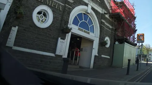
The Olympia
Bar and pub · 1.9 mi
Morgan Street, Tredegar
Mo-Th 08:00-00:00; Fr 08:00-00:00; Sa 00:00-01:00,08:00-00:00; Su...
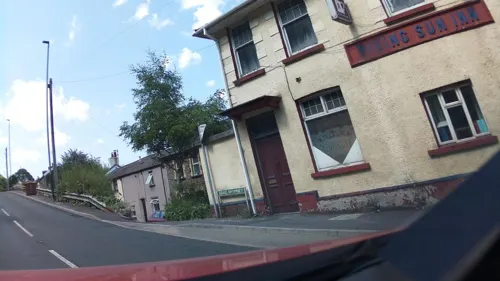
Rising Sun
Bar and pub · 2.7 mi
Graig Rhymni, Bargoed
Mo-Su 19:00-23:00

Farmers Arms
Bar and pub · Kebab, Burger, British, Grill · 0.4 mi
Old Brewery Lane, Tredegar
We-Th 16:00-23:00; Fr 16:00-00:00; Sa 15:00-00:00; Su 12:00-18:00
Prince of Wales
Bar and pub · 1.5 mi
Merthyr Road, Tredegar
Mo-Fr 11:00-23:00; Sa 11:00-00:00; Su 11:00-22:30
The Railway Tavern
Bar and pub · 2.3 mi
Dukestown Road, Tredegar
Mo off; Tu off; We-Th 17:00-23:00; Fr 13:00-15:30; Sa 17:00-23:00;...


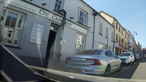
The Cambrian
Bar and pub · 1.9 mi
1-2 Castle Street, Tredegar
Mo-We 10:00-22:00; Th 10:00-23:00; Fr-Sa 10:00-00:00; Su 10:00-23:00
Happy Gathering
Restaurant · Chinese · 2.1 mi
60 Vale Terrace, Tredegar
Mo 17:00-00:00; Tu Off; We-Su 17:00-00:00
Morgans Coffee Shop
Cafe · Cake, Breakfast, Coffee Shop · 1.9 mi
8-9 Castle Street, Tredegar
Mo Off; Tu-Sa 09:00-16:00; Su 09:30-15:00
53 more on the map.
History
The countryside around present day Rhymney would have been very different in the early 17th century. In 1624 the parish of Bedwellty was created which covered the lower division of the Wentloog Hundred, in the county of Monmouth, a hilly district between the River Rhymney on the west and the Sirhowy River on the east. The upper Sirhowy Valley at this time would have been a natural well-wooded valley, consisting of a few farms and the occasional small ironworks where iron ore and coal had occurred together naturally. Later it would have contained the chapelries of Rhymney and Tredegar, the latter being known as a market town. Industrialisation began in the 1750s with the establishment of the Sirhowy Ironworks. However, in his famous An historical tour in Monmouthshire, historian William Coxe (1801) referred to: the rich vale of Carno; the diffridfs fertilifed by the Rumney; the romantic vallies of the Ebwy and Sorwy; and the whole of the beautiful and undulating country I vlfited in thefe excurfions.
Read more of the history
In 1906 John Edward Lloyd, the Welsh historian, documented that in 1800 David Evans, Thomas Williams, John Ambrose and Richard Cunningham entered into an agreement to build a furnace and to carry on an iron works and a cast iron trade on a plot of land owned by the Duke of Beaufort and Mr Glover. The name of the firm was The Union Iron Company. The works started production in 1801. Two years later negotiations were conducted by Benjamin Hall and a partnership was formed between Richard Crawshay, Watkin George, Benjamin Hall, Richard Cunningham and Thomas Williams to form The Union Iron Works Company. After documenting the arrangements of the partnership, Lloyd (1906) then documented: 'then appears the following remarkable provision: about which Jones commented: 'Possibly it refers to a Small Forge or Smith's Shop being established.'
In the following year a dispute arose between Cunningham and Crawshay whereby the latter accused the former 'with having improperly drawn up bills on account of the co-partnership', of being, as Lloyd (1906) put it, 'a swindler, or words to that effect.' Subsequently Cunningham responded to the dispute by inaugurating a suit against Crawshay and others which alleged that his signature on the deed of Dissolution of the previous partnership had been improperly obtained and under threats and duress, and was altogether void ....' Lloyd (1906) commented: 'it may be assumed that Mr. Cunningham could not, and did not, continue a member of the firm any longer'. And he observed that, after 1806: A whole troupe of English Ironmasters had invaded the Welsh Hills, the indigenous Welsh inhabitants being either lookers-on, or hewers and drawers for those who, with capital and skill, soon changed the solitudes of the high plateau land and the valleys and slopes of the mountains, from a solitude into a teeming hive of human industry. The Welsh looked on and wondered at the changes effected before their eyes: great furnaces being erected in every direction, and money lavishly expended by strangers, of whom they scarcely knew the names, and nothing as to where they came from, except from Staffordshire, London, or Bristol.
In 1825 the Bute Iron Works were built, so-called because it was built on land owned by the Marquess of Bute. It was situated on the right bank of the River Rhymney and immediately opposite the Union Iron Works. Its partners were William Forman, Thomas Seton and Thomas Johnson. The lease for the land was for 92 years. However, a few years after 1825 or thereabouts, the owners of the adjoining Bute Works and The Union Iron Works Company agreed that they should be amalgamated to form one company, the Rhymney Iron Company (Rhymney and Bute). Mushet (1840) observed that the company had six blast furnaces.
Coal mining was occurring at Rhymney by 1870, with employee strikes of 1871, 1873, and April 1875, with a strike averted there and at nearby Dowlais.
In 1906, Sir Henry W. Tyler, the Chairman of Rhymney Iron Company, Limited wrote to Lloyd from London in response to a request for information from him about the modern history of the iron works. Tyler recalled:
A strike was threatened in July 1890 by employees of the Taff Vale and Rhymney Railway, who were seeking a reduction of working hours down to sixty hours a week. The directors threatened to close the railway, and the Cardiff Docks and Colliery too, impacting 150,000 persons.
By the early 20th century the town's collieries employed nearly the entire local population.
September 1906 saw a short strike of 6,000 miners due to the employment of non-unionist labour. The scene again was repeated in April 1913, this time with 52,000 Rhondda and Rhymney union miners against the 50,000 non-union miners employed by mine owners.
August 1911 saw the South Wales anti-Jewish riots in Rhymney, Ebbw Vale, and Tredegar, over "a long-standing grievance with respect to house rents". Shops were looted, and persons injured in conflicts with police and military personnel.
In June 1920, 15,000 miners went on strike, in support of 2,000 miners of the nearby Bargoed Colliery, over safety concerns.
In June 1925, the Rhymney United Choir of 190 mixed voices under conductor John Price gave a command performance before King George V and the Queen at Windsor Castle. The choir had won the National Eisteddfod several times. Pieces included 'God Bless the Prince of Wales', 'Yr Haf', 'Bugeilio'r gweneth gwyn', 'Hob y deri dando', 'Efe a ddaw', 'Llan baglan', 'Aberystwyth', and the 'Welsh national anthem'.
Residents of the valley faced water shortages in October 1925 with a drought to the local reservoir. In late 1925, with the slump in a demand for British coal, 5000 miners of the valley were dismissed by the Powell Durry Steam Coal Company Limited; the valley population given to be 20,000.
From the History section of Rhymney on Wikipedia, under CC BY-SA 4.0.
Notable people from Rhymney
 Haydn Llewellyn DaviesCanadian sculptorPhoto: Fungus Guy, CC BY-SA 3.0
 Alfred MathewsWelsh rugby union playerPhoto: David Duncan, Public domain
- Idris DaviesWelsh poet (1905–1953)
- Thomas JonesWelsh civil servant and educationalist (1870–1955)
- Berwyn JonesWelsh sprint athlete, rugby union and rugby league footballer (1940-2007)
- Jack Howellsfilm director (1913-1990)
- John JarmanWelsh footballer (1931-2009)
- Eric WeaverWelsh footballer (born 1943)
- Harry GreeneWelsh television personality (1923-2013)
- Wayne MumfordWelsh footballer (born 1964)
- David Rocyn-JonesBritish rugby union official
- Abel J. JonesBritish writer (1878-1949)
Born in Rhymney, according to Wikidata (CC0). Each name links to its Wikipedia article.
Where to stay4
Churches and places of worship19
Shopping9
Gas and EV charging5
Schools, colleges and libraries16
Healthcare8
Map of Rhymney
161 places. The map loads OpenStreetMap tiles when you open it.
Getting there and nearby towns
Cardiff Airport (CWL) is the nearest airport with scheduled flights listed in OpenStreetMap, 25 miles away.
- Tredegar 2 mi northeast, about 3 min by car
- Ebbw Vale 4 mi east, about 6 min by car
- Merthyr Tydfil 4 mi west, about 6 min by car
- Brynmawr 5 mi northeast, about 8 min by car
- Bargoed 6 mi southeast, about 9 min by car
- Gelligaer 7 mi south, about 11 min by car
- Treharris 7 mi south, about 11 min by car
- Mountain Ash 7 mi southwest, about 11 min by car
- Abertillery 7 mi east, about 11 min by car
- Blackwood 7 mi southeast, about 12 min by car
Drive times are estimates from straight-line distance, not routes.
Towns near Rhymney


Keep exploring
Local news
Headlines from INDB.
Reviews, tips and questions
Loading what members have shared...
Sources and licences
- GeoNames (CC BY 4.0): population, coordinates, regions and time zone
- Mapillary (see each image): photos
- OpenStreetMap contributors (ODbL 1.0): places, airports, map data
- Wikidata (CC0 1.0): elevation, founding date, time zone, website, landmarks and historic places
- Wikimedia Commons (see each image): photos
- Wikipedia (CC BY-SA 4.0): overview and history text
Photo credits
- Ynysgau Chapel, Unknown author, Public domain
- Canolfan Soar, Merthyr Tudful, Daicaregos, CC BY-SA 4.0
- Tredegar Central Surgery 1821167 730c1e4a, John Grayson, CC BY-SA 2.0
- Street-level photo, southglos, CC BY-SA 4.0
- Street-level photo, southglos, CC BY-SA 4.0
- Street-level photo, southglos, CC BY-SA 4.0
- Street-level photo, southglos, CC BY-SA 4.0
- Street-level photo, southglos, CC BY-SA 4.0
- Street-level photo, southglos, CC BY-SA 4.0
- Street-level photo, trigpoint, CC BY-SA 4.0
- Street-level photo, southglos, CC BY-SA 4.0
- Street-level photo, trigpoint, CC BY-SA 4.0
Page built November 10, 2026. Spotted a mistake? Tell us or suggest a place.