


Adderbury, United Kingdom
Adderbury is a town of 2,819 people in England, United Kingdom.
Why visit Adderbury
Townapedia lists 5 museums and landmarks, 6 parks and trails, 10 places to eat and 2 places to stay in and around town.
Highlights include Banbury Museum, Bloxham Village Museum, Adderbury Lakes and Farthinghoe Nature Reserve.
Weather in Adderbury
Forecast from MET Norway (CC BY 4.0). Full forecast
About Adderbury
Adderbury is a linear village and rural civil parish located in Oxfordshire, England, 4 miles south of Banbury and 3 miles north of Deddington. As of the 2021 census, Adderbury has a population of 3,318. Its name comes from Anglo-Saxon Eadburgesbyrig or Edburgberie, meaning "Eadburg's town", honoring Saint Eadburga, a daughter of the 7th-century King of Mercia.
From the Wikipedia article Adderbury (this version), under CC BY-SA 4.0.
Photos of Adderbury


Museums and landmarks5

Banbury Museum
Museum · 3.4 mi
Museum in Banbury, England, United Kingdom
Bloxham Village Museum
Museum · 2.7 mi
Local museum in Bloxham, England, United Kingdom

Broughton Castle
Museum · 3.8 mi
Medieval manor house in Oxfordshire, England, UK

Banbury Castle
Monument and historic site · 3.3 mi
Archaeological site in Banbury, Cherwell, England, UK
Parks, trails and playgrounds6

Adderbury Lakes
Park
Local nature reserve in Oxfordshire, England, UK
Farthinghoe Nature Reserve
Park · 4.0 mi
Nature reserve in the United Kingdom
Restaurants and cafes10

Where to stay2

History
Adderbury is an ancient village, with reference to Æthelstan granting land here to the Bishop of Winchester in 1014.
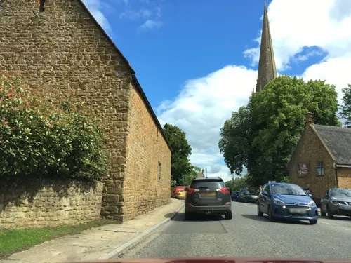
Adderbury is noted for the many honey-coloured limestone cottages and houses in the older parts of the village. East Adderbury's manor house is 16th-century and features diamond-patterned brick chimney-stacks. The Grange, also in East Adderbury, was built by John Bloxham of Banbury for Sir Thomas Cobb, first Baronet of Banbury, in 1684.
Near St Mary's Parish Church is a tithe barn that was built for New College, Oxford. In the 1970s Jennifer Sherwood dated it mainly to the 14th century but English Heritage dates the earliest parts of the building to 1422. The walls are of ashlar marlstone and the roof is of Stonesfield slate. In the 17th century the barn was reduced to its present length of five bays and partly rebuilt. In about 1877 it was altered for Lawrence Palk, 1st Baron Haldon. The barn has similarities with tithe barns at Swalcliffe and Upper Heyford, both of which were also built for New College early in the 15th century. Because of its post-Medieval alterations it is only a Grade II listed building.
Major Larnach of Adderbury House's horse Jeddah won the Epsom Derby at odds of 100–1 and also won at Ascot. The Major paid for the building of the Village Institute which opened in 1898.
From the History section of Adderbury on Wikipedia, under CC BY-SA 4.0.
Notable people from Adderbury
- Charles CobbEnglish cricketer (1863-1922)
Born in Adderbury, according to Wikidata (CC0). Each name links to its Wikipedia article.
Churches and places of worship16
Church of the Annunciation to the Blessed Virgin Mary
Church · 3.9 mi
Shopping1
Gas and EV charging1
Schools, colleges and libraries6
Map of Adderbury
47 places. The map loads OpenStreetMap tiles when you open it.
Getting there and nearby towns
Oxford Airport (OXF) is the nearest airport with scheduled flights listed in OpenStreetMap, 12 miles away.
- Kings Sutton 2 mi east, about 3 min by car
- Bloxham 3 mi west, about 4 min by car
- Deddington 3 mi south, about 4 min by car
- Banbury 3 mi north, about 6 min by car
- Brackley 7 mi east, about 11 min by car
- Hook Norton 7 mi west, about 12 min by car
- Farnborough 9 mi north, about 15 min by car
- Lower Brailes 10 mi west, about 16 min by car
- Bicester 11 mi southeast, about 17 min by car
- Woodstock 12 mi south, about 19 min by car
Drive times are estimates from straight-line distance, not routes.
Towns near Adderbury


Keep exploring
Local news
Headlines from INDB.
Reviews, tips and questions
Loading what members have shared...
Sources and licences
- GeoNames (CC BY 4.0): population, coordinates, regions and time zone
- Mapillary (see each image): photos
- OpenStreetMap contributors (ODbL 1.0): places, airports, map data
- Wikidata (CC0 1.0): elevation, founding date, time zone, website, landmarks and historic places
- Wikimedia Commons (see each image): photos
- Wikipedia (CC BY-SA 4.0): overview and history text
Photo credits
- Lyndhurst, High Street, Adderbury, Banbury, Oxfordshire, Mertbiol, CC0
- Mannville, High Street, Adderbury, Banbury, Oxfordshire, Mertbiol, CC0
- Adderbury Methodist Church, High Street, Adderbury, Banbury, Oxfordshire, Mertbiol, CC0
- Urina Cottage, High Street, Adderbury, Banbury, Oxfordshire, Mertbiol, CC0
- Long Cottage. High Street, Adderbury, Banbury, Oxfordshire, Mertbiol, CC0
- Scotts Corner, High Street, Adderbury, Oxfordshire, Mertbiol, CC0
- Adderbury Day of Dance, Jo, CC BY-SA 2.0
- Adderbury Church (St. Mary the Virgin), hugh llewelyn, CC BY-SA 2.0
- Adderbury Church (St. Mary the Virgin) - 49908696823, hugh llewelyn, CC BY-SA 2.0
- Banbury Museum - Oxford Canal, Banbury (8723264045), Elliott Brown from Birmingham, United Kingdom, CC BY 2.0
- Broughton castle2, David Stowell, CC BY-SA 2.0
- Banbury StJohnE WNW, Motacilla, CC BY-SA 4.0
- St. Mary's Church - Banbury, Jim Linwood, CC BY 2.0
- Souldern StMaryTheVirgin SouthElevation, Motacilla, CC BY-SA 3.0
- Bodicote StJohnB southeast, Motacilla, CC BY-SA 4.0
- Street-level photo, alexanderar, CC BY-SA 4.0
- Street-level photo, southglos, CC BY-SA 4.0
- Street-level photo, laye, CC BY-SA 4.0
- Street-level photo, southglos, CC BY-SA 4.0
- Street-level photo, southglos, CC BY-SA 4.0
- Street-level photo, alexanderar, CC BY-SA 4.0
- Street-level photo, southglos, CC BY-SA 4.0
- Street-level photo, southglos, CC BY-SA 4.0
- Street-level photo, alexanderar, CC BY-SA 4.0
- Street-level photo, southglos, CC BY-SA 4.0
- Street-level photo, alexanderar, CC BY-SA 4.0
- Street-level photo, alexanderar, CC BY-SA 4.0
- Street-level photo, alexanderar, CC BY-SA 4.0
- Street-level photo, laye, CC BY-SA 4.0
- Street-level photo, southglos, CC BY-SA 4.0


Page built November 10, 2026. Spotted a mistake? Tell us or suggest a place.