


Why visit Alveston
Townapedia lists 10 museums and landmarks, 7 parks and trails, 35 places to eat, 1 place to stay and 3 attractions in and around town.
Highlights include Thornbury and District Museum, Alveston War Memorial and Thornbury Golf Centre.
Weather in Alveston
Forecast from MET Norway (CC BY 4.0). Full forecast
About Alveston
Alveston is a village, civil parish and former royal manor in South Gloucestershire, England, inhabited in 2014 by about 3,000 people. The village lies 1 mile (1.6 km) south of Thornbury and 10 miles (16 km) north of Bristol. Alveston is twinned with Courville sur Eure, France. The civil parish also includes the villages of Rudgeway and Earthcott.
From the Wikipedia article Alveston (this version), under CC BY-SA 4.0.
Things to do3


Museums and landmarks10


Alveston War Memorial
Monument and historic site
The memorial takes the form of a Celtic cross, with carved knot work in panels to the arms and shaft. The tapering, square-section shaft...

Bowl Barrow and Moot
Monument and historic site · 0.5 mi
The barrow survives as a circular flat-topped mound measuring approximately 25m in diameter and 1m high. It is later mentioned in...
Parks, trails and playgrounds7

Thornbury Golf Centre
Golf course · 0.8 mi
18 hole Par 71 Marlwood Course& 18 hole Par 54 Severn View Course
Bristol Road, Thornbury


Restaurants and cafes35
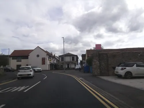

Ship Inn
Bar and pub · 0.4 mi
Coaching inn. C17 with later alterations and additions.
Fr,Sa 09:00-23:00; Mo-Th 11:00-23:00; Su 09:00-10:30


23 more on the map.
Notable people from Alveston
- Christopher HolderEarly Quaker activist
Born in Alveston, according to Wikidata (CC0). Each name links to its Wikipedia article.
Where to stay1
Churches and places of worship8
Shopping15
Gas and EV charging1
Schools, colleges and libraries6
Healthcare4
Map of Alveston
90 places. The map loads OpenStreetMap tiles when you open it.
Getting there and nearby towns
Bristol Airport (BRS) is the nearest airport with scheduled flights listed in OpenStreetMap, 16 miles away.
- Thornbury 2 mi north, about 2 min by car
- Almondsbury 3 mi southwest, about 5 min by car
- Stoke Gifford 5 mi south, about 8 min by car
- Pilning 5 mi west, about 8 min by car
- Yate 6 mi southeast, about 9 min by car
- Wickwar 6 mi east, about 9 min by car
- Severn Beach 6 mi west, about 10 min by car
- Charfield 6 mi northeast, about 10 min by car
- Mangotsfield 7 mi south, about 11 min by car
- Chepstow 7 mi northwest, about 12 min by car
Drive times are estimates from straight-line distance, not routes.
Towns near Alveston


Keep exploring
Local news
Headlines from INDB.
Reviews, tips and questions
Loading what members have shared...
Sources and licences
- GeoNames (CC BY 4.0): population, coordinates, regions and time zone
- Mapillary (see each image): photos
- OpenStreetMap contributors (ODbL 1.0): places, airports, map data
- Wikidata (CC0 1.0): elevation, founding date, time zone, website
- Wikimedia Commons (see each image): photos
- Wikipedia (CC BY-SA 4.0): overview and history text
Photo credits
- Alveston-sthelens, Unknown author, Public domain
- MARLWOOD SCHOOL, South Gloucestershire, Peppermintleaf, CC0
- Jekka's Herb Farm, Rose Cottage, Shellards Lane, Alveston - panoramio, cowbridgeguide.co.uk, CC BY 3.0
- Street-level photo, southglos, CC BY-SA 4.0
- Street-level photo, southglos, CC BY-SA 4.0
- Street-level photo, southglos, CC BY-SA 4.0
- Street-level photo, southglos, CC BY-SA 4.0
- Street-level photo, southglos, CC BY-SA 4.0
- Street-level photo, southglos, CC BY-SA 4.0
- Street-level photo, southglos, CC BY-SA 4.0
- Street-level photo, southglos, CC BY-SA 4.0
- Street-level photo, southglos, CC BY-SA 4.0
- Street-level photo, southglos, CC BY-SA 4.0
- Street-level photo, southglos, CC BY-SA 4.0
Page built November 10, 2026. Spotted a mistake? Tell us or suggest a place.