


Why visit Apsley
Townapedia lists 12 museums and landmarks, 33 parks and trails, 82 places to eat, 9 places to stay and 11 attractions in and around town.
Highlights include Bridge Carrying Railway Over North End Of Road, Dacorum Pavilion, Frogmore Paper Mill and Hemel Hempstead War Memorial.
Weather in Apsley
Forecast from MET Norway (CC BY 4.0). Full forecast
About Apsley
Apsley is a village in Hertfordshire, England, in a valley of the Chiltern Hills below the confluence of the River Gade and Bulbourne. It was the site of water mills serving local agriculture and from the early 19th century became an important centre for papermaking. Today it is a suburb of Hemel Hempstead.
From the Wikipedia article Apsley, Hertfordshire (this version), under CC BY-SA 4.0.
Photos of Apsley


Things to do11
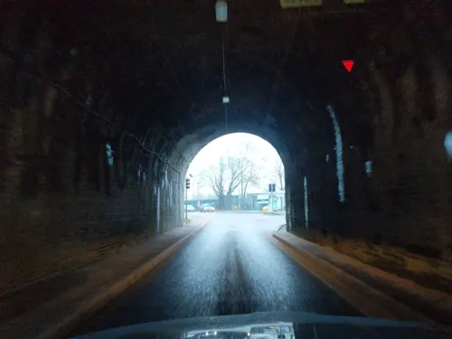
Bridge Carrying Railway Over North End Of Road
Bridge · 1.2 mi
Railway bridge in Abbots Langley, Three Rivers, Hertfordshire, England, UK
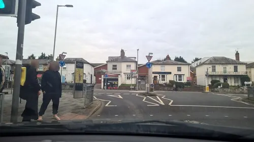
Dacorum Pavilion
Cinema and theater · 1.2 mi
Former theatre in Hemel Hempstead, England
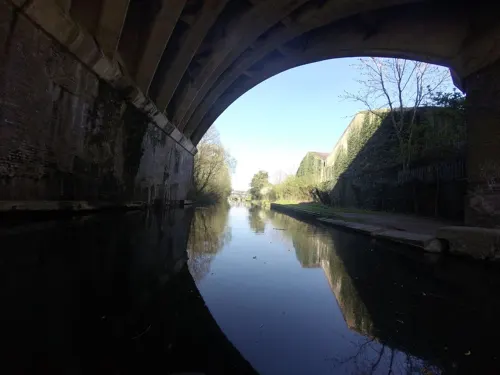
Nash Mills Railway Bridge
Bridge · 1.1 mi
Railway bridge in Abbots Langley, Three Rivers, Hertfordshire, England, UK

The Old Town Hall
Cinema and theater · 1.6 mi
Theatre and arts centre in Hemel Hempstead, England





Museums and landmarks12



Kings Langley Palace
Monument and historic site · 1.7 mi
Former 13th-century Royal Palace in Kings Langley, Hertfordshire, England, UK

The Arches . WW2, Polish Radio Intelligence Company HQ
Monument and historic site · 1.0 mi
Parks, trails and playgrounds33

Longspring Wood
Park · 2.3 mi
Small Nature Reserve in Southern England



21 more on the map.
Restaurants and cafes82
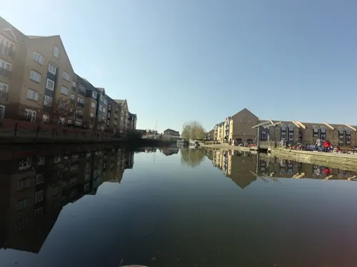
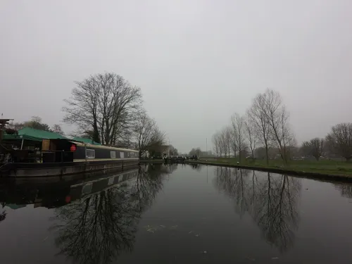
Fishery Wharf Cafe
Cafe · 1.2 mi
Fishery Wharf, Fishery Road, Hemel Hempstead
Su-Th 10:00-16:00; Fr-Sa 10:00-23:00
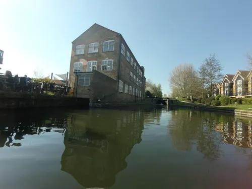
The Paper Mill
Bar and pub
Stationers Place, Hemel Hempstead
Mo-Th 09:00-23:00; Fr 09:00-00:00; Sa 10:00-00:00; Su 10:00-22:30

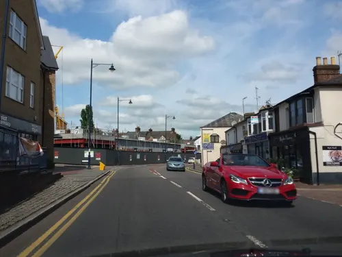
The White Lion
Bar and pub
44 London Road, Hemel Hempstead
Mo-Th 15:00-23:00; Fr-Sa 12:00-00:00; Su 12:00-23:00
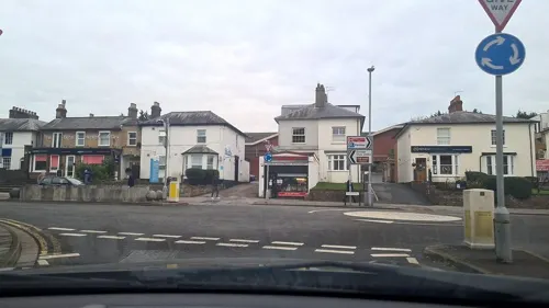
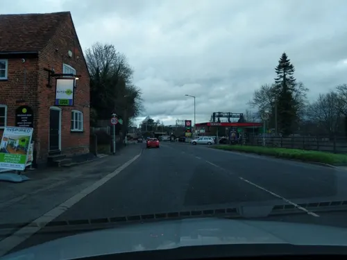
Inspired Cafe
Cafe · Coffee Shop · 1.0 mi
127 Hempstead Road, Kings Langley
08:00-15:00

Banana Leaf
Restaurant · Thai · 1.1 mi
127-129 Marlowes, Hemel Hempstead
Mo-Su 12:00-15:00,18:00-22:00
70 more on the map.
History
It was the construction of the trunk canal (later to be called the Grand Union Canal) between London and the Midlands through the valley in 1798 that began its industrial rise at the start of the 19th century. The canal gave an easy way of transporting the raw and manufactured products to and from the mills.
John Dickinson, the inventor of a new method of continuous papermaking, purchased Apsley Mill in 1809. During the 1930s, Apsley Mill became a vast industrial complex and its owner, John Dickinson Stationery, acquired Shendish Manor for use as its sports and social club.
In the 1950s the adjacent town of Hemel Hempstead was designated a New Town as part of the provision of new residential areas surrounding London and Apsley became a part of the development, also giving its name to the new school of Apsley Grammar School at Bennetts End.
Read more of the history
Apsley is an outer district of Hemel Hempstead and is still a busy commercial centre. The Victorian shops that grew up when it was a mill town now house newsagents, public houses, restaurants, and a range of small businesses. The former mill sites are taken up with supermarkets, retail parks and offices (including large offices on the Dolittle Meadows site occupied by Hertfordshire County Council, Epson, HSBC and until recently, British Telecom). Housing developments combining the canal-side location with the ease of access to Apsley railway station have been very successful, and Apsley Marina is a thriving location for boaters.
The local parish church is St Mary's, in London Road. There is also a Methodist church.
An important local issue since the summer of 2003 is the proposal to build on land surrounding the Manor Estate in Apsley that had previously been designated as green belt land. A new housing estate, called the Aspen Estate, has since been built on the hills above the Manor Estate.
Frogmore Paper Mill is a working paper mill and visitor centre located in some of the original mill buildings. Paper continued to be made until 2006 a short distance away at Nash Mill by the global Sappi group. This too closed for production in 2006 but continued as a distribution centre for some time.
From the History section of Apsley, Hertfordshire on Wikipedia, under CC BY-SA 4.0.
Notable people from Apsley
- Lancelot WardEnglish soldier and cricketer (1875-1929)
Born in Apsley, according to Wikidata (CC0). Each name links to its Wikipedia article.
Where to stay9
Alexandra Guest House
Motel and hotel · 1.4 mi
40-42 Alexandra Road, Hemel Hempstead
Churches and places of worship23
Church of St John the Evangelist and Attached Church Hall
Church · 0.7 mi
Quwwatul Islam Markazi Jamia Mosque Mehria Ghousia
Place of worship · Sunni · 0.8 mi
150 Saint Albans Hill, Hemel Hempstead
Hemel Hempstead Methodist Church
Church · Methodist · 1.5 mi
270 Northridge Way, Hemel Hempstead
Shopping16
Gas and EV charging6
Schools, colleges and libraries27
Nash Mills Church of England Primary School
School · Anglican · 0.7 mi
Belswains Lane, Hemel Hempstead
Saint Albert the Great Catholic Primary School
School · Roman Catholic · 1.2 mi
Acorn Road, Hemel Hempstead
Healthcare2
Map of Apsley
221 places. The map loads OpenStreetMap tiles when you open it.
Getting there and nearby towns
London Luton Airport (LTN) is the nearest airport with scheduled flights listed in OpenStreetMap, 11 miles away.
- Hemel Hempstead 1 mi northeast, about 2 min by car
- Sarratt 4 mi south, about 6 min by car
- Berkhamsted 4 mi west, about 7 min by car
- North Watford 5 mi southeast, about 8 min by car
- St Albans 6 mi east, about 9 min by car
- Watford 6 mi southeast, about 10 min by car
- Chorleywood 6 mi south, about 10 min by car
- Chesham 6 mi southwest, about 10 min by car
- Northchurch 6 mi northwest, about 9 min by car
- Rickmansworth 7 mi south, about 11 min by car
Drive times are estimates from straight-line distance, not routes.
Towns near Apsley


Keep exploring
Local news
Headlines from INDB.
Reviews, tips and questions
Loading what members have shared...
Sources and licences
- GeoNames (CC BY 4.0): population, coordinates, regions and time zone
- Mapillary (see each image): photos
- OpenStreetMap contributors (ODbL 1.0): places, airports, map data
- Wikidata (CC0 1.0): elevation, founding date, time zone, website, landmarks and historic places
- Wikimedia Commons (see each image): photos
- Wikipedia (CC BY-SA 4.0): overview and history text
Photo credits
- Apsley - White Lion, Nigel Cox, CC BY-SA 2.0
- St Mary’s Church Apsley 12 36 00 694000, Cnbrb, CC0
- St Mary’s Church Apsley 12 35 40 299000, Cnbrb, CC0
- St Mary’s Church Apsley 12 35 20 528000, Cnbrb, CC0
- St Mary’s Church Apsley 12 36 25 049000, Cnbrb, CC0
- Church of St Mary, Apsley, August 2024 02, No Swan So Fine, CC BY-SA 4.0
- Church of St Mary, Apsley, August 2024 10, No Swan So Fine, CC BY-SA 4.0
- Church of St Mary, Apsley, August 2024 06, No Swan So Fine, CC BY-SA 4.0
- Church of St Mary, Apsley, August 2024 13, No Swan So Fine, CC BY-SA 4.0
- Church of St Mary, Apsley, September 2024 04, No Swan So Fine, CC BY-SA 4.0
- Church of St Mary, Apsley, September 2024 07, No Swan So Fine, CC BY-SA 4.0
- Church of St Mary, Apsley, August 2024 16, No Swan So Fine, CC BY-SA 4.0
- Church of St Mary, Apsley, September 2024 06, No Swan So Fine, CC BY-SA 4.0
- The Old Town Hall, Hemel Hempstead, Dormskirk, CC BY-SA 3.0
- Kings Langley Church, UKgeofan ( talk ), CC BY-SA 3.0
- Frogmore Mill Apsley, Nigel Cox, CC BY-SA 2.0
- Rose and Crown Inn, High Street, Hemel Hempstead, July 2021, No Swan So Fine, CC BY-SA 4.0
- Hemel Hempstead Hospital, Dormskirk, CC BY-SA 3.0
- Hemel Hempstead War Memorial, April 2024 01, No Swan So Fine, CC BY-SA 4.0
- Longspring Wood 5, Dudley Miles, CC BY-SA 4.0
- Sainsbury’s exit barriers, Cnbrb, CC BY-SA 4.0
- Fourdrinier machine model, Chris55, CC BY-SA 4.0
- GOC Hemel Hempstead 109 Boxmoor Hall (48722673901), Peter O'Connor aka anemoneprojectors, CC BY-SA 2.0
- GOC Hemel Hempstead 101 River Bulbourne (48718629381), Peter O'Connor aka anemoneprojectors, CC BY-SA 2.0
- GOC Hemel Hempstead 107 Pump and lamppost (48722847902), Peter O'Connor aka anemoneprojectors, CC BY-SA 2.0
- Street-level photo, rudolfmayer, CC BY-SA 4.0
- Street-level photo, _mark, CC BY-SA 4.0
- Street-level photo, volucris, CC BY-SA 4.0
- Street-level photo, _mark, CC BY-SA 4.0
- Street-level photo, _mark, CC BY-SA 4.0
- Street-level photo, rudolfmayer, CC BY-SA 4.0
- Street-level photo, tallguy, CC BY-SA 4.0
- Street-level photo, tallguy, CC BY-SA 4.0
- Street-level photo, tallguy, CC BY-SA 4.0
- Street-level photo, mappo2, CC BY-SA 4.0
- Street-level photo, mappo2, CC BY-SA 4.0
- Street-level photo, mappo2, CC BY-SA 4.0
- Street-level photo, tallguy, CC BY-SA 4.0
- Street-level photo, _mark, CC BY-SA 4.0
- Street-level photo, rudolfmayer, CC BY-SA 4.0
- Street-level photo, _mark, CC BY-SA 4.0
- Street-level photo, volucris, CC BY-SA 4.0
- Street-level photo, zymurgic, CC BY-SA 4.0
- Street-level photo, mappo2, CC BY-SA 4.0


Page built November 10, 2026. Spotted a mistake? Tell us or suggest a place.