


Why visit Awsworth
Townapedia lists 14 museums and landmarks, 18 parks and trails, 107 places to eat, 3 places to stay and 3 attractions in and around town.
Highlights include Bennerley Viaduct, Giltbrook Viaduct, D.H. Lawrence Birthplace Museum and Erewash Museum.
Weather in Awsworth
Forecast from MET Norway (CC BY 4.0). Full forecast
About Awsworth
Awsworth is a village and civil parish in the Borough of Broxtowe, Nottinghamshire, England. Its population of 2,266 in the 2001 census and 2,204 in that of 2011, further decreasing to 2,166 for the 2021 census. It is a component of the Greater Nottingham area, between Kimberley, Nottinghamshire and Ilkeston, Derbyshire. It has been a civil parish since 1894.
From the Wikipedia article Awsworth (this version), under CC BY-SA 4.0.
Photos of Awsworth


Things to do3

Bennerley Viaduct
Bridge · 0.6 mi
Railway viaduct spanning the Erewash Valley

Giltbrook Viaduct
Bridge
Bridge in Greasley and Kimberley, Nottinghamshire

The American Adventure Theme Park
Monument and historic site · 2.2 mi
Former theme park in Ilkeston, Derbyshire, England
Museums and landmarks14

D.H. Lawrence Birthplace Museum
Museum · 2.3 mi
Museum in Nottingham, England, United Kingdom

Erewash Museum
Museum · 1.6 mi
Museum in Ilkeston, Derbyshire, United Kingdom

Kimberley School War Memorial
Monument and historic site · 1.5 mi
A small monument consisting of 3 wooden planks stood upright and a metal outline of a soldier remembering those lost during both world wars.
David Greenhalgh, Rebecca Moss, Desmond Ball
Monument and historic site · 1.2 mi
Lt Colonel Brian Duncan Shaw MM BSc PhD DSc (Hon) 1898-1999
Monument and historic site · 1.1 mi
2 more on the map.
Parks, trails and playgrounds18




6 more on the map.
Restaurants and cafes107
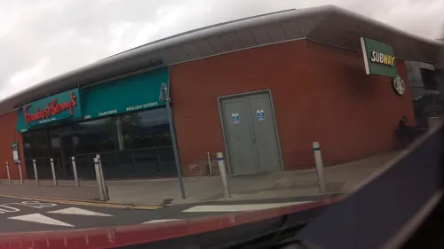
Frankie & Benny's
Diner · American · 1.0 mi
Ikea Way, Nottingham
Mo-Th 09:00-21:30; Fr-Sa 09:00-22:30; Su 09:00-21:30
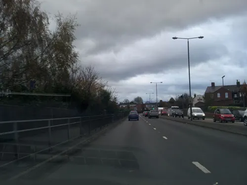

Stacey's
Bakery · 1.4 mi
100 Bath Street, Ilkeston
Tu-Th 08:15-15:00; Fr 08:15-16:00; Sa 07:30-15:00; Su,Mo off

Coffee and Cream
Cafe · 1.4 mi
84 Bath Street, Ilkeston
Mo-Su,PH 09:00-15:00


The Humble Rutland
Cafe · 1.3 mi
5 Mundy Street, Ilkeston
Mo-Sa 08:00-13:00; Su off

95 more on the map.
History
The oldest existing record of Awsworth comes from 1004, when the toponym is listed as Ealdeswy(rðe) in the charter of Æthelred the Unready to Burton Abbey that confirmed Wulfric Spot's bequest of 1002.
From the History section of Awsworth on Wikipedia, under CC BY-SA 4.0.
Where to stay3
Churches and places of worship20
Shopping22
Gas and EV charging3
Schools, colleges and libraries17
Healthcare8
Kimberley Health Clinic
Clinic and pharmacy · 1.3 mi
Newdigate Street, Nottingham
Map of Awsworth
215 places. The map loads OpenStreetMap tiles when you open it.
Getting there and nearby towns
Nottingham City Airport (NQT) is the nearest airport with scheduled flights listed in OpenStreetMap, 10 miles away.
- Kimberley 1 mi southeast, about 1 min by car
- Eastwood 1 mi northwest, about 2 min by car
- Ilkeston 2 mi southwest, about 3 min by car
- Heanor 3 mi northwest, about 5 min by car
- Basford 4 mi east, about 7 min by car
- Hucknall 5 mi northeast, about 7 min by car
- Stapleford 5 mi south, about 8 min by car
- Smalley 5 mi west, about 8 min by car
- Nottingham 6 mi southeast, about 10 min by car
- Ripley 6 mi northwest, about 9 min by car
Drive times are estimates from straight-line distance, not routes.
Towns near Awsworth


Keep exploring
Local news
Headlines from INDB.
Reviews, tips and questions
Loading what members have shared...
Sources and licences
- GeoNames (CC BY 4.0): population, coordinates, regions and time zone
- Mapillary (see each image): photos
- OpenStreetMap contributors (ODbL 1.0): places, airports, map data
- Wikidata (CC0 1.0): elevation, founding date, time zone, website, landmarks and historic places
- Wikimedia Commons (see each image): photos
- Wikipedia (CC BY-SA 4.0): overview and history text
Photo credits
- The Lane, Awsworth (1) - 1 May 2026, Aethonatic, CC0
- Housing on The Lane, Awsworth - 1 May 2026, Aethonatic, CC0
- Middleton Street, Awsworth - 1 May 2026, Aethonatic, CC0
- Twin Dragon, Awsworth - 1 May 2026, Aethonatic, CC0
- The Lane, Awsworth - 1 May 2026, Aethonatic, CC0
- Awsworth Lane, Cossall - 1 May 2026, Aethonatic, CC0
- Awsworth fingerpost - 1 May 2026, Aethonatic, CC0
- Awsworth Village Hall - 1 May 2026, Aethonatic, CC0
- The Lane, Awsworth (2) - 1 May 2026, Aethonatic, CC0
- Awsworth St Peters Eco Garden - 1 May 2026, Aethonatic, CC0
- Bennerley Viaduct Ilkeston, Grant Shaw, CC BY-SA 3.0
- Erewash Museum - 20 June 2025, Aethonatic, CC0
- Kirk Hallam Church, Garth Newton, CC BY-SA 2.0
- St Andrew's Church, Langley Mill, Roger Templeman, CC BY-SA 2.0
- St Mary's Church, Ilkeston, Derbyshire, Russ Hamer, CC BY-SA 3.0
- Cossall St Catherine's Church, Russ Hamer, CC BY-SA 3.0
- St Lukes Stapleford, Oxymoron, CC BY-SA 2.0
- Greasley St Mary from ENE GeoUK5967241, Alan Murray-Rust, CC BY-SA 2.0
- NatWest Hole, Ilkeston - 23 April 2026, Aethonatic, CC0
- Middleton Street bus stop - 1 May 2026, Aethonatic, CC0
- Newton's Lane, Cossall (6) - 1 May 2026, Aethonatic, CC0
- Royal Mail post box - 1 May 2026, Aethonatic, CC0
- Papaver cambricum - 1 May 2026, Aethonatic, CC0
- D. H. Lawrence Birthplace Museum, Graham Hogg, CC BY-SA 2.0
- Cotmanhay Linear Park - 10 August 2026, Aethonatic, CC0
- Street-level photo, adam2, CC BY-SA 4.0
- Street-level photo, adam2, CC BY-SA 4.0
- Street-level photo, tallguy, CC BY-SA 4.0
- Street-level photo, adam2, CC BY-SA 4.0
- Street-level photo, southglos, CC BY-SA 4.0
- Street-level photo, adam2, CC BY-SA 4.0
- Street-level photo, adam2, CC BY-SA 4.0
- Street-level photo, southglos, CC BY-SA 4.0
- Street-level photo, adam2, CC BY-SA 4.0
- Street-level photo, adam2, CC BY-SA 4.0
- Street-level photo, tallguy, CC BY-SA 4.0
- Street-level photo, tallguy, CC BY-SA 4.0
- Street-level photo, adam2, CC BY-SA 4.0
- Street-level photo, tallguy, CC BY-SA 4.0
- Street-level photo, adam2, CC BY-SA 4.0
- Street-level photo, tallguy, CC BY-SA 4.0
- Street-level photo, adam2, CC BY-SA 4.0
- Street-level photo, adam2, CC BY-SA 4.0
- Street-level photo, adam2, CC BY-SA 4.0


Page built November 10, 2026. Spotted a mistake? Tell us or suggest a place.