


Why visit Smalley
Townapedia lists 3 museums and landmarks, 6 parks and trails, 8 places to eat, 1 place to stay and 1 attraction in and around town.
Highlights include The American Adventure Theme Park and Horsley Lodge Golf Club.
Weather in Smalley
Forecast from MET Norway (CC BY 4.0). Full forecast
About Smalley
Smalley is a village on the main A608 Heanor to Derby road in Derbyshire in the East Midlands of England. The population of the civil parish as of the 2011 census was 2,784.
From the Wikipedia article Smalley, Derbyshire (this version), under CC BY-SA 4.0.
Things to do1

The American Adventure Theme Park
Monument and historic site · 2.5 mi
Former theme park in Ilkeston, Derbyshire, England
Museums and landmarks3
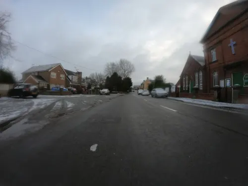
Millennium Wall
Monument and historic site · 0.9 mi
Stonework originally from the Church Hall. Erected here in 2000.
Parks, trails and playgrounds6



Restaurants and cafes8
Rose and Crown
Bar and pub · 1.2 mi
51 Woodside, Ilkeston
Mo-We 11:30-22:00; Th-Sa 11:30-23:00; Su 09:00-22:00
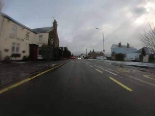
Old Oak Inn
Bar and pub · 1.1 mi
Plus RuRAD (Rural Real Ale Drinkers) bar open weekends
176 Main Street, Ilkeston


History
Smalley's name came from the Anglo-Saxon Smæl-lēah = "narrow woodland clearing". It was mentioned in a charter of 1009 by King Æþelræd Unræd ("Ethelred the Unready") relating to a manor known as Westune (modern-day Weston-on-Trent) which land included the areas now known as Shardlow, Great Wilne, Church Wilne, Crich, Smalley, Morley, Weston and Aston-on-Trent. Under this charter Ethelred gave his minister, Morcar, some exemptions from tax.
Smalley's Parish Church of St John the Baptist was built in the late 18th century on the site of a much earlier church, the transepts being added later in 1844. A seventh century Saxon cross forms part of the porch. The bell tower was built in 1911, to the designs of Currey and Thompson, housing five bells donated by the Rev. Charles Kerry. The chime of five bells is said to be the heaviest in England, the largest bell weighing over 2 tons. The parish church hosts occasional street parties for the residents of Smalley.
Its pub, the Bell Inn, was voted "Best Derbyshire Pub of 2006".
From the History section of Smalley, Derbyshire on Wikipedia, under CC BY-SA 4.0.
Where to stay1
Churches and places of worship12
United Church of All Saints
Church · Anglican, Methodist · 1.6 mi
Belper Road, Ilkeston
Horsley Woodhouse Central Methodist Church
Church · Methodist · 0.9 mi
Main Street, Ilkeston
Gas and EV charging1
Schools, colleges and libraries4
Healthcare1
Map of Smalley
37 places. The map loads OpenStreetMap tiles when you open it.
Getting there and nearby towns
East Midlands Airport (EMA) is the nearest airport with scheduled flights listed in OpenStreetMap, 12 miles away.
- Heanor 2 mi northeast, about 3 min by car
- Ripley 2 mi north, about 4 min by car
- Ilkeston 4 mi southeast, about 6 min by car
- Belper 4 mi northwest, about 6 min by car
- Eastwood 4 mi east, about 6 min by car
- Chaddesden 5 mi south, about 8 min by car
- Kimberley 5 mi east, about 9 min by car
- Derby 6 mi southwest, about 10 min by car
- Alfreton 7 mi north, about 11 min by car
- Pinxton 7 mi northeast, about 11 min by car
Drive times are estimates from straight-line distance, not routes.
Towns near Smalley


Keep exploring
Local news
Headlines from INDB.
Reviews, tips and questions
Loading what members have shared...
Sources and licences
- GeoNames (CC BY 4.0): population, coordinates, regions and time zone
- Mapillary (see each image): photos
- OpenStreetMap contributors (ODbL 1.0): places, airports, map data
- Wikidata (CC0 1.0): elevation, founding date, time zone, website, landmarks and historic places
- Wikimedia Commons (see each image): photos
- Wikipedia (CC BY-SA 4.0): overview and history text
Photo credits
- Smalley church hall, Adam Foster, CC BY-SA 2.0
- St Andrew's Church, Langley Mill, Roger Templeman, CC BY-SA 2.0
- St Clements, Horsley, Derbyshire, Rob Howl, CC BY-SA 2.0
- St Wilfrid's West Hallam, Russ Hamer, CC BY-SA 3.0
- St James, Cross Hill (i), PaleCloudedWhite, CC BY-SA 4.0
- Denby - church tower and nave, Dave Bevis, CC BY-SA 2.0
- Heanor gate science college, Victuallers, CC BY-SA 3.0
- Church of St John the Baptist, Smalley, Alan Murray-Rust, CC BY-SA 2.0
- Street-level photo, ntzm, CC BY-SA 4.0
- Street-level photo, ntzm, CC BY-SA 4.0
- Street-level photo, orangutanclyde, CC BY-SA 4.0
- Street-level photo, ntzm, CC BY-SA 4.0
- Street-level photo, southglos, CC BY-SA 4.0
- Street-level photo, southglos, CC BY-SA 4.0
- Street-level photo, ntzm, CC BY-SA 4.0
- Street-level photo, ntzm, CC BY-SA 4.0
- Street-level photo, ntzm, CC BY-SA 4.0
- Street-level photo, ntzm, CC BY-SA 4.0
- Street-level photo, orangutanclyde, CC BY-SA 4.0
- Street-level photo, southglos, CC BY-SA 4.0


Page built November 10, 2026. Spotted a mistake? Tell us or suggest a place.