


Ilkeston, United Kingdom
Ilkeston is a town of 40,953 people in England, United Kingdom.
Why visit Ilkeston
Townapedia lists 20 museums and landmarks, 35 parks and trails, 122 places to eat, 2 places to stay and 4 attractions in and around town.
Highlights include Bennerley Viaduct, Giltbrook Viaduct, Erewash Museum and D.H. Lawrence Birthplace Museum.
Weather in Ilkeston
Forecast from MET Norway (CC BY 4.0). Full forecast
About Ilkeston
Ilkeston is a town located in the Borough of Erewash in Derbyshire, England, with a population of 40,953 at the 2021 census. Its major industries, coal mining, iron working and lace making/textiles, have now all but disappeared. Part of the Nottingham Urban Area, the town is located between the cities Derby and Nottingham, near the M1 motorway, and on the River Erewash. Its eastern boundary borders Nottinghamshire to the east and is only two miles from Nottingham's western edge.
From the Wikipedia article Ilkeston (this version), under CC BY-SA 4.0.
Photos of Ilkeston


Things to do4

Bennerley Viaduct
Bridge · 1.4 mi
Railway viaduct spanning the Erewash Valley

Giltbrook Viaduct
Bridge · 1.7 mi
Bridge in Greasley and Kimberley, Nottinghamshire

The American Adventure Theme Park
Monument and historic site · 2.0 mi
Former theme park in Ilkeston, Derbyshire, England

Museums and landmarks20


D.H. Lawrence Birthplace Museum
Museum · 3.3 mi
Museum in Nottingham, England, United Kingdom

Dale Abbey
Monument and historic site · 2.5 mi
Monastery ruins in Derbyshire, England, UK


David Greenhalgh, Rebecca Moss, Desmond Ball
Monument and historic site · 1.5 mi
8 more on the map.
Parks, trails and playgrounds35



23 more on the map.
Restaurants and cafes122
The Humble Rutland
Cafe · 0.5 mi
5 Mundy Street, Ilkeston
Mo-Sa 08:00-13:00; Su off

The Newdigate
Bar and pub · 1.4 mi
Large family friendly food led place
High Lane East, Ilkeston
Mo-Su 11:30-23:00

OhannesS Burger
Restaurant · Burger
25 Bath Street, Ilkeston
Su,Mo,We,Th 16:00-23:00; Fr,Sa 16:00-24:00; Tu off

Stacey's
Bakery
100 Bath Street, Ilkeston
Tu-Th 08:15-15:00; Fr 08:15-16:00; Sa 07:30-15:00; Su,Mo off


Beestonia Brewing Company
Brewery and winery · 1.5 mi
Goodhill Court, Ilkeston
Mo-Th closed; Fr 13:30-22:00; Sa 13:00-20:00; Su 13:00-18:00
Coffee and Cream
Cafe
84 Bath Street, Ilkeston
Mo-Su,PH 09:00-15:00
Gallows Grub
Cafe · 1.0 mi
Nottingham Road, Ilkeston
Mo-Fr 07:30-14:00
110 more on the map.
History
Ilkeston was likely founded during the 6th century, and gets its name from its supposed founder Elch or Elcha, who was an Anglian chieftain. The town appears as Tilchestune in the Domesday Book of 1086, when it was owned principally by Gilbert de Ghent. Gilbert also controlled nearby Shipley, West Hallam and Stanton by Dale. Ilkeston was created a borough by Queen Victoria in 1887.
Ilkeston is one of several places where the distinctive dialect of East Midlands English is extensively spoken. Ilkeston is referred to as 'Ilson' in this dialect. Generally the name is pronounced with three syllables, Ilkisstun, not Ilk's tun.
The American Adventure, a large theme park which closed in 2007, was located on the outskirts of Ilkeston on the former Woodside Colliery adjoining Shipley Country Park.
NatWest's Ilkeston branch gained much media interest when a hole in a neighbouring wall received an influx of reviews on Tripadvisor, causing them to suspend reviews in February 2020.
Read more of the history
One of the biggest and most important local employers was the Stanton Ironworks, later known as Stanton and Staveley – the continuation of a long-standing tradition of iron working in this area. There has been evidence of iron working and quarrying in the area since Roman times, and the industry began blossoming into a huge industrial concern in the 1780s. By the mid-19th century there were several blast furnaces and the production rose from around 500 tons of pig iron per month to 7,000 at the end of the century. The Stanton Ironworks acquired a number of smaller ironstone quarrying and ironworks companies. These included the Wellingborough Iron Company in 1932.
Steel pipe manufacturing began at Stanton after World War I and later concrete pipes were produced, Stanton being the first in the UK to develop the 'spun pipe' process.
In the mid-19th century the works produced 20,000 tons of iron castings per year, 2.5 millions by 1905. Up to 12,500 people were employed during the period when the works were part of British Steel Corporation, of which 7,000 worked at the Stanton works.
During its long existence the works produced huge quantities of a variety of products, including pig iron, tunnel castings, (used in projects such as the London Underground), pipes and street furniture as well as bitumen, roadstone, chemicals and munition casings.
The works gradually declined, the business being run from 1985 by the French Saint-Gobain Group. The last casting was an emotional event in 2007. The huge Stanton site has been partially given over to business park and the rest of the site is earmarked for redevelopment which is subject to local opposition.
Ilkeston Market Place is the site of a Charter fair. The fair celebrated its 772nd anniversary in 2024, the Charter being granted by King Henry III in 1252. This makes the fair older than Nottingham's famous Goose Fair and it is one of the largest street fairs in the Country, indeed in Europe.
The present fair developed from two separate fairs, as another 'agricultural hiring fair' or 'Statutes Fair' was traditionally held on Wakes week in October as well as the original Charter Fair which was held on the Feast of the Assumption of the Blessed Virgin Mary (15 August). The two fairs were combined in 1888 and the one Charter Fair has been held in October ever since.
Since 1931 the fair has been officially opened by the Mayor - first of Ilkeston and since 1974 of Erewash - on the Fair Thursday at noon with the Town Clerk (Chief Executive) reading the Charter from the steps of the Town Hall.
From early in the 19th century the existence of natural mineral waters was noted here and exploited. A local businessman Thomas Potter built, in 1831, the famous Ilkeston Bath at the bottom of Town Street attached to the Rutland Hotel. For over 60 years the baths helped tourism to the town at a time when spa towns like Bath and Harrogate enjoyed popularity. 'If you're doubled in pain and thin as a lath, Come at once then and try, the famed Ilkeston Bath,' was a well known advertising slogan. A mixture of a general decline in the popularity of spa bathing and, reportedly, contamination of the waters from mining activities led to the eventual closure of the baths just before 1900. The baths and the adjacent Rutland Hotel, which also enjoyed a revenue from tourism, no longer exist though they are remembered in the name of 'Bath Street'.
From the History section of Ilkeston on Wikipedia, under CC BY-SA 4.0.
Notable people from Ilkeston
 Chick ChurchillEnglish musicianPhoto: Stefan Brending ( 2eight ), CC BY-SA 3.0 de
 Frank SuggCricket player of England. (1862-1933)Photo: Unknown author Unknown author, Public domain
 Mel RamsdenBritish artist (1944–2024)Photo: Art & Language, CC BY-SA 4.0
 Linsey FarnsworthBritish politician, from 2024, Member of Parliament for Amber ValleyPhoto: ©House of Commons / Jessica Taylor, CC BY 3.0
- Robert LindsayBritish actor
- Scott BarrettEnglish footballer (born 1963)
- Jane Smitcricketer (born 1972)
- Jim BakerEnglish footballer (1891-1966)
- Geoff BarrowcliffeEnglish footballer (1931-2009)
- John TudorEnglish footballer ( 1946-2025)
- John BroughEnglish footballer (born 1973)
- Alf FreemanBritish association football player (1904-1966)
Born in Ilkeston, according to Wikidata (CC0). Each name links to its Wikipedia article.
Where to stay2
Churches and places of worship26
Shopping15
Gas and EV charging4
Schools, colleges and libraries24
Healthcare7
Map of Ilkeston
250 places. The map loads OpenStreetMap tiles when you open it.
Getting there and nearby towns
East Midlands Airport (EMA) is the nearest airport with scheduled flights listed in OpenStreetMap, 10 miles away.
- Kimberley 2 mi northeast, about 3 min by car
- Eastwood 2 mi north, about 3 min by car
- Heanor 4 mi northwest, about 6 min by car
- Stapleford 4 mi southeast, about 7 min by car
- Long Eaton 5 mi south, about 8 min by car
- Chilwell 5 mi southeast, about 8 min by car
- Basford 5 mi east, about 8 min by car
- Ripley 6 mi northwest, about 9 min by car
- Chaddesden 6 mi southwest, about 10 min by car
- Nottingham 7 mi east, about 11 min by car
Drive times are estimates from straight-line distance, not routes.
Towns near Ilkeston


Keep exploring
Local news
Headlines from INDB.
Reviews, tips and questions
Loading what members have shared...
Sources and licences
- GeoNames (CC BY 4.0): population, coordinates, regions and time zone
- Mapillary (see each image): photos
- OpenStreetMap contributors (ODbL 1.0): places, airports, map data
- Wikidata (CC0 1.0): elevation, founding date, time zone, website, landmarks and historic places
- Wikimedia Commons (see each image): photos
- Wikipedia (CC BY-SA 4.0): overview and history text
Photo credits
- Market Square, Ilkeston, Derbyshire, Garth Newton, CC BY-SA 2.0
- Market Place, Ilkeston - 20 June 2025, Aethonatic, CC0
- Wharncliffe Road, Ilkeston - 20 June 2025, Aethonatic, CC0
- Ilkeston Cenotaph - 16 December 2025, Aethonatic, CC0
- Ilkeston Town Hall - 16 December 2025, Aethonatic, CC0
- The Old Co-op, Ilkeston - 28 June 2026, Aethonatic, CC0
- Bennerley Viaduct Ilkeston, Grant Shaw, CC BY-SA 3.0
- Erewash Museum - 20 June 2025, Aethonatic, CC0
- Dale Abbey ruins - September 2019, Bulphan, CC BY-SA 4.0
- Kirk Hallam Church, Garth Newton, CC BY-SA 2.0
- St Wilfrid's West Hallam, Russ Hamer, CC BY-SA 3.0
- Cossall St Catherine's Church, Russ Hamer, CC BY-SA 3.0
- St Mary's Church, Ilkeston, Derbyshire, Russ Hamer, CC BY-SA 3.0
- Baptist Chapel, Ilkeston, Alan Murray-Rust, CC BY-SA 2.0
- NatWest Hole, Ilkeston - 23 April 2026, Aethonatic, CC0
- Trentbarton - The Two (775 - BD65 EWG) - 16 December 2025, Aethonatic, CC0
- Trentbarton - The Two (777 - BD65 EWJ) - 16 December 2025, Aethonatic, CC0
- Midland General (296 - DNU 20C) - 10 August 2025, Aethonatic, CC0
- Midland General (296 - DNU 20C) (interior) - 10 August 2025, Aethonatic, CC0
- Trent Buses (101 - YCH 890M) - 10 August 2025, Aethonatic, CC0
- Trentbarton - My15 (805 - YJ11 ENK) - 7 July 2025, Aethonatic, CC0
- Barton buses lined up - 10 August 2025, Aethonatic, CC0
- Midland General (313 - YNU 351G) - 10 August 2025, Aethonatic, CC0
- Trentbarton Mango (848 - YJ14 BRX) - 6 July 2024, Aethonatic, CC0
- Trent Buses (101 - YCH 890M) (interior, facing rear) - 10 August 2025, Aethonatic, CC0
- Trentbarton - The Two (152 - YX20 OHG) (front) - 16 December 2025, Aethonatic, CC0
- Triumph TR6 (PYL 63L) engine - 10 August 2025, Aethonatic, CC0
- Barton Transport (784 - XAL 784) - 10 August 2025, Aethonatic, CC0
- Trentbarton My15 (809 - YJ11 ENO) - 28 April 2025, Aethonatic, CC0
- Trentbarton - The Two (149 - YX20 OHD) - 16 December 2025, Aethonatic, CC0
- Trent Buses (101 - YCH 890M) (interior, facing front) - 10 August 2025, Aethonatic, CC0
- Ducati Monster - 10 August 2025, Aethonatic, CC0
- Trentbarton - The Two (148 - YX20 OHC) - 16 December 2025, Aethonatic, CC0
- Triumph TR6 (PYL 63L) - 10 August 2025, Aethonatic, CC0
- Barton Transport (782 - WAL 782) - 10 August 2025, Aethonatic, CC0
- Trentbarton - The Two (770 - BF65 WLE) - 16 December 2025, Aethonatic, CC0
- Motorcycles on display - 10 August 2025, Aethonatic, CC0
- Buell motorcycle - 10 August 2025, Aethonatic, CC0
- BSA A65 (KBJ 154D) - 10 August 2025, Aethonatic, CC0
- Littles Travel (B9 - B29 LTL) - 5 August 2026, Aethonatic, CC0
- D. H. Lawrence Birthplace Museum, Graham Hogg, CC BY-SA 2.0
- Cotmanhay Linear Park - 5 August 2026, Aethonatic, CC0
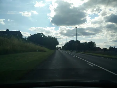
- Street-level photo, adam2, CC BY-SA 4.0
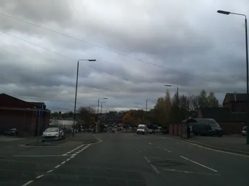
- Street-level photo, adam2, CC BY-SA 4.0
- Street-level photo, adam2, CC BY-SA 4.0
- Street-level photo, adam2, CC BY-SA 4.0
- Street-level photo, adam2, CC BY-SA 4.0
- Street-level photo, adam2, CC BY-SA 4.0
- Street-level photo, adam2, CC BY-SA 4.0
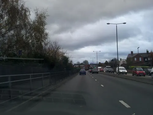
- Street-level photo, orangutanclyde, CC BY-SA 4.0
- Street-level photo, adam2, CC BY-SA 4.0
- Street-level photo, adam2, CC BY-SA 4.0
- Street-level photo, adam2, CC BY-SA 4.0
- Street-level photo, adam2, CC BY-SA 4.0
- Street-level photo, adam2, CC BY-SA 4.0
- Street-level photo, adam2, CC BY-SA 4.0
- Street-level photo, adam2, CC BY-SA 4.0
- Street-level photo, adam2, CC BY-SA 4.0


Page built November 10, 2026. Spotted a mistake? Tell us or suggest a place.