
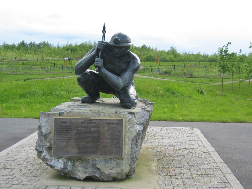

Why visit Bagworth
Townapedia lists 5 parks and trails and 3 places to eat in and around town.
Highlights include Altar Stones Nature Reserve and Bagworth Heath Woods.
Weather in Bagworth
Forecast from MET Norway (CC BY 4.0). Full forecast
About Bagworth
Bagworth is a village in the civil parish of Bagworth and Thornton, in the Hinckley and Bosworth district, in Leicestershire, England, 9 miles (14 km) west of Leicester.
From the Wikipedia article Bagworth (this version), under CC BY-SA 4.0.
Parks, trails and playgrounds5


Restaurants and cafes3



Churches and places of worship6
Bardon Park Chapel
Church · 2.2 mi
Grade II listed church in Bardon, North West Leicestershire, England,UK
Church of St Peter
Church · 2.5 mi
Church building in North West Leicestershire, England, UK

Chapel of the Holy Rood, Bagworth
Church · 0.4 mi
Chapel in Bagworth, Leicestershire
St Giles' Church, Barlestone
Church · 2.0 mi
Church in Barlestone, Leicestershire
Schools, colleges and libraries2

History
There are records of the manor of Bagworth from the early 14th and early 15th centuries, when it was held by the same feudal lords as the neighbouring manor of Thornton.
Bagworth Park is first recorded in 1279 under ownership of the Bishop of Durham. In 1318 Roger de Holland was given permission to fortify his property at Bagworth. It is recorded under the ownership of Matilda Lovell in 1411. The Lovell family later sold the land to the Hastings family. Development of the site was granted to William, Lord Hastings by Edward IV in 1474 for "crenellation and emparkment of 2000 acres of land" along with the castle developments at Ashby de la Zouche and Kirby Muxloe but there is no indication of any building by Hastings on the site prior to his execution by Richard III in 1483. A later moated house was developed on the site by Sir Robert Banaster in 1616.
In 1761 Baron Maynard funded the building and endowment of a village school for Bagworth.
The then Viscount Maynard had the first shaft of Bagworth Colliery sunk in 1828 and, initially, the coal was carried to Leicester by road.
In 1832 the Leicester and Swannington Railway was opened. It passed within 1⁄2-mile (800 m) of Bagworth and provided a railway station to serve the village at the foot of the rope-worked Bagworth Incline, and a convenient connection to the colliery at the top of the incline.
Read more of the history
The Midland Railway took over the Leicester and Swannington in 1845 and built a gentler graded deviation line which bypassed the old incline and opened a new Bagworth railway station 1 mile (1.6 km) north of the centre of the old village in 1849. The new station was renamed Bagworth and Ellistown in 1894 to reflect the nearby colliery village that had developed since Ellistown colliery was sunk in 1873. British Railways withdrew passenger services from the line and closed the station in September 1964. The railway remains open for freight.
Bagworth Colliery was connected underground to Nailstone Colliery in 1966. There the coal was raised, washed, and transported by train back along a branch line to interchange sidings next to the site of Bagworth and Ellistown station. In 1980 the branch line from Nailstone colliery was replaced by a conveyor belt which transported the coal to a rapid loader to the north of the site of Bagworth and Ellistown station. The colliery closed in 1991 when economic reserves were exhausted and the rapid loader was demolished.
In the 1990s BR planned to restore Leicester to Burton upon Trent Line passenger services through Bagworth as the second phase of its Ivanhoe Line project. However, after the privatisation of British Rail in 1995 this phase of the project was discontinued. In 2009 the Association of Train Operating Companies published a £49 million proposal to restore passenger services to the line that would include reopening a station at Bagworth.
In 1931 the parish had a population of 1568. On 1 April 1935 the parish of Thornton was merged with Bagworth, on 13 August 2001 the parish was renamed "Bagworth & Thornton".
From the History section of Bagworth on Wikipedia, under CC BY-SA 4.0.
Notable people from Bagworth
- Peter BadhamEnglish cricketer (1911-1983)
Born in Bagworth, according to Wikidata (CC0). Each name links to its Wikipedia article.
Map of Bagworth
16 places. The map loads OpenStreetMap tiles when you open it.
Getting there and nearby towns
East Midlands Airport (EMA) is the nearest airport with scheduled flights listed in OpenStreetMap, 11 miles away.
- Coalville 4 mi north, about 6 min by car
- Ravenstone 4 mi northwest, about 7 min by car
- Leicester Forest East 6 mi southeast, about 10 min by car
- Glenfield 6 mi east, about 10 min by car
- Earl Shilton 7 mi south, about 11 min by car
- Shepshed 7 mi north, about 11 min by car
- Ashby-de-la-Zouch 7 mi northwest, about 12 min by car
- Braunstone 8 mi southeast, about 13 min by car
- Leicester 9 mi east, about 15 min by car
- Loughborough 9 mi northeast, about 14 min by car
Drive times are estimates from straight-line distance, not routes.
Towns near Bagworth


Keep exploring
Local news
Headlines from INDB.
Reviews, tips and questions
Loading what members have shared...
Sources and licences
- GeoNames (CC BY 4.0): population, coordinates, regions and time zone
- Mapillary (see each image): photos
- OpenStreetMap contributors (ODbL 1.0): places, airports, map data
- Wikidata (CC0 1.0): elevation, founding date, time zone, website, landmarks and historic places
- Wikimedia Commons (see each image): photos
- Wikipedia (CC BY-SA 4.0): overview and history text
Photo credits
- BagworthMinerStatue, Bjrobinson ( talk ) ( Uploads ), CC BY-SA 3.0
- Altar Stones 10, Dudley Miles, CC BY-SA 4.0
- Street-level photo, southglos, CC BY-SA 4.0
- Street-level photo, adam2, CC BY-SA 4.0
Page built November 10, 2026. Spotted a mistake? Tell us or suggest a place.