
Ballynahinch, United Kingdom
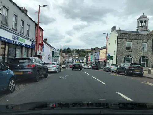
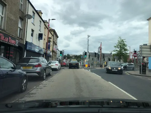
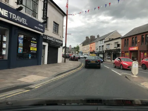
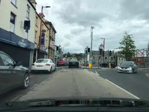
Ballynahinch is a town of 5,701 people in Northern Ireland, United Kingdom.
Why visit Ballynahinch
Townapedia lists 3 museums and landmarks, 13 parks and trails, 12 places to eat, 1 place to stay and 1 attraction in and around town.
Weather in Ballynahinch
Forecast from MET Norway (CC BY 4.0). Full forecast
About Ballynahinch
Ballynahinch (from Irish Baile na hInse, meaning 'settlement of the island/water-meadow') is a market town in County Down, Northern Ireland. It is 14 miles (23 km) south of Belfast city centre, the town lies on the main A24 road from Belfast to Clough, near Newcastle. It had a population of 6,164 people in the 2021 census.
From the Wikipedia article Ballynahinch, County Down (this version), under CC BY-SA 4.0.
Things to do1

Museums and landmarks3

Parks, trails and playgrounds13



1 more on the map.
Restaurants and cafes12
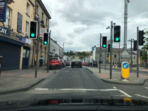
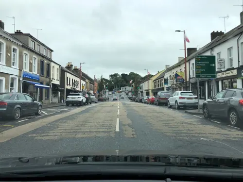


History
Before the 17th century, the area around Ballynahinch was controlled by the McCartan clan. During the Wars of the Three Kingdoms, Catholic military officer Patrick McCartan captured a Parliamentarian-controlled castle in Downpatrick. After he was captured, McCartan was executed in 1653 and his lands were confiscated by the Parliamentarian authorities and sold to Sir George Rawdon, an associate of Sir William Petty. Prior to his death in 1678, Petty leased his interest in the former McCartan lands purchased by Rawdon, leaving the latter in sole possession of the estate; Rawdon subsequently ordered the construction of two gristmills on the estate and established the town of Ballynahinch, which was founded with a market square. In 1683, King Charles II granted a royal patent to Ballynahinch allowing it the right to open the market square on Thursdays and hold two fairs every 1 February and 29 June.
Read more of the history
Settlers from lowland Scotland increased the population and Ballynahinch grew as a market town with the sale of livestock, corn, potatoes and increasingly, flax was being cultivated. Sir John Rawdon, descendant of Sir George and now the Earl of Moira took up residence in Montalto house in Ballynahinch. He made significant improvements to the estate and to the town by promoting the linen market and causing Ballynahinch Market House to be built. By the end of the eighteenth century sales in the market were grossing around £300 per week and the town was prospering.
The Society of United Irishmen launched a rebellion in 1798. It began in Leinster and quickly spread to Ulster. The United Irishmen had been founded in 1791 by liberal Protestants in Belfast. Its goal was to unite Catholics and Protestants and make Ireland an independent republic. Although its membership was mainly Catholic, many of its leaders and members in northeast Ulster were Protestant. The Battle of Ballynahinch began on 12 June 1798, when about 4,000 United Irishmen stationed at Ballynahinch were attacked by a government force led by George Nugent. Nugent's forces bombarded the town with cannon for a full day until the United Irishmen retreated. Following this, the victorious troops burnt sixty-three houses in Ballynahinch and its hinterland. The commander of the United Irishmen, Henry Munro, was betrayed, captured and executed shortly after.
Montalto and Ballynahinch was sold in 1802 to David Ker Esq. who took advantage of the rising fashion for 'taking the waters' amongst tourists with money and developed the medicinal spa wells just over two miles outside the town. The village continued to expand thereafter. In mid-1920, the Royal Irish Constabulary (RIC) barracks at Ballynahinch was subject to a bomb attack by the Irish Republican Army (IRA). On 16 October 1986 Terence Mullan age 31 and Kathleen Mullan age 79, both Catholic civilians, were shot dead by the Ulster Freedom Fighters at their home, Dromore Road, Ballynahinch. Then British Prime Minister John Major visited Ballynahinch in December 1996. Ballynahinch is the site of Montalto Estate, Montalto House and The Carriage Rooms. The latter of which was the setting for Disney's The Lodge.
From the History section of Ballynahinch, County Down on Wikipedia, under CC BY-SA 4.0.
More about Ballynahinch
Education
There are a number of primary schools in the area, including Drumlins Integrated Primary School, Ballynahinch Primary School, Saint Patrick's Primary School and Spa Primary School.
Secondary schools include Assumption Grammar School, the High School Ballynahinch and St Colman's High and Sixth Form College.
At third-level, the South Eastern Regional College has a campus in Ballynahinch.
From the Wikipedia article Ballynahinch, County Down, under CC BY-SA 4.0.
Notable people from Ballynahinch
- James ThomsonIrish mathematician (1786–1849)
- Amanda McKittrick RosIrish novelist, poet
- David Howlandfootballer (born 1986)
- John McMullenFirst bishop of the Roman Catholic Diocese of Davenport, Iowa, USA.
- Frank ThompsonNorthern Irish footballer and manager (1885-1950)
- Hugh GourleyNew Zealand politician
- John EdgarIrish activist
- Aaron HallIrish rugby union player
- Eileen BellIrish lawn bowls player
- William ReddickIrish-American businessman, farmer, lawman, politician, landowner and philanthropist (1812-1885)
Born in Ballynahinch, according to Wikidata (CC0). Each name links to its Wikipedia article.
Where to stay1
Churches and places of worship8
Shopping3
Gas and EV charging2
Schools, colleges and libraries8
Healthcare3
Map of Ballynahinch
54 places. The map loads OpenStreetMap tiles when you open it.
Getting there and nearby towns
George Best Belfast City Airport (BHD) is the nearest airport with scheduled flights listed in OpenStreetMap, 15 miles away.
- Saintfield 5 mi northeast, about 8 min by car
- Crossgar 6 mi east, about 9 min by car
- Carryduff 8 mi north, about 13 min by car
- Hillsborough 8 mi northwest, about 13 min by car
- Downpatrick 9 mi southeast, about 14 min by car
- Lisburn 10 mi northwest, about 16 min by car
- Dromore 10 mi west, about 16 min by car
- Castlewellan 10 mi south, about 16 min by car
- Dundrum 10 mi south, about 16 min by car
- Belfast 13 mi north, about 22 min by car
Drive times are estimates from straight-line distance, not routes.
Towns near Ballynahinch


Keep exploring
Local news
Headlines from INDB.
Reviews, tips and questions
Loading what members have shared...
Sources and licences
- GeoNames (CC BY 4.0): population, coordinates, regions and time zone
- Mapillary (see each image): photos
- OpenStreetMap contributors (ODbL 1.0): places, airports, map data
- Wikidata (CC0 1.0): elevation, founding date, time zone, website
- Wikipedia (CC BY-SA 4.0): overview and history text
Photo credits
- Street-level photo, laye, CC BY-SA 4.0
- Street-level photo, laye, CC BY-SA 4.0
- Street-level photo, laye, CC BY-SA 4.0
- Street-level photo, laye, CC BY-SA 4.0
- Street-level photo, laye, CC BY-SA 4.0
- Street-level photo, laye, CC BY-SA 4.0
- Street-level photo, laye, CC BY-SA 4.0
- Street-level photo, toho, CC BY-SA 4.0
- Street-level photo, laye, CC BY-SA 4.0
- Street-level photo, toho, CC BY-SA 4.0
- Street-level photo, laye, CC BY-SA 4.0
- Street-level photo, laye, CC BY-SA 4.0
- Street-level photo, laye, CC BY-SA 4.0
- Street-level photo, laye, CC BY-SA 4.0
- Street-level photo, laye, CC BY-SA 4.0
- Street-level photo, laye, CC BY-SA 4.0
Page built November 10, 2026. Spotted a mistake? Tell us or suggest a place.