


Downpatrick, United Kingdom
Downpatrick is a town of 10,507 people in Northern Ireland, United Kingdom.
Why visit Downpatrick
Townapedia lists 15 museums and landmarks, 13 parks and trails, 14 places to eat, 1 place to stay and 2 attractions in and around town.
Highlights include Quoile Bridge, Omniplex, Down County Museum and Ballynoe Stone Circle.
Weather in Downpatrick
Forecast from MET Norway (CC BY 4.0). Full forecast
About Downpatrick
Downpatrick (from Irish Dún Pádraig, meaning 'Patrick's fort') is a historic town in County Down, Northern Ireland. It is on the Lecale peninsula, about 21 mi (34 km) south of Belfast. In the Middle Ages, it was the capital of the Dál Fiatach, the main ruling dynasty of Ulaid. Its cathedral is said to be the burial place of Saint Patrick.
From the Wikipedia article Downpatrick (this version), under CC BY-SA 4.0.
Travel tips from other travellers: Downpatrick on Wikivoyage (CC BY-SA 4.0).
Photos of Downpatrick


Things to do2


Museums and landmarks15


Ballynoe Stone Circle
Monument and historic site · 2.6 mi
Stone circle in County Down, Northern Ireland

Struell Wells
Monument and historic site · 1.6 mi
Wells in County Down



The King in the North
Monument and historic site · 0.8 mi
The ruins of Inch Abbey was the film location for the iconic Game of Thrones® scene in season 1 episode 10, where Robb Stark's bannermen...

3 more on the map.
Parks, trails and playgrounds13



1 more on the map.
Restaurants and cafes14
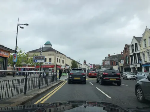
Murphy's Bar & Restaurant
Bar and pub
78 Market Street, Downpatrick
Tu 11:30-17:00; We,Su 11:30-20:00; Th-Sa 11:30-21:00; Mo off; PH...
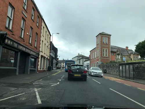




Kim On In
Fast food · Sandwich
30A St. Patrick'S Avenue, Downpatrick
2 more on the map.
History
An early Bronze Age site was excavated in the Meadowlands area of Downpatrick, revealing two roundhouses, one was four metres across and the other was over seven metres across. Archaeological excavations in the 1950s found what was thought to be a Bronze Age hillfort on Cathedral Hill, but further work in the 1980s revealed that this was a much later rampart surrounding an early Christian monastery.
Downpatrick is one of Ireland's oldest towns. It takes its name from a dún, a medieval royal fort, which stood on a drumlin overlooking the River Quoile. In the Middle Ages, the river was an estuary that would have surrounded the drumlin on most sides. It is believed that there was a ringfort on the site in the early Middle Ages. This may have been the site called Ráth Celtchair (later anglicized Rathkeltair), the 'fort of Celtchar', after a hero in the Ulster Cycle of Irish mythology.
A small Christian monastic settlement was also built on the neighbouring drumlin to the south, now known as 'Cathedral Hill'. Nearby Saul Monastery was associated with Saint Patrick. The saint is said to have been buried on Cathedral Hill in the 5th century, and his reputed grave is still a place of pilgrimage. Down Cathedral was later built on this spot.
Read more of the history
In the early 11th century, a much bigger fort with earthen ramparts was built on the northern drumlin, now known as the 'Mound of Down'. This was the capital of the Dál Fiatach, the main ruling dynasty of Ulaidh (Ulster), who held the title "Rí Uladh", "King of Ulster". Deirdre Flanagan suggests that the older name Dún Lethglaise referred to Cathedral Hill, while Dún da Lethglas was the name of this new royal residence.
The King of Norway, Magnus Barefoot, was killed in an ambush near Downpatrick in 1102. It is believed his grave is marked by a mound at Horse Island, southwest of Cathedral Hill.
Saint Malachy became the Bishop of Down (Dún da Lethglas) in 1137. He administered the diocese from Bangor and introduced a community of Augustinians (canons) to Dún da Lethglas dedicated to St John the Evangelist. Malachy and his successors repaired and enlarged Down Cathedral.
In the late 12th century, the area was conquered by Anglo-Normans led by John de Courcy, becoming part of his Earldom of Ulster. In February 1177, a Norman army of 300 men and 20 knights marched north from Dublin and took the town by surprise. The King of Ulster and Dál Fiatach, Ruaidrí mac Duinn Sléibe (Rory MacDunleavy), tried to retake the town, but was forced to withdraw after a fierce battle. The Normans began building a motte (fortified mound) inside the older royal fort, but abandoned it when de Courcy made Carrickfergus his capital in 1178.
In 1183, de Courcy brought in Benedictine monks from the abbey of St Werburgh in Chester (today Chester Cathedral), England. He built a friary for them at Downpatrick; this building was destroyed by an earthquake in 1245. He also re-dedicated the cathedral to Saint Patrick, giving it the name Ecclesia S. Patricii Duni in Latin. It is claimed that de Courcy miraculously found the bones of St Patrick, St Brigid and St Colmcille at Downpatrick. In the presence of the Papal Legate, Vivian, the relics were reburied inside the cathedral on 9 June 1196. This story of their discovery is thought to have been crafted by de Courcy for political reasons. In the Anglo-Norman and later medieval era the town's name in Latin and English documentation is variously 'Dunum', 'Dun' or 'Down'. The oldest surviving record of the name 'Downpatrick' is in the Bodley Survey of the early 1600s.
In 1260 Brian O'Neill, King of Tír Eoghain (Tyrone) and claimed High King of Ireland, marched to Downpatrick, which was then part of the Anglo-Norman earldom of Ulster. Allied with a Connacht force under Hugh O'Conor, he fought the Anglo-Normans in the Battle of Down. O'Neill was killed and the Irish were defeated. The death of O'Neill and defeat of the Irish was lamented in a poem by the Cenél nEógain bard Giolla Brighde Mac Con Midhe (1210–1272).
The earldom collapsed in the 1300s, but the English retained a foothold in Lecale. In 1375, Niall O'Neill of Tyrone defeated the English at Dundalethglas.
Under orders from King Henry VIII of England, Downpatrick's monastic community was dissolved by the English around 1540, and the cathedral fell into ruins. In 1600, the cathedral was allegedly burnt by English forces led by Edward Cromwell. A painting from 1788 shows the abbey ruins and its round tower.
The Archbishop of Armagh, composer of Irish bardic poetry and Christian poetry in the Classical Gaelic literary language, and Franciscan Counter-Reformation theologian Aodh Mac Cathmhaoil was born outside Downpatrick in 1571. On 21 January 1575, Franciscans John Lochran, Donagh O'Rorke, and Edmund Fitzsimon were hanged by Protestants at Downpatrick.
After his 25 April 1681 assassination by his foster brother, Art McCall O'Hanlon near Hilltown, County Down, rapparee leader Count Redmond O'Hanlon's severed head was displayed spiked upon Downpatrick Gaol. The count's body was buried in the Roman Catholic cemetery at Ballynabeck, on the road between Tandragee and Scarva.
Cathedral Hill was the subject of an archaeological investigation in series 5 of the Channel 4 Time Team programme.
Four main thoroughfares are shown converging on a town plan of 1724, namely English Street, Scotch (now Saul) Street, Barrack (now Scotch) Street, and Irish Street. The landscape limited the growth of the town. The early-18th-century street plan continued largely unchanged until 1838 when Church Street was built, followed by Market Street in 1846.
From the History section of Downpatrick on Wikipedia, under CC BY-SA 4.0.
More about Downpatrick
Education
Bunscoil Naomh Pádraig (St Patrick's Primary School) – Irish Speaking Primary School.
St Colmcille's Primary School – Roman Catholic Primary School.
Our Lady & St Patrick Primary School – Roman Catholic Primary School. (St Patrick's Boys' Primary School & Convent of Mercy Primary School merged to form this school which is situated at the old Convent of Mercy building, with a new school building in the planning stages.)
Down High School – (known locally as "The Green High") "Controlled" coeducational Grammar School
Lecale Trinity Grammar – mixed sex grammar school (St Mary's High School, St Patrick's Grammar School and De La Salle High School merged to form Lecale Trinity Grammar
South Eastern Regional College ( Downpatrick Campus ) – the local campus of the regional further and higher education college
From the Wikipedia article Downpatrick, under CC BY-SA 4.0.
Notable people from Downpatrick
 Conor HazardNorthern Irish association football playerPhoto: Timmy96, CC0
 E. Neville IsdellAmerican businessmanPhoto: World Economic Forum, CC BY-SA 2.0
 Margaret RitchieIrish republican politician (born 1958)Photo: ©House of Lords / photography by Roger Harris, CC BY 3.0
 Tim WheelerNorthern Irish singerPhoto: Chensiyuan, CC BY-SA 4.0
 Colin McGrathpolitician from Northern Ireland (born 1975)Photo: Northern Ireland Assembly, CC BY 3.0
- David HealyNorthern Irish footballer & manager
- Trevor CarsonNorthern Irish footballer
- Charles JohnstonIrish writer (1867–1931)
- Conor McMenaminassociation football player
- Alan NeillIrish cricket umpire
- Miles KingtonBritish journalist and musician (1941-2008)
- John AndersonBritish Army officer (1908–1988)
Born in Downpatrick, according to Wikidata (CC0). Each name links to its Wikipedia article.
Where to stay1
Churches and places of worship4
Shopping7
Gas and EV charging5
Schools, colleges and libraries10
Lecale Trinity Grammar School
School · Roman Catholic · 0.4 mi
109 Saul Street, Downpatrick
Healthcare4
Map of Downpatrick
75 places. The map loads OpenStreetMap tiles when you open it.
Getting there and nearby towns
George Best Belfast City Airport (BHD) is the nearest airport with scheduled flights listed in OpenStreetMap, 21 miles away.
- Newtownards 18 mi north, about 29 min by car
- Lisburn 19 mi northwest, about 30 min by car
- Dundonald 19 mi north, about 30 min by car
- Belfast 20 mi northwest, about 33 min by car
- Holywood 22 mi north, about 35 min by car
- Newtownabbey 24 mi north, about 39 min by car
- Newry 27 mi west, about 44 min by car
- Portadown 30 mi west, about 48 min by car
- Larne 36 mi north, about 58 min by car
- Dungannon 44 mi west, about 1 h 15 min by car
Drive times are estimates from straight-line distance, not routes.
Towns near Downpatrick


Keep exploring
Local news
Headlines from INDB.
Reviews, tips and questions
Loading what members have shared...
Sources and licences
- GeoNames (CC BY 4.0): population, coordinates, regions and time zone
- Mapillary (see each image): photos
- OpenStreetMap contributors (ODbL 1.0): places, airports, map data
- Wikidata (CC0 1.0): elevation, founding date, time zone, website, landmarks and historic places
- Wikimedia Commons (see each image): photos
- Wikipedia (CC BY-SA 4.0): overview and history text
Photo credits
- Downpatrick view (02), August 2009, Ardfern, CC BY-SA 3.0
- Market Street, Downpatrick, Aubrey Dale, CC BY-SA 2.0
- Downpatrick signs (07), August 2009, Ardfern, CC BY-SA 3.0
- Ballynoe (27), September 2009, Ardfern, CC BY-SA 3.0
- Struell Wells (19), October 2009, Ardfern, CC BY-SA 3.0
- Inch Abbey, Downpatrick, March 2010 (03), Ardfern, CC BY-SA 3.0
- Down Cathedral (01), August 2009, Ardfern, CC BY-SA 3.0
- Down High School (01), August 2009, Ardfern, CC BY-SA 3.0
- Saint Patrick Centre, Downpatrick, February 2010 (01), Ardfern, CC BY-SA 3.0
- DownCountyMuseumBuilding, Notafly, CC BY-SA 3.0
- Down Arts Centre (03), August 2009, Ardfern, CC BY-SA 3.0
- Down Arts Centre (02), August 2009, Ardfern, CC BY-SA 3.0
- Quoile Tavern, August 2009, Ardfern, CC BY-SA 3.0
- Down Recorder, August 2009, Ardfern, CC BY-SA 3.0
- Circle shop, August 2009, Ardfern, CC BY-SA 3.0
- Estate agents, August 2009, Ardfern, CC BY-SA 3.0
- Gallery 12 (02), August 2009, Ardfern, CC BY-SA 3.0
- Ráth Cealtchair (Mound of Down) - panoramio, Peter Moore (Moorso), CC BY-SA 3.0
- Street-level photo, laye, CC BY-SA 4.0
- Street-level photo, laye, CC BY-SA 4.0
- Street-level photo, laye, CC BY-SA 4.0
- Street-level photo, laye, CC BY-SA 4.0
- Street-level photo, toho, CC BY-SA 4.0
- Street-level photo, laye, CC BY-SA 4.0
- Street-level photo, laye, CC BY-SA 4.0
- Street-level photo, laye, CC BY-SA 4.0
- Street-level photo, laye, CC BY-SA 4.0
- Street-level photo, laye, CC BY-SA 4.0
- Street-level photo, laye, CC BY-SA 4.0
- Street-level photo, laye, CC BY-SA 4.0
- Street-level photo, laye, CC BY-SA 4.0
- Street-level photo, laye, CC BY-SA 4.0
- Street-level photo, laye, CC BY-SA 4.0


Page built November 10, 2026. Spotted a mistake? Tell us or suggest a place.