


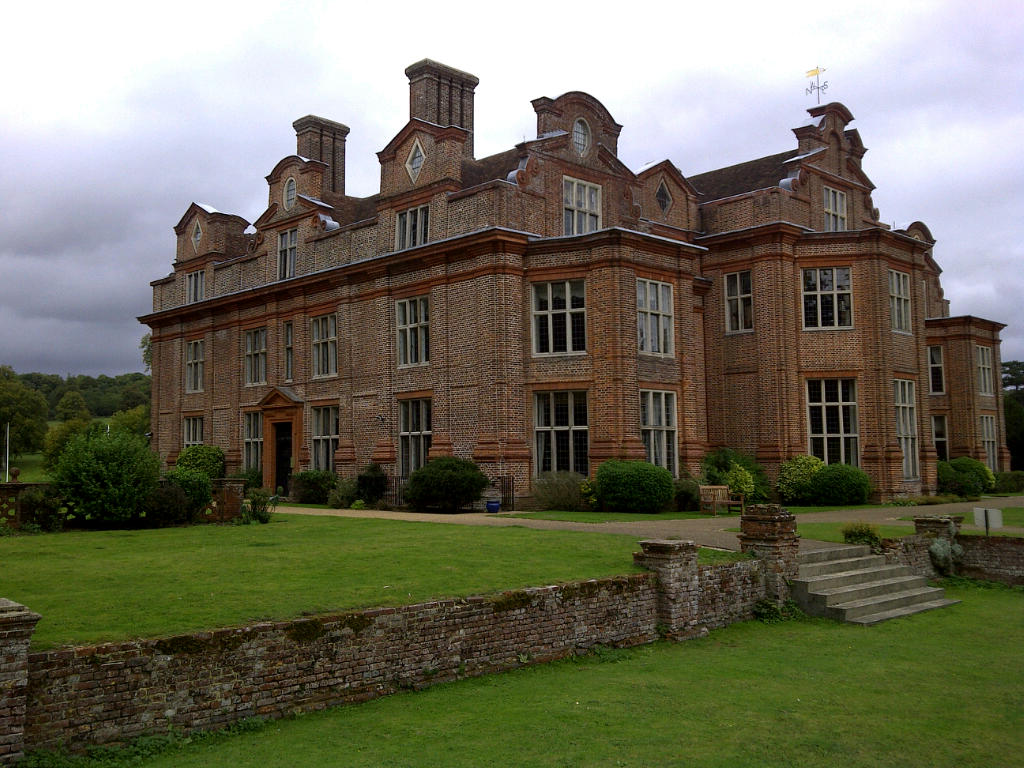
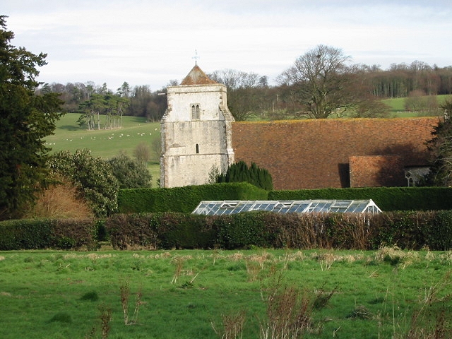

Why visit Barham
Townapedia lists 7 museums and landmarks, 6 parks and trails, 9 places to eat, 3 places to stay and 1 attraction in and around town.
Highlights include Fern & Farrow Farm Shop, Adisham Water Tower, Goodnestone Park and Jumping Downs.
Weather in Barham
Forecast from MET Norway (CC BY 4.0). Full forecast
About Barham
Barham BARR-əm is a village and civil parish in the City of Canterbury district of Kent, England. Barham village is approximately 6 miles (10 km) south-east from Canterbury and 8 miles (13 km) north from Folkestone. In 2011 the parish had a population of 1355.
From the Wikipedia article Barham, Kent (this version), under CC BY-SA 4.0.
Photos of Barham


Things to do1

Fern & Farrow Farm Shop
Farm and orchard · 2.1 mi
Frog Lane, Canterbury
We-Fr 09:00-16:00; Sa 09:00-15:00; Su 09:00-12:00
Museums and landmarks7


Goodnestone Park
Museum · 4.0 mi
Country house and garden in Goodnestone, Dover district, Kent, England, UK


Parks, trails and playgrounds6


Restaurants and cafes9



Mermaid Inn
Bar and pub · 1.9 mi
The Street, Canterbury
Mo-Tu 18:00-23:00;We-Fr 12:00-15:00,18:00-23:00;Sa 12:00-23:00;Su...

Vineyard Garden Centre Cafe
Cafe · 1.4 mi
Elham Valley Road, Canterbury
Mo-Sa 09:00-16:00; Su 10:00-16:00

History
The name Barham was spelt Bioraham in 799, from Biora (derived from Beora, a Saxon chief) and Ham ("settlement" or "homestead").
Just outside Barham stood the Black Mill, a windmill which was accidentally burnt down in 1970. Barham Downs Golf Club (now defunct) was founded in 1890. The club disappeared following the First World War.
From the History section of Barham, Kent on Wikipedia, under CC BY-SA 4.0.
More about Barham
Geography
The land of the village is a mostly rural and wooded right-angled triangle of land (irregular in shape) commencing with the A2 road between Canterbury and Dover on its north-east border, with its housing grouped among wooded hills and pasture of the village. Elevations range between 138 feet (42m) in the north to 427 feet (130 m) in the south-west. Barham Downs are wooded hills north-west of the village centre. The Nailbourne, a tributary of the Little Stour, rises in Lyminge and flows intermittently in line with the seasons and rainfall through the centre of the village.
To the south of Barham village is the residential area of Derringstone (conjoined to the village), and the hamlet of Breach at 1 mile (1.6 km) south. At the north of the parish is the hamlet of Out Elmstead.
From the Wikipedia article Barham, Kent, under CC BY-SA 4.0.
Notable people from Barham
- Leonard DiggesBritish mathematician
- Sir Thomas Thompson, 1st Baronetofficer of the British Royal Navy (1766–1828)
Born in Barham, according to Wikidata (CC0). Each name links to its Wikipedia article.
Where to stay3
Goldpark Leisure Camping and Caravan Site
Campground · 2.0 mi
Canterbury Road, Canterbury
Churches and places of worship7
Shopping3
Gas and EV charging1
Schools, colleges and libraries2
Healthcare1
Map of Barham
40 places. The map loads OpenStreetMap tiles when you open it.
Getting there and nearby towns
Manston Airport (MSE) is the nearest airport with scheduled flights listed in OpenStreetMap, 12 miles away.
- Bridge 3 mi northwest, about 5 min by car
- Shepherdswell 3 mi east, about 5 min by car
- Littlebourne 5 mi north, about 8 min by car
- Wingham 5 mi northeast, about 8 min by car
- Canterbury 6 mi northwest, about 10 min by car
- Folkestone 9 mi south, about 14 min by car
- Dover 9 mi southeast, about 14 min by car
- Blean 9 mi northwest, about 14 min by car
- Hythe 10 mi south, about 16 min by car
- Herne Bay 12 mi north, about 19 min by car
Drive times are estimates from straight-line distance, not routes.
Towns near Barham


Keep exploring
Local news
Headlines from INDB.
Reviews, tips and questions
Loading what members have shared...
Sources and licences
- GeoNames (CC BY 4.0): population, coordinates, regions and time zone
- Mapillary (see each image): photos
- OpenStreetMap contributors (ODbL 1.0): places, airports, map data
- Wikidata (CC0 1.0): elevation, founding date, time zone, website, landmarks and historic places
- Wikimedia Commons (see each image): photos
- Wikipedia (CC BY-SA 4.0): overview and history text
Photo credits
- The Duke of Cumberland pub, Barham, Nick Smith, CC BY-SA 2.0
- Goodnestone Park. Dover 1, Dhowes9, CC BY-SA 3.0
- North Downs Way near Hollingbourne 1, GkgAlf at English Wikipedia, CC BY-SA 3.0
- Broome Park, KJP1, CC BY-SA 3.0
- Bishopsbourne church, Nick Smith, CC BY-SA 2.0
- The Two Sawyers pub, Woolage Green, Kent, Nick Smith, CC BY-SA 2.0
- Adisham Water Tower, FutureArchaeology, CC BY-SA 4.0
- Walking the pilgrims way North Downs Way near Hollingbourne, Ray B's world, CC BY 2.0
- Broome Park country house, Kent, August 2010, Julie Anne Workman, CC BY-SA 3.0
- Street-level photo, southglos, CC BY-SA 4.0
- Street-level photo, tallguy, CC BY-SA 4.0
Page built November 10, 2026. Spotted a mistake? Tell us or suggest a place.