


Why visit Barmouth
Townapedia lists 11 museums and landmarks, 4 parks and trails, 43 places to eat, 20 places to stay and 13 attractions in and around town.
Highlights include Barmouth Bridge, Dragon Threatre, Sailors' Institute and The White House.
Weather in Barmouth
Forecast from MET Norway (CC BY 4.0). Full forecast
About Barmouth
Barmouth (formal Welsh: Abermaw, or Abermawddach; colloquially Y Bermo) is a seaside town and community in the county of Gwynedd, north-west Wales; it lies on the estuary of the Afon Mawddach and Cardigan Bay. Located in the historic county of Merionethshire, the Welsh form of the name is derived from aber (estuary) and the river's name, Mawddach. The English form of the name is a corruption of the earlier Welsh form Abermawdd. The community includes the villages of Llanaber, Cutiau and Caerdeon.
From the Wikipedia article Barmouth (this version), under CC BY-SA 4.0.
Travel tips from other travellers: Barmouth on Wikivoyage (CC BY-SA 4.0).
Photos of Barmouth


Things to do13

Barmouth Bridge
Bridge · 0.9 mi
Railway bridge across the Mawddach estuary

1 more on the map.
Museums and landmarks11




Parks, trails and playgrounds4



Restaurants and cafes43
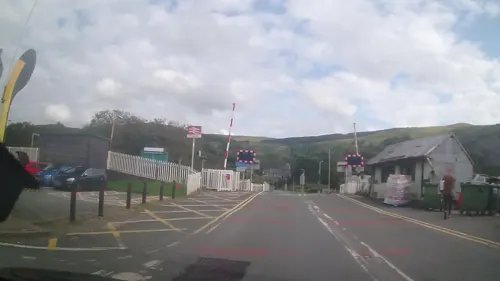
Fairbourne Chippy
Restaurant · Fish And Chips · 1.9 mi
6-7 Station Road, Fairbourne
Mo-Fr 12:00-14:00,16:30-19:30



31 more on the map.
History
Barmouth was first recorded in 1565 as a hamlet of four houses. In the late 18th century, it grew around the shipbuilding industry, and a harbour was built for fishing and exporting wool from nearby sheep farms. In the first half of the 19th century, Barmouth became known as a seaside resort. After Barmouth Bridge was constructed and the railway reached the town in 1867, more and more tourists arrived. New guest houses were built, but Barmouth never developed a conspicuous resort architecture. It was still mainly visited for the experience of the sea and the mountains, especially Cadair Idris. The German philologist Friedrich Althaus (1829–1897) wrote in 1889: "Cader Idris is to Barmouth what the Vesuvius is to Naples. (…) The prospect from the summit is said to be the grandest in all of Wales. (…) Climbing Cader Idris therefore takes top priority among many visitors of Barmouth."
William Wordsworth, a visitor to Barmouth in the 19th century, described it thus: "With a fine sea view in front, the mountains behind, the glorious estuary running eight miles [13 km] inland, and Cadair Idris within compass of a day's walk, Barmouth can always hold its own against any rival."
Notable buildings include the medieval Tŷ Gwyn tower house, the 19th century Tŷ Crwn roundhouse prison and St John's Church.
Read more of the history
Dinas Oleu (Citadel of Light), which is located east of the town on the adjoining hillside, was the first tract of land to be donated to the National Trust. Panorama Walk, to the east of the town, was developed as a coastal footpath in the Victorian era to contribute to the town's attractions for visitors. The walk is designated at Grade II on the Cadw/ICOMOS Register of Parks and Gardens of Special Historic Interest in Wales. On the route of the walk stands the Glan-y-Mawddach estate. Originally a Regency villa, the house, which is listed at Grade II, was extended in the late 19th and early 20th centuries and an important garden laid out which is designated at Grade II* on the Cadw/ICOMOS register.
Barmouth features prominently in the serialised short-story 'Rob the Red-Hand' published by Dolgellau-born Thomas Richards who published it in the Hobart Town Magazine between 1833 and 1834. In addition, the town is a key location the novel Austerlitz by Max Sebald. The town is featured in an idyllic light, with the narrator visiting several times during his childhood [see box].
In January 2014, two trains were stranded at Barmouth after severe winter storms destroyed the sea wall at nearby Llanaber.
From the History section of Barmouth on Wikipedia, under CC BY-SA 4.0.
Notable people from Barmouth
 Ken Hughesassociation football playerPhoto: Skippo10, CC BY-SA 4.0
- Tommy NutterBritish fashion designer (1943–1992)
- Johnny WilliamsWelsh boxer (1926-2007)
- Adrian DingleCanadian painter and comic book cartoonist (1911-1974)
- John GriffithWelsh journalist
Born in Barmouth, according to Wikidata (CC0). Each name links to its Wikipedia article.
Where to stay20
Churches and places of worship18
Shopping12
Schools, colleges and libraries2
Healthcare1
Map of Barmouth
124 places. The map loads OpenStreetMap tiles when you open it.
Getting there and nearby towns
RAF Valley - Anglesey Airport (VLY) is the nearest airport with scheduled flights listed in OpenStreetMap, 41 miles away.
- Dolgellau 7 mi east, about 12 min by car
- Harlech 10 mi north, about 15 min by car
- Machynlleth 13 mi southeast, about 20 min by car
- Penrhyndeudraeth 14 mi north, about 23 min by car
- Porthmadog 15 mi north, about 23 min by car
- Criccieth 15 mi northwest, about 25 min by car
- Borth 16 mi south, about 26 min by car
- Pwllheli 19 mi northwest, about 30 min by car
- Blaenau-Ffestiniog 19 mi north, about 31 min by car
- Aberystwyth 21 mi south, about 34 min by car
Drive times are estimates from straight-line distance, not routes.
Towns near Barmouth


Keep exploring
Local news
Headlines from INDB.
Reviews, tips and questions
Loading what members have shared...
Sources and licences
- GeoNames (CC BY 4.0): population, coordinates, regions and time zone
- Mapillary (see each image): photos
- OpenStreetMap contributors (ODbL 1.0): places, airports, map data
- Openverse (see each image): photos
- Wikidata (CC0 1.0): elevation, founding date, time zone, website, landmarks and historic places
- Wikimedia Commons (see each image): photos
- Wikipedia (CC BY-SA 4.0): overview and history text
Photo credits
- Aber y Mawddach o'r Bermo - Mawddach esuary from Bermo (Barmouth), Wales 13, Llywelyn2000, CC BY-SA 4.0
- Barmouth, United Kingdom (Unsplash), Cerys Lowe ceryslowe_1, CC0
- Barmouth railway station MMB 01, mattbuck ( category ), CC BY-SA 3.0
- Barmouth, United Kingdom (Unsplash ie6MtYduuLA), Cerys Lowe ceryslowe_1, CC0
- Co-operative Barmouth, Peter_Glyn, CC0
- Arthog - Barmouth Bridge - 20070915150033, Themountainphotographer, CC BY-SA 4.0
- Salem Chapel, Llwyngwril (43075777742), Alex Liivet from Chester, United Kingdom, CC BY 2.0
- Church of St Dwywe, Dyffryn Ardudwy, Pjposullivan, CC BY-SA 3.0
- St Tudwal's Church, Barmouth, Pjposullivan ; retouched by user Jaybear, CC BY-SA 3.0
- Stjohnbarmouthfrombeach, Rhiniog, CC BY-SA 3.0
- St.MaryAndBodfanBarmouth1, Helge Klaus Rieder, CC BY-SA 4.0
- Barmouth, Plas Mynach 2, R. Davison, Public domain
- Ty Gwyn (7748089676), Peter Broster, CC BY 2.0
- Tal-Y-Don Hotel, Probinaries, CC BY-SA 3.0
- The Last Inn, Probinaries, CC BY-SA 3.0
- Tŷ Crwn, Probinaries, CC BY-SA 3.0
- Barmouth, Plas Mynach, R. Davison, Public domain
- St Mary and St Bodfan Church, Llanaber south side, Pjposullivan, CC BY-SA 3.0
- Rock climbing on Garn Goruwyn near Barmouth, Roger Davies, CC BY-SA 2.0
- Street-level photo, trigpoint, CC BY-SA 4.0
- Street-level photo, trigpoint, CC BY-SA 4.0
- Street-level photo, trigpoint, CC BY-SA 4.0
- Street-level photo, trigpoint, CC BY-SA 4.0
- Street-level photo, trigpoint, CC BY-SA 4.0
- Street-level photo, trigpoint, CC BY-SA 4.0
- Street-level photo, trigpoint, CC BY-SA 4.0
- Street-level photo, trigpoint, CC BY-SA 4.0
- Street-level photo, trigpoint, CC BY-SA 4.0
- Street-level photo, trigpoint, CC BY-SA 4.0
- Street-level photo, trigpoint, CC BY-SA 4.0
- Street-level photo, trigpoint, CC BY-SA 4.0
- Street-level photo, trigpoint, CC BY-SA 4.0
- Street-level photo, trigpoint, CC BY-SA 4.0
- Street-level photo, trigpoint, CC BY-SA 4.0
- Street-level photo, trigpoint, CC BY-SA 4.0
- Street-level photo, trigpoint, CC BY-SA 4.0
- Street-level photo, trigpoint, CC BY-SA 4.0
- Street-level photo, trigpoint, CC BY-SA 4.0
- Street-level photo, trigpoint, CC BY-SA 4.0
- Street-level photo, trigpoint, CC BY-SA 4.0
- Street-level photo, trigpoint, CC BY-SA 4.0
- Street-level photo, trigpoint, CC BY-SA 4.0
- Street-level photo, trigpoint, CC BY-SA 4.0
- Street-level photo, trigpoint, CC BY-SA 4.0
- Street-level photo, trigpoint, CC BY-SA 4.0


Page built November 10, 2026. Spotted a mistake? Tell us or suggest a place.