


Why visit Hornsey
Townapedia lists 58 museums and landmarks, 106 parks and trails, 182 places to eat, 18 places to stay and 18 attractions in and around town.
Highlights include ArtHouse Crouch End, Hornsey Town Hall, Jacksons Lane and Alexandra Palace.
Weather in Hornsey
Forecast from MET Norway (CC BY 4.0). Full forecast
About Hornsey
Hornsey () is a district of north London, England, in the London Borough of Haringey. It is an inner-suburban, for the most part residential, area centred 10 km (6.2 mi) north of Charing Cross. It adjoins green spaces Queen's Wood to the west and Alexandra Park to the north, and lies in the valley of the now-culverted River Moselle. The central core of the area is known as Hornsey Village.
From the Wikipedia article Hornsey (this version), under CC BY-SA 4.0.
Things to do18


Hornsey Town Hall
Cinema and theater · 0.6 mi
A public building and former town hall in Crouch End area of Hornsey, London

Middle Lane Market
Farm and orchard
226 Middle Lane, London
Mo-Tu 09:00-16:00; We-Th, Sa 09:00-19:00; Fr 09:00-20:00; Su 09:00-17:00

Almeida Theatre
Cinema and theater · 3.4 mi
Theatre in Islington, London


Golders Green Hippodrome
Cinema and theater · 3.2 mi
Theatre in London, England, UK

New End Theatre
Cinema and theater · 3.1 mi
Former theatre in Hampstead, London

Everyman Cinema
Cinema and theater · 1.0 mi
Art deco cinema
Fortis Green Road, London
Mo-Su 12:00-23:00

Arcola Theatre
Cinema and theater · 3.2 mi
Theatre in Hackney, London, England
Etcetera Theatre
Cinema and theater · 3.4 mi
Pub theatre in Camden Town, London
Everyman Cinema
Cinema and theater · 3.3 mi
Cinema and former theatre in Hampstead, London, England
6 more on the map.
Museums and landmarks58


2 Willow Road
Museum · 2.9 mi
Heritage Museum in London, United Kingdom


Estorick Collection of Modern Italian Art
Museum · 3.2 mi
Art museum in London, United Kingdom

Fenton House
Museum · 3.2 mi
17th-century house with walled garden in Hampstead, London, UK

Francis Skaryna Belarusian Library and Museum
Museum · 3.3 mi
Library

Golders Green War Memorial
Monument and historic site · 3.3 mi
War memorial in London

Burgh House and Hampstead Museum
Museum · 3.1 mi
Local museum in Camden, London, England, United Kingdom

46 more on the map.
Parks, trails and playgrounds106


Barfield Allotments Nature Park
Park · 3.1 mi
Parkland in London, England


Bingfield Park
Park · 3.3 mi
Park in the London Borough of Islington, England


Gillespie Park
Park · 2.1 mi
Nature reserve in the London Borough of Islington


Little Dinosaurs
Playground · 0.7 mi
Alexandra Palace Way, London
Mo-Th 09:30-17:30; Fr 09:30-18:30; Sa-Su 10:00-18:00

Alexandra Palace Pitch & Putt
Golf course · 0.5 mi
10 hole Pitch & Putt course, par 3 course
Alexandra Palace Way, London
94 more on the map.
Restaurants and cafes182

The Bull
Bar and pub · British · 1.5 mi
13 North Hill, London
Mo-Th 12:00-23:00; Fr-Sa 12:00-24:00; Su 12:00-22:30

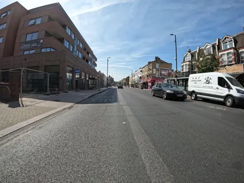
Langham Working Mens Club
Bar and pub · 1.0 mi
600 Green Lanes, London
Mo-Th 16:30-32:00; Fr 13:00-24:00; Sa 12:00-24:00; Su 12:00-23:00

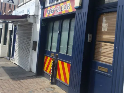
The Great Northern Railway Tavern
Bar and pub
67 High Street, London
Mo-Th 12:00-23:00; Fr-Sa 12:00-00:00; Su 12:00-22:30

The Mossy Well
Bar and pub · Usual Wetherspoons Selection · 0.9 mi
258-260 Muswell Hill Broadway, London
Mo 08:00-23:30; Tu-We 08:00-24:00; Th-Su 08:00-01:00

The Queens
Bar and pub · British, Pub, Roast · 0.5 mi
26 Tottenham Lane, London
Mo-Th 12:00-23:00; Fr-Sa 12:00-24:00; Su 12:00-23:00

The Starting Gate
Bar and pub · 0.8 mi
Station Road, London
Mo-Th 12:00-23:00; Fr 12:00-24:00; Sa 11:00-24:00; Su 11:00-22:30;...
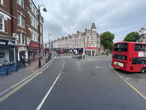
Akatuki
Restaurant · Japanese · 0.9 mi
224 Muswell Hill Broadway, London
Mo-Su 12:00-15:00,17:00-23:00
Bar Esteban
Restaurant · Spanish, Tapas · 0.5 mi
29 Park Road, London
Tu-Th 18:00-22:00; Fr-Sa 17:00-23:00
Barbers Bazaar
Restaurant · Indian
37 Tottenham Lane, London
Mo off; Tu-Fr 17:00-22:30; Sa-Su 12:00-22:30
170 more on the map.
History
The name Hornsey has its origin in the Saxon period and is derived from the name of a Saxon chieftain called Haering. Haering's Hege meant Haering's enclosure. The earliest-written form of the name was recorded as Harenhg' in about 1195. Its development thereafter gave rise to the modern-day names of Harringay (the district of London), the London Borough of Haringey and Hornsey. The church was first mentioned in 1291. Hornsey Village developed along what is now Hornsey High Street, and in the seventeenth century it was bisected by the New River that crossed the village in three places: first at the end of Nightingale Lane, secondly from behind the Three Compasses and lastly, as it does now, at the bottom of Tottenham Lane. The village grew dramatically after about 1860 and eventually merged with the separate settlement at Crouch End (first mentioned in 1465), to form an urban area in the middle of the parish.
Read more of the history
Hornsey was a much larger original ancient parish than today's electoral ward of the same name. These entities are smaller than the Municipal Borough of Hornsey which co-governed the area with Middlesex County Council from 1889 until 1965, since when the name refers, as a minimum, to the London neighbourhood with a high street at its traditional heart to the west of Hornsey railway station. Its parish ranked sixth in size, of more than forty in Ossulstone, the largest hundred in Middlesex and was a scattered semi-rural community of 2,716 people in 1801. By 1901 the population had risen about eightfold in forty years, reaching 87,626, by which time new localities/districts, mainly Crouch End and Muswell Hill, were popularly becoming considered distinct from Hornsey. The N8 postcode district, the current form of Hornsey ward as devised from time-to-time for equal representation (electorate) across wards of the Borough, and the choice of other railway and tube stations towards, on these definitions, outer parts create conflicting definitions of Hornsey and it is unclear whether since 1965 the term is distinct from Hornsey Village, a term unrecognised by some residents.
The old parish used to have two small detached parts immediately beyond and within Stoke Newington Parish. In the 1840s the parish had 5,937 residents, slightly reduced by the loss of Finsbury Park but comprised 2,362 acres (9.56 km2) taking in besides its own village, the established hamlets of Muswell Hill, Crouch End, Stroud Green, and part of Highgate.
In the later eighteenth and the first half of the nineteenth century, Hornsey became an increasingly popular area for wealthy merchants wanting a comfortable home close to London. With them came the laying out some large estates and subsequently the development of large villas along the principal routes. The arrival of the railway in 1850 made Hornsey a commuter town and accelerated urban development. In the late 1860s, large areas of Hornsey were developed by freehold land societies for working-class housing including Abyssinia (later known as Hornsey Vale) and Campsbourne. Development of a generally much more middle-class nature continued throughout the Victorian and Edwardian eras with the final gaps being filled during interwar period. Most of the early freehold land estates have since been demolished for public housing, or in the case of Abyssinia (Hornsey Vale) to accommodate the Hornsey School for Girls.
The tower of the original parish church still stands in its ancient graveyard in Hornsey High Street, at the centre of the old village. One-time well-known poets buried in the churchyard include English poet Samuel Rogers and Dutch poet Gerrit van de Linde. Thomas Moore's daughter Barbara is buried but the location has been lost.
Other notable places are the former Hornsey Town Hall in Crouch End. On the north side of the High Street was the old public bath and wash house (not to be confused with Hornsey Road Baths & Laundry 1+1⁄2 miles (2.4 km) away on Hornsey Road) which was demolished to make way for a new housing scheme and Sainsbury's. Opened in 1932, it had 33,000 users a year in the 1950s. A small group of residents wished Haringey Council to purchase the site and install arts and crafts studios, with a gallery, primarily for local artists.
For 1978 to 2002 in the borough, having in its initial 13 years no wards mentioning Hornsey, three wards bearing the name existed and so popularised it among bordering, competing areas with newer names, strongly reflecting their historic, shared identity:
In the 1840s a section of a major new railway line from London to the north, the Great Northern Railway (Great Britain), was constructed right through Hornsey near to the centre of the village, and a station - the first out of London on the line - was built to serve it on Tottenham Lane, opened on 8 August 1850. It was successful and sidings on both sides of the line were constructed s well as goods depots, so Hornsey became somewhat of a railway town. This tradition continues: two major maintenance depots for the new electric trains running from Finsbury Park to Brighton have been constructed beside the main line.
In 1870 the first shop of what would become the David Greig national grocery chain, once a rival to Sainsbury's, was opened in 32 Hornsey High Street by Greig's mother.
In 1951 the first Lotus Cars factory was established in stables behind the Railway Hotel (now No5 Dining) on Tottenham Lane. The company was formed as Lotus Engineering Ltd by Colin Chapman. The Railway Hotel pub was owned by Chapman's father. In its early days, Lotus sold cars aimed at private racers and trialists. Its early road cars could be bought as kits, in order to save on purchase tax. Lotus moved to Cheshunt in 1959, and to Hethel in Norfolk in 1966. Adjacent to the pub was the first Lotus showroom. The site is now being developed by Fifth State as the Lotus Buildings and will celebrate the Lotus heritage with a community cafe, new public spaces and housing for students.
From the History section of Hornsey on Wikipedia, under CC BY-SA 4.0.
More about Hornsey
Geography
There are various views as to the location of Hornsey's current boundaries. The northern and eastern boundaries are relatively uncontentious. Although the eastern boundary of the parish was Green Lanes, it is alleged by some that these are now restricted by Alexandra Park and the Great Northern Railway respectively. The southern and western boundaries are less clear cut. A recent version of those boundaries was provided by local opinion as expressed in a small residents' survey undertaken as part of the application for the Crouch End Neighbourhood Forum. It offers a contemporary view of where local residents see the boundary between Hornsey and Crouch End and so defines the southern and western boundaries. The area defined is almost identical to that presented by one individual on a personal Google Map. Both closely resemble the post-19th-century Anglican parish and refer to former methods of property reference such as the layout of building schemes (developers' estates).
Education
Secondary schools serving the area include Greig City Academy, Hornsey School for Girls and Highgate Wood Secondary School.
Primary schools within Hornsey include Campsbourne Primary School and St Mary's Primary School.
Hornsey has its own active local learned Society, Hornsey Historical Society.
From the Wikipedia article Hornsey, under CC BY-SA 4.0.
Notable people from Hornsey
 Edward Albert Sharpey-SchäferEnglish physiologist (1850–1935)Photo: Lippiatt, CC BY 4.0
 Mary ForbesBritish-American actress (1883–1974)Photo: Film screenshot (Universal Pictures), Public domain
 Eric PowellBritish rower and artist (1886-1933)Photo: Grindel1, CC BY-SA 3.0
 Charles KeeneEnglish artist and illustrator (1823–1891)Photo: Elliott & Fry, Public domain
 George Bowdler BucktonEnglish chemist, physicist and naturalist (1818-1905)Photo: W.T. Pike (died 1924), Public domain
 Jazzie BBritish disc jockeyPhoto: Loz Pycock from London, UK, CC BY-SA 2.0
- Richard TurnerEnglish footballer (1882-1960)
- Lindsay CooperEnglish musician (1951–2013)
- SwayBritish rapper and record producer (1982–2026)
- Walter BuchananEnglish footballer (1855–1926)
- Shayon HarrisonEnglish association football player (born 1997)
- Wil Malonemusic producer and arranger
Born in Hornsey, according to Wikidata (CC0). Each name links to its Wikipedia article.
Where to stay18
Churches and places of worship77
Shopping90
Gas and EV charging17
Schools, colleges and libraries47
Healthcare37
Map of Hornsey
250 places. The map loads OpenStreetMap tiles when you open it.
Getting there and nearby towns
London City Airport (LCY) is the nearest airport with scheduled flights listed in OpenStreetMap, 9 miles away.
- Wood Green 1 mi north, about 1 min by car
- Archway 1 mi south, about 2 min by car
- Palmers Green 2 mi north, about 3 min by car
- Southgate 2 mi northeast, about 4 min by car
- Tottenham 3 mi northeast, about 4 min by car
- Islington 4 mi south, about 6 min by car
- Walthamstow 4 mi east, about 7 min by car
- London 5 mi south, about 9 min by car
- Enfield Town 5 mi north, about 8 min by car
- Totteridge 5 mi northwest, about 7 min by car
Drive times are estimates from straight-line distance, not routes.
Towns near Hornsey


Keep exploring
Local news
Headlines from INDB.
Reviews, tips and questions
Loading what members have shared...
Sources and licences
- GeoNames (CC BY 4.0): population, coordinates, regions and time zone
- Mapillary (see each image): photos
- OpenStreetMap contributors (ODbL 1.0): places, airports, map data
- Wikidata (CC0 1.0): elevation, founding date, time zone, website, landmarks and historic places
- Wikimedia Commons (see each image): photos
- Wikipedia (CC BY-SA 4.0): overview and history text
Photo credits
- Hornsey Church Tower, Simon from London, United Kingdom, CC BY 2.0
- The Little Shop Hornsey 2024-07-28, Tom Page, CC BY-SA 2.0
- Tav, Hornsey, N8, Ewan-M, CC BY-SA 4.0
- 144 bus on Hornsey High Street 2026-02-06, Tom Page, CC BY-SA 4.0
- Hornsey Tavern, Hornsey, N8 (4262737478), Ewan Munro from London, UK, CC BY-SA 2.0
- Almeida Theatre 05 (2023), GilPe, CC BY-SA 4.0
- Lock 17 Market Bar, Camden Town, NW1 (6800612358), Ewan Munro from London, UK, CC BY-SA 2.0
- New End Theatre, Hampstead, London, England-27June2008, Andy Roberts, CC BY 2.0
- 1-3 Willow Road, Steve Cadman from London, U.K., CC BY-SA 2.0
- Museum Arsenal Football Club Museum, Gael13011, CC BY-SA 3.0
- Bruce Castle front 2024-02-24 (2), The wub, CC BY-SA 4.0
- Estorick Collection, Luke McKernan, CC BY-SA 2.0
- Fenton House Hampstead front February 2006, Unknown author, CC BY-SA 2.0
- Belarusian library London, Aleksandrs Čaičics, Public domain
- War memorial at Golders Green (12465422183), Ian Wright, CC BY-SA 2.0
- Walking in Finsbury Park, Hjuk at en.wikipedia, CC BY-SA 3.0
- Barfield Allotments Nature Park, Dudley Miles, CC0
- Belsize Wood south end 2, Dudley Miles, CC BY-SA 3.0
- Bethune Park nature area 2, Dudley Miles, CC BY-SA 3.0
- Bingfieldpark, Stetay ( talk ) ( Uploads ), Public domain
- Friary Park, Dudley Miles, Public domain
- Gillespie Park pond, Dudley Miles, CC BY-SA 3.0
- Muswell Hill Baptist Church 04, Philafrenzy, CC BY-SA 4.0
- APalace 1, Jack Rose, CC BY-SA 4.0
- Priory Park 2006, Pterre, CC BY-SA 3.0
- St Aloysius' College, Highgate, London, Mx. Granger, CC0
- St Benet Fink 2008-10-22 09-04-10, Arbus Driver, CC BY-SA 2.0 uk
- Flickr - Duncan~ - The Queens, Duncan Harris from Nottingham, UK, CC BY 2.0
- New Testament Church of God 01, Philafrenzy, CC BY-SA 4.0
- Parish Church of St. Michael Wood Green 10, Philafrenzy, CC BY-SA 4.0
- GOC Ally Pally 077 The Starting Gate pub, Wood Green (28935949052), Peter O'Connor aka anemoneprojectors, CC BY-SA 2.0
- St Mark's, N22, Iridescent, CC BY-SA 3.0
- Muswell Hill Library 02, Philafrenzy, CC BY-SA 4.0
- Bull, Highgate, N6 (7285705742), Ewan Munro from London, UK, CC BY-SA 2.0
- W. Martyn grocers shop 01, Philafrenzy, CC BY-SA 4.0
- United Reformed Church, Muswell Hill 02, Philafrenzy, CC BY-SA 4.0
- Arthouse Cinema, Tottenham Lane - panoramio, N19±, CC BY-SA 3.0
- The Bomb Factory Art Foundation, Bethsface, CC BY-SA 4.0
- The Mossy Well pub, Muswell Hill - 2022-09-02, The wub, CC BY-SA 4.0
- Greig City Academy, Mx. Granger, CC0
- The Salisbury, Barney Laurance, CC BY-SA 4.0
- St James' Church, Muswell Hill, Philafrenzy, CC BY-SA 4.0
- O'Neill's pub, Muswell Hill 07, Philafrenzy, CC BY-SA 4.0
- Middle Lane Market 2026-03-19, Keith Page, CC BY-SA 4.0
- Hornsey Town Hall 2026-03-26, Tom Page, CC BY-SA 4.0
- Golders Green Hippodrome North End Road London NW11 7RP, Spudgun67, CC BY-SA 4.0
- Jacksons Lane Arts Centre 2026-09-19, Matt Brown, CC BY 4.0
- Flickr - Duncan~ - Clissold Park Lions, Duncan Harris from Nottingham, UK, CC BY 2.0
- Street-level photo, matth81, CC BY-SA 4.0
- Street-level photo, erias, CC BY-SA 4.0
- Street-level photo, erias, CC BY-SA 4.0
- Street-level photo, matth81, CC BY-SA 4.0
- Street-level photo, matth81, CC BY-SA 4.0
- Street-level photo, matth81, CC BY-SA 4.0
- Street-level photo, asturksever, CC BY-SA 4.0
- Street-level photo, asturksever, CC BY-SA 4.0
- Street-level photo, matth81, CC BY-SA 4.0
- Street-level photo, matth81, CC BY-SA 4.0
- Street-level photo, matth81, CC BY-SA 4.0
- Street-level photo, asturksever, CC BY-SA 4.0
- Street-level photo, gness, CC BY-SA 4.0
- Street-level photo, matth81, CC BY-SA 4.0
- Street-level photo, gness, CC BY-SA 4.0
- Street-level photo, gness, CC BY-SA 4.0
- Street-level photo, matth81, CC BY-SA 4.0
- Street-level photo, matth81, CC BY-SA 4.0
- Street-level photo, erias, CC BY-SA 4.0
- Street-level photo, erias, CC BY-SA 4.0
- Street-level photo, erias, CC BY-SA 4.0
- Street-level photo, zymurgic, CC BY-SA 4.0
- Street-level photo, gness, CC BY-SA 4.0
- Street-level photo, matth81, CC BY-SA 4.0


Page built November 10, 2026. Spotted a mistake? Tell us or suggest a place.