


Friern Barnet, United Kingdom
Friern Barnet is a town of 17,250 people in England, United Kingdom.
Why visit Friern Barnet
Townapedia lists 57 museums and landmarks, 81 parks and trails, 194 places to eat, 11 places to stay and 6 attractions in and around town.
Highlights include Alexandra Palace, Golders Green Hippodrome, St Pancras and Islington Cemetery and Arts Depot.
Weather in Friern Barnet
Forecast from MET Norway (CC BY 4.0). Full forecast
About Friern Barnet
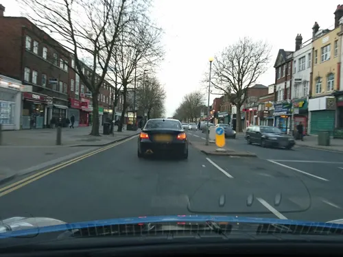
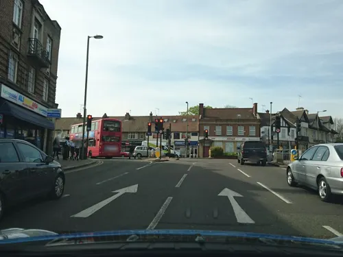
Friern Barnet () is a suburban area within the London Borough of Barnet, 7.4 miles (11.9 km) north of Charing Cross. Its centre is formed by the busy intersection of Colney Hatch Lane (running north and south), Woodhouse Road (taking westbound traffic towards North Finchley) and Friern Barnet Road (leading east towards New Southgate).
From the Wikipedia article Friern Barnet (this version), under CC BY-SA 4.0.
Photos of Friern Barnet


Things to do6

Alexandra Palace
Cinema and theater · 1.8 mi
Entertainment venue in Alexandra Park, London

Golders Green Hippodrome
Cinema and theater · 3.2 mi
Theatre in London, England, UK

Hornsey Town Hall
Cinema and theater · 2.8 mi
A public building and former town hall in Crouch End area of Hornsey, London

Crouch End Hippodrome
Cinema and theater · 2.7 mi
Former theatre in Tottenham Lane, Crouch End, Haringey, London
Intimate Theatre
Cinema and theater · 2.5 mi
Theatre in Palmers Green, London
Museums and landmarks57


Church Farmhouse Museum
Museum · 3.4 mi
Former museum in Barnet, London

Francis Skaryna Belarusian Library and Museum
Museum · 1.1 mi
Library

Golders Green War Memorial
Monument and historic site · 3.3 mi
War memorial in London

Kenwood House
Museum · 2.9 mi
Art museum and historic house in Hampstead, London



Bringer of Peace
Monument and historic site · 0.4 mi
Dedicated to the memory of King Edward VII, and erected on 7 May 1910, the day after his death
Hiroshima & Nagasaki Memorial Cherry Tree
Monument and historic site · 1.3 mi
Cherry Tree planted in 1984 to commemorate the estimated 214,000 people killed by the atomic bombs dropped on the Japanese cities of...
45 more on the map.
Parks, trails and playgrounds81


Long Lane Pasture
Park · 1.5 mi
Nature preserve in Finchley, Barnet, Greater London, United Kingdom


Arrandene Open Space and Featherstone Hill
Park · 3.1 mi
Local nature reserve in Barnet, London, England


Barfield Allotments Nature Park
Park · 0.9 mi
Parkland in London, England

Belmont Open Space
Park · 2.3 mi
Public park in Cockfosters in the London Borough of Barnet

Bittacy Hill Park
Park · 2.4 mi
Park in London Borough of Barnet, United Kingdom

Brent Park
Park · 3.0 mi
Park in London Borough of Barnet, United Kingdom


69 more on the map.
Restaurants and cafes194
Sushimania
Restaurant · Sushi, Japanese · 0.7 mi
650 High Road, London
Mo-Fr 12:00-15:00,18:00-23:00; Sa,Su 12:00-23:00
The Griffin
Bar and pub · Local · 1.4 mi
1262 High Road, London
Mo-Th 12:00-23:00; Fr-Sa 12:00-00:00; Su 12:00-22:30
Uri's Kitchen
Restaurant · British, Mediterranean
Friern Barnet Road, London
Mo-We 09:00-22:00; Th-Sa 09:00-23:00; Su 09:00-21:00
Elephant Inn
Bar and pub · 0.9 mi
283 Ballards Lane, London
Mo-Th 11:00-23:00; Fr-Sa 11:00-00:00; Su 12:00-22:30

182 more on the map.
History
Friern Barnet was an ancient parish in the Finsbury division of Ossulstone hundred, in the county of Middlesex.
The area was originally considered to be part of Barnet, most of which was in Hertfordshire. By the 13th century the Middlesex section of Barnet was known as Little Barnet, before becoming Frerenbarnet and then Friern Barnet (sometimes spelt in other ways, such as "Fryern Barnett"). The "Friern" part of the parish's name derives from the French for "brother" and refers to the medieval lordship of the Brotherhood or Knights of the Hospital of St John of Jerusalem.
Friern Barnet was mainly rural until the 19th century. The opening of Colney Hatch paupers' lunatic asylum in 1851, and of railway stations on the Great Northern and Metropolitan Railways, also in the mid-19th century, prompted its development as an outer London suburb. This process was accelerated by the arrival of electric trams in the 1900s.
Read more of the history
Local affairs were administered by the parish vestry until 1875, when it was grouped with neighbouring parishes as part of Barnet Rural Sanitary District. In response to a petition by local ratepayers who wished the area to be removed from the Barnet RSD, the parish adopted the Local Government Act 1858 and formed a local board of health of nine members in 1883. Under the Local Government Act 1894 the local board's area became the Friern Barnet Urban District. This occupied an area of 1,304 acres (5.28 km2) in 1911 and had a population of 14,924. In 1961 it occupied an area of 1,342 acres (5.43 km2) and the population was 28,813. In 1965 it became part of the London Borough of Barnet.
Lawrence Campe (died 1613), draper and citizen of the City of London, funded the building of almshouses in "Fryan Barnett".
Charlotte Maria Tucker (1821–1893), pseudonym A.L.O.E. (A Lady of England), was born at Friern Hatch. She was a prolific writer and poet for children and adults, who tempered her didactic Evangelicalism with realistic depictions of the poor.
Wilfred Kitching (1893–1977), 7th General of the Salvation Army, was educated at Friern Barnet Grammar School.
Dorothy Lawrence (1896–1964), a reporter who posed as a man to join the army in World War I, was later confined in Colney Hatch Lunatic Asylum (latterly Friern Hospital), where she died.
Jack Cohen, founder of the Tesco retail chain, funded with his wife the Jewish care facility Lady Sarah Cohen House in Friern Barnet.
Hazel Alden Reason (1901–1976), chemist and popular science writer, was born in Friern Barnet.
H. G. H. Kearns (1902–1986), an entomologist with a strong knowledge of engineering, was born in Friern Barnet.
Cyril Fletcher (1913–2005), comedian and actor, was educated at Woodhouse Grammar School.
Colin Pearson (1923–2007), a studio potter and art teacher, was born in Friern Barnet.
Edgar Mann (1926–2013), a politician who chaired the Executive Council of the Isle of Man and then headed its government, was educated at Woodhouse Barnet Grammar School.
John Williams (born 1941), classical guitarist, was educated at Friern Barnet Grammar School
Václav Jelínek (born 1944), Czech spy who was arrested in his flat in Friern Barnet on 22 April 1988, while in the process of receiving coded messages by radio.
Neil 'Roberto' Williams (born 1978), a radio and TV presenter, was educated at Friern Barnet Grammar School.
From the History section of Friern Barnet on Wikipedia, under CC BY-SA 4.0.
More about Friern Barnet
Education
Local schools and colleges include Coppetts Wood Primary School, Friern Barnet School, Dwight School London (being the former Friern Barnet Grammar School), The Compton School, Woodhouse College, St John's CE Primary School, Holly Park Primary School and the Wren Academy.
From the Wikipedia article Friern Barnet, under CC BY-SA 4.0.
Notable people from Friern Barnet
 Charlotte Maria TuckerEnglish children's writerPhoto: W. Kotzman?, Public domain
- Jamie DemetriouEnglish comedian and actor
- Ian BedfordEnglish cricketer (1930-1966)
- Martin PageBritish writer and journalist (1938–2003)
- Reginald le BasEnglish cricketer, solicitor and barrister
- Nick PetfordBritish academic
- H.G.H. KearnsProfessor, Entomologist, Academic researcher (1902–1986)
Born in Friern Barnet, according to Wikidata (CC0). Each name links to its Wikipedia article.
Where to stay11
Churches and places of worship66
Church of St Cyril of Turau and All the Patron Saints of the Belarusian People
Church · Greek Catholic · 1.1 mi
Holden Avenue, London
Shopping30
Gas and EV charging8
Schools, colleges and libraries54
Our Lady of Lourdes Catholic Primary School
School · Roman Catholic · 1.0 mi
The Limes Avenue, London
Sacred Heart Roman Catholic Primary School
School · Roman Catholic · 1.1 mi
2 Oakleigh Park South, London
Healthcare18
Map of Friern Barnet
250 places. The map loads OpenStreetMap tiles when you open it.
Getting there and nearby towns
London City Airport (LCY) is the nearest airport with scheduled flights listed in OpenStreetMap, 12 miles away.
- Wood Green 2 mi southeast, about 3 min by car
- Palmers Green 2 mi east, about 3 min by car
- Totteridge 2 mi northwest, about 4 min by car
- Hornsey 2 mi southeast, about 4 min by car
- Southgate 3 mi east, about 4 min by car
- New Barnet 3 mi north, about 4 min by car
- Archway 3 mi south, about 5 min by car
- Highgate 3 mi south, about 5 min by car
- Tottenham 4 mi east, about 6 min by car
- Enfield Town 4 mi northeast, about 7 min by car
Drive times are estimates from straight-line distance, not routes.
Towns near Friern Barnet


Keep exploring
Local news
Headlines from INDB.
Reviews, tips and questions
Loading what members have shared...
Sources and licences
- GeoNames (CC BY 4.0): population, coordinates, regions and time zone
- Mapillary (see each image): photos
- OpenStreetMap contributors (ODbL 1.0): places, airports, map data
- Wikidata (CC0 1.0): elevation, founding date, time zone, website, landmarks and historic places
- Wikimedia Commons (see each image): photos
- Wikipedia (CC BY-SA 4.0): overview and history text
Photo credits
- Friern Barnet town hall2, User:Grim23, CC BY-SA 3.0
- Orange Tree, Friern Barnet, N11 (6043153828), Ewan Munro from London, UK, CC BY-SA 2.0
- 36 Queens Parade Trentasei, Friern Barnet, N11, Ewan Munro, CC BY-SA 2.0
- St John the Evangelist, Friern Barnet 28, Philafrenzy, CC BY-SA 4.0
- St John the Evangelist, Friern Barnet 29, Philafrenzy, CC BY-SA 4.0
- St John the Evangelist, Friern Barnet 33, Philafrenzy, CC BY-SA 4.0
- St John the Evangelist, Friern Barnet 32, Philafrenzy, CC BY-SA 4.0
- APalace 1, Jack Rose, CC BY-SA 4.0
- Church Farmhouse Museum, Grim23, CC BY-SA 3.0
- Belarusian library London, Aleksandrs Čaičics, Public domain
- War memorial at Golders Green (12465422183), Ian Wright, CC BY-SA 2.0
- The Noble Sage, East Finchley art gallery (354235321), Mark Hillary from São Paulo, Brazil, CC BY 2.0
- Bethune Park nature area 2, Dudley Miles, CC BY-SA 3.0
- Friary Park, Dudley Miles, Public domain
- Swan Lane Open Space pond, Dudley Miles, CC BY-SA 3.0
- Barfield Allotments Nature Park, Dudley Miles, CC0
- Belmont Open Space Cockfosters, Dudley Miles, Public domain
- Bittacy Hill Park 2, Dudley Miles, CC0
- River Brent in Brent Park, Dudley Miles, CC BY-SA 3.0
- Finchley Methodist Church (2), Philafrenzy, CC BY-SA 4.0
- Christ Church North Finchley 30 September 2016 04, Philafrenzy, CC BY-SA 4.0
- Artsdepot, Grim23, CC BY-SA 3.0
- SPNS interior, Angelic Doc, CC BY-SA 4.0
- Church of St Cyril of Turau and All the Patron Saints of the Belarusian People (2016-11-24), Nieszczarda2, CC BY-SA 4.0
- Finchley War Memorial 5 April 2016 01, Philafrenzy, CC BY-SA 4.0
- The whetstone outside The Griffin, Whetstone, July 2021 01, No Swan So Fine, CC BY-SA 4.0
- East Finchley Library 01, Philafrenzy, CC BY-SA 4.0
- All Saints' Church, East Finchley 05, Philafrenzy, CC BY-SA 4.0
- East Finchley Baptist Church Sept 2016, Philafrenzy, CC BY-SA 4.0
- Finchley Memorial Hospital, Dudley Miles, CC BY-SA 4.0
- The whetstone outside The Griffin, Whetstone, July 2021 02, No Swan So Fine, CC BY-SA 4.0
- Islington Chapel, Mark Kobayashi-Hillary, CC BY 2.0
- Artsdepot, North Finchley 02, Philafrenzy, CC BY-SA 4.0
- Cherry tree woods finchley, G ri m 2 3 ★, CC BY-SA 3.0
- Burtonhole Lane, Dudley Miles, Public domain
- Arrandene Open Space, Dudley Miles, Public domain
- Ashley Lane, Dudley Miles, Public domain
- Golders Green Hippodrome North End Road London NW11 7RP, Spudgun67, CC BY-SA 4.0
- Hornsey Town Hall 2026-03-26, Tom Page, CC BY-SA 4.0
- Kenwood House King Charles I by unknown Artist, Ricardalovesmonuments, CC BY-SA 4.0
- Long Lane Pasture, Dudley Miles, CC BY-SA 3.0
- Street-level photo, zymurgic, CC BY-SA 4.0
- Street-level photo, zymurgic, CC BY-SA 4.0
- Street-level photo, zymurgic, CC BY-SA 4.0
- Street-level photo, zymurgic, CC BY-SA 4.0
- Street-level photo, zymurgic, CC BY-SA 4.0
- Street-level photo, zymurgic, CC BY-SA 4.0
- Street-level photo, zymurgic, CC BY-SA 4.0
- Street-level photo, zymurgic, CC BY-SA 4.0
- Street-level photo, zymurgic, CC BY-SA 4.0
- Street-level photo, zymurgic, CC BY-SA 4.0
- Street-level photo, zymurgic, CC BY-SA 4.0
- Street-level photo, gness, CC BY-SA 4.0
- Street-level photo, zymurgic, CC BY-SA 4.0
- Street-level photo, gness, CC BY-SA 4.0
- Street-level photo, gness, CC BY-SA 4.0
- Street-level photo, gness, CC BY-SA 4.0
- Street-level photo, matth81, CC BY-SA 4.0
- Street-level photo, zymurgic, CC BY-SA 4.0
- Street-level photo, zymurgic, CC BY-SA 4.0
- Street-level photo, zymurgic, CC BY-SA 4.0
- Street-level photo, zymurgic, CC BY-SA 4.0
- Street-level photo, zymurgic, CC BY-SA 4.0
- Street-level photo, zymurgic, CC BY-SA 4.0
- Street-level photo, zymurgic, CC BY-SA 4.0
- Street-level photo, zymurgic, CC BY-SA 4.0
- Street-level photo, zymurgic, CC BY-SA 4.0
- Street-level photo, zymurgic, CC BY-SA 4.0
- Street-level photo, erias, CC BY-SA 4.0
- Street-level photo, gness, CC BY-SA 4.0
- Street-level photo, zymurgic, CC BY-SA 4.0
- Street-level photo, gness, CC BY-SA 4.0


Page built November 10, 2026. Spotted a mistake? Tell us or suggest a place.