
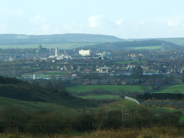


Barnsley, United Kingdom
Barnsley is a town of 71,447 people in England, United Kingdom.
Why visit Barnsley
Townapedia lists 45 museums and landmarks, 46 parks and trails, 275 places to eat, 7 places to stay and 8 attractions in and around town.
Highlights include Parkway, The Electric Theatre, Wentworth Castle and Cannon Hall.
Weather in Barnsley
Forecast from MET Norway (CC BY 4.0). Full forecast
About Barnsley
Barnsley is a market town in South Yorkshire, England. It is the main settlement of the Metropolitan Borough of Barnsley and the fourth largest settlement in South Yorkshire. The town's population was recorded as 71,599 at the 2021 census, while the wider borough (as of 2025) has a population of 251,770.
From the Wikipedia article Barnsley (this version), under CC BY-SA 4.0.
Travel tips from other travellers: Barnsley on Wikivoyage (CC BY-SA 4.0).
Photos of Barnsley


Things to do8




Museums and landmarks45

Wentworth Castle
Museum · 2.3 mi
Grade I listed historic house museum in Stainborough, Barnsley, South Yorkshire, England, UK

Cannon Hall
Museum · 4.6 mi
Country house museum in Cawthorne, South Yorkshire, England, United Kingdom

Elsecar Heritage Centre
Museum · 4.7 mi
Living history museum in Elsecar, England


Obelisk to Lady Mary Wortley Montagu
Monument and historic site · 2.5 mi
Obelisk in Stainborough, Barnsley, South Yorkshire, England, UK

Stainborough Castle
Monument and historic site · 2.5 mi
Stainborough Lane, Barnsley

Experience Barnsley Museum and Discovery Centre
Museum
Church Street, Barnsley
Tu-Fr 10:00-16:00; Sa 10:00-15:30

33 more on the map.
Parks, trails and playgrounds46


Penny Pie Park
Park · 1.1 mi
Park in Barnsley, South Yorkshire, England, United Kingdom




34 more on the map.
Restaurants and cafes275


The Strafford Arms
Bar and pub · 1.8 mi
Park Drive, Barnsley
Mo-We 12:00-21:30; Th 12:00-22:00; Fr,Sa 12:00-23:00; Su 12:00-19:30


Dolly's Desserts
Restaurant · Dessert
May Day Green, Barnsley
Mo-Th 10:00-20:00; Fr-Sa 10:00-21:00; Su 11:00-19:00
Funny Gals
Bar and pub
9 Wellington Street, Barnsley
Tu-Su 23:00-05:00
263 more on the map.
History
The name Barnsley derives from the Old English Beornslēah meaning 'Beorn's wood or clearing'.
Following the Norman invasion of 1066, many abbeys and priories were built in Yorkshire. Norman landowners increased their revenues and established new towns such as Barnsley, Doncaster, Hull, Leeds, Scarborough and Sheffield. Of towns founded before the conquest, only Bridlington, Pocklington, and York continued at a prominent level.
Although settlements had been established in the Barnsley area for centuries prior, and was a well known centre to trade, the first reference to Barnsley occurs in 1086 in the Domesday Book, in which it is called Berneslai and has a population of around 200.
The town was in the parish of Silkstone and developed little until in the 1150s, when it was given to the Pontefract Priory. The monks built a town where three roads met: the Sheffield to Wakefield, Rotherham to Huddersfield and Cheshire to Doncaster routes. The Domesday village became known as Old Barnsley, and a town grew up on the new site.
Read more of the history
The monks erected a chapel of ease dedicated to Saint Mary, which survived until 1820 , and established a market. In 1249, a Royal charter was granted to Barnsley permitting it to hold a weekly market on Wednesdays and annual four-day fair at Michaelmas. By the 1290s, three annual fairs were held. The town was the centre of the Staincross wapentake but, in the mid-16th century, it had only 600 inhabitants.
From the 17th century, Barnsley developed into a stop-off point on the route between Leeds, Wakefield, Sheffield and London. The traffic generated as a result of its location fuelled trade, with hostelries and related services prospering. A principal centre for linen-weaving during the 18th and 19th century, Barnsley grew into an important manufacturing town.
The first passenger station to serve Barnsley was opened by the North Midland Railway in 1840. Barnsley station (later called Cudworth) was located some 2+1⁄2 miles (4 km) away at Cudworth. On 1 January 1850, the Manchester and Leeds Railway opened Barnsley Exchange station, close to the town centre. On 1 May 1870, the Midland Railway opened Regent Street station, a temporary structure. A new station was opened by the MR on the Regent Street site on 23 August 1873. As it incorporated the old court house in its construction, Regent Street station was renamed Barnsley Court House.
Barnsley became a municipal borough in 1869 and a county borough in 1913. The town's boundaries were extended to absorb Ardsley and Monk Bretton in 1921, and Carlton in 1938.
The town was the site of a human crush that resulted in the deaths of 16 children in 1908 at a public hall, now known as The Civic, when children were rushing to watch a film in the building.
Barnsley has a long tradition of glass-making, however Barnsley is most famous for its coal mines. In 1960, there were 70 collieries within a 15 miles (24 km) radius of Barnsley town centre, but the last of these closed in 1994. The National Union of Mineworkers still has its HQ in Barnsley.
George Orwell mentioned the town in The Road to Wigan Pier. He arrived in the town on 11 March 1936 and spent a number of days living in the houses of the working class miners, while researching for the book. He wrote very critically of the council's expenditure on the construction of Barnsley Town Hall and claimed that the money should have been spent on improving the housing and living conditions of the local miners.
From the History section of Barnsley on Wikipedia, under CC BY-SA 4.0.
More about Barnsley
Geography
Barnsley is located in the valley of the River Dearne at the eastern foothills of the Pennines, near the uplands of the Peak District to the west. Geologically, the town is located within the area of the South Yorkshire Coalfield, consisting of the middle coal measures and sandstones laid down in the Carboniferous period. The town lies approximately 12 miles (19 km) north of Sheffield, 17 miles (27 km) south of Leeds, 9 miles (14 km) south of Wakefield and 32 miles (51 km) east of Manchester.
Ardsley, Athersley, Barugh Green, Bank End, Birdwell, Darton, Carlton, Cawthorne, Cudworth, Cundy Cross, Darfield, Dodworth, Elsecar, Gawber, Grimethorpe, Higham, Honeywell, Hoyland, High Hoyland, Hoylandswaine, Kendray, Kexbrough, Kingstone, Langsett Lundwood, Mapplewell, Monk Bretton, Tankersley, New Lodge, Oakwell, Old Town, Penistone, Pogmoor, Royston, Shafton, Smithies, Silkstone, Staincross, Stairfoot, Thurnscoe, Wilthorpe, Woolley Colliery, Worsbrough (includes Worsbrough Bridge, Rockley, Worsbrough Dale, Swaithe, Worsbrough Village, and Ward Green), Worsbro Common, Wombwell and Wortley.
Economy
A large part of Barnsley town centre was constructed during the 1960s. The area around Cheapside and May Day Green, the Metropolitan Centre, is home to the market and many national high street chains. Alhambra Shopping Centre, which was opened in 1991, houses several retailers.
Other prominent areas include Queen Street, Market Street, Eldon Street and the Victorian Arcade, which houses the majority of the independent and designer retailers in Barnsley. The town also has a large concentration of pubs and bars in the central district. There is also a twin auditorium cinema called Parkway Cinema Barnsley occupying what once was the Odeon Cinema on Eldon Street.
The development of a new shopping centre was started in the town centre in late 2015.
Barnsley town centre has been undergoing a period of change; projects include:
Experience Barnsley – The creation of the Barnsley People's Museum and Archives Centre. This project was awarded almost £3m of funding from the Heritage Lottery Fund, which means two floors of Barnsley's town hall were transformed into museum galleries (now completed)
Barnsley College A Block was completed and opened in September 2011.
A new area of town opened in 2021, the Glass Works. It re-houses the town's historic market, and adds a food court, a 13-screen Cineworld cinema, bowling alley and high street shops. (now completed)
Arts and culture
The Civic, in the town centre, is a multi-purpose performance venue in a grade II listed building. The building was originally the Barnsley Mechanics Institute and Public Hall, built by Henry Harvey in 1877. His brother Charles Harvey, gave the building to the people of the town a few years later, renaming it the Harvey Institute. The Harvey Institute was host to many types of entertainment, including variety shows and cinema. It was also home to the public library and shops; public meetings and celebrations were held in the hall; and education was provided. The School of Art occupied the Public Hall from 1878 to 1948, which was also used as first headquarters and billets for "Barnsley Pals" during World War I. In 1962, the building became Barnsley Civic Theatre, closing in 1998.
The Civic was reopened in March 2009 after a major redevelopment, which included provision for a theatre and public art gallery. The Civic has hosted high-profile acts such as Al Murray and Russell Howard. The Civic houses a contemporary art gallery that hosts touring exhibition from the V&A and the Flow Gallery in London. The Civic also curates its own work for touring.
The Lamproom Theatre has four theatrical companies, and showcases theatre in the town.
Education
Barnsley College is situated on a number of sites throughout the town centre, chiefly Old Mill Lane campus, SciTech Centre, Honeywell sports campus, CUBE Construction Centre and STEM Centre. The University of Huddersfield has recently opened a campus in the town on Church Street, beside Barnsley Town Hall; this is known as the University Campus Barnsley.
All 14 secondary schools in Barnsley were demolished and replaced by academy education centres, named SuperSchools. These combined all the previous LEA run comprehensive schools in the area into newly PFI built academies under the Building Schools for the Future programme.
From the Wikipedia article Barnsley, under CC BY-SA 4.0.
Notable people from Barnsley
 John StonesEnglish footballer (born 1994)Photo: Bryan Berlin, CC BY-SA 4.0
 Joanne HarrisBritish and French authorPhoto: Keyserzozie, CC BY-SA 4.0
 Mick McCarthyIrish-English association football managerPhoto: Ncadc2004, CC BY-SA 4.0
 Tommy TaylorEnglish footballer (1932–1958)Photo: Eskil Malmberg, Public domain
 Hudson TaylorBritish Protestant missionary in ChinaPhoto: London: Morgan & Scott, Public domain
 Ed ClancyEnglish racing cyclistPhoto: Nicola, CC BY-SA 4.0
 Katherine KellyEnglish actressPhoto: BeaumontComms, CC BY-SA 4.0
 Kenny DoughtyBritish actorPhoto: OfficialKennyDoughty, CC BY-SA 3.0
 Arthur Hollandfootball refereePhoto: Joop van Bilsen for Anefo, CC0
 Katherine BruntEngland women cricketer (born 1985)Photo: Bahnfrend, CC BY-SA 4.0
- John ArdenBritish playwright (1930–2012)
- Paul HeckingbottomEnglish footballer and manager
Born in Barnsley, according to Wikidata (CC0). Each name links to its Wikipedia article.
Where to stay7
Churches and places of worship45
Shopping46
Gas and EV charging12
Schools, colleges and libraries48
Healthcare33
Map of Barnsley
250 places. The map loads OpenStreetMap tiles when you open it.
Getting there and nearby towns
Leeds Bradford Airport (LBA) is the nearest airport with scheduled flights listed in OpenStreetMap, 23 miles away.
- Darton 3 mi northwest, about 5 min by car
- Cudworth 3 mi northeast, about 5 min by car
- Hoyland Nether 4 mi south, about 6 min by car
- Wombwell 4 mi southeast, about 7 min by car
- Chapeltown 6 mi south, about 9 min by car
- Penistone 6 mi west, about 10 min by car
- Wath upon Dearne 7 mi southeast, about 10 min by car
- Stocksbridge 7 mi southwest, about 10 min by car
- Bolton upon Dearne 7 mi east, about 12 min by car
- Wakefield 9 mi north, about 15 min by car
Drive times are estimates from straight-line distance, not routes.
Towns near Barnsley


Keep exploring
Local news
Headlines from INDB.
Reviews, tips and questions
Loading what members have shared...
Sources and licences
- GeoNames (CC BY 4.0): population, coordinates, regions and time zone
- Mapillary (see each image): photos
- OpenStreetMap contributors (ODbL 1.0): places, airports, map data
- Wikidata (CC0 1.0): elevation, founding date, time zone, website, landmarks and historic places
- Wikimedia Commons (see each image): photos
- Wikipedia (CC BY-SA 4.0): overview and history text
Photo credits
- Barnsley, David Johnston, CC BY-SA 2.0
- Barnsley (29100940867), JuliaC2006 from Rochester, UK, CC BY 2.0
- Barnsley Belles (6843369410), Bryan Ledgard, CC BY 2.0
- Wentworth Castle02 2007-08-13, Klaus with K . Blue fringing removed by Digon3 13:34, 24 August 2007 (UTC), CC BY-SA 3.0
- Cannon Hall (Barnsley), Dave Gorman, Public domain
- Sun Monument, Wentworth Castle, habiloid, CC BY-SA 2.0
- LockePark 26042015, ChicXulub, CC BY-SA 4.0
- PennyPiePark 26042015, ChicXulub, CC BY-SA 4.0
- All Saints Silkstone, Geoff Pick, CC BY-SA 2.0
- StJohnsRoyston, Chemical Engineer, Public domain
- Worsbrough - Saint Mary's Church, Steve F, CC BY-SA 2.0
- Monk Bretton Priory, from the south, Tony Grist, CC0
- Stainborough Castle01 2007-08-13, Klaus with K, CC BY-SA 3.0
- St John's Church, Dodworth, Ian S, CC BY-SA 2.0
- Engineers Arms in Higham, Barnsley - 18042015, ChicXulub, CC BY-SA 4.0
- MonkBrettonPriory, JohnArmagh, Public domain
- Oakwell Stadium-1.Cropped, HK7000, CC BY-SA 4.0
- Children's library (43319141144), JuliaC2006 from Rochester, UK, CC BY 2.0
- Neuroterus quercusbaccarum 204650864, kitbeard, CC BY 4.0
- From the series 'Life in the North' (6989481955), Bryan Ledgard, CC BY 2.0
- From the series 'Life in the North' (6989475135), Bryan Ledgard, CC BY 2.0
- From the series 'Life in the North' (6843368056), Bryan Ledgard, CC BY 2.0
- From the series 'Life in the North' (6989486817), Bryan Ledgard, CC BY 2.0
- Lamproom Theatre, Barnsley, Dave Bevis, CC BY-SA 2.0
- Elsecar Heritage Centre Sentinel Elizabeth locomotive - November 2017, Neil Turner, CC BY-SA 2.0
- Street-level photo, mappo2, CC BY-SA 4.0
- Street-level photo, lvl5, CC BY-SA 4.0
- Street-level photo, mappo2, CC BY-SA 4.0
- Street-level photo, mappo2, CC BY-SA 4.0
- Street-level photo, mappo2, CC BY-SA 4.0
- Street-level photo, mappo2, CC BY-SA 4.0
- Street-level photo, mappo2, CC BY-SA 4.0
- Street-level photo, cuttlebug, CC BY-SA 4.0


Page built November 10, 2026. Spotted a mistake? Tell us or suggest a place.