


Beckenham, United Kingdom
Beckenham is a town of 60,739 people in England, United Kingdom.
Why visit Beckenham
Townapedia lists 38 museums and landmarks, 114 parks and trails, 206 places to eat, 8 places to stay and 21 attractions in and around town.
Highlights include Bromley Little Theatre, Broadway Theatre, Bromley War Memorial and Bethlem Museum of the Mind.
Weather in Beckenham
Forecast from MET Norway (CC BY 4.0). Full forecast
About Beckenham
Beckenham () is a town in south-east London, England, within the London Borough of Bromley. Prior to 1965, it was part of Kent. It is situated north of Elmers End and Eden Park, east of Penge, south of Lower Sydenham and Bellingham, and west of Bromley and Shortlands, and 8.4 miles (13.5 km) south-east of Charing Cross. Its population in 2021 was 60,739.
From the Wikipedia article Beckenham (this version), under CC BY-SA 4.0.
Photos of Beckenham

Things to do21

Bromley Little Theatre
Cinema and theater · 1.8 mi
Community theatre in London Borough of Bromley, England
North Street, Bromley

Broadway Theatre
Cinema and theater · 2.5 mi
Theatre and former cinema in Catford, Lewisham, London, England

Churchill Theatre
Cinema and theater · 1.7 mi
Theatre in Bromley, London, England

Fairfield Halls
Cinema and theater · 4.0 mi
Arts, entertainment and conference centre in Croydon, London

South London Theatre
Cinema and theater · 3.7 mi
Theatre in West Norwood, London

The Spread Eagle Theatre
Cinema and theater · 4.1 mi
Pub theatre above the Spread Eagle pub in Croydon, London, England

Warehouse Theatre
Cinema and theater · 3.8 mi
Former theatre in Croydon, London, England

Ashcroft Theatre
Cinema and theater · 3.9 mi
Theatre within the Fairfield Halls, Croydon, London, England
Brockley Jack Theatre
Cinema and theater · 3.1 mi
Pub theatre in Crofton Park, Lewisham, London, England
Laser Quest & VR Centre Bromley
Cinema and theater · 1.3 mi
Laser Quest is a non-contact sci-fi adventure for people of all ages and abilities.
94 Bromley Hill, Bromley
Mo-Th 15:00-21:00; Fr 15:00-22:00; Sa,Su 10:00-22:00
9 more on the map.
Museums and landmarks38

Bromley War Memorial
Monument and historic site · 1.6 mi
War memorial in London

Bethlem Museum of the Mind
Museum · 3.1 mi
Re-sited and relaunched art and medical museum, sited at the Bethlam Royal Hospital, Beckenham, London Borough of Bromley, United Kingdom

Bromley Parish Church Memorial
Monument and historic site · 1.7 mi
War memorial in London

Croydon War Memorial
Monument and historic site · 4.1 mi
War memorial in London

Dulwich College War Memorial
Monument and historic site · 3.3 mi
War memorial in London

Dulwich Old College War Memorial
Monument and historic site · 3.7 mi
War memorial in London

Dulwich Outdoor Gallery
Museum · 3.9 mi
Street art collection in London, England

Dulwich Picture Gallery
Museum · 3.7 mi
Art gallery in Dulwich, South London, United Kingdom


Horniman Museum and Gardens
Museum · 2.7 mi
Museum in Forest Hill, London, England, United Kingdom

Bethlem Gallery
Museum · 1.9 mi
Art gallery in Beckenham, Bromley, England
26 more on the map.
Parks, trails and playgrounds114


Woodside Green
Park · 2.3 mi
Street and green space in the London Borough of Croydon, England, UK


Addiscombe Railway Park
Park · 2.9 mi
Park in London Borough of Croydon, United Kingdom


Beckenham Place Park
Park · 0.5 mi
Park in London Borough of Lewisham, England, UK
102 more on the map.
Restaurants and cafes206


The Jolly Sailor
Bar and pub · 2.2 mi
64 High Street, London
Mo-We 14:00-23:00; Th 14:00-00:00; Fr 13:00-00:00; Sa 12:00-00:00;...

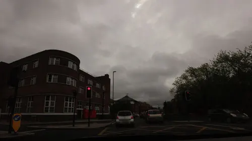
The Railway Tavern
Bar and pub · 1.8 mi
45 East Street, Bromley
Mo-Th 16:00-23:00; Fr-Sa 12:00-24:00; Su 12:00-22:30
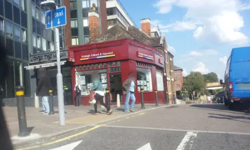
Caffè Nero
Cafe · Coffee Shop · 1.9 mi
12-14 High Street, Bromley
Mo-Fr 06:00-19:00; Sa 07:00-19:00; Su 07:30-18:00
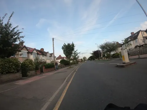
Branching Out
Cafe · Breakfast, Cake, Coffee Shop, Sandwich, Tea · 0.9 mi
149 Croydon Road, Beckenham
Mo-Fr 08:00-16:00; Sa 08:30-16:00; Su 08:00-14:00
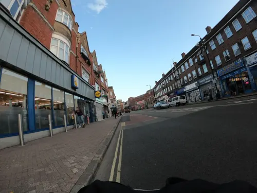
Carnival Coffee Roasters
Cafe · Coffee Shop · 1.2 mi
9 High Street, London
Tu-We 08:00-14:00; Mo, Fr 08:00-15:00; Sa-Su 09:00-15:00
Dilz Cafe
Cafe · Breakfast · 1.7 mi
11 Sydenham Road, London
Mo-Fr 06:00-16:00; Sa 07:00-17:00; Su 08:00-15:00


Cork n Cask
Bar and pub · 2.3 mi
Bar & Real Ale Delivery
139 Masons Hill, Bromley
Mo-Th 16:00-21:30; Fr 16:00-23:00; Sa 12:00-23:00; Su 13:00-19:00

194 more on the map.
History
Archaeological evidence at nearby Holwood Park, where Stone Age and Bronze Age artefacts have been found, reveals some evidence of early settlers. A Roman camp was sited here, and a Roman road, the London to Lewes Way passed through the district.
Early written history tells little of the area; there is an entry in the Domesday Book of 1086 and various records in Court Rolls, Feet of Fines and other historical documents. Thomas Philipott recorded it in his Villare Cantianum in 1659 based on the research of his father John Philipott. Hasted wrote about it in 1778 in his History and Topography of Kent based on Philipott's material. Lysons and others continued to record Beckenham Manor, Foxgrove Manor, Kelsey and Langley estates and Kent House Farm.
By the time of the arrival of the Normans, the manor of Beckenham encompassed much of what is modern Beckenham, with other areas covered by the estates of Foxgrove Manor, Kelsey and Langley. Although William the Conqueror's half brother, Bishop Odo, was overlord of all of Kent, the manor of Beckenham was held or enfeoffed to Anschil of Rochester. The manor became divided but eventually rejoined under the St. John family until Frederick St. John, 3rd Viscount Bolingbroke sold most of the manor to John Cator the younger in 1773. The manor house and its grounds had been exchanged with Peter Burrell, Lord Gwydir in 1757.
Read more of the history
Beckenham remained a small village until well into the 19th century. After Cator died in 1806, his heirs under his nephew John Barwell Cator became aware that an area relatively close to London was ripe for development, and the Cator estates and those of Lord Gwydir (who died in 1820) began to be split up, sold and developed, especially once the railway arrived in 1857, and large villas began to be built around the new station. Wide roads and large gardens epitomised these properties, often built by developers who acquired land from the Cators.
The manor of Foxgrove, previously owned by the Leigh family, passed into the ownership of Lancelot Tolson, circa 1716. His heirs divided it and it was acquired in part by John Cator and Jones Raymond. Raymond's part passed to the Burrells. After a land exchange in 1793 the northern parts of the manor joined Cator's estates; the southern parts were absorbed into the Burrells' Langley and Kelsey estates.
The Kelsey Estate, named from a manorial estate, Kelsies, was recorded in 1479. The estate was granted to William Kelshulle in 1408. The first Peter Burrell bought Kelsey in 1688; a house which had belonged to John Brograve was on the site. In the mid 18th century, a mansion was built overlooking the lake. This was later rebuilt, extended or altered, circa 1835, before being demolished in 1921, and the grounds became Kelsey Park. The only surviving buildings are the two Grade II listed lodge cottages at the entrance, which are over 200 years old.
In 1876 Beckenham Cemetery opened (originally Crystal Palace District Cemetery), located south of the town in Elmers End.
Today Beckenham is an outer London suburb, though it has maintained its own identity and forms a town in its own right. It is centred on its non-pedestrianised curving high street. Further rows of shops run east from the town centre along Bromley Road, south along Croydon Road, and west along Beckenham Road around Clock House station, where the town's library can be found. To the north lies the New Beckenham area, essentially a residential suburb of Beckenham proper.
From the History section of Beckenham on Wikipedia, under CC BY-SA 4.0.
More about Beckenham
Geography
Beckenham lies 1.7 miles (2.7 km) west of Bromley and 3.8 miles (6.1 km) north-east of Croydon.
The original village of Beckenham was a cluster of development surrounded by the lands of a series of manorial estates: Beckenham, Foxgrove, Kelsey, Langley and Kent House Farm with their mansions, halls and Parks.
The parish boundary has changed over time but extended from Crystal Palace Park to Bromley and Lewisham to West Wickham.
The River Ravensbourne flows northwards at the eastern side of the town, towards its confluence with the River Thames forming an eastern boundary with Bromley. A small stream, the River Beck (sometimes referred to as the Hawkesbrook), passes through the town before joining the Ravensbourne via the Pool River further north near Catford.
The area is part of an outcrop of London Clay which were the basis for several brickworks during the development period with areas of Harwich Formation and consists of many small hills. Several gravel pits extracted parts of the Blackheath Beds which are now included in the Harwich Formation
Economy
Beckenham was the headquarters to Capita Registrars Limited, who provide share registration services for more than half of the UK's quoted companies; they have since moved from Beckenham. Proper Records, the UK's biggest independent music distributor, was originally based in Beckenham but relocated to Surrey Quays in 2017.
Arts and culture
Like most towns of its size, Beckenham has several leisure organisations and societies. The local Odeon cinema has six screens and is a grade II listed building. The Beckenham Festival of Music and Dancing takes place every November. Beckenham Theatre puts on amateur productions. The Beckenham Concert Band is a community wind band which has, over the last 35 years, raised thousands of pounds for local and national charities. It caters for amateur wind and brass musicians and performs locally during the winter months and across London and the South East during the summer.
The South East London Green Chain, a long-distance footpath, passes through Beckenham. Both Cator Park and Beckenham Place Park form part of the Chain. Other open spaces in the town include Croydon Road Recreation Ground and Kelsey Park. Beckenham Green, in the town centre, hosts regular markets and activities throughout the year.
Education
The principal secondary schools in Beckenham are Harris Academy Beckenham (formerly Kelsey Park Sports College), Harris Academy Bromley (formerly Cator Park School), the two Langley Park schools, for boys and for girls, and Orion Eden Park (formerly Eden Park High School).
There are also a large number of schools catering for primary education, including the independent Roman Catholic school, Bishop Challoner, St Mary's Catholic Primary School, Marian Vian Primary School, Balgowan Primary School, Worsley Bridge Primary School, Harris Primary Academy Beckenham (formerly Bromley Road Infants School), Clare House Primary School and Churchfields Primary School.
From the Wikipedia article Beckenham, under CC BY-SA 4.0.
Notable people from Beckenham
 Gary O'NeilEnglish association football managerPhoto: COYB123, CC BY 4.0
 Simon WardEnglish stage and film actor (1941-2012)Photo: EMI Film Distributors Limited, Public domain
 Andy BownEnglish keyboardist and bass guitaristPhoto: Inthevidual, CC BY 4.0
 Charles BurnellBritish rower (1876–1969)Photo: Unknown author, Public domain
 Andrew ManzeEnglish violinist and conductorPhoto: helsingborgskonserthus, CC BY 2.0
 Django BatesBritish musicianPhoto: Richard Kaby, CC BY 2.0
- George GroteEnglish historian and political radical (1794–1871)
- David SylvianEnglish musician
- George Eden, 1st Earl of AucklandBritish politician (1784-1849)
- Duncan GoodhewBritish swimmer, Olympic gold medallist
- Philip Fotheringham-ParkerBritish racecar driver
- Carl ErhardtBritish ice hockey player (1897–1988)
Born in Beckenham, according to Wikidata (CC0). Each name links to its Wikipedia article.
Where to stay8
Premier Inn London Bromley hotel
Motel and hotel · 1.9 mi
14 St Mark's Square, Bromley
Churches and places of worship70
Shopping84
Gas and EV charging18
Schools, colleges and libraries52
Our Lady and St Philip Neri Catholic Primary School
School · Roman Catholic · 1.4 mi
208 Sydenham Road, London
St Augustine's Catholic Primary School and Nursery
School · Roman Catholic · 1.1 mi
Dunfield Road, London
Healthcare40
Map of Beckenham
250 places. The map loads OpenStreetMap tiles when you open it.
Getting there and nearby towns
London Biggin Hill Airport (BQH) is the nearest airport with scheduled flights listed in OpenStreetMap, 6 miles away.
- Shirley 2 mi southwest, about 4 min by car
- Crystal Palace 2 mi west, about 4 min by car
- Catford 3 mi north, about 4 min by car
- Hayes 3 mi southeast, about 5 min by car
- West Wickham 3 mi south, about 5 min by car
- Crofton Park 3 mi north, about 5 min by car
- Bickley 3 mi east, about 5 min by car
- Ladywell 3 mi north, about 5 min by car
- Thornton Heath 3 mi west, about 5 min by car
- Croydon 4 mi southwest, about 6 min by car
Drive times are estimates from straight-line distance, not routes.
Towns near Beckenham


Keep exploring
Local news
Headlines from INDB.
Reviews, tips and questions
Loading what members have shared...
Sources and licences
- GeoNames (CC BY 4.0): population, coordinates, regions and time zone
- Mapillary (see each image): photos
- OpenStreetMap contributors (ODbL 1.0): places, airports, map data
- Wikidata (CC0 1.0): elevation, founding date, time zone, website, landmarks and historic places
- Wikimedia Commons (see each image): photos
- Wikipedia (CC BY-SA 4.0): overview and history text
Photo credits
- Lych gate, St George's church Beckenham, Wheeltapper, CC0
- Broadway Theatre - Catford, Steve Cadman derivative work: MrPanyGoff, CC BY-SA 2.0
- Fairfield Halls - London, Jim Linwood, CC BY 2.0
- South London Theatre 118125, RHaworth, CC BY-SA 2.0
- Spreadeagle, Croydon, CR0 (2353133094), Ewan Munro from London, UK, CC BY-SA 2.0
- Bromley War Memorial (Southwest View - 03), Doyle of London, CC BY-SA 4.0
- Bethlem Royal Hospital Main building view 1, SLaMNHSFT, CC BY-SA 3.0
- Bromley Parish Church Memorial 2, Back ache, CC BY-SA 4.0
- Croydon War Memorial - West, hahnchen at Wikimedia Commons (must include link if medium allows), CC BY-SA 3.0
- Dulwich College War Memorial, 2018, No Swan So Fine, CC BY-SA 4.0
- The Dulwich Estate - DSC05986, Rept0n1x, CC BY-SA 3.0
- 1212906 II Star ELTHAM COURT (ELTHAM PALACE), COURT YARD, from SW Greenwich London 20250610 0005, Tilman2007, CC BY-SA 4.0
- Horniman Museum tower, 2015, No Swan So Fine, CC BY-SA 4.0
- Joiners Arms, Woodside, SE25 (5717641899), Ewan Munro from London, UK, CC BY-SA 2.0
- Addington-hills-view, Harvest1, CC BY 3.0
- All-saints-dulwich, Le Deluge, CC BY-SA 3.0
- Churchill Theatre, Back ache, CC BY-SA 4.0
- ChallonerSchoolbuilding, Ollywozere ( talk ), Public domain
- Crystal Palace Park, Ewan-M, CC BY-SA 2.0
- Moon and Stars, Penge, SE20, Ewan-M, CC BY-SA 2.0
- Fox & Hounds, High Street, Sydenham, London, UK, c.1890 - line drawing, J. H. Smith, architect, Public domain
- Our Lady and St Philip Neri, Sydenham cf 10, Secretlondon, CC BY-SA 4.0
- Jolly Sailor, South Norwood, SE25 (5718197616), Ewan Munro from London, UK, CC BY-SA 2.0
- Outside the Churchill Theatre at night, Tomwatney, CC BY-SA 4.0
- 'Fight Club' by Conor Harrington based on 'Massacre of the Innocents' by Charles Le Brun in Dulwich Picture Gallery, Peter Faulkner, CC0
- Bromley Blues Club at the Bromley Little Theatre, Back ache, CC BY-SA 4.0
- Warehouse Theatre Warehouse Cafe Bar, Croydon, CR0 (6109125574), Ewan Munro from London, UK, CC BY-SA 2.0
- Dulwich Picture Gallery, June 2018 (3), No Swan So Fine, CC BY-SA 4.0
- Kelsey Park Waterfall - 1 (17454852414), Alan Stanton, CC BY-SA 2.0
- Addiscombe Railway Park 4, Mx. Granger, CC0
- Ashburton Park, London Borough of Croydon, SE25 CR0 (2352153099), Ewan Munro from London, UK, CC BY-SA 2.0
- Street-level photo, tallguy, CC BY-SA 4.0
- Street-level photo, paulbiv, CC BY-SA 4.0
- Street-level photo, paulbiv, CC BY-SA 4.0
- Street-level photo, paulbiv, CC BY-SA 4.0
- Street-level photo, tallguy, CC BY-SA 4.0
- Street-level photo, tallguy, CC BY-SA 4.0
- Street-level photo, tallguy, CC BY-SA 4.0
- Street-level photo, tallguy, CC BY-SA 4.0
- Street-level photo, tallguy, CC BY-SA 4.0
- Street-level photo, paulbiv, CC BY-SA 4.0
- Street-level photo, paulbiv, CC BY-SA 4.0
- Street-level photo, tallguy, CC BY-SA 4.0
- Street-level photo, tallguy, CC BY-SA 4.0
- Street-level photo, paulbiv, CC BY-SA 4.0
- Street-level photo, paulbiv, CC BY-SA 4.0
- Street-level photo, paulbiv, CC BY-SA 4.0
- Street-level photo, paulbiv, CC BY-SA 4.0
- Street-level photo, paulbiv, CC BY-SA 4.0
- Street-level photo, tallguy, CC BY-SA 4.0
- Street-level photo, paulbiv, CC BY-SA 4.0
- Street-level photo, firefishy, CC BY-SA 4.0
- Street-level photo, paulbiv, CC BY-SA 4.0
- Street-level photo, paulbiv, CC BY-SA 4.0


Page built November 10, 2026. Spotted a mistake? Tell us or suggest a place.