


Crofton Park, United Kingdom
Crofton Park is a town of 14,937 people in England, United Kingdom.
Why visit Crofton Park
Townapedia lists 49 museums and landmarks, 90 parks and trails, 253 places to eat, 3 places to stay and 12 attractions in and around town.
Highlights include Brockley Jack Theatre, Broadway Theatre, Horniman Museum and Horniman Museum and Gardens.
Weather in Crofton Park
Forecast from MET Norway (CC BY 4.0). Full forecast
About Crofton Park
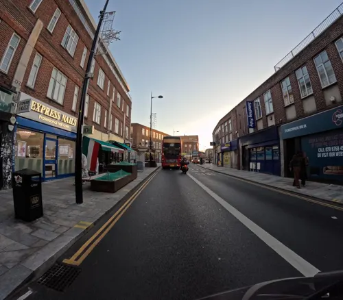
Crofton Park is a predominantly residential suburb in the London Borough of Lewisham.
From the Wikipedia article Crofton Park (this version), under CC BY-SA 4.0.
Photos of Crofton Park


Things to do12
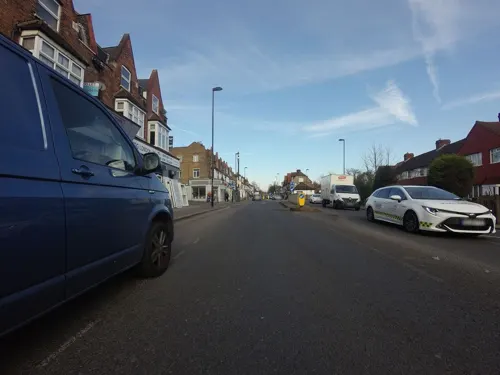
Brockley Jack Theatre
Cinema and theater
Pub theatre in Crofton Park, Lewisham, London, England
Brockley Road, London

Broadway Theatre
Cinema and theater · 0.7 mi
Theatre and former cinema in Catford, Lewisham, London, England
Catford Road, London

Blue Elephant Theatre
Cinema and theater · 3.4 mi
Community theatre in Camberwell, London

Greenwich Theatre
Cinema and theater · 2.2 mi
Theatre in Greenwich, London, England

South London Theatre
Cinema and theater · 3.2 mi
Theatre in West Norwood, London

The Albany
Cinema and theater · 1.8 mi
Theatre and arts centre in Deptford, London, England

Greenwich Playhouse
Cinema and theater · 2.0 mi
Former pub theatre in Greenwich, London, England
Theatre Peckham
Cinema and theater · 2.6 mi
Community theatre in Peckham, London, England


Museums and landmarks49

Horniman Museum and Gardens
Museum · 1.4 mi
Museum in Forest Hill, London, England, United Kingdom

198 Contemporary Arts and Learning
Museum · 3.0 mi
Arts gallery/organisation in London


Dulwich College War Memorial
Monument and historic site · 2.3 mi
War memorial in London

Dulwich Old College War Memorial
Monument and historic site · 2.2 mi
War memorial in London

Dulwich Outdoor Gallery
Museum · 1.9 mi
Street art collection in London, England

Dulwich Picture Gallery
Museum · 2.3 mi
Art gallery in Dulwich, South London, United Kingdom


House of Dreams Museum
Museum · 2.0 mi
Art museum of tiles and sculpture in East Dulwich, London


Goldsmiths CCA
Museum · 1.6 mi
Art gallery located at the University of London
37 more on the map.
Parks, trails and playgrounds90

Brookmill Park
Park · 1.4 mi
Park in London Borough of Lewisham, United Kingdom

Brookmill Road Local Nature Reserve
Hiking and trails · 1.3 mi
Nature reserve in Lewisham, London, England


Blythe Hill Fields
Park
Park in London Borough of Lewisham, United Kingdom


Brunswick Park
Park · 2.8 mi
Public park located in Camberwell, Southwark, London


Beckenham Place Park
Park · 2.6 mi
Park in London Borough of Lewisham, England, UK
78 more on the map.
Restaurants and cafes253

The Blythe Hill Tavern
Bar and pub · Local · 0.6 mi
319 Stanstead Road, London
Mo-We 11:00-23:00; Th-Sa 11:00-24:00; Su 12:00-23:00

The Ivy House
Bar and pub · 0.9 mi
London's first co-operatively owned pub
40 Stuart Road, London
Mo-Th 12:00-23:00; Fr-Sa 12:00-24:00; Su 12:00-22:30

The Watch House
Bar and pub · 1.1 mi
198-204 Lewisham High Street, London
Su-Th 08:00-24:00; Fr-Sa 08:00-25:00
Amrutha
Restaurant · International · 0.4 mi
37-39 Honor Oak Park, London
Mo off; Tu-Th 18:00-22:00; Fr 12:30-14:30; Sa 13:00-22:00; Su 13:00-21:00
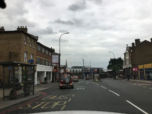
Canvas & Cream
Restaurant · Breakfast, Coffee Shop · 1.2 mi
18 London Road, London
Mo-Fr 09:00-17:00; Sa-Su 10:00-18:00
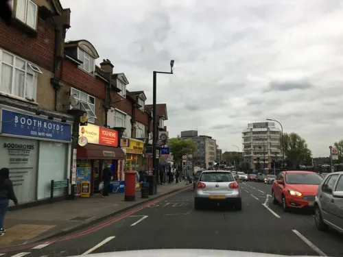
Catford Bridge Tavern
Bar and pub · Burger · 0.6 mi
Station Approach, London
Mo-Th 12:00-23:00; Fr 12:00-24:00; Sa 00:00-01:00,12:00-24:00; Su...
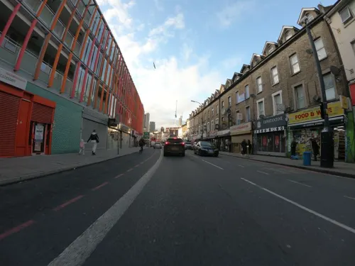
Cow Cow BBQ
Restaurant · Barbecue, Korean · 1.4 mi
47-49 Lee High Road, London
Mo-Tu, Th-Sa 13:00-22:00; Su 13:00-22:30
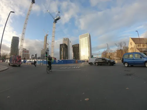

George's Cafe Brockley
Cafe · Breakfast · 0.9 mi
199 Brockley Road, London
Mo-Fr 06:30-17:00,Sa-Su 07:00-17:00
241 more on the map.
History
Before the area was built in the late 19th century, the principal buildings were Brockley Farm, Brockley Hall, and the Brockley Jack public house. The area expanded rapidly in the 1890s with the opening of a new railway line (informally known as the Catford Loop) and railway station which opened in 1892. It was the naming of the station as Crofton Park which gave the area its modern and invented name. Despite this being the historic heart of Brockley, that name had already been used for two earlier railway stations further north – Brockley Station and Brockley Lane Station.
The rapid pace of expansion of the area continued pre-First World War, with the building of more shops and facilities to support the growing population. The London Encyclopaedia describes this development as: "a mixture of terrace houses for 'clerkly classes' and local authority flats and houses." A handsome Edwardian public library was built next to the railway station in 1905 and, eight years later, a local cinema – the Crofton Park Picture Palace – first opened its doors. This later became the Rivoli Ballroom.
Read more of the history
Brockley Hall, a large private residence, stood on land to the west of the road which now bears its name. The property had a somewhat obscure history. There was a house on the site before 1745 and probably long before that date. It was the most associated with its final owners, the Noakes family who lived there. The Noakes were brewers and their ales were sold in many local pubs, including The Brockley Jack which they owned and was just across the road from Brockley Hall. The Hall's lodge stood in Brockley Grove on the approximate site of what are now the front gardens of nos. 24–28.
The 1901 census returns show Bertram Noakes as head of the household living in Brockley Hall with his five spinster sisters (Pauline, Elizabeth, Kate, Ada and Maude) and four servants. Lewisham Arhive's photograph of the Hall suggests at one time it was called Noakes Farm.
Maude Noakes was the last survivor. An eccentric, she was well known for her large collection of pets. The old lady would bury her pets in the grounds of Brockley Hall and give each one a marked gravestone – even her pigs and cows.
Following Maude's death in April 1931 the property was quickly sold and demolished. Brockley Hall Road, Bearsted Rise, Horsmonden Road, Sevenoaks Road and the 1930s houses in Brockley Grove were built on the site of the Hall and its grounds by the building company Wates.
In common with many areas of London, Crofton Park was damaged during the Second World War, particularly by V1 flying bombs and V2 rockets, with the area north of Crofton Park Station on Brockley Road suffering many strikes. A V1 'doodlebug' hit on the evening of 18 June 1944 destroyed Brockley Road School and killed five members of the Crofton Park Home Guard. The men are commemorated by a plaque in St Hilda's Church.
From the History section of Crofton Park on Wikipedia, under CC BY-SA 4.0.
Where to stay3
Churches and places of worship86
Shopping61
Gas and EV charging13
Schools, colleges and libraries65
St Mary's Lewisham Church of England Primary School
School · Anglican · 0.9 mi
329 Lewisham High Street, London
Healthcare22
Map of Crofton Park
250 places. The map loads OpenStreetMap tiles when you open it.
Getting there and nearby towns
London City Airport (LCY) is the nearest airport with scheduled flights listed in OpenStreetMap, 5 miles away.
- Ladywell 1 mi east, about 1 min by car
- Brockley 1 mi north, about 1 min by car
- Lee 2 mi east, about 3 min by car
- Blackheath 2 mi northeast, about 3 min by car
- Kidbrooke 3 mi east, about 5 min by car
- Crystal Palace 3 mi southwest, about 5 min by car
- Brixton Hill 4 mi west, about 6 min by car
- Charlton 4 mi northeast, about 6 min by car
- Shadwell 4 mi north, about 7 min by car
- London 6 mi northwest, about 9 min by car
Drive times are estimates from straight-line distance, not routes.
Towns near Crofton Park


Keep exploring
Local news
Headlines from INDB.
Reviews, tips and questions
Loading what members have shared...
Sources and licences
- GeoNames (CC BY 4.0): population, coordinates, regions and time zone
- Mapillary (see each image): photos
- OpenStreetMap contributors (ODbL 1.0): places, airports, map data
- Wikidata (CC0 1.0): elevation, founding date, time zone, website, landmarks and historic places
- Wikimedia Commons (see each image): photos
- Wikipedia (CC BY-SA 4.0): overview and history text
Photo credits
- Crofton Park stn signage, Sunil060902, CC BY-SA 3.0
- Crofton Park railway station in 2008, Stephen Craven, CC BY-SA 2.0
- St Hilda's Crofton Park, London Less Travelled, CC BY 2.0
- Broadway Theatre - Catford, Steve Cadman derivative work: MrPanyGoff, CC BY-SA 2.0
- Blue Elephant Theatre, secretlondon123, CC BY-SA 2.0
- Greenwichtheatre, Burnley, CC BY-SA 3.0
- South London Theatre 118125, RHaworth, CC BY-SA 2.0
- Albany Theatre in Deptford, SilkTork, CC BY-SA 3.0
- External view of 198 Contemporary Arts and Learning, 2010, Barby Asante, CC BY-SA 4.0
- Dulwich College War Memorial, 2018, No Swan So Fine, CC BY-SA 4.0
- The Dulwich Estate - DSC05986, Rept0n1x, CC BY-SA 3.0
- The Fan Museum (3400819225), Visit Greenwich from Greenwich, United Kingdom, CC BY 2.0
- House of Dreams, 42 Melbourne Grove, East Dulwich, 2018 (1), No Swan So Fine, CC BY-SA 4.0
- BrockwellParkHut, Richard Irons, CC BY-SA 3.0
- Burgess Park, London Borough of Southwark, SE5 SE15 (3038879613), Ewan Munro from London, UK, CC BY-SA 2.0
- All Saints Peckham, Swanseaeu1 at English Wikipedia, CC BY-SA 3.0
- All-saints-dulwich, Le Deluge, CC BY-SA 3.0
- Christ Church, Gipsy Hill, London SE19, Mark Ahsmann, CC BY-SA 3.0
- Horniman Museum tower, 2015, No Swan So Fine, CC BY-SA 4.0
- LewishamShopping, The original uploader was Secretlondon at English Wikipedia ., CC BY-SA 3.0
- St Dunstan's College, 2008, Steve Cadman from London, U.K., CC BY-SA 2.0
- University Hospital Lewisham Riverside02, Gilo1969, CC BY-SA 3.0
- New Cross Gate Cutting 4, Dudley Miles, CC BY-SA 4.0
- Ivy House, Nunhead, SE15 (5478867910), Ewan Munro from London, UK, CC BY-SA 2.0
- St Swithun's Church, Hither Green (01), Ethan Doyle White, CC BY-SA 4.0
- Church of St Stephen, Lewisham, Ethan Doyle White, CC BY-SA 4.0
- The Chapel at Camberwell New Cemetery, Ethan Doyle White, CC BY-SA 4.0
- Church of St Augustine, One Tree Hill, Honor Oak, SilverMilkshake, CC BY-SA 4.0
- Deptford Borough War Memorial (9175974877), Reading Tom from Reading, UK, CC BY 2.0
- Lewisham War Memorial (9178133262), Reading Tom from Reading, UK, CC BY 2.0
- Watch House, Lewisham, SE13 (2663057161), Ewan Munro from London, UK, CC BY-SA 2.0
- Blythe Hill Tavern, Forest Hill, SE23 (3756867279), Ewan Munro from London, UK, CC BY-SA 2.0
- An aerial view of the Horniman Museum and Gardens, OrdinaryTomatoes, CC BY 4.0
- Lewisham Shopping Centre 1, Mx. Granger, CC0
- Brookmill Road LNR 1, Dudley Miles, CC BY-SA 3.0
- 'Fight Club' by Conor Harrington based on 'Massacre of the Innocents' by Charles Le Brun in Dulwich Picture Gallery, Peter Faulkner, CC0
- Bellenden Road Nature Garden 6, Dudley Miles, CC BY-SA 4.0
- Cameras and Lenses, Richard Fisher from London, UK, CC BY 2.0
- Edward VII Postbox, Stondon Park - Honor Oak Park, SE23, Palfrey, CC BY-SA 4.0
- Brockley Jack, Brockley, SE4 (2289060198), Ewan Munro from London, UK, CC BY-SA 2.0
- London skyline from Blythe Hill fields, Amakuru, CC BY-SA 4.0
- Dulwich Picture Gallery, June 2018 (3), No Swan So Fine, CC BY-SA 4.0
- Brookmill Park, London Borough of Lewisham, SE8, Ewan-M, CC BY-SA 2.0
- 1 and 2 Brunswick Park and attached railings, No Swan So Fine, CC BY-SA 4.0
- Street-level photo, rskedgell, CC BY-SA 4.0
- Street-level photo, jjhaslanded, CC BY-SA 4.0
- Street-level photo, wibbit, CC BY-SA 4.0
- Street-level photo, IpswichEdits, CC BY-SA 4.0
- Street-level photo, jjhaslanded, CC BY-SA 4.0
- Street-level photo, jjhaslanded, CC BY-SA 4.0
- Street-level photo, wibbit, CC BY-SA 4.0
- Street-level photo, wasd42, CC BY-SA 4.0
- Street-level photo, firefishy, CC BY-SA 4.0
- Street-level photo, jjhaslanded, CC BY-SA 4.0
- Street-level photo, erias, CC BY-SA 4.0
- Street-level photo, wasd42, CC BY-SA 4.0
- Street-level photo, wibbit, CC BY-SA 4.0
- Street-level photo, tomchance, CC BY-SA 4.0
- Street-level photo, IpswichEdits, CC BY-SA 4.0
- Street-level photo, IpswichEdits, CC BY-SA 4.0
- Street-level photo, smsm1, CC BY-SA 4.0
- Street-level photo, wasd42, CC BY-SA 4.0
- Street-level photo, wasd42, CC BY-SA 4.0
- Street-level photo, vlivyur, CC BY-SA 4.0
- Street-level photo, paulbiv, CC BY-SA 4.0
- Street-level photo, erias, CC BY-SA 4.0
- Street-level photo, wasd42, CC BY-SA 4.0
- Street-level photo, wasd42, CC BY-SA 4.0
- Street-level photo, firefishy, CC BY-SA 4.0
- Street-level photo, wibbit, CC BY-SA 4.0
- Street-level photo, jjhaslanded, CC BY-SA 4.0
- Street-level photo, jjhaslanded, CC BY-SA 4.0
- Street-level photo, IpswichEdits, CC BY-SA 4.0
- Street-level photo, wibbit, CC BY-SA 4.0


Page built November 10, 2026. Spotted a mistake? Tell us or suggest a place.