


Crystal Palace, United Kingdom
Crystal Palace is a town of 12,255 people in England, United Kingdom.
Why visit Crystal Palace
Townapedia lists 62 museums and landmarks, 90 parks and trails, 278 places to eat, 5 places to stay and 15 attractions in and around town.
Highlights include South London Theatre, Broadway Theatre, Crystal Palace Museum and The Old Library.
Weather in Crystal Palace
Forecast from MET Norway (CC BY 4.0). Full forecast
About Crystal Palace
Crystal Palace is a place in South London, named after the Crystal Palace Exhibition building which stood in the area from 1854, until it was destroyed by a fire in 1936. About 7 miles (11 km) southeast of Charing Cross, it includes one of the highest points in London, at 367 feet (112 m), offering views over the capital.
From the Wikipedia article Crystal Palace, London (this version), under CC BY-SA 4.0.
Photos of Crystal Palace


Things to do15

South London Theatre
Cinema and theater · 1.4 mi
Theatre in West Norwood, London
2A Norwood High Street, London

Broadway Theatre
Cinema and theater · 3.1 mi
Theatre and former cinema in Catford, Lewisham, London, England

Empress Theatre of Varieties
Cinema and theater · 3.4 mi
Former theatre and cinema in Brixton, London, England

Fairfield Halls
Cinema and theater · 3.3 mi
Arts, entertainment and conference centre in Croydon, London

Former Streatham Hill Theatre
Cinema and theater · 2.5 mi
Former theatre now used as a casino, Streatham, London, UK

The Spread Eagle Theatre
Cinema and theater · 3.4 mi
Pub theatre above the Spread Eagle pub in Croydon, London, England

Warehouse Theatre
Cinema and theater · 3.1 mi
Former theatre in Croydon, London, England

Ashcroft Theatre
Cinema and theater · 3.3 mi
Theatre within the Fairfield Halls, Croydon, London, England
Brockley Jack Theatre
Cinema and theater · 2.9 mi
Pub theatre in Crofton Park, Lewisham, London, England
3 more on the map.
Museums and landmarks62

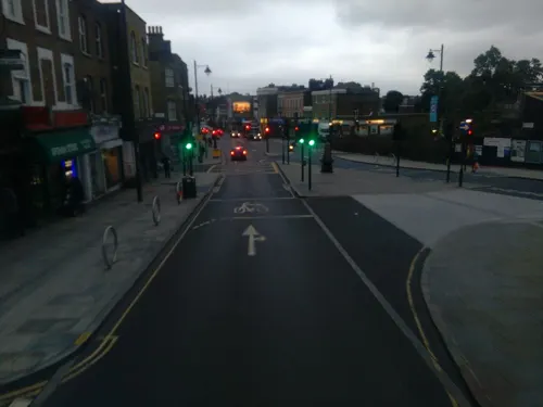
The Old Library
Monument and historic site · 1.4 mi
Large hall, meeting room, equipped recording studio, workspace, lounge, playroom
14-16 Knight's Hill, London

198 Contemporary Arts and Learning
Museum · 2.6 mi
Arts gallery/organisation in London

African and Caribbean War Memorial
Monument and historic site · 3.2 mi
War memorial in London

Cherry Groce Memorial Pavilion
Monument and historic site · 3.3 mi
Memorial to Cherry Groce in Brixton, London SW9

Croydon War Memorial
Monument and historic site · 3.4 mi
War memorial in London

Dulwich College War Memorial
Monument and historic site · 1.5 mi
War memorial in London

Dulwich Old College War Memorial
Monument and historic site · 1.9 mi
War memorial in London

Dulwich Outdoor Gallery
Museum · 2.5 mi
Street art collection in London, England

Dulwich Picture Gallery
Museum · 1.9 mi
Art gallery in Dulwich, South London, United Kingdom


Bethlem Gallery
Museum · 3.4 mi
Art gallery in Beckenham, Bromley, England
50 more on the map.
Parks, trails and playgrounds90


Betts Park
Park · 0.9 mi
Public park in Penge, London Borough of Bromley, in London, England

Norwood Grove
Park · 1.6 mi
Grade II listed urban park in London, England, UK


Addiscombe Railway Park
Park · 2.6 mi
Park in London Borough of Croydon, United Kingdom


Beckenham Place Park
Park · 2.5 mi
Park in London Borough of Lewisham, England, UK
78 more on the map.
Restaurants and cafes278


The Jolly Sailor
Bar and pub · 1.4 mi
64 High Street, London
Mo-We 14:00-23:00; Th 14:00-00:00; Fr 13:00-00:00; Sa 12:00-00:00;...


The Rosendale
Bar and pub · 1.3 mi
65 Rosendale Road, London
Mo-Th 11:00-23:00; Fr 11:00-00:00; Sa 11:00-01:00; Su 12:00-22:00
Badger Badger
Bar and pub · Japanese · 1.5 mi
543 Norwood Road, London
Mo-Tu off; We-Th 12:00-23:00; Fr-Sa 12:00-00:00; Su 12:00-22:00
Carnival Coffee Roasters
Cafe · Coffee Shop · 1.2 mi
9 High Street, London
Tu-We 08:00-14:00; Mo, Fr 08:00-15:00; Sa-Su 09:00-15:00



Cocos
Restaurant · Caribbean
90 Westow Hill, London
Tu-Th 17:30-23:00; Fr 12:00-22:30; Sa 10:00-15:00, 16:00-23:30; Su...
266 more on the map.
History
The ridge and the historic oak tree known as the Vicar's Oak (at the crossroads of the A212 Church Road and A214 Westow Hill) were used to mark parish boundaries. This has led to the Crystal Palace area straddling the boundaries of five London Boroughs; Bromley, Croydon, Lambeth, Southwark and Lewisham. The area also straddles three postcode districts: SE19, SE20, and SE26. The ancient boundary between Surrey and Kent passes through the area, and until 1889 included parts of both counties. From 1889 to 1965 the area was on the south-eastern boundary of the County of London.
For centuries the area was covered by the Great North Wood, an extensive area of natural oak forest that formed a wilderness close to the southern edge of the then expanding city of London. The forest was a popular area for Londoners' recreation right up to the 19th century, when it began to be built over. It also became a home for some Romani people, with local street names and pubs recording the link, and the area still retains vestiges of woodland.
Read more of the history
A pneumatic railway was briefly trialled in the area in 1864. Once the railways arrived, Crystal Palace was eventually served by two railway stations, the high level and low level stations, built to handle the large volume of passengers visiting the exhibition building. After the Palace was destroyed by fire, and with railway travel declining, passenger numbers fell and the high level station was closed in 1954 and demolished seven years later. Rail services gradually declined, and for a period in the 1960s and 1970s, there were plans to construct an urban motorway through the area as part of the London Ringways plan. With rising passenger numbers, additional London Overground services began stopping at the station and a major station redevelopment occurred.
The Crystal Palace, designed by Joseph Paxton, was a remarkable construction of prefabricated parts. It was a cast-iron and glass building originally erected in Hyde Park to house the Great Exhibition of 1851. Following the success of the exhibition, the Palace was moved and reconstructed in 1854 in a modified and enlarged form in the grounds of the Penge Place estate at Sydenham Hill. The buildings housed the Crystal Palace School of Art, Science, and Literature and Crystal Palace School of Engineering. It attracted visitors for over seven decades.
Sydenham Hill is one of the highest locations in London; 109 metres (357 ft) above sea level (spot height on Ordnance Survey Map); and the size of the Palace and prominence of the site made it easy to identify from much of London. This led to the residential area around the building becoming known as Crystal Palace instead of Sydenham Hill. The Palace was destroyed by fire on 30 November 1936 and the site of the building and its grounds is now known as Crystal Palace Park.
From the History section of Crystal Palace, London on Wikipedia, under CC BY-SA 4.0.
More about Crystal Palace
Geography
Crystal Palace is about 7 miles (11 km) southeast of Charing Cross on Norwood Ridge and includes one of the highest points of London at 112 metres above the mean sea level (OS map reference TQ337707). The Crystal Palace National Sports Centre, in the centre of the park, is 88 metres (289 ft) above the mean sea level. The soil in the area has been classified as typically "Slowly permeable, seasonally wet, slightly acid but base-rich loamy and clayey soils", with impeded drainage, moderate fertility and a loamy profile. The nearest Met Office climate station is based in Greenwich Park.
Education
Crystal Palace contains three primary schools, Paxton Primary School, Rockmount Primary School and All Saints C of E Primary School, and one secondary school, Harris City Academy. Crystal Palace Park also contains a branch of Capel Manor College, offering courses in Animal Care, Arboriculture and Countryside, Horticulture and Landscaping and Garden Design along with other short courses.
In 2013, due to a shortage of primary school places in both Crystal Palace and London, proposals to open a new primary school by September 2015 were put forward, with plans submitted to the Department for Education in January 2014. The proposals were approved as part of wave 6 of the Free Schools Programme and the school is scheduled to open in September 2015. As of October 2014, the school is considering three possible building configurations – with the Greater London Authority running a public consultation on each option – all of which would involve demolishing one of the seated stands around the athletics track at the National Sports Centre.
From the Wikipedia article Crystal Palace, London, under CC BY-SA 4.0.
Notable people from Crystal Palace
 Susan WattsBritish journalistPhoto: Susan_Watts_and_Raymond_Jeanloz_CTBTO..., CC BY 2.0
- Troy SouthgateBritish far-right activist and publisher
Born in Crystal Palace, according to Wikidata (CC0). Each name links to its Wikipedia article.
Where to stay5
Churches and places of worship66
Shopping52
Gas and EV charging9
Schools, colleges and libraries56
St Cyprian's Greek Orthodox Primary Academy
School · Greek Orthodox · 1.1 mi
Springfield Road, Thornton Heath
St James the Great RC Primary and Nursery School
School · Roman Catholic · 1.5 mi
Windsor Road, Thornton Heath
Healthcare19
Map of Crystal Palace
250 places. The map loads OpenStreetMap tiles when you open it.
Getting there and nearby towns
London Biggin Hill Airport (BQH) is the nearest airport with scheduled flights listed in OpenStreetMap, 8 miles away.
- Thornton Heath 2 mi southwest, about 3 min by car
- Croydon 3 mi south, about 4 min by car
- Brixton Hill 3 mi northwest, about 5 min by car
- Shirley 3 mi southeast, about 5 min by car
- Balham 4 mi northwest, about 6 min by car
- West Wickham 5 mi southeast, about 7 min by car
- Wallington 5 mi southwest, about 8 min by car
- Hayes 5 mi southeast, about 8 min by car
- London 6 mi north, about 10 min by car
- City of Westminster 6 mi northwest, about 10 min by car
Drive times are estimates from straight-line distance, not routes.
Towns near Crystal Palace


Keep exploring
Local news
Headlines from INDB.
Reviews, tips and questions
Loading what members have shared...
Sources and licences
- GeoNames (CC BY 4.0): population, coordinates, regions and time zone
- Mapillary (see each image): photos
- OpenStreetMap contributors (ODbL 1.0): places, airports, map data
- Wikidata (CC0 1.0): elevation, founding date, time zone, website, landmarks and historic places
- Wikimedia Commons (see each image): photos
- Wikipedia (CC BY-SA 4.0): overview and history text
Photo credits
- Upper Norwood Town Centre - 1, No machine-readable author provided. Regan123~commonswiki assumed (based on copyright claims)., CC BY-SA 2.5
- Coffee from Four Boroughs, Crystal Palace (51188433249), Bex Walton from London, England, CC BY 2.0
- Coffee from Four Boroughs, Crystal Palace (51188723030), Bex Walton from London, England, CC BY 2.0
- Four Boroughs, Crystal Palace, London 2024-07-05, Bex Walton, CC BY 2.0
- Piccolo at Four Boroughs, Crystal Palace, London, Bex Walton, CC BY 2.0
- Four Boroughs, Crystal Palace, London - 2024-07-05, Bex Walton, CC BY 2.0
- Coffee from Four Boroughs, Crystal Palace (51187658291), Bex Walton from London, England, CC BY 2.0
- Four Boroughs, Crystal Palace, 2024-07-05, Bex Walton, CC BY 2.0
- Cambridge, Crystal Palace, SE19 (2631005726), Ewan Munro from London, UK, CC BY-SA 2.0
- Palace, Crystal Palace, SE19, Ewan-M, CC BY-SA 2.0
- Scampi and chips with lemon in Grape and Grain, Crystal Palace, London (4672680806), Ewan Munro from London, UK, CC BY-SA 2.0
- Hamburger and fries - Grape and Grain, Crystal Palace, London, Ewan Munro from London, UK, CC BY-SA 2.0
- Grape and Grain, Crystal Palace, SE19, Ewan-M, CC BY-SA 2.0
- Grape and Grain, Crystal Palace, SE19 - 2010-05-23, Ewan-M, CC BY-SA 2.0
- 2005-03-30 - London - Crystal Palace - Train Station 4887161003, CGP Grey, CC BY 2.0
- Crystal Palace Transmitter 4887933298, CGP Grey, CC BY 2.0
- 2005-03-30 - London - Crystal Palace - BBC Radio Tower 1 4887152961, CGP Grey, CC BY 2.0
- 2005-03-30 - London - Crystal Palace - Rock Layers 4887761016, CGP Grey, CC BY 2.0
- Crystal Palace Transmitter 4887766408, CGP Grey, CC BY 2.0
- 2005-03-30 - London - Crystal Palace - Maze The Escape Gate 4887156183, CGP Grey, CC BY 2.0
- 2005-03-30 - London - Crystal Palace - Stairs and Crystal Palace Transmitter 4887765452, CGP Grey, CC BY 2.0
- 2005-03-30 - London - Crystal Palace - Sphinx 4887757692, CGP Grey, CC BY 2.0
- 2005-03-30 - London - Crystal Palace - Victorian Dinosaurs 4887158469, CGP Grey, CC BY 2.0
- 2005-03-30 - London - Crystal Palace - BBC Radio Tower 4887152673, CGP Grey, CC BY 2.0
- London - Crystal Palace - Victorian Dinosaurs 4887762938, CGP Grey, CC BY 2.0
- South London Theatre 118125, RHaworth, CC BY-SA 2.0
- Broadway Theatre - Catford, Steve Cadman derivative work: MrPanyGoff, CC BY-SA 2.0
- Empress Theatre Brixton 1910, Unknown photographer (1910), Public domain
- Fairfield Halls - London, Jim Linwood, CC BY 2.0
- Former Playhouse Theatre (9176302961), Reading Tom from Reading, UK, CC BY 2.0
- Spreadeagle, Croydon, CR0 (2353133094), Ewan Munro from London, UK, CC BY-SA 2.0
- External view of 198 Contemporary Arts and Learning, 2010, Barby Asante, CC BY-SA 4.0
- African and Caribbean Memorial, 31 July 2017 02 (cropped), Kelly Foster, CC BY-SA 4.0
- At Brixton 2026 03, Photograph by Mike Peel ( www.mikepeel.net )., CC BY-SA 4.0
- Croydon War Memorial - West, hahnchen at Wikimedia Commons (must include link if medium allows), CC BY-SA 3.0
- Dulwich College War Memorial, 2018, No Swan So Fine, CC BY-SA 4.0
- The Dulwich Estate - DSC05986, Rept0n1x, CC BY-SA 3.0
- Flat Time House facade, Ken Adlard, CC BY-SA 4.0
- Crystal Palace Park, Ewan-M, CC BY-SA 2.0
- Betts, Matt-rex, Public domain
- The White House at Norwood Grove in September 2019, Eagleash, CC BY-SA 4.0
- Sydenham Wells Park, Konstantin Dankov, CC BY-SA 2.0
- All-saints-dulwich, Le Deluge, CC BY-SA 3.0
- St John's Church, Penge (2017), Alan Hughes, CC BY-SA 2.0
- Christ Church, Gipsy Hill, London SE19, Mark Ahsmann, CC BY-SA 3.0
- Upper Norwood Library, London SE19, Mark Ahsmann, CC BY-SA 3.0
- All Saints Upper Norwood, Timothy Titus, CC BY-SA 4.0
- The Rosendale, West Dulwich, SE21, 2018, No Swan So Fine, CC BY-SA 4.0
- Moon and Stars, Penge, SE20, Ewan-M, CC BY-SA 2.0
- Fox & Hounds, High Street, Sydenham, London, UK, c.1890 - line drawing, J. H. Smith, architect, Public domain
- Jolly Sailor, South Norwood, SE25 (5718197616), Ewan Munro from London, UK, CC BY-SA 2.0
- 'Fight Club' by Conor Harrington based on 'Massacre of the Innocents' by Charles Le Brun in Dulwich Picture Gallery, Peter Faulkner, CC0
- Warehouse Theatre Warehouse Cafe Bar, Croydon, CR0 (6109125574), Ewan Munro from London, UK, CC BY-SA 2.0
- Crystal Palace Museum, Crystal Palace, SE19, Ewan-M, CC BY-SA 2.0
- Dulwich Picture Gallery, June 2018 (3), No Swan So Fine, CC BY-SA 4.0
- View from Norwood Park, Amakuru, CC BY-SA 4.0
- Addiscombe Railway Park 4, Mx. Granger, CC0
- Ashburton Park, London Borough of Croydon, SE25 CR0 (2352153099), Ewan Munro from London, UK, CC BY-SA 2.0
- Street-level photo, tomchance, CC BY-SA 4.0
- Street-level photo, paulbiv, CC BY-SA 4.0
- Street-level photo, ris, CC BY-SA 4.0
- Street-level photo, paulbiv, CC BY-SA 4.0
- Street-level photo, ris, CC BY-SA 4.0
- Street-level photo, ris, CC BY-SA 4.0
- Street-level photo, paulbiv, CC BY-SA 4.0
- Street-level photo, paulbiv, CC BY-SA 4.0
- Street-level photo, paulbiv, CC BY-SA 4.0
- Street-level photo, paulbiv, CC BY-SA 4.0
- Street-level photo, paulbiv, CC BY-SA 4.0
- Street-level photo, paulbiv, CC BY-SA 4.0
- Street-level photo, paulbiv, CC BY-SA 4.0
- Street-level photo, paulbiv, CC BY-SA 4.0
- Street-level photo, paulbiv, CC BY-SA 4.0
- Street-level photo, paulbiv, CC BY-SA 4.0
- Street-level photo, paulbiv, CC BY-SA 4.0
- Street-level photo, ris, CC BY-SA 4.0
- Street-level photo, ris, CC BY-SA 4.0
- Street-level photo, ris, CC BY-SA 4.0
- Street-level photo, ris, CC BY-SA 4.0
- Street-level photo, ris, CC BY-SA 4.0
- Street-level photo, ris, CC BY-SA 4.0
- Street-level photo, Opspin, CC BY-SA 4.0


Page built November 10, 2026. Spotted a mistake? Tell us or suggest a place.