


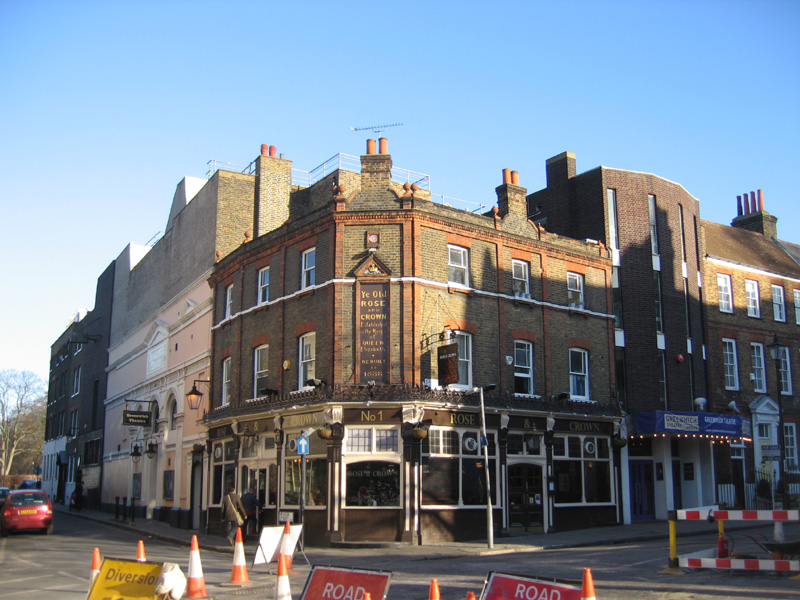


Ladywell, United Kingdom
Ladywell is a town of 14,515 people in England, United Kingdom.
Why visit Ladywell
Townapedia lists 59 museums and landmarks, 74 parks and trails, 247 places to eat, 10 places to stay and 11 attractions in and around town.
Highlights include Brockley Jack Theatre, Broadway Theatre, Baltic Exchange Memorial Glass and Deptford War Memorial.
Weather in Ladywell
Forecast from MET Norway (CC BY 4.0). Full forecast
About Ladywell
Ladywell is an area in Lewisham in South East London, England, and a ward in the London Borough of Lewisham between Brockley, Crofton Park and Lewisham proper. It has ample green space including Ladywell Fields and Hilly Fields which borders Brockley. Ladywell Village, the main shopping area along Ladywell Road, was given a facelift in 2013 with £800,000 of Transport for London funding. The pavements were widened, short stay bays created to help local businesses and shoppers, and trees were added.
From the Wikipedia article Ladywell (this version), under CC BY-SA 4.0.
Photos of Ladywell

Things to do11
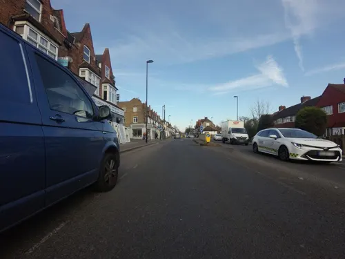
Brockley Jack Theatre
Cinema and theater · 0.7 mi
Pub theatre in Crofton Park, Lewisham, London, England
Brockley Road, London

Broadway Theatre
Cinema and theater · 0.6 mi
Theatre and former cinema in Catford, Lewisham, London, England
Catford Road, London

Greenwich Theatre
Cinema and theater · 1.8 mi
Theatre in Greenwich, London, England

The Albany
Cinema and theater · 1.6 mi
Theatre and arts centre in Deptford, London, England


Greenwich Playhouse
Cinema and theater · 1.7 mi
Former pub theatre in Greenwich, London, England
Theatre Peckham
Cinema and theater · 2.9 mi
Community theatre in Peckham, London, England
Museums and landmarks59

Baltic Exchange Memorial Glass
Monument and historic site · 2.0 mi
Stained glass war memorial windows


Dulwich College War Memorial
Monument and historic site · 2.8 mi
War memorial in London

Dulwich Old College War Memorial
Monument and historic site · 2.8 mi
War memorial in London

Dulwich Outdoor Gallery
Museum · 2.4 mi
Street art collection in London, England

Dulwich Picture Gallery
Museum · 2.8 mi
Art gallery in Dulwich, South London, United Kingdom


Horniman Museum and Gardens
Museum · 1.9 mi
Museum in Forest Hill, London, England, United Kingdom

House of Dreams Museum
Museum · 2.5 mi
Art museum of tiles and sculpture in East Dulwich, London


Livesey Hall War Memorial
Monument and historic site · 1.7 mi
War memorial in Sydenham, London
47 more on the map.
Parks, trails and playgrounds74

Brookmill Park
Park · 1.1 mi
Park in London Borough of Lewisham, United Kingdom

Brookmill Road Local Nature Reserve
Hiking and trails · 1.0 mi
Nature reserve in Lewisham, London, England


Blythe Hill Fields
Park · 0.5 mi
Park in London Borough of Lewisham, United Kingdom



Beckenham Place Park
Park · 2.7 mi
Park in London Borough of Lewisham, England, UK
62 more on the map.
Restaurants and cafes247

The Blythe Hill Tavern
Bar and pub · Local · 1.0 mi
319 Stanstead Road, London
Mo-We 11:00-23:00; Th-Sa 11:00-24:00; Su 12:00-23:00

The Ivy House
Bar and pub · 1.3 mi
London's first co-operatively owned pub
40 Stuart Road, London
Mo-Th 12:00-23:00; Fr-Sa 12:00-24:00; Su 12:00-22:30

Royal Albert
Bar and pub · 1.5 mi
460 New Cross Road, London
Mo-Th 16:00-23:00; Fr-Sa 12:00-01:00; Su 12:00-22:30
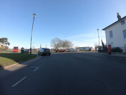
The Hare and Billet
Bar and pub · 1.5 mi
1a Eliot Cottages, London
Mo-Th 12:00-23:00; Fr 12:00-24:00; Sa 11:00-24:00; Su 11:00-22:30

The Watch House
Bar and pub · 0.6 mi
198-204 Lewisham High Street, London
Su-Th 08:00-24:00; Fr-Sa 08:00-25:00
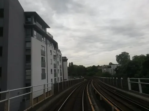
Amrutha
Restaurant · International · 1.0 mi
37-39 Honor Oak Park, London
Mo off; Tu-Th 18:00-22:00; Fr 12:30-14:30; Sa 13:00-22:00; Su 13:00-21:00
Catford Bridge Tavern
Bar and pub · Burger · 0.7 mi
Station Approach, London
Mo-Th 12:00-23:00; Fr 12:00-24:00; Sa 00:00-01:00,12:00-24:00; Su...
Cow Cow BBQ
Restaurant · Barbecue, Korean · 0.8 mi
47-49 Lee High Road, London
Mo-Tu, Th-Sa 13:00-22:00; Su 13:00-22:30

George's Cafe Brockley
Cafe · Breakfast · 0.9 mi
199 Brockley Road, London
Mo-Fr 06:30-17:00,Sa-Su 07:00-17:00
235 more on the map.
History
The name Ladywell was in use by the 15th century, and maps dating to this period show the site of the original Lady well, in front of the area later to be occupied by the Freemason's Arms and now marked by a plaque.
The well was probably a holy well dedicated to Virgin Mary and was 1.8 m to 2 m (six to seven feet) deep and surrounded by an iron railing. It was in use until the 1850s, when it was covered over as part of the construction of the railway. The coping stones of this well were later uncovered during work to underpin the railway bridge, and rescued by a signalman. In 1896 they were incorporated as part of the fountain that stood in the grounds of the Ladywell Public Baths, a local landmark built in red brick in 1884.
Another well is located nearby at what is now 148 Ladywell Road. This was a mineral spring, the waters of which local people drank for medicinal purposes.
Until the second half of the eighteenth century there were few dwellings in Ladywell, the most notable being 'The Bridge House Farm' and Ladywell House. Ladywell House was the vicarage built in 1693 for Dean George Stanhope, the vicar of Lewisham and Deptford. Stanhope was a friend of the writer Jonathan Swift, Swift visited Ladywell House in 1711. The house was extended in 1881 and 1895, and is now used by the South London and Maudsley NHS Foundation Trust.
Read more of the history
The opening of Ladywell Station in 1857 brought expansion to the area. Church Grove and the terraces to either side of it in Ladywell Road were built in the following year, which also saw the opening of Ladywell Cemetery, Railway Terrace, Prospect Place, and Mercy Terrace. The public park Ladywell Fields opened in the 1890s. Hilly Fields park opened on 16 May 1896 after campaigning by one of the Founders of the National Trust, Octavia Hill.
From the History section of Ladywell on Wikipedia, under CC BY-SA 4.0.
Notable people from Ladywell
- Peter Elliscricketer (born 1932)
- Herbert JamesEnglish military officer (1888–1958); recipient of the Victoria Cross
Born in Ladywell, according to Wikidata (CC0). Each name links to its Wikipedia article.
Where to stay10
Churches and places of worship79
Shopping65
Gas and EV charging13
Schools, colleges and libraries64
All Saints' Church of England Primary School Blackheath
School · Anglican · 1.5 mi
2 Blackheath Vale, London
St Mary's Lewisham Church of England Primary School
School · Anglican
329 Lewisham High Street, London
Healthcare28
Map of Ladywell
250 places. The map loads OpenStreetMap tiles when you open it.
Getting there and nearby towns
London City Airport (LCY) is the nearest airport with scheduled flights listed in OpenStreetMap, 5 miles away.
- Lee 1 mi east, about 2 min by car
- Blackheath 1 mi northeast, about 2 min by car
- Kidbrooke 2 mi east, about 4 min by car
- Charlton 3 mi northeast, about 6 min by car
- Crystal Palace 3 mi southwest, about 6 min by car
- Shadwell 4 mi north, about 7 min by car
- Brixton Hill 4 mi west, about 7 min by car
- Stepney 4 mi north, about 7 min by car
- Chislehurst 5 mi southeast, about 8 min by car
- London 6 mi northwest, about 9 min by car
Drive times are estimates from straight-line distance, not routes.
Towns near Ladywell


Keep exploring
Local news
Headlines from INDB.
Reviews, tips and questions
Loading what members have shared...
Sources and licences
- GeoNames (CC BY 4.0): population, coordinates, regions and time zone
- Mapillary (see each image): photos
- OpenStreetMap contributors (ODbL 1.0): places, airports, map data
- Wikidata (CC0 1.0): elevation, founding date, time zone, website, landmarks and historic places
- Wikimedia Commons (see each image): photos
- Wikipedia (CC BY-SA 4.0): overview and history text
Photo credits
- Ladywell Fields, London Borough of Lewisham, SE13 SE6 (2611258266), Ewan Munro from London, UK, CC BY-SA 2.0
- Ladywell Tavern, Ladywell, SE13 (2610914631), Ewan Munro from London, UK, CC BY-SA 2.0
- Broadway Theatre - Catford, Steve Cadman derivative work: MrPanyGoff, CC BY-SA 2.0
- Greenwichtheatre, Burnley, CC BY-SA 3.0
- Albany Theatre in Deptford, SilkTork, CC BY-SA 3.0
- Stained glass window from Baltic Exchange, Heidi De Vries, CC BY 2.0
- Dulwich College War Memorial, 2018, No Swan So Fine, CC BY-SA 4.0
- The Dulwich Estate - DSC05986, Rept0n1x, CC BY-SA 3.0
- The Fan Museum (3400819225), Visit Greenwich from Greenwich, United Kingdom, CC BY 2.0
- Flat Time House facade, Ken Adlard, CC BY-SA 4.0
- Horniman Museum tower, 2015, No Swan So Fine, CC BY-SA 4.0
- House of Dreams, 42 Melbourne Grove, East Dulwich, 2018 (1), No Swan So Fine, CC BY-SA 4.0
- Livesey War Memorial, Bell Green, David Anstiss, CC BY-SA 2.0
- Burgess Park, London Borough of Southwark, SE5 SE15 (3038879613), Ewan Munro from London, UK, CC BY-SA 2.0
- Burnt Ash Pond, Dudley Miles, CC BY-SA 3.0
- Centre for Wildlife Gardening, JoshuaAnthonyGill, CC BY-SA 4.0
- All Saints Peckham, Swanseaeu1 at English Wikipedia, CC BY-SA 3.0
- LewishamShopping, The original uploader was Secretlondon at English Wikipedia ., CC BY-SA 3.0
- St Dunstan's College, 2008, Steve Cadman from London, U.K., CC BY-SA 2.0
- University Hospital Lewisham Riverside02, Gilo1969, CC BY-SA 3.0
- New Cross Gate Cutting 4, Dudley Miles, CC BY-SA 4.0
- Ivy House, Nunhead, SE15 (5478867910), Ewan Munro from London, UK, CC BY-SA 2.0
- Royal Albert, New Cross, SE14 (2538821107), Ewan Munro from London, UK, CC BY-SA 2.0
- St Swithun's Church, Hither Green (01), Ethan Doyle White, CC BY-SA 4.0
- Church of St Stephen, Lewisham, Ethan Doyle White, CC BY-SA 4.0
- The Chapel at Camberwell New Cemetery, Ethan Doyle White, CC BY-SA 4.0
- Church of St Augustine, One Tree Hill, Honor Oak, SilverMilkshake, CC BY-SA 4.0
- 71-75, Greenwich South Street, Hjamesberglen, CC0
- Deptford Borough War Memorial (9175974877), Reading Tom from Reading, UK, CC BY 2.0
- Lewisham War Memorial (9178133262), Reading Tom from Reading, UK, CC BY 2.0
- Blackheath Quaker Meeting House, south aspect (rotated), EEye, CC BY-SA 4.0
- Watch House, Lewisham, SE13 (2663057161), Ewan Munro from London, UK, CC BY-SA 2.0
- Blythe Hill Tavern, Forest Hill, SE23 (3756867279), Ewan Munro from London, UK, CC BY-SA 2.0
- The Bookshop on the Heath (cropped), Reading Tom from Reading, UK, CC BY 2.0
- Lewisham Shopping Centre 1, Mx. Granger, CC0
- St Matthew Academy 1, Mx. Granger, CC0
- West Face of the Church of St Margaret, Lee (II), Ethan Doyle White, CC BY-SA 4.0
- Brookmill Road LNR 1, Dudley Miles, CC BY-SA 3.0
- 'Fight Club' by Conor Harrington based on 'Massacre of the Innocents' by Charles Le Brun in Dulwich Picture Gallery, Peter Faulkner, CC0
- Bellenden Road Nature Garden 6, Dudley Miles, CC BY-SA 4.0
- EH1289615 Point House, Katie Chan, CC BY-SA 3.0
- Dulwich Picture Gallery, June 2018 (3), No Swan So Fine, CC BY-SA 4.0
- Brookmill Park, London Borough of Lewisham, SE8, Ewan-M, CC BY-SA 2.0
- London skyline from Blythe Hill fields, Amakuru, CC BY-SA 4.0
- Camberwell Green Park - panoramio, jeffwarder, CC BY-SA 3.0
- Street-level photo, wasd42, CC BY-SA 4.0
- Street-level photo, rskedgell, CC BY-SA 4.0
- Street-level photo, jjhaslanded, CC BY-SA 4.0
- Street-level photo, jjhaslanded, CC BY-SA 4.0
- Street-level photo, erias, CC BY-SA 4.0
- Street-level photo, wibbit, CC BY-SA 4.0
- Street-level photo, wasd42, CC BY-SA 4.0
- Street-level photo, wasd42, CC BY-SA 4.0
- Street-level photo, jjhaslanded, CC BY-SA 4.0
- Street-level photo, wibbit, CC BY-SA 4.0
- Street-level photo, firefishy, CC BY-SA 4.0
- Street-level photo, wasd42, CC BY-SA 4.0
- Street-level photo, vlivyur, CC BY-SA 4.0
- Street-level photo, wasd42, CC BY-SA 4.0
- Street-level photo, IpswichEdits, CC BY-SA 4.0
- Street-level photo, wasd42, CC BY-SA 4.0
- Street-level photo, wasd42, CC BY-SA 4.0
- Street-level photo, jjhaslanded, CC BY-SA 4.0
- Street-level photo, erias, CC BY-SA 4.0
- Street-level photo, agatefilm, CC BY-SA 4.0
- Street-level photo, wmorland, CC BY-SA 4.0
- Street-level photo, ris, CC BY-SA 4.0
- Street-level photo, firefishy, CC BY-SA 4.0
- Street-level photo, wpoi, CC BY-SA 4.0
- Street-level photo, wasd42, CC BY-SA 4.0
- Street-level photo, rskedgell, CC BY-SA 4.0
- Street-level photo, wasd42, CC BY-SA 4.0
- Street-level photo, wasd42, CC BY-SA 4.0
- Street-level photo, athuler, CC BY-SA 4.0
- Street-level photo, wasd42, CC BY-SA 4.0
- Street-level photo, jjhaslanded, CC BY-SA 4.0


Page built November 10, 2026. Spotted a mistake? Tell us or suggest a place.