


Highbury, United Kingdom
Highbury is a town of 26,664 people in England, United Kingdom.
Why visit Highbury
Townapedia lists 140 museums and landmarks, 72 parks and trails, 139 places to eat, 35 places to stay and 51 attractions in and around town.
Highlights include Little Angel Theatre, EartH, London Canal Museum and Estorick Collection.
Weather in Highbury
Forecast from MET Norway (CC BY 4.0). Full forecast
About Highbury
Highbury is an area of North London, England, in the London Borough of Islington.
From the Wikipedia article Highbury (this version), under CC BY-SA 4.0.
Photos of Highbury


Things to do51

Little Angel Theatre
Cinema and theater · 0.8 mi
13 Dagmar Passage, London
Mo 11:00-17:00; Tu-Su 11:00-15:00


Odeon Holloway
Cinema and theater · 1.1 mi
State-of-the-art chain cinema for blockbusters in 2-D or 3-D format, plus family and student deals.
419-427 Holloway Road, London


Adelphi Theatre
Cinema and theater · 2.9 mi
West End theatre in London, England, fourth of that name on this site

Ambassadors Theatre
Cinema and theater · 2.8 mi
West End theatre in London

Banqueting House
Cinema and theater · 3.3 mi
Former palace consisting of banquet halls, later Whitehall Chapel in London

Vue Islington
Cinema and theater · 1.1 mi
36 Parkfield Street, London
Mo-Fr 09:30-24:00; Sa-Su 10:30-24:00
39 more on the map.
Museums and landmarks140

London Canal Museum
Museum · 1.4 mi
12-13 New Wharf Road, London
Tu-Su 10:00-16:30; PH Mo 10:00-16:30; Dec 23-Jan 01 Off

Estorick Collection
Museum · 0.4 mi
39a Canonbury Square, London
We-Sa 11:00-18:00; Th 11:00-20:00; Su 12:00-17:00

Nags Head Market
Monument and historic site · 1.0 mi
22 Seven Sisters Road, London
Mo 08:00-20:30; Tu 08:00-21:30; We-Th 08:00-21:30; Fr-Sa...


Bazalgette Memorial
Monument and historic site · 3.2 mi
Memorial in London to Joseph Bazalgette


7 to 9 and 13 to 53 (odd) Noel Road and attached railings
Monument and historic site · 1.1 mi
128 more on the map.
Parks, trails and playgrounds72

The Castle Climbing Centre
Sports field and stadium · 1.1 mi
Engine House of Metropolitan Water Board
Green Lanes, London
Mo-Fr 08:00-22:00, Sa-Su 09:00-20:00
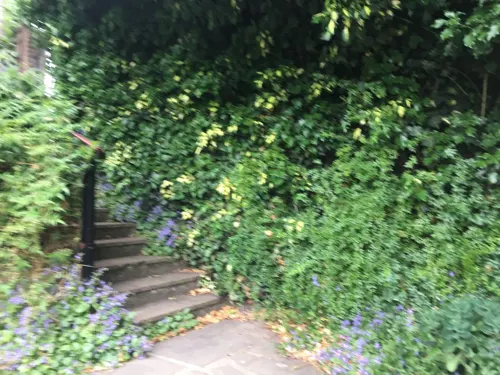


Dalston Eastern Curve Garden
Park · 1.2 mi
13 Dalston Lane, London
Mo, We-Th 11:00-19:00; Tu 19:00-23:00; Fr-Su 11:00-23:00



Lonsdale Square Garden
Park · 0.8 mi
Lonsdale Square, London
Mo-Su 08:00-sunset
60 more on the map.
Restaurants and cafes139
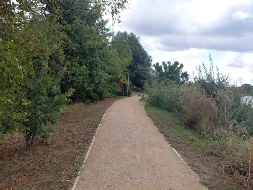
Coal House Cafe
Cafe · Sandwich, Coffee Shop · 1.5 mi
Gas house to West of reservoir
226 Lordship Road, London
Mo-Su 09:00-17:00

Camden Head
Bar and pub · 1.0 mi
2 Camden Walk, London
Mo-Tu, Th, Su 12:00-24:00; We 12:00-23:00; Fr-Sa 12:00-01:00

Hope & Anchor
Bar and pub · 0.5 mi
207 Upper Street, London
Mo-Th 12:00-23:00; Fr-Sa 12:00-01:00; Su 12:00-23:00


The Duke of Richmond
Bar and pub · 1.4 mi
316 Queensbridge Road, London
Mo-Th 16:00-22:30; Fr,Sa 12:00-22:30; Su 12:00-22:00

The Old Queen's Head
Bar and pub · 0.9 mi
44 Essex Road, London
Su-We 12:00-00:00; Th 12:00-01:00, Fr 12:00-02:00, Sa 12:00-03:00

The Rochester Castle
Bar and pub · 1.3 mi
143, 145 Stoke Newington High Street, London
Su-Th 08:00-24:00; Fr-Sa 08:00-25:00


The Coronet
Bar and pub · 0.8 mi
338-346 Holloway Road, London
Mo-Th 11:00-00:30; Fr-Sa 11:00-01:00; Su 11:00-00:30

Marquess Tavern
Bar and pub · 0.5 mi
32 Canonbury Street, London
Mo-Th 12:00-23:00; Fr-Sa 12:00-24:00; Su 12:00-22:00

Thai Square
Restaurant · Thai · 1.1 mi
Thai Square Islington attracts local residents and businesses alike. With its flawless service, thoughtfully curated and excellent...
347-349 Upper Street, London
Mo-Th 12:00-15:00,17:30-22:00; Fr 12:00-15:00,17:30-23:00; Sa...
127 more on the map.
Notable people from Highbury
 Henry BarklyBritish politician and colonial governor (1815–1898)Photo: Unknown author Unknown author, Public domain
 Philip FyshAustralian politician (1835-1919)Photo: John Watt Beattie, Public domain
 Joe GoochBritish musicianPhoto: Eckhard Henkel, CC BY-SA 3.0 de
- George MartinEnglish record producer (1926–2016)
- Robert W. PaulBritish cinema pioneer (1869–1943)
- Mary NortonEnglish children's writer (1903–1992)
- Madge AdamEnglish solar astronomer (1912-2001)
- Frederick HumphreysBritish tug-of-war competitor
- Eileen WhelanEnglish cricketer and supercentenarian (1911–2021)
- Cyril ShapsEnglish actor (1923-2003)
- Phoebe LankesterBritish botanist known for popular science writing (1825–1900)
- Edward TeschemacherBritish lyricist, translator, arranger, librettist, and composer (1876–1940)
Born in Highbury, according to Wikidata (CC0). Each name links to its Wikipedia article.
Where to stay35
Churches and places of worship44
Shopping67
Gas and EV charging23
Schools, colleges and libraries36
St Andrew's (Barnsbury) Church of England Primary School
School · Anglican · 1.0 mi
Matilda Street, London
Healthcare34
Map of Highbury
250 places. The map loads OpenStreetMap tiles when you open it.
Getting there and nearby towns
London City Airport (LCY) is the nearest airport with scheduled flights listed in OpenStreetMap, 7 miles away.
- Islington 1 mi south, about 2 min by car
- Archway 2 mi northwest, about 3 min by car
- Holborn 2 mi south, about 4 min by car
- London 3 mi south, about 5 min by car
- Hornsey 3 mi north, about 4 min by car
- Highgate 3 mi northwest, about 4 min by car
- Stepney 3 mi southeast, about 5 min by car
- City of Westminster 4 mi southwest, about 6 min by car
- Wood Green 4 mi north, about 6 min by car
- Tottenham 4 mi north, about 6 min by car
Drive times are estimates from straight-line distance, not routes.
Towns near Highbury


Keep exploring
Local news
Headlines from INDB.
Reviews, tips and questions
Loading what members have shared...
Sources and licences
- GeoNames (CC BY 4.0): population, coordinates, regions and time zone
- Mapillary (see each image): photos
- OpenStreetMap contributors (ODbL 1.0): places, airports, map data
- Wikidata (CC0 1.0): elevation, founding date, time zone, website, landmarks and historic places
- Wikimedia Commons (see each image): photos
- Wikipedia (CC BY-SA 4.0): overview and history text
Photo credits
- Highbury House, Unknown author, Public domain
- Ashurst Lodge, Highbury Grove, N5 1HN, Spudgun67, CC BY-SA 4.0
- Charles Alfred Cruft - Ashurst Lodge, Highbury Grove, N5 1HN, Spudgun67, CC BY-SA 4.0
- 25 Highbury Place N5, Spudgun67, CC BY-SA 4.0
- NewAmbass, KF, Public domain
- Joseph Bazalgette memorial, Victoria Embankment - close up view, Prioryman, CC BY-SA 4.0
- London Emirates Stadium arsenal, Arne Müseler, CC BY-SA 3.0 de
- Sadler's Wells Theatre (September 2015), Sadler's Wells Theatre, CC BY-SA 4.0
- Walking in Finsbury Park, Hjuk at en.wikipedia, CC BY-SA 3.0
- Museum Arsenal Football Club Museum, Gael13011, CC BY-SA 3.0
- Estorick Collection, Luke McKernan, CC BY-SA 2.0
- Kings Place from York Way in 2009, Alan Stanton, CC BY-SA 2.0
- London Canal Museum TQ3083, Oxyman, CC BY-SA 2.0
- Unitarian chapel newington green, Unknown author, CC BY-SA 2.5
- St Luke, Oseney Crescent, Mike Quinn, CC BY-SA 2.0
- Old Queen's Head, https://www.flickr.com/people/55935853@N00/, CC BY-SA 2.0
- Screen on the Green 14 Sept. 2016, Philafrenzy, CC BY-SA 4.0
- Dalston culture house, Tarquin Binary, CC BY-SA 2.5
- Crown, Barnsbury, N1 (6190406874), Ewan Munro from London, UK, CC BY-SA 2.0
- Aerial photo of the The Castle Climbing Centre in Stoke Newington, Hackney, London (2), Jonty Wareing, CC BY-SA 4.0
- Cafe Oto, Dalston, E8 (5273183631), Ewan Munro from London, UK, CC BY-SA 2.0
- New River Head in Islington, Designhistory2, CC BY-SA 4.0
- Rochester Castle, Stoke Newington, N16 (2585479142), Ewan Munro from London, UK, CC BY-SA 2.0
- Islington Inn, 366 Essex Road, Islington, October 2023, No Swan So Fine, CC BY-SA 4.0
- Islington north library (29053629081), JuliaC2006 from Rochester, UK, CC BY 2.0
- London Borough of Hackney - The Duke Of Richmond Public House - 20241023155334, Hjamesberglen, CC BY-SA 4.0
- Islington Central Library (16237236403), DncnH from Nottingham, UK, CC BY 2.0
- London (46461655895), Fred Romero from Paris, France, CC BY 2.0
- Holloway Odeon, Holloway, N7 (3750259188), Ewan Munro from London, UK, CC BY-SA 2.0
- Gas holder 0656, Photograph by Clem Rutter, Rochester, Kent. ( www.clemrutter.net )., CC BY-SA 3.0
- Coronet, Holloway, N7 (2472100800), Ewan Munro from London, UK, CC BY-SA 2.0
- Dalston CLR James Library (7652771398), secretlondon123 from London, England, CC BY-SA 2.0
- Aerial view of de beauvoir square 1, Rameshgopal54, CC BY-SA 4.0
- At London 2025 975, Photograph by Mike Peel ( www.mikepeel.net )., CC BY-SA 4.0
- Queer Britain, proposed UK national LGBTQ+ museum, Queer Britain, Public domain
- Rio Cinema (Dalston), Rio Cinema, CC BY-SA 3.0
- Hope & Anchor pub Upper Street, Islington, Philafrenzy, CC BY-SA 4.0
- Kings Place 022, Panhard, CC BY 2.5
- ScreenOnTheGreen-night, Jeff, CC BY-SA 4.0
- The Old Queens Head Angel April 2021, Ojlewis1989, CC BY-SA 4.0
- Barnsbury Wood 6, Dudley Miles, CC BY-SA 3.0
- Barnsbury Square - gardens, User:Masato.harada, CC BY-SA 4.0
- John Wright MBE (1905-1991) master puppeteer founded the Little Angel Theatre here in 1961, Spudgun67, CC BY-SA 4.0
- Gazpacho live at Earth Dalston, London, 17th April 2022 - 52016714485, kitmasterbloke, CC BY 2.0
- The Rat Pack Live from Las Vagas on the Adelphi Theatre (4039501475), Elliott Brown from Birmingham, United Kingdom, CC BY 2.0
- Banqueting House, London interior 10, Paul the Archivist, CC BY-SA 4.0
- Nags Head Market - panoramio, N19±, CC BY-SA 3.0
- London Irish Centre (49445867092), Reading Tom from Reading, UK, CC BY 2.0
- Flickr - Duncan~ - Clissold Park Lions, Duncan Harris from Nottingham, UK, CC BY 2.0
- 27.3.16 Dalston Eastern Curve Garden 1 (27075913071), donald judge, CC BY 2.0
- Street-level photo, rskedgell, CC BY-SA 4.0
- Street-level photo, sk53bis, CC BY-SA 4.0
- Street-level photo, rskedgell, CC BY-SA 4.0
- Street-level photo, matth81, CC BY-SA 4.0
- Street-level photo, gness, CC BY-SA 4.0
- Street-level photo, laye, CC BY-SA 4.0
- Street-level photo, pbb, CC BY-SA 4.0
- Street-level photo, gness, CC BY-SA 4.0
- Street-level photo, gness, CC BY-SA 4.0
- Street-level photo, pbb, CC BY-SA 4.0
- Street-level photo, sk53bis, CC BY-SA 4.0
- Street-level photo, harry_wood, CC BY-SA 4.0
- Street-level photo, gness, CC BY-SA 4.0
- Street-level photo, gness, CC BY-SA 4.0
- Street-level photo, hendo, CC BY-SA 4.0
- Street-level photo, gness, CC BY-SA 4.0
- Street-level photo, gness, CC BY-SA 4.0
- Street-level photo, erias, CC BY-SA 4.0
- Street-level photo, southglos, CC BY-SA 4.0
- Street-level photo, erias, CC BY-SA 4.0
- Street-level photo, erias, CC BY-SA 4.0
- Street-level photo, rskedgell, CC BY-SA 4.0


Page built November 10, 2026. Spotted a mistake? Tell us or suggest a place.