


Biddulph, United Kingdom
Biddulph is a town of 17,669 people in England, United Kingdom.
Why visit Biddulph
Townapedia lists 6 museums and landmarks, 7 parks and trails, 25 places to eat, 2 places to stay and 1 attraction in and around town.
Highlights include Little Moreton Hall, The Bridestones, Biddulph Grange Country Park and Limekiln Wood Nature Reserve.
Weather in Biddulph
Forecast from MET Norway (CC BY 4.0). Full forecast
About Biddulph
Biddulph is a town and civil parish in the Staffordshire Moorlands district of the county of Staffordshire, England. The town lies 9 miles (14 km) north of Stoke-on-Trent and 5 miles (8 km) south-east of Congleton, close to part of the Staffordshire/Cheshire county border. In 2011 the parish had a population of 19,892.
From the Wikipedia article Biddulph (this version), under CC BY-SA 4.0.
Photos of Biddulph


Things to do1

Museums and landmarks6

Little Moreton Hall
Museum · 3.2 mi
Moated half-timbered manor house near Congleton in England, built between about 1504 and 1610.

The Bridestones
Monument and historic site · 3.1 mi
Burial chamber in Cheshire, England, UK




Parks, trails and playgrounds7

Biddulph Grange Country Park
Park · 1.3 mi
Country park in Biddulph, Staffordshire, England, UK

Restaurants and cafes25

Becci's Kitchen
Cafe · Coffee Shop, Regional, Sandwich, Breakfast, Tea, Salad · 0.4 mi
89 St. Johns Road, Biddulph, Stoke-on-Trent
Tu-Su 08:30-13:00

The Talbot
Bar and pub · 1.5 mi
73 Grange Road, Stoke-on-Trent
Mo-Tu 11:30-22:00; We-Sa 11:30-23:00; Su 11:30-22:30
Rose & Crown
Bar and pub · 1.5 mi
440 New Street, Stoke-on-Trent
Mo-Su 17:00-00:00
Staffordshire Knot
Bar and pub · 0.7 mi
Marshfield Lane, Stoke-on-Trent

13 more on the map.
More about Biddulph
Education
In common with other parts of the area administered by Staffordshire LEA, the Middle School system operates in Biddulph.
The town has one high school (ages 13–16), with a sixth form (ages 16–18) called Biddulph High School; it was awarded Sports College status in 2002 and has since gained Technology College status. Biddulph also has two middle schools: Woodhouse Middle School (formerly Biddulph Grammar School), and James Bateman Middle School (formerly Park Middle School), serving pupils aged 9–13. These are fed by several first schools, including Kingsfield First School, Knypersley First School, Squirrel Hayes First School and Oxhey First School.
From the Wikipedia article Biddulph, under CC BY-SA 4.0.
Notable people from Biddulph
 Adam PorterEnglish professional footballerPhoto: Dominic Nelson, CC BY-SA 4.0
- James WilsonEnglish association football player, born 1995
- Rob BaileyEnglish cricketer and umpire (born 1963)
- John ArcherBritish footballer (1941-2021)
- Malcolm BaileyBritish footballer (1950-2017)
- Dennis BaileyFootballer (born 1935)
- John FarmerEnglish footballer (born 1947)
- Roger LancasterEnglish cricketer (born 1951)
- Jack SimcockBritish artist (1929-2012)
Born in Biddulph, according to Wikidata (CC0). Each name links to its Wikipedia article.
Where to stay2
Churches and places of worship12
Shopping2
Gas and EV charging3
Schools, colleges and libraries11
Healthcare5
Biddulph Late Night Pharmacy
Clinic and pharmacy
1-3 Tunstall Road, Stoke-on-Trent
Map of Biddulph
74 places. The map loads OpenStreetMap tiles when you open it.
Getting there and nearby towns
Manchester Airport (MAN) is the nearest airport with scheduled flights listed in OpenStreetMap, 17 miles away.
- Kidsgrove 3 mi southwest, about 5 min by car
- Congleton 4 mi northwest, about 6 min by car
- Leek 6 mi east, about 10 min by car
- Stoke-on-Trent 8 mi south, about 13 min by car
- Newcastle under Lyme 8 mi south, about 14 min by car
- Sandbach 8 mi west, about 13 min by car
- Longton 9 mi south, about 15 min by car
- Middlewich 12 mi northwest, about 20 min by car
- Cheadle 12 mi southeast, about 20 min by car
- Wilmslow 15 mi north, about 24 min by car
Drive times are estimates from straight-line distance, not routes.
Towns near Biddulph


Keep exploring
Local news
Headlines from INDB.
Reviews, tips and questions
Loading what members have shared...
Sources and licences
- GeoNames (CC BY 4.0): population, coordinates, regions and time zone
- Mapillary (see each image): photos
- OpenStreetMap contributors (ODbL 1.0): places, airports, map data
- Wikidata (CC0 1.0): elevation, founding date, time zone, website, landmarks and historic places
- Wikimedia Commons (see each image): photos
- Wikipedia (CC BY-SA 4.0): overview and history text
Photo credits
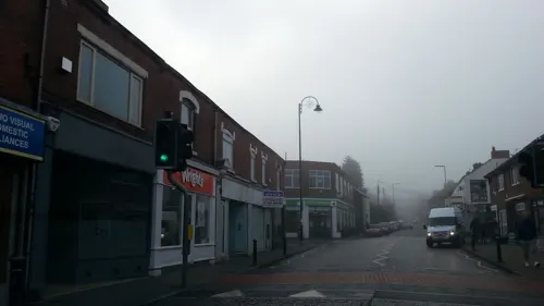
- Biddulph 2023 022, Photograph by Mike Peel ( www.mikepeel.net )., CC BY-SA 4.0
- Biddulph 2023 023, Photograph by Mike Peel ( www.mikepeel.net )., CC BY-SA 4.0
- Biddulph 2023 054, Photograph by Mike Peel ( www.mikepeel.net )., CC BY-SA 4.0
- Biddulph 2023 053, Photograph by Mike Peel ( www.mikepeel.net )., CC BY-SA 4.0
- Biddulph 2023 052, Photograph by Mike Peel ( www.mikepeel.net )., CC BY-SA 4.0
- Biddulph 2023 024, Photograph by Mike Peel ( www.mikepeel.net )., CC BY-SA 4.0
- Biddulph 2023 041, Photograph by Mike Peel ( www.mikepeel.net )., CC BY-SA 4.0
- Biddulph 2023 045, Photograph by Mike Peel ( www.mikepeel.net )., CC BY-SA 4.0
- Biddulph 2023 042, Photograph by Mike Peel ( www.mikepeel.net )., CC BY-SA 4.0
- Biddulph 2023 044, Photograph by Mike Peel ( www.mikepeel.net )., CC BY-SA 4.0
- Biddulph 2023 043, Photograph by Mike Peel ( www.mikepeel.net )., CC BY-SA 4.0
- Biddulph 2023 055, Photograph by Mike Peel ( www.mikepeel.net )., CC BY-SA 4.0
- LittleMoretonHall, Christine-Ann Martin, CC BY-SA 3.0
- Bridestones 1, Photograph by Mike Peel ( www.mikepeel.net )., CC BY-SA 4.0
- Biddulph Grange Country Park 2019 029, Photograph by Mike Peel ( www.mikepeel.net )., CC BY-SA 4.0
- St Anne, Brown Edge 1, AtticTapestry, CC BY-SA 4.0
- Holy Trinity Church, Mossley, Congleton, Maurice Oly, CC BY-SA 4.0
- Church of St Lawrence, Biddulph 2022 25, Photograph by Mike Peel ( www.mikepeel.net )., CC BY-SA 4.0
- Biddulph Moor 2021 102, Photograph by Mike Peel ( www.mikepeel.net )., CC BY-SA 4.0
- Christ Church, Church Lane, Biddulph Moor (NHLE Code 1037843) (May 2022) (9), User:Hassocks5489, CC0
- Mow Cop - panoramio, Keith Daulby, CC BY 3.0
- At Biddulph Grange 2022 009, Photograph by Mike Peel ( www.mikepeel.net )., CC BY-SA 4.0
- Chinese Temple at Biddulph Grange Gardens, Nigel Baker, CC BY-SA 4.0
- Street-level photo, adam2, CC BY-SA 4.0
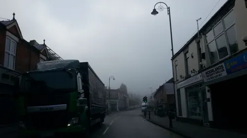
- Street-level photo, adam2, CC BY-SA 4.0
- Street-level photo, adam2, CC BY-SA 4.0
- Street-level photo, adam2, CC BY-SA 4.0
- Street-level photo, adam2, CC BY-SA 4.0
- Street-level photo, adam2, CC BY-SA 4.0
- Street-level photo, adam2, CC BY-SA 4.0
- Street-level photo, adam2, CC BY-SA 4.0
- Street-level photo, adam2, CC BY-SA 4.0
- Street-level photo, adam2, CC BY-SA 4.0
- Street-level photo, adam2, CC BY-SA 4.0


Page built November 10, 2026. Spotted a mistake? Tell us or suggest a place.