


Kidsgrove, United Kingdom
Kidsgrove is a town of 29,480 people in England, United Kingdom.
Why visit Kidsgrove
Townapedia lists 8 museums and landmarks, 10 parks and trails, 51 places to eat and 3 attractions in and around town.
Highlights include Queen's Theatre, Burslem United Reformed Church (Formerly Woodall Memorial Congregational Church), Ceramica and Bathpool Park.
Weather in Kidsgrove
Forecast from MET Norway (CC BY 4.0). Full forecast
About Kidsgrove
Kidsgrove is a town in the borough of Newcastle-under-Lyme, Staffordshire, England, on the border with Cheshire. It is part of the Potteries Urban Area, along with Stoke-on-Trent and Newcastle-under-Lyme. It has a population of 26,276 (2019 census). Most of the town is in the Kidsgrove ward, whilst the western part is in Ravenscliffe.
From the Wikipedia article Kidsgrove (this version), under CC BY-SA 4.0.
Things to do3

Queen's Theatre
Cinema and theater · 3.3 mi
Music venue and theatre in Burslem, Stoke-on-Trent, England; built as town hall and theatre

Museums and landmarks8
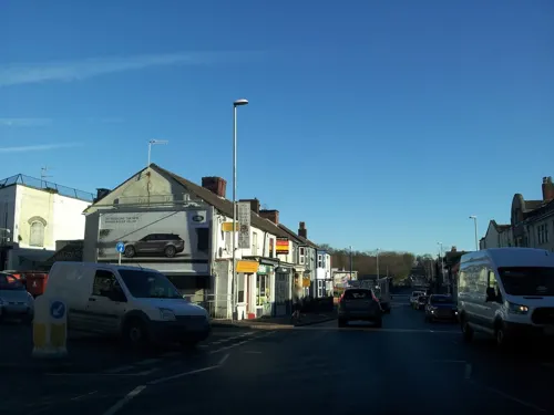
Burslem United Reformed Church (Formerly Woodall Memorial Congregational Church)
Monument and historic site · 3.3 mi
Memorial in Stoke-on-Trent, Staffordshire, England, UK
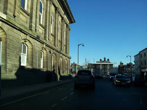
Ceramica
Museum · 3.3 mi
Museum in Burslem, Staffordshire, England, UK

Little Moreton Hall
Museum · 2.8 mi
Moated half-timbered manor house near Congleton in England, built between about 1504 and 1610.

Rode Hall
Museum · 2.3 mi
English country house in Cheshire, England, UK


Parks, trails and playgrounds10

Bathpool Park
Park · 0.6 mi
Park in Kidsgrove, Staffordshire, England, UK

Burslem Park
Park · 3.3 mi
Park in Stoke-on-Trent, Staffordshire, England, UK

Victoria Park
Park · 2.3 mi
Park in Stoke-on-Trent, Staffordshire, England, UK


Restaurants and cafes51



39 more on the map.
History
From the 18th century, Kidsgrove grew around coal mining, although the pits have now closed. Clough Hall mansion in the town is now demolished.
The engineer James Brindley cut the first Harecastle Tunnel on the Trent and Mersey Canal near the town; Thomas Telford cut the second. Kidsgrove also marks the southern extremity of the Macclesfield Canal. There is a legend regarding a headless ghost that is said to haunt the Harecastle Tunnel. The ghost is said to be that of a young woman who was murdered inside the tunnel. She is referred to as the "Kidsgrove Boggart".
Kidsgrove was made an urban district in 1904 with the abolition of the Wolstanton Rural District, including the parishes of Kidsgrove and Newchapel. Talke, previously part of the Audley Urban District, was added in 1932.
Kidsgrove railway station was opened by the North Staffordshire Railway on 9 October 1848 as Harecastle, later becoming Kidsgrove Central. It continues to serve the town
Kidsgrove Liverpool Road, on the Potteries Loop Line, between 1875 and 1964
Market Street Halt, also on the loop line, between 1909 and 1950.
Read more of the history
In 1975, kidnapping victim Lesley Whittle was kept in Bathpool Park, south of Kidsgrove, in an air ventilation shaft from a disused coal mine. She was kept in the shaft for several weeks, with a noose around her neck, and was hanged. Donald Neilson, the killer known as the "Black Panther," was later convicted of murdering her after repeated delays in getting the ransom.
The town used to house the English Electric site on West Avenue, Nelson Industrial Estate. Over the years, it went through various name changes: GEC, CEGELEC, Alstom and Converteam, before finally General Electric. GE closed the Kidsgrove site in 2016 and the last remaining original building has since been demolished, leaving only the recently erected warehouse which is now under use of another company.
From the History section of Kidsgrove on Wikipedia, under CC BY-SA 4.0.
Notable people from Kidsgrove
 Duncan RobinsonBritish curatorPhoto: Deryck Chan, CC BY-SA 3.0
- Frances MacDonaldpainter from the UK (1873–1921)
- Ken HiggsEnglish Test and County cricketer, footballer (1937-2016)
- Percy BrookeEnglish association footballer (1893-1971)
- Alfred BourneFootballer (1898-1939)
- Bill CatonFootballer (1924-2011)
- Sam JohnsonEnglish footballer (1901-1975)
- Brewster MasonBritish actor (1922-1987)
- Stan SmithEnglish footballer and manager (1931-2010)
Born in Kidsgrove, according to Wikidata (CC0). Each name links to its Wikipedia article.
Churches and places of worship19
Roman Catholic Church of St Joseph, Front Walls and Steps
Church · 3.2 mi
Roman Catholic Church of the Sacred Heart and Attached Railings
Church · 2.4 mi
Shopping13
Schools, colleges and libraries15
Healthcare4
Map of Kidsgrove
123 places. The map loads OpenStreetMap tiles when you open it.
Getting there and nearby towns
Manchester Airport (MAN) is the nearest airport with scheduled flights listed in OpenStreetMap, 18 miles away.
- Stoke-on-Trent 6 mi south, about 10 min by car
- Newcastle under Lyme 6 mi south, about 10 min by car
- Sandbach 7 mi northwest, about 11 min by car
- Longton 8 mi southeast, about 13 min by car
- Leek 9 mi east, about 15 min by car
- Middlewich 11 mi northwest, about 18 min by car
- Nantwich 12 mi west, about 19 min by car
- Stone 13 mi south, about 21 min by car
- Winsford 14 mi northwest, about 22 min by car
- Knutsford 16 mi north, about 26 min by car
Drive times are estimates from straight-line distance, not routes.
Towns near Kidsgrove


Keep exploring
Local news
Headlines from INDB.
Reviews, tips and questions
Loading what members have shared...
Sources and licences
- GeoNames (CC BY 4.0): population, coordinates, regions and time zone
- Mapillary (see each image): photos
- OpenStreetMap contributors (ODbL 1.0): places, airports, map data
- Wikidata (CC0 1.0): elevation, founding date, time zone, website, landmarks and historic places
- Wikimedia Commons (see each image): photos
- Wikipedia (CC BY-SA 4.0): overview and history text
Photo credits
- Kidsgrove, www fotodiscs4u co uk, CC BY-SA 2.0
- The Queens Theatre, Burslem, Rept0n1x, CC BY-SA 2.0
- LittleMoretonHall, Christine-Ann Martin, CC BY-SA 3.0
- Rode Hall (Ian Greig), Ian Greig, CC BY-SA 2.0
- Westport Lake - panoramio, Andrew Woodvine (awo…, CC BY 3.0
- Pavilion in Burslem Park, AtticTapestry, CC BY-SA 4.0
- Boating lake in Victoria Park, Tunstall, AtticTapestry, CC BY-SA 4.0
- Church Lawton 3, Peter I. Vardy, Public domain
- Christ Church Alsager, Sep 2023, Dominic Nelson, CC BY-SA 4.0
- Christ Church, Tunstall 2018, AtticTapestry, CC BY-SA 4.0
- St Joseph's Church, Burslem, AtticTapestry, CC BY-SA 4.0
- St Paul's Church, Burslem 2, AtticTapestry, CC BY-SA 4.0
- Swan Bank Church, Burslem 1, AtticTapestry, CC BY-SA 4.0
- Rugby pitch at Bathpool - panoramio, Andrew Woodvine (awo…, CC BY 3.0
- Talke Church - panoramio, Andrew Woodvine (awo…, CC BY 3.0
- Bowling Green, Clough Hall Park - panoramio, Andrew Woodvine (awo…, CC BY 3.0
- Street-level photo, mfk, CC BY-SA 4.0
- Street-level photo, mfk, CC BY-SA 4.0
- Street-level photo, adam2, CC BY-SA 4.0
- Street-level photo, adam2, CC BY-SA 4.0
- Street-level photo, mfk, CC BY-SA 4.0
- Street-level photo, adam2, CC BY-SA 4.0


Page built November 10, 2026. Spotted a mistake? Tell us or suggest a place.