


Blackheath, United Kingdom
Blackheath is a town of 25,116 people in England, United Kingdom.
Why visit Blackheath
Townapedia lists 99 museums and landmarks, 69 parks and trails, 201 places to eat, 13 places to stay and 12 attractions in and around town.
Highlights include Greenwich Picturehouse, Up the Creek, Queen's House and Cutty Sark.
Weather in Blackheath
Forecast from MET Norway (CC BY 4.0). Full forecast
About Blackheath
Blackheath is an area in Southeast London, straddling the border of the Royal Borough of Greenwich and the London Borough of Lewisham. Historically within the county of Kent, it is located 1-mile (1.6 km) northeast of Lewisham, 1.5 miles (2.4 km) south of Greenwich and 6.4 miles (10.3 km) southeast of Charing Cross, the traditional centre of London.
From the Wikipedia article Blackheath, London (this version), under CC BY-SA 4.0.
Photos of Blackheath


Things to do12

Greenwich Picturehouse
Cinema and theater · 1.3 mi
180 Greenwich High Road, London
"whenever a film is on"


Greenwich Theatre
Cinema and theater · 1.2 mi
Theatre in Greenwich, London, England
Crooms Hill, London

Bob Hope Theatre
Cinema and theater · 2.0 mi
Community theatre in Eltham, Royal Borough of Greenwich, London, England

Broadway Theatre
Cinema and theater · 1.8 mi
Theatre and former cinema in Catford, Lewisham, London, England

The Albany
Cinema and theater · 1.8 mi
Theatre and arts centre in Deptford, London, England

Deptford Spider
Bridge · 1.5 mi
Lifting bridge, steel frame towers, over Deptford Creek, between Deptford and Greenwich. The present structure was built in 1963, to...


Biota!
Monument and historic site · 2.8 mi
Proposed aquarium in Docklands, London

Brockley Jack Theatre
Cinema and theater · 2.1 mi
Pub theatre in Crofton Park, Lewisham, London, England
Greenwich Playhouse
Cinema and theater · 1.3 mi
Former pub theatre in Greenwich, London, England
Museums and landmarks99

Queen's House
Museum · 1.2 mi
Explore an internationally renowned art collection set amidst the history and beauty of the 17th-century Queen’s House, originally the...
Mo-Su 10:00-17:00


National Maritime Museum
Museum · 1.3 mi
Museum in London, England, United Kingdom
Romney Road, London
Mo-Su 10:00-17:00

Old Royal Naval College Visitor Centre
Museum · 1.4 mi
King William Walk
Mo-Su 10:00-17:00; Dec 24-26 off

Royal Observatory Greenwich
Museum · 1.0 mi
Blackheath Avenue, London
Mo-Su 10:00-18:00; Dec 24-26 off


Old Royal Naval College
Monument and historic site · 1.4 mi
Architectural landmark in Greenwich, London and UNESCO World Heritage Site


Ranger's House
Monument and historic site · 0.7 mi
May 23-Sep 20 Sa-Su 11:00-16:00;May 25,Aug 31 11:00-16:00;Aug 15 off

Queen Elizabeth's Oak
Monument and historic site · 1.0 mi
This tree known as Queen Elizabeth's Oak and is thought to have been planted in the 12th Century. It has traditions linking it with...


87 more on the map.
Parks, trails and playgrounds69

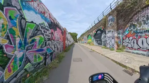
Creekside Discovery Centre
Hiking and trails · 1.5 mi
Nature reserve in Lewisham, London
14 Creekside, London


Brookmill Park
Park · 1.3 mi
Park in London Borough of Lewisham, United Kingdom

Manor House Gardens
Park · 0.6 mi
Public park and gardens situated in Lee, in south east London


Blythe Hill Fields
Park · 2.0 mi
Park in London Borough of Lewisham, United Kingdom



East Greenwich Pleasaunce
Park · 1.4 mi
Park in the United Kingdom
Jan-Feb 08:00-16:00, Mar-Apr 08:00-18:00, May 08:00-20:00, Jun-Aug...
57 more on the map.
Restaurants and cafes201
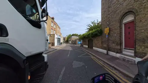

The Admiral Hardy
Bar and pub · 1.4 mi
7 College Approach, London
Mo 12:00-19:00; Tu-We 12:00-21:00; Th-Sa 12:00-23:00; Su 12:00-20:00


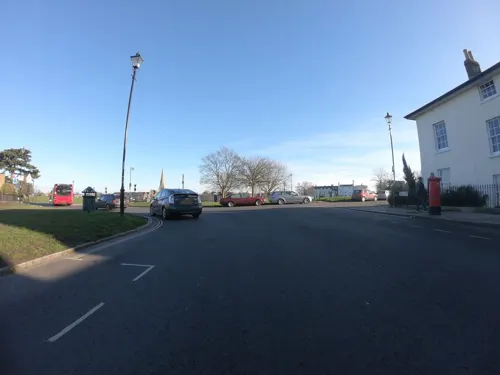
The Hare and Billet
Bar and pub
1a Eliot Cottages, London
Mo-Th 12:00-23:00; Fr 12:00-24:00; Sa 11:00-24:00; Su 11:00-22:30

The Royal Standard
Bar and pub · 1.0 mi
44 Vanbrugh Park, London
Mo-Th 12:00-23:00; Fr-Sa 12:00-24:00; Su 12:00-22:30

The Spanish Galleon
Bar and pub · 1.4 mi
48 Greenwich Church Street, London
Mo-We 10:30-23:00; Th 10:30-24:00; Fr 10:30-26:00; Sa 10:00-26:00;...


The Watch House
Bar and pub · 0.9 mi
198-204 Lewisham High Street, London
Su-Th 08:00-24:00; Fr-Sa 08:00-25:00

Ye Olde Rose and Crown
Bar and pub · 1.2 mi
1 Crooms Hill, London
Mo-Th 12:00-23:00; Fr-Sa 12:00-25:30; Su 12:00-22:30

189 more on the map.
History
The name is from Old English spoken words 'blæc' and 'hǣth'. The name is recorded in 1166 as Blachehedfeld which means "dark, or black heath field" – field denotes an enclosure or clearing. Lewis's topological dictionary opines, considering the adjective developed equally into derived term bleak, that Blackheath "takes its name either from the colour of the soil, or from the bleakness of its situation" before adding, reflecting Victorian appreciation, mention of "numerous villas with which it now abounds...it is pleasantly situated on elevated ground, commanding diversified and extensive views of the surrounding country, which is richly cultivated, and abounds with fine scenery". It was an upland, open space that was the meeting place of the hundred of Blackheath.
By 1848 Blackheath was noted as a place with two dependent chapels under Lewisham vestry and another, St Michael and All Angels, erected 1828-1830 designed by George Smith. The latter made use of £4000 plus land from land developer John Cator, plus a further £11,000 from elsewhere. The name of Blackheath gained independent official boundaries by the founding of an Anglican parish in 1854 (construction of the parish church, All Saints, began in 1857), then others (in 1859, 1883 and 1886) which reflected considerable housing built on nearby land.
Read more of the history
In local government, Blackheath never saw independence; at first split between the Lewisham, Lee, Charlton and Greenwich vestries or civil parish councils and Kidbrooke liberty, which assembled into Greenwich, Plumstead (in final years called Lee) and Lewisham Districts, then re-assembled with others into Greenwich and Lewisham metropolitan boroughs in 1900.
An urban myth is Blackheath could derive from the 1665 Plague or the Black Death of the mid-14th century. A local burial pit is nonetheless likely during the Black Death, given the established village and safe harbour (hithe) status of Greenwich. At those times the high death rate meant that a guaranteed churchyard burial became impractical.
A key Celtic trackway (becoming a Roman road and later Watling Street) scaled the rise that is shared with Greenwich Park and a peak 1 mile (1.6 km) east-by-southeast, Shooters Hill. In the west this traversed the mouth of Deptford Creek (the River Ravensbourne), a corruption or throwback to earlier pronunciation of deep ford. Other finds can be linked to passing trade connected with royal palaces. In 1710, several Roman urns were dug up, two of which were of fine red clay, one of a spherical, and the other of a cylindrical, form; and in 1803, several more were discovered in the gardens of the Earl of Dartmouth and given to the British Museum.
Certain monarchs passed through and their senior courtiers kept residences here and in Greenwich. Before the Tudor-built Greenwich Palace and Stuart-built Queen's House, one of the most frequently used was Eltham Palace about 2.5 miles (4.0 km) to the southeast of the ridge, under the late Plantagenets, before cessation as a royal residence in the 16th century.
On the north side of the heath, Ranger's House, a medium-sized red brick Georgian mansion in the Palladian style, backs directly onto Greenwich Park. Associated with the Ranger of Greenwich Park, a royal appointment, the house was the Ranger's official residence for most of the 19th century. Neighbouring Montagu House, demolished in 1815, was a royal residence of Caroline of Brunswick. Since 2002, Ranger's House has housed the Wernher Collection of art.
The Pagoda is a notably exquisite home, built in 1760 by Sir William Chambers in the style of a traditional Chinese pagoda. It was later leased to the Prince Regent, principally used as a summer home by Caroline of Brunswick.
Blackheath was a rallying point for Wat Tyler's Peasants' Revolt of 1381, and for Jack Cade's Kentish rebellion in 1450, both recalled by road names on the west side of the heath. After camping at Blackheath, Cornish rebels were defeated at the foot of the west slope in the Battle of Deptford Bridge, sometimes called the Battle of Blackheath, on 17 June 1497.
In 1400, Henry IV of England met here with Byzantine Emperor Manuel II Palaiologos who toured western royalty to seek support to oppose Bayezid I (Bajazet), the Ottoman Sultan. In 1415, the lord mayor and aldermen of London, in their robes of state, attended by 400 of the principal citizens, clothed in scarlet, came hither in procession to meet Henry V of England on his triumphant return from the Battle of Agincourt.
Blackheath was, along with Hounslow Heath, a common assembly point for army forces, such as in 1673 when the Blackheath Army was assembled under Marshal Schomberg to serve in the Third Anglo-Dutch War. In 1709–10, army tents were set up on Blackheath to house a large part of the 15,000 or so German refugees from the Palatinate and other regions who fled to England, most of whom subsequently settled in America or Ireland.
With Watling Street carrying stagecoaches across the heath, en route to north Kent and the Channel ports, it was also a notorious haunt of highwaymen during the 17th and 18th centuries. As reported in Edward Walford's Old and New London (1878), "In past times it was planted with gibbets, on which the bleaching bones of men who had dared to ask for some extension of liberty, or who doubted the infallibility of kings, were left year after year to dangle in the wind." In 1909 Blackheath had a local branch of the London Society for Women's Suffrage.
The Vanbrugh Pits, known locally as the Dips, are on the north-east of the heath. A former gravel workings site, it has long been reclaimed by nature and form a feature in its near-flat expanse; particularly attractive in spring when its gorse blossoms brightly.
From the History section of Blackheath, London on Wikipedia, under CC BY-SA 4.0.
More about Blackheath
Geography
Blackheath is one of the largest areas of common land in Greater London, with 85.58 hectares (211.5 acres) of protected commons. The heath is managed by Lewisham and Greenwich councils. Highlights on the Greenwich side include the Long Pond, also known as Folly Pond, close to the main entrance of Greenwich Park.
On the Lewisham side are three ponds, with Hare and Billet pond the most natural, and probably the best wildlife habitat. Lewisham retains important areas of acid grassland that support locally rare wild plants such as Common stork's bill, Fiddle dock and Spotted medick. Key areas are to the east of Granville Park between South Row and Morden Row and on the cricket field east of Golfers Road.
The heath's habitat was well known to early botanists. In the 18th century Carl Linnaeus reportedly fell to his knees to thank God when he first saw the gorse growing there. However, this disputed account is more often attributed to Putney Heath. This environment supported both the flora and fauna of wild grassland. In 1859, Greenwich Natural History Society recorded a wide list of animal species, including natterjack toads, hares, common lizards, bats, quail, ring ouzel and nightingale. Today, bats remain and migrating ring ouzel may occasionally be seen in spring.
Arts and culture
Two clusters of amenities vie for retail and leisure: the "Village" around Blackheath railway station to the south of the heath and the "Standard" in the north of St Johns/Vanbrugh Park i.e. beyond the A2 road, named after the Royal Standard pub in Greenwich. The north of the green is in the Westcombe Park neighbourhood, which has its own railway station about 400 metres north – part of East Greenwich.
The total 0.35-hectare (0.9-acre) green and fountain sub-green was at first one village green, known during the 18th century as Sheepgate Green, beside a crossroads of what was the London-Dover road. Around 1885 local philanthropist William Fox Batley had it refurbished and it became known as Batley Green or Batley Park. Batley's contribution is recorded in an inscription on a memorial fountain.
Just south of the railway station is the Blackheath Conservatoire of Music and the Arts. It is located close to Blackheath Halls, a concert venue today owned and managed by Trinity Laban Conservatoire of Music and Dance. To the north of the railway station, in Tranquil Vale, All Saints' Parish Hall is a locally listed building in Arts and Crafts style, built in 1928. It has housed the Mary Evans Picture Library since 1988.
From the Wikipedia article Blackheath, London, under CC BY-SA 4.0.
Notable people from Blackheath
 Richard BransonBritish business magnatePhoto: U.S. Department of State from United States, Public domain
 Vanessa RedgraveBritish actress and activist (born 1937)Photo: Raph_PH, CC BY 2.0
 Mary QuantBritish fashion designer (1930–2023)Photo: Jack de Nijs for Anefo / Anefo, CC0
 Hugh BonnevilleBritish actor (born 1963)Photo: Martin Kraft, CC BY-SA 3.0
 Emily DavisonBritish activist who fought for women's suffragePhoto: Andrew William Dron (1864-1935); [ 1..., Public domain
 Ruth Williams KhamaFirst Lady of Botswana (1923-2002)Photo: Associated Press, Public domain
 Thomas HoldingBritish actor (1880-1929)Photo: Underwood and Underwood, Public domain
 Gerald Amesactor, director, olympic fencer (1880–1933)Photo: Cinema Chat, Public domain
- Sarita ChoudhuryBritish actress
- Clemence DaneEnglish novelist (1888-1965)
- Marty WildeBritish singer (born 1939)
- David HillierEnglish footballer (born 1969)
Born in Blackheath, according to Wikidata (CC0). Each name links to its Wikipedia article.
Where to stay13
Churches and places of worship72
Shopping68
Gas and EV charging21
Schools, colleges and libraries51
All Saints' Church of England Primary School Blackheath
School · Anglican · 0.4 mi
2 Blackheath Vale, London
St Alfege with St Peter's Church of England Primary School
School · Anglican · 1.5 mi
Creek Road, London
St Mary's Lewisham Church of England Primary School
School · Anglican · 1.2 mi
329 Lewisham High Street, London
Healthcare40
Map of Blackheath
250 places. The map loads OpenStreetMap tiles when you open it.
Getting there and nearby towns
London City Airport (LCY) is the nearest airport with scheduled flights listed in OpenStreetMap, 3 miles away.
- Kidbrooke 1 mi east, about 1 min by car
- Plumstead 3 mi east, about 6 min by car
- Chislehurst 4 mi southeast, about 7 min by car
- Stepney 4 mi northwest, about 7 min by car
- Shadwell 4 mi northwest, about 7 min by car
- Abbey Wood 5 mi east, about 7 min by car
- Bickley 5 mi south, about 8 min by car
- West Ham 5 mi north, about 8 min by car
- Crystal Palace 5 mi southwest, about 8 min by car
- London 6 mi northwest, about 10 min by car
Drive times are estimates from straight-line distance, not routes.
Towns near Blackheath


Keep exploring
Local news
Headlines from INDB.
Reviews, tips and questions
Loading what members have shared...
Sources and licences
- GeoNames (CC BY 4.0): population, coordinates, regions and time zone
- Mapillary (see each image): photos
- OpenStreetMap contributors (ODbL 1.0): places, airports, map data
- Wikidata (CC0 1.0): elevation, founding date, time zone, website, landmarks and historic places
- Wikimedia Commons (see each image): photos
- Wikipedia (CC BY-SA 4.0): overview and history text
Photo credits
- Blackheath Quaker Meeting House, south aspect (rotated), EEye, CC BY-SA 4.0
- 52 Lee Terrace, Blackheath (01), Doyle of London, CC BY-SA 4.0
- Blackheath QMH east view (2), EEye, CC BY-SA 4.0
- Blackheath Quaker Meeting House, south aspect, EEye, CC BY-SA 4.0
- Railway, Blackheath, SE3 (3562858968), Ewan Munro from London, UK, CC BY-SA 2.0
- Railway, Blackheath, SE3, Ewan-M, CC BY-SA 2.0
- Apartment Block in Blackheath Village, Doyle of London, CC BY-SA 4.0
- Blackheath Conservatoire of Music and Concert Hall (9175927409), Reading Tom from Reading, UK, CC BY 2.0
- Graffiti inside the Blackheath Conservatoire of Music (02), Doyle of London, CC BY-SA 4.0
- Graffiti inside the Blackheath Conservatoire of Music (01), Doyle of London, CC BY-SA 4.0
- Bianco, Blackheath, SE3, Ewan-M, CC BY-SA 2.0
- 2020-08-21 Class 465 at Blackheath, Huhorihe2, CC BY-SA 4.0
- Car park at Blackheath railway station, Mx. Granger, CC0
- Blackheath railway station 2, Mx. Granger, CC0
- Greenwichtheatre, Burnley, CC BY-SA 3.0
- Eltham highstreet 3, PeterEltham, CC BY-SA 3.0
- Broadway Theatre - Catford, Steve Cadman derivative work: MrPanyGoff, CC BY-SA 2.0
- Albany Theatre in Deptford, SilkTork, CC BY-SA 3.0
- Greenwich London, Vladimír Procházka, CC BY-SA 4.0
- EH1211481 National Maritime Museum 10 (cropped), Katie Chan, CC BY-SA 3.0
- RNCpano, © Bill Bertram (Pixel8) 2007-08, CC BY-SA 3.0
- Manor House Gardens, Hohlroller ( talk ), Public domain
- Birdbrook Road Nature Reserve 4, Dudley Miles, CC BY-SA 4.0
- AllSaints Blackheath, Taken by Mark Duwe, Vbloke at English Wikipedia, Public domain
- Cutty Sark (16719233476), Krzysztof Belczyński from Warsaw, POLAND, CC BY-SA 2.0
- GreenwichParcRoyal, Photograher and original uploader was Sebjarod at fr.wikipedia, Public domain
- The Fan Museum (3400819225), Visit Greenwich from Greenwich, United Kingdom, CC BY 2.0
- LewishamShopping, The original uploader was Secretlondon at English Wikipedia ., CC BY-SA 3.0
- EH1218679 The Ranger's House, Katie Chan, CC BY-SA 3.0
- Trafalgar Tavern-358SFEC LONDON-20070917, Steve F-E-Cameron, CC BY-SA 3.0
- St John's Church Blackheath, Mdhsmith, CC BY-SA 3.0
- Spanish Galleon Tavern, Greenwich, SE10 (2468547383), Ewan Munro from London, UK, CC BY-SA 2.0
- View over the Greenwich Park Barrow Cemetery, Ethan Doyle White, CC BY-SA 4.0
- Painted Hall at Royal Naval College in Greenwich, London, England, UK, Shawn M. Kent, CC BY-SA 4.0
- Admiral Hardy, Greenwich, SE10 (2524104714), Ewan Munro from London, UK, CC BY-SA 2.0
- The Clarendon Hotel (9175930801), Reading Tom from Reading, UK, CC BY 2.0
- St Swithun's Church, Hither Green (01), Ethan Doyle White, CC BY-SA 4.0
- Church of St Stephen, Lewisham, Ethan Doyle White, CC BY-SA 4.0
- Coach and Horses, Greenwich, SE10 (6845792309), Ewan Munro from London, UK, CC BY-SA 2.0
- HE1214382 Royal Naval College Pepys Building (1), Katie Chan, CC BY-SA 4.0
- 71-75, Greenwich South Street, Hjamesberglen, CC0
- Greenwich Picturehouse 2026-01-24, The wub, CC BY-SA 4.0
- Gate Clock, Greenwich, SE10 (2523281049), Ewan Munro from London, UK, CC BY-SA 2.0
- Watch House, Lewisham, SE13 (2663057161), Ewan Munro from London, UK, CC BY-SA 2.0
- SteveHolmesAtUpTheCreekGreenwich, Back ache, CC BY-SA 4.0
- Greenwich - Grand Square - View ESE on Queen Mary Court Dome & Chapel, Txllxt TxllxT, CC BY-SA 4.0
- Royal Standard, Blackheath, SE3, Ewan-M, CC BY-SA 2.0
- Creekside lift bridge (5671685561), John Lord from Edinburgh, Scotland, CC BY 2.0
- The Bookshop on the Heath (cropped), Reading Tom from Reading, UK, CC BY 2.0
- Ye Old Rose and Crown and Greenwich Theatre, Crooms Hill, London SE10, Mark Ahsmann, CC BY-SA 3.0
- West Face of the Church of St Margaret, Lee (II), Ethan Doyle White, CC BY-SA 4.0
- Brookmill Road LNR 1, Dudley Miles, CC BY-SA 3.0
- Brimmington Gardens, London Borough of Southwark, SE15 (2476992512), Ewan Munro from London, UK, CC BY-SA 2.0
- EH1289615 Point House, Katie Chan, CC BY-SA 3.0
- Royal Observatory Greenwich - Altazimuth Pavilion (8142814614), Elliott Brown from Birmingham, United Kingdom, CC BY 2.0
- Queen Elizabeth's Oak Greenwich Park 6386, Photograph by Clem Rutter, Rochester, Kent. ( www.clemrutter.net )., CC BY-SA 3.0
- Queens Orchard, Greenwich Park opening plaque, Harry Bond, CC BY-SA 4.0
- Brookmill Park, London Borough of Lewisham, SE8, Ewan-M, CC BY-SA 2.0
- London skyline from Blythe Hill fields, Amakuru, CC BY-SA 4.0
- Street-level photo, wasd42, CC BY-SA 4.0
- Street-level photo, wasd42, CC BY-SA 4.0
- Street-level photo, athuler, CC BY-SA 4.0
- Street-level photo, wasd42, CC BY-SA 4.0
- Street-level photo, athuler, CC BY-SA 4.0
- Street-level photo, wpoi, CC BY-SA 4.0
- Street-level photo, wasd42, CC BY-SA 4.0
- Street-level photo, txllxt, CC BY-SA 4.0
- Street-level photo, wasd42, CC BY-SA 4.0
- Street-level photo, wasd42, CC BY-SA 4.0
- Street-level photo, vlivyur, CC BY-SA 4.0
- Street-level photo, wasd42, CC BY-SA 4.0
- Street-level photo, wasd42, CC BY-SA 4.0
- Street-level photo, erias, CC BY-SA 4.0
- Street-level photo, wasd42, CC BY-SA 4.0
- Street-level photo, jjhaslanded, CC BY-SA 4.0
- Street-level photo, athuler, CC BY-SA 4.0
- Street-level photo, wmorland, CC BY-SA 4.0
- Street-level photo, richlv, CC BY-SA 4.0
- Street-level photo, athuler, CC BY-SA 4.0
- Street-level photo, athuler, CC BY-SA 4.0
- Street-level photo, txllxt, CC BY-SA 4.0
- Street-level photo, jjhaslanded, CC BY-SA 4.0
- Street-level photo, kgvx, CC BY-SA 4.0
- Street-level photo, wasd42, CC BY-SA 4.0


Page built November 10, 2026. Spotted a mistake? Tell us or suggest a place.