


Abbey Wood, United Kingdom
Abbey Wood is a town of 17,700 people in England, United Kingdom.
Why visit Abbey Wood
Townapedia lists 19 museums and landmarks, 44 parks and trails, 51 places to eat, 1 place to stay and 4 attractions in and around town.
Highlights include Erith Playhouse, Thames Gateway Bridge, Danson House and Duke of Wellington.
Weather in Abbey Wood
Forecast from MET Norway (CC BY 4.0). Full forecast
About Abbey Wood
Abbey Wood is an area in southeast London, England, in the Royal Borough of Greenwich and bordering the London Borough of Bexley. It is located 10.6 miles (17 km) east of Charing Cross. According to the 2021 census, Abbey Wood has a population of 17,700 (rounded to the nearest 100).
From the Wikipedia article Abbey Wood (this version), under CC BY-SA 4.0.
Photos of Abbey Wood

Things to do4

Erith Playhouse
Cinema and theater · 2.7 mi
Theatre in Erith, Bexley, London, England, formerly a cinema

Thames Gateway Bridge
Bridge · 1.7 mi
Proposed new crossing of the River Thames, in east London, England

Museums and landmarks19

Danson House
Museum · 2.2 mi
Grade I listed historic house museum in London Borough of Bexley, United Kingdom


Eastbury Manor House
Museum · 3.3 mi
Grade I listed historic house museum in London Borough of Barking and Dagenham, United Kingdom

Greenwich Heritage Centre
Museum · 1.7 mi
Former museum in local history resource centre in Woolwich, London, UK

North Woolwich Old Station Museum
Museum · 2.1 mi
Former railway museum in North Woolwich, London, opened 1984, closed 2008

Red House
Museum · 2.4 mi
Grade I listed historic house museum, former home of William Morris


Royal Artillery Museum
Museum · 1.6 mi
Closed military museum in London, United Kingdom

South African War Memorial
Monument and historic site · 1.9 mi
War memorial in Woolwich, London



7 more on the map.
Parks, trails and playgrounds44


Danson Park
Park · 2.1 mi
Park in the London Borough of Bexley, England, UK


Gilbert's Pit
Park · 2.8 mi
Nature reserve in Charlton, London, England


Lesnes Abbey Woods
Park · 0.9 mi
Area of ancient woodland in southeast London, England

Shoulder of Mutton Green
Park · 1.6 mi
Public open space in Welling, London, England
Charlton Park, Greenwich
Park · 2.8 mi
Park in Royal Borough of Greenwich, United Kingdom
32 more on the map.
Restaurants and cafes51
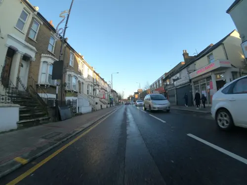
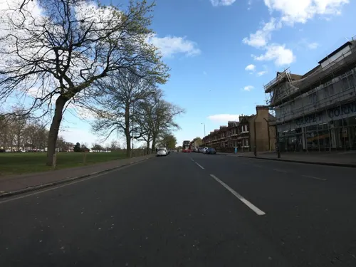

Spices
Restaurant · Indian · 1.1 mi
48 Lessness Avenue, Bexleyheath
17:00-23:00

The Abbey Arms
Bar and pub · 0.6 mi
31 Wilton Road, London
Mo,Tu 15:00-23:00; We-Sa 12:00-23:00; Su 12:00-22:00
Wood Pizza Time
Restaurant · Pizza · 1.3 mi
187 Plumstead Common Road, London
The Plum Tree Beer Shop
Bar and pub · 1.3 mi
Pub and bottle shop
154 Plumstead Common Road, London
39 more on the map.
More about Abbey Wood
Geography
Abbey Wood borders Thamesmead to the northwest, north and northeast, Belvedere to the east and southeast, West Heath.
The Abbey Wood train station is located approximately 1.4 miles from the River Thames, between the Thames Barrier (3.5 miles to the West) and the Dartford Crossing (6 miles to the East).
Arts and culture
Time 106.8, a licensed local radio station that evolved from an early cable channel - Radio Thamesmead - had studios on the Abbey Wood/Plumstead borders, and closed in April 2009. Abbey Wood also hosted London's first cable TV station, Cablevision, on Plumstead High Street, near Wickham Lane.
The Thamesmead estate was the focus of an exhibition at RIBA to mark its 50th anniversary. "Thamesmead: A Town for the 21st Century" presented a series of archival images of Thamesmead, displayed alongside contemporary photographs of the estate's residents. The buildings have been utilised as a backdrop for many filmic projects, including the Stanley Kubrick film A Clockwork Orange and the video of "Come to Daddy" by electronic musician Aphex Twin.
The 'Thamesmead Community Archive' is an online archive of material collected from local residents, Bexley Local Studies Archive, London Metropolitan Archive, the British Library, the RIBA archive and local authorities. 'Thamesmead Codex' by artist Bob and Roberta Smith was exhibited at Tate Modern in 2024–2026.
The Lakeside Centre, situated on the edge of Southmere Lake, is home to a growing creative community, with 38 affordable artist studios, two artist in residence studios, a community darkroom and community garden.
Education
St Paul's Academy is a Roman Catholic secondary school located in the area, on the original site of the Abbey Wood comprehensive school. It was previously known as St Paul's RC Secondary School, whilst located in Wickham Lane, before converting to academy status in 2005 when it moved to the new site.
From the Wikipedia article Abbey Wood, under CC BY-SA 4.0.
Notable people from Abbey Wood
- Rod LiddleEnglish journalist (1960–2026)
- Darsie AndersonEnglish rugby player
- Eric DavisAustralian rugby union player (1917-2001)
Born in Abbey Wood, according to Wikidata (CC0). Each name links to its Wikipedia article.
Where to stay1
Churches and places of worship45
Shopping9
Gas and EV charging3
Schools, colleges and libraries47
St Michael's East Wickham Church of England Primary School
School · Anglican · 1.3 mi
Wrotham Road, Welling
Healthcare9
Map of Abbey Wood
232 places. The map loads OpenStreetMap tiles when you open it.
Getting there and nearby towns
London City Airport (LCY) is the nearest airport with scheduled flights listed in OpenStreetMap, 2 miles away.
- Plumstead 1 mi west, about 2 min by car
- Barking 3 mi north, about 5 min by car
- Bexley 4 mi southeast, about 6 min by car
- Kidbrooke 4 mi west, about 6 min by car
- Sidcup 4 mi south, about 7 min by car
- Rainham 4 mi northeast, about 7 min by car
- Ilford 5 mi north, about 8 min by car
- Dagenham 5 mi northeast, about 8 min by car
- West Ham 5 mi northwest, about 8 min by car
- Chislehurst 5 mi south, about 8 min by car
Drive times are estimates from straight-line distance, not routes.
Towns near Abbey Wood


Keep exploring
Local news
Headlines from INDB.
Reviews, tips and questions
Loading what members have shared...
Sources and licences
- GeoNames (CC BY 4.0): population, coordinates, regions and time zone
- Mapillary (see each image): photos
- OpenStreetMap contributors (ODbL 1.0): places, airports, map data
- Wikidata (CC0 1.0): elevation, founding date, time zone, website, landmarks and historic places
- Wikimedia Commons (see each image): photos
- Wikipedia (CC BY-SA 4.0): overview and history text
Photo credits
- Danson Mansion, Stacey Harris, CC BY-SA 2.0
- Eastbury Manor House, Gordon Joly, CC BY 2.5
- Flickr - davehighbury - Royal Arsenal Woolwich London 039 (cropped), DAVID HOLT from London, England, CC BY-SA 2.0
- The Red House, Bexleyheath, Velela, Public domain
- London-Woolwich, Second Boer War Memorial 03, Kleon3, CC BY-SA 4.0
- London, Plumstead Common 04, Kleon3, CC BY-SA 4.0
- Beckton District Park South, Dudley Miles, CC0
- Crossness Nature Reserve 1, Dudley Miles, CC BY-SA 3.0
- Danson Park, Stacey Harris, CC BY-SA 2.0
- Gilberts Pit, London Borough of Greenwich, SE7 (2252315297), Ewan Munro from London, UK, CC BY-SA 2.0
- Greatfields Park (18843012584), Matt Brown from London, England, CC BY 2.0
- Nave of Lesnes Abbey, Ethan Doyle White, CC BY-SA 4.0
- Woolwich Granada Cinema, Simon Armstrong, CC BY-SA 3.0
- Woolwich, Beresford Square, c 1835, Unknown author, Public domain
- New Wine Church building, Danny Robinson, CC BY-SA 2.0
- London, Woolwich, Royal Garrison Church 01, Kleon3, CC BY-SA 4.0
- London, North-Woolwich, St John with St Mary & St Edward 01, Kleon3, CC BY-SA 4.0
- Church of St Nicholas plumstead, Simon Armstrong, CC BY-SA 3.0
- Lesnes Abbey in October 2013, Ethan Doyle White, CC BY-SA 3.0
- Plumstead Common 1820, Ranwell, Public domain
- London-Woolwich, Royal Arsenal, Wellington Park, statue Duke of Wellington 01, Kleon3, CC BY-SA 4.0
- Plumstead Library, 2015, No Swan So Fine, CC BY-SA 4.0
- Doorway on the Western Side of the Courtyard at Lesnes Abbey, Ethan Doyle White, CC BY-SA 4.0
- Eltham Common path, Dudley Miles, CC BY-SA 3.0
- Shrewsbury Park, Shooter's Hill, London, Paul W, CC BY-SA 4.0
- London, North Woolwich Old Station Museum 01, Kleon3, CC BY-SA 4.0
- London-Woolwich, Rotunda 06, Kleon3, CC BY-SA 4.0
- Flickr - davehighbury - Royal Artillery Museum Woolwich London 158, DAVID HOLT from London, England, CC BY-SA 2.0
- Street-level photo, dankarran, CC BY-SA 4.0
- Street-level photo, wasd42, CC BY-SA 4.0
- Street-level photo, dankarran, CC BY-SA 4.0
- Street-level photo, wasd42, CC BY-SA 4.0
- Street-level photo, wasd42, CC BY-SA 4.0
- Street-level photo, wasd42, CC BY-SA 4.0
- Street-level photo, dankarran, CC BY-SA 4.0
- Street-level photo, dankarran, CC BY-SA 4.0
- Street-level photo, wasd42, CC BY-SA 4.0
- Street-level photo, dankarran, CC BY-SA 4.0
- Street-level photo, wasd42, CC BY-SA 4.0
- Street-level photo, dankarran, CC BY-SA 4.0
- Street-level photo, wasd42, CC BY-SA 4.0
- Street-level photo, tallguy, CC BY-SA 4.0
- Street-level photo, wasd42, CC BY-SA 4.0
- Street-level photo, wasd42, CC BY-SA 4.0


Page built November 10, 2026. Spotted a mistake? Tell us or suggest a place.