


Bourton on the Water, United Kingdom
Bourton on the Water is a town of 3,296 people in England, United Kingdom.
Why visit Bourton on the Water
Townapedia lists 10 museums and landmarks, 4 parks and trails, 25 places to eat, 17 places to stay and 1 attraction in and around town.
Highlights include Birdland Park and Gardens, Cotswold Motoring Museum & Toy Collection, Cotswold Motoring Museum and Bourton-on-the-Water model village.
Weather in Bourton on the Water
Forecast from MET Norway (CC BY 4.0). Full forecast
About Bourton on the Water
Bourton-on-the-Water is a village and civil parish in Gloucestershire, England, that lies on a wide flat vale within the Cotswolds Area of Outstanding Natural Beauty. The village had a population of 3,296 at the 2011 census. Much of the village centre is a designated Conservation Area.
From the Wikipedia article Bourton-on-the-Water (this version), under CC BY-SA 4.0.
Travel tips from other travellers: Bourton on the Water on Wikivoyage (CC BY-SA 4.0).
Photos of Bourton on the Water


Things to do1

Museums and landmarks10

Cotswold Motoring Museum
Museum
Museum in Bourton-on-the-Water, Gloucestershire, England, UK
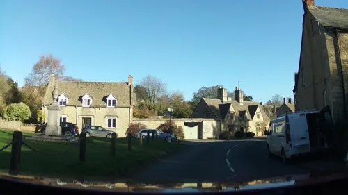
Lower Swell War Memorial
Monument and historic site · 2.9 mi
War memorial in Swell, Gloucestershire, England, UK



Parks, trails and playgrounds4

Bourton-on-the-Water model village
Park
Scale model village in Gloucestershire, UK


Restaurants and cafes25




A'moore Coffee House
Cafe · Cake, Coffee Shop, Sandwich, Tea
Moore Road, Cheltenham
13 more on the map.
History
The earliest evidence of human activity within the Bourton-on-the-Water area was found in the Slaughter Bridge gravel-spread, where Neolithic pottery (dated c. 4000 B.C.) was discovered. Moreover, excavations of the Salmonsbury Camp give evidence of almost continuous habitation through the Neolithic period, the Bronze Age and throughout England's Roman period (c. 43 to 410 A.D.). A Roman road, Icknield Street (also known as Ryknild Street), ran from the Fosse Way at Bourton-on-the-Water to Templeborough in South Yorkshire. Ancient Roman pottery and coins discovered in the village itself give clear evidence of extended Roman occupation. By the 11th century a Christian church, Norman, was established and the village had developed along the River Windrush much as it is today. Centuries earlier, a Saxon timber church was located on that site in about AD 708, built on the site of an old Roman temple. Some of the St Lawrence church on that site today was built in the 14th century but most of it is from the 17th and 18th centuries.
The village was served by a passenger railway between 1862 and 1962. Tourism did not become a significant factor in the village until the 1920s and 1930s. The Model Village opened in 1937. There was a significant increase in the population between 1931 and 1951.
Read more of the history
Following the formation of the Territorial Force in 1908, the town, for recruiting, was granted to the Royal Gloucestershire Hussars. Following this formation the regiment maintained a troop from B Squadron. Today the regiment, now a squadron of The Royal Wessex Yeomanry, continues to recruit from this area.
The Cotswold School opened in the village in 1988 following the amalgamation of Bourton Vale Secondary Modern (Bourton on the Water) and Westwood's Grammar School (Northleach). It achieved academy status in September 2010, and was named 'Comprehensive School of the Year 2015/16' by The Sunday Times. During construction of the school's maths block, it was discovered to be situated upon a Roman cemetery which also contained Iron Age roundhouses, burials, and pottery.
The houses and shops in the village are constructed of the ashlar yellow limestone characteristic of the Cotswolds and they have embellishments such as projecting gables, string-courses, windows with stone mullions, dripmoulds and stone hoodmoulds over the doors.
Parts of the James Bond movie Die Another Day (2002) were filmed in the car park at Bourton-on-the-Water and on the nearby ex-RAF aircraft runway at RAF Little Rissington.
From the History section of Bourton-on-the-Water on Wikipedia, under CC BY-SA 4.0.
More about Bourton on the Water
Arts and culture
During the summer, a game of medieval football is played with goalposts set up in the River Windrush itself. Two teams play with a standard football and a referee attempts to keep order. Crowds line the banks of the river and the aim is to score as many goals as possible (while getting everyone else as wet as possible).
The model village is a 1:9 replica of the village and includes a model of the model village itself (a model within a model). It was built by local craftsmen in the 1930s, and opened in 1937. The model village was awarded Grade II listed status in 2013 in recognition of its uniquely precise details and the genuine building materials and methods used, which replicate those used in the construction of the life-size village.
Birdland Park and Gardens, which has a collection of birds, including penguins, parrots and passerine (perching) birds and a large pond full of salmon which can be fed by the public. There are bird-of-prey displays and a penguin feeding demonstration.
On the fourth Sunday of each month, there is a farmers' market
Oasis' music video "I'm Outta Time" was recorded in the town, and shows Liam Gallagher walking in the countryside of the area, and in the model village and the town.
From the Wikipedia article Bourton-on-the-Water, under CC BY-SA 4.0.
Notable people from Bourton on the Water
 John Churton CollinsBritish literary criticPhoto: Reginald Haynes, Public domain
- Wilfrid Hyde-WhiteBritish actor (1903–1991)
- Dudley Graham JohnsonRecipient of the Victoria Cross (1884-1975)
- John PainterEnglish cricketer (1856-1900)
- Adrian BecherEnglish cricketer (1897-1957)
Born in Bourton on the Water, according to Wikidata (CC0). Each name links to its Wikipedia article.
Where to stay17
Churches and places of worship9
Shopping13
Gas and EV charging3
Schools, colleges and libraries3
Healthcare1
Map of Bourton on the Water
86 places. The map loads OpenStreetMap tiles when you open it.
Getting there and nearby towns
RAF Brize Norton (BZZ) is the nearest airport with scheduled flights listed in OpenStreetMap, 12 miles away.
- Stow on the Wold 3 mi northeast, about 5 min by car
- Northleach 5 mi southwest, about 8 min by car
- Shipton under Wychwood 7 mi east, about 11 min by car
- Burford 7 mi southeast, about 12 min by car
- Moreton in Marsh 8 mi north, about 12 min by car
- Blockley 9 mi north, about 14 min by car
- Carterton 11 mi southeast, about 18 min by car
- Chipping Campden 11 mi north, about 18 min by car
- Charlton Kings 12 mi west, about 20 min by car
- Cheltenham 14 mi west, about 22 min by car
Drive times are estimates from straight-line distance, not routes.
Towns near Bourton on the Water


Keep exploring
Local news
Headlines from INDB.
Reviews, tips and questions
Loading what members have shared...
Sources and licences
- GeoNames (CC BY 4.0): population, coordinates, regions and time zone
- Mapillary (see each image): photos
- OpenStreetMap contributors (ODbL 1.0): places, airports, map data
- Wikidata (CC0 1.0): elevation, founding date, time zone, website, landmarks and historic places
- Wikimedia Commons (see each image): photos
- Wikipedia (CC BY-SA 4.0): overview and history text
Photo credits
- Bourton-on-the-Water 2010 PD 09, Bin im Garten, CC BY-SA 3.0
- Bourton-on-the-water 1990 03, Mrfinch, CC BY-SA 3.0
- ColdAstonChurch, Philip Halling, CC BY-SA 2.0
- Church and churchyard, Rebecca C., CC BY 2.0
- Cotswold Motoring Museum, DeFacto, CC BY-SA 3.0
- The Dial House - High Street, Bourton-on-the-Water (14796334259), Elliott Brown from Birmingham, United Kingdom, CC BY-SA 2.0
- The Manor House (6), Cataleirxs, CC BY-SA 3.0
- War memorial in Bourton-on-the-Water (1399), Nilfanion, CC BY-SA 4.0
- Pulham's Travel - Bus Garage - Bourton-on-the-Water - fingerposts (14776298917), Elliott Brown from Birmingham, United Kingdom, CC BY-SA 2.0
- Pulham's Travel - Bus Garage - Bourton-on-the-Water (14776246528), Elliott Brown from Birmingham, United Kingdom, CC BY-SA 2.0
- Pulham's Travel - Bus Garage - Bourton-on-the-Water (14939869146), Elliott Brown from Birmingham, United Kingdom, CC BY-SA 2.0
- Pulham's Travel - Bus Garage - Bourton-on-the-Water (14962842415), Elliott Brown from Birmingham, United Kingdom, CC BY-SA 2.0
- Pulham's Travel - Bus Garage - Bourton-on-the-Water (14939853516), Elliott Brown from Birmingham, United Kingdom, CC BY-SA 2.0
- Pulham's Travel - Bus Garage - Bourton-on-the-Water (14962518802), Elliott Brown from Birmingham, United Kingdom, CC BY-SA 2.0
- Pulham's Travel - Bus Garage - Bourton-on-the-Water (14776194580), Elliott Brown from Birmingham, United Kingdom, CC BY-SA 2.0
- Penguin at Birdland Park and Gardens, Bourton-on-the-Water, Gloucestershire, Tanya Dedyukhina, CC BY 3.0
- The Model Village at Bourton-on-the-Water 23-09-2013, Karen Roe, CC BY 2.0
- The Old Mill, Lower Slaughter. - panoramio, Robert Powell, CC BY-SA 3.0
- Street-level photo, southglos, CC BY-SA 4.0
- Street-level photo, trigpoint, CC BY-SA 4.0
- Street-level photo, trigpoint, CC BY-SA 4.0
- Street-level photo, trigpoint, CC BY-SA 4.0
- Street-level photo, trigpoint, CC BY-SA 4.0
- Street-level photo, coljay72, CC BY-SA 4.0
- Street-level photo, southglos, CC BY-SA 4.0
- Street-level photo, trigpoint, CC BY-SA 4.0
- Street-level photo, swinetown, CC BY-SA 4.0
- Street-level photo, OrangeHurst97, CC BY-SA 4.0
- Street-level photo, coljay72, CC BY-SA 4.0
- Street-level photo, southglos, CC BY-SA 4.0
- Street-level photo, trigpoint, CC BY-SA 4.0
- Street-level photo, trigpoint, CC BY-SA 4.0
- Street-level photo, southglos, CC BY-SA 4.0
- Street-level photo, trigpoint, CC BY-SA 4.0
- Street-level photo, trigpoint, CC BY-SA 4.0
- Street-level photo, southglos, CC BY-SA 4.0
- Street-level photo, trigpoint, CC BY-SA 4.0


Page built November 10, 2026. Spotted a mistake? Tell us or suggest a place.